segredos do algarve rural
TRANSCRIPT
Bar
ran
co
Rua Nova
Alcariado Peso
Portelada Viúva
Chilrão
Casais
Lisboa
Faro
0Km 5Km 10Km
1 2 3 4
Almada de Ouro
Furnazinhas
Valedo Pereiro
Casas Baixas
1234
1
24
8 9
56
181617
15
7
1012
11
87
5 6
1918
917
13 151614
1210
11252324
34
38
22
21
262732
33
3536
37
2830
3129
1920
21
20
1314
3
Discovering the Vicentine CoastBudens > Odeceixe
1 Through the Monchique HillsCaldas de Monchique > Marmelete
2
Cultural Heritage
4 Ermida das Caldas Chapel
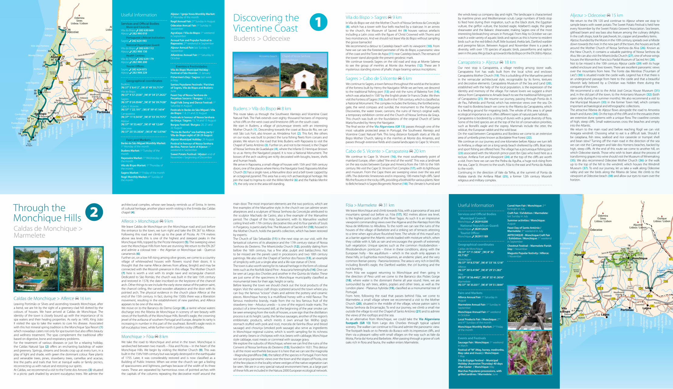
7 Alferce Mother Church
9 Monchique Mother Church
10 Museum of Sacred Art
11 Church of São Sebastião
12 Misericórdia Church
13 Chapel of Senhor dos Passos
15 Convent of Nossa Senhora do Desterro
20 Marmelete Mother Church
21 Chapel of Santo António
Natural Heritage
1 Monchique Spa Resort
2 Caldas Natural Spa
3 Fonte dos Amores
5 Picota Viewpoint
6 Algerian Oak or Monchique Oak
8 Barranco do Demo Gorge
14 Norfolk Island Pine - Araucaria heterophylla
16 Magnolia - Magnolia grandiflora
17 Fóia Viewpoint
18 Barranco dos Pisões Gorge
19 London Plane - Platanus hybrida
Cultural Heritage
1 Budens Mother Church
2 São Luís (Almádena) Fort
3 Chapel of Santo António
4 Chapel of Nossa Senhora de Guadalupe
5 Raposeira Mother Church
6 Milrei Menhir
7 Padrão Menhir
8 Mother Church of Nossa Senhora da Conceição
9 Museum of Sacred Art
10 Castelejo Viewpoint
11 Torre de Aspa
12 Group of Menhirs at Monte dos Amantes
13 Traditional Fishing Port
14 Baleeira Fort
15 Fortress of Sagres
16 Cape St. Vincent
17 Cape St. Vincent Fort Complex
19 Carrapateira Fort / Carrapateira Mother Church
20 Carrapateira Museum of the Sea and Land
21 Carrapateira Fishing Port
23 Arrifana Fishing Port
24 Arrifana Fort and Viewpoint
25 Arrifana Ribat
26 Church of Nossa Senhora da Alva
27 Misericórdia Church
28 Monsenhor Francisco Pardal Museum of Sacred Art
29 Aljezur Castle
30 Fonte das Mentiras
31 Artist José Cercas House Museum
32 Antoniano Museum
33 Municipal Museum
35 Museum of Winemaking
36 Odeceixe Mother Church
37 Windmill Museum
Natural Heritage
18 Sagres Biogenetic Reserve
22 Sagres Biogenetic Reserve
34 Amoreira Beach and Dune System
38 Odeceixe Beach Viewpoint
1
1
Scissor chairs
Alferce Mother Church
Odeceixe Windmill
Aljezur
1
1
1
1
2
2
2
21Torre de Aspa
Castelejo Beach Medronho fruit
Monchique
1Fortress of Sagres
Fortress of Sagres
Aljezur Castle Fóia
Lighthouse at Cape St. Vincent
Monchique Mother Church
2Monchique Hills
From the Vicentine Coast to Monchique
Secrets of Rural Algarve
We are going to explore the Southwest Alentejo and Vicentine Coast Natural Park and follow the Route of the Infante: forts, castles and viewpoints. We go in search of the tastes of the sea and the land: goose barnacles, sea bream, beans and sweet potatoes.We follow the Infante D. Henrique Routes through a landscape of rocky headlands, cliffs, dunes, endless sandy beaches and an immense sea. This is “the world’s end”, in the heart of the Southwest Alentejo and Vicentine Coast Natural Park. We may spot the occasional eagle, otter and other fauna. Mysterious standing stones, forts that bring to mind corsairs and pirates, and the castles of kings and princesses. Viewpoints overlooking the endless horizon of the Atlantic. And with the wind for company. We descend to wild beaches, tranquil coves, traditional fishing ports, streams and yet more streams. And everywhere the taste of the sea: goose barnacles, cataplanas, lots of fish and seafood. And the taste of the land: sweet potatoes, beans, chickpeas. Through pine forests and Mediterranean scrub we ascend hillsides tumbling with white houses, and enter small churches and local museums. We are captivated by the people and their stories.
Scenarios of water and greenery with the sea forming the horizon. In luxuriant valleys the sound of water blends with birdsong. We discover hot springs, and the tastes of the mountains and the land: sausages, honey and medronho.In this route through the Monchique Hills, the “Sintra of the Algarve”, the scenery is characterised by water and luxuriant vegetation. Springs and streams can be found at every turn, in a play of light and shade beneath strawberry trees, pines and chestnuts. We discover hot springs and relax under age-old trees. What better setting for a family picnic than this lush greenery, with the sound of running water mingling with birdsong? We savour the tastes of the hills and the land: sausages, honey and medronho. We cross peaks and hills that lead us into sheltered valleys with luxuriant flora: camellias, acacias and wild peonies. At 902 metres above sea level stands Fóia, an imposing natural viewpoint with sweeping views over the Algarve and the Alentejo, the mountains and the sea.
Co-financed by
© F
ebru
ary
2012
EN
Credits
Publisher and Copyright OwnerTurismo do Algarve [email protected] www.turismodoalgarve.pt www.visitalgarve.pt
Registered OfficeAv. 5 de Outubro, 18 8000-076 Faro, Algarve, Portugal
Telephone: 289 800 400Fax: 289 800 489
CoordinationMarketing Department Turismo do Algarve [email protected]
Graphic Design and LayoutDCB design
Texts Archives of Turismo do Algarve
PhotographyHélio Ramos, Luís da Cruz, F32, Archives of Turismo do Algarve (Pedro Reis, Hugo Santos, Rafaela Oliveira)
TranslationEuroscript Portugal, Lda.
Distributionfree
Cover: Odeceixe Key
PRINCIPAL ROADS
RAILWAY
ROUTE 1BUDENS > ODECEIXE
ROUTE 2CALDAS DE MONCHIQUE > MARMELETE
PROTECTED LANDSCAPE
SECONDARY ROADS
Bar
ran
co
Almada de Ouro
Furnazinhas
Valedo Pereiro
Casas Baixas
1
24
8 9
56
181617
15
7
1012
11
252324
34
38
22
262732
33
3536
37
283031
29
192021
1314
3
Bar
ran
co
Rua Nova
Alcariado Peso
Portelada Viúva
Chilrão
Casais
Malhão
Azinhal
Almada de Ouro
Furnazinhas
Valedo Pereiro
Casas Baixas
12178
7
1234
5 6
1918
913 15
1614
10112120
Budens > Vila do Bispo 8 kmThis route takes us through the Southwest Alentejo and Vicentine Coast Natural Park. The Park extends over eighty thousand hectares of imposing schist cliffs on the west coast and limestone cliffs on the south coast.We start in Budens, a village of picturesque streets with an interesting Mother Church (1). Descending towards the coast at Boca do Rio, we can visit São Luís Fort, also known as Almádena Fort (2). This fort, like others on our route, was built to protect the tuna fishing fleets from corsairs and pirates. We return to the road that links Budens with Raposeira to visit the Chapel of Santo António (3). Further on, and not to be missed, is the Chapel of Nossa Senhora de Guadalupe (4), where the Infante D. Henrique (known to us as Henry the Navigator) prayed. It is now a National Monument. The bosses of the arch vaulting are richly decorated with boughs, leaves, shells and human heads.We arrive in Raposeira, a small village of houses with 15th and 16th century doors, one of the places where Henry the Navigator lived. Raposeira Mother Church (5) has a single nave, a Manueline door and a bell tower capped by an octagonal pyramid. This area has a very rich archaeological heritage. We join the road to Ingrina to visit the Milrei Menhir (6) and the Padrão Menhir (7), the only one in the area still standing.
Vila do Bispo > Sagres 9 km In Vila do Bispo we visit the Mother Church of Nossa Senhora da Conceição (8), which has a tower with four bells reached by a staircase. In an annex to the church, the Museum of Sacred Art (9) houses various artefacts including a Latin cross with the figure of Christ Crowned with Thorns and two monstrances. And we should not leave Vila do Bispo without sampling the goose barnacles!We recommend a detour to Castelejo beach with its viewpoint (10). From here we can see the forested perimeter of Vila do Bispo, a panoramic view of the coast and the Torre de Aspa (11) near Castelejo beach. The remains of the tower stand alongside the present geodesic mark.We continue towards Sagres on the old road and stop at Monte Salema to see the group of menhirs at Monte dos Amantes (12). These are 9 mysterious standing stones of phallic shape bearing various inscriptions.
Sagres > Cabo de S.Vicente 6 kmWe continue to Sagres, a town famous throughout the world as the location of the fortress built by Henry the Navigator. While we are here, we descend to the traditional fishing port (13) and visit the ruins of Baleeira Fort (14), which was attacked in 1587 by the English pirate Sir Francis Drake. We then visit the Fortress of Sagres (15), built in the 15th century, which is classified as a National Monument. The complex includes the fortress, the fortified entry gate, the wind compass and sundial, the monument to the Portuguese Discoveries, the water tower, cannons, the ruins of Henry’s original walls, a temporary exhibition centre and the Church of Nossa Senhora da Graça. This church was built on the foundations of the original Church of Santa Maria founded by Henry the Navigator.The final sector of the Via Algarviana (GR 13) passes through one of the most valuable protected areas in Portugal, the Southwest Alentejo and Vicentine Coast Natural Park. This long distance footpath starts at Vila do Bispo Mother Church, taking in the menhirs at Monte dos Amantes, and passes through extensive fields and coastal landscapes to Cape St. Vincent.
Cabo de S. Vicente > Carrapateira 20 km We continue to Cape St. Vincent (16), the most southeasterly point of mainland Europe, often called “the end of the world”. This was a landmark on the sea routes between Europe and America from the 13th to the 16th century. We visit the Cape St. Vincent Fort Complex (17), with its lighthouse and museum. From the Cape there are sweeping views over the sea and cliffs. The dolomitic limestones end in imposing, 100-metre high cliffs. Sand fills the fissures in the rocky cliffs, providing a foothold for various plants. Next to Beliche beach is Sagres Biogenetic Reserve (18). The climate is humid and
the winds keep us company day and night. The landscape is characterised by maritime pines and Mediterranean scrub. Large numbers of birds stop to feed here during their migration, such as the black stork, the Egyptian vulture, the griffon vulture, the booted eagle, Adalbert’s eagle, the great shearwater and the Balearic shearwater, making Sagres one of the most interesting birdwatching venues in Portugal. From May to October we can watch a wide variety of aquatic birds and raptors as this is home to resident birds such as the red-billed chuff, little bustard, thekla lark, Dartford warbler and peregrine falcon. Between August and November there is a peak in diversity, with over 170 species of aquatic birds, passeriforms and raptors seen in this area. We go back up towards Vila do Bispo on the EN 268 to Aljezur.
Carrapateira > Aljezur 18 kmOur next stop is Carrapateira, a village nestling among stone walls. Carrapateira Fort has walls built from the local schist and encloses Carrapateira Mother Church (19). This is a building of the Manueline period in the vernacular architectural style, recognisable by its forms, textures and decorative elements. Carrapateira Museum of the Sea and Land (20), established with the help of the local population, is the expression of the identity and memory of the village. For nature lovers we suggest a short detour from Carrapateira to Amado beach to see the traditional fishing port of Carrapateira (21). We resume our journey, passing through Ponta do A de Pau, Palheirão and Pontal, which has extensive views over the sea. On the road to Bordeira beach we come to the Ribeira da Carrapateira, which is a feeding ground for migrating birds. The whole of this area is of great ecological importance as it offers different types of natural park habitats.Carrapateira is bordered by a string of dunes with a great diversity of flora. Some of the bird species are at the top of the list of conservation priorities, such as Bonelli’s eagle and the osprey. Mammals include the otter, the wildcat, the European rabbit and the wild boar.On the road between Carrapateira and Bordeira we come to an extensive area of umbrella pines known as Bordalete Pine Forest (22).We continue on our journey and one kilometre before Aljezur we turn left to Arrifana, a village set on a long sandy beach sheltered by cliffs. Boat trips and sport fishing are offered here. The village has a picturesque fishing port (23) associated with the Moorish prince-poet Ibn Qasi who lived here as a recluse. Arrifana Fort and Viewpoint (24) at the top of the cliffs are worth a visit. From here we can see the Pedra da Agulha, a huge rock rising from the sea, Cape St. Vincent to the south, Fóia to the east and Ponta da Atalaia to the north.Continuing in the direction of Vale da Telha, at the summit of Ponta da Atalaia stands the Arrifana Ribat (25), a former 12th century Moorish religious and military complex.
Caldas de Monchique > Alferce 16 kmLeaving Portimão or Silves and ascending towards Monchique, after a bend, we are hit by the sight of a greenery-clad hill dotted by the colours of houses. We have arrived at Caldas de Monchique. The identity of the town is closely bound up with the importance of its spa waters and their healing properties. As early as 1495, King João II visited the spa to take the waters to cure his disease. Associated with this hot mineral spring tradition is the Monchique Spa Resort (1) which nowadays caters not only for spa tourism but also offers beauty and wellness treatment. The spas complement the traditional offer based on digestive, bone and respiratory problems.For the treatment of various diseases or just for a relaxing holiday, the Caldas Natural Spa (2) offers an enchanting backdrop of water and greenery. Springs, streams and brooks crop up at every turn, in a play of light and shade, with green the dominant colour. Rare plants and venerable trees, pines, strawberry trees, camellias and acacias, line the paths and trails that hint at tranquil walks or family picnics, reconnecting us with nature and restoring our spirits.At Caldas, we recommend a visit to the Fonte dos Amores (3) situated in a picnic park shaded by ancient eucalyptus trees. We admire the
architectural complex, whose rare beauty reminds us of Sintra. In terms of cultural heritage, another place worth visiting is the Ermida das Caldas chapel (4).
Alferce > Monchique 9 kmWe leave Caldas de Monchique on the Monchique road and just before the entrance to the town, we turn right and take the EN 267 to Alferce. Following this road we climb up to the peak of Picota. At 774 metres above sea level, this is one of the highest and steepest peaks in the Monchique Hills, topped by the Picota Viewpoint (5). The sweeping views over the Monchique Hills from here are stunning. We return to the EN 267 and admire a colossal tree – the Algerian or Monchique oak - Quercus canariensis (6).Further on, on a low hill rising among olive groves, we come to a country village of whitewashed houses with flowers round their doors. It is thought that the name Alferce derives from alfaraç (knight) and may be connected with the Moorish presence in this village. The Mother Church (7) here is worth a visit with its single nave and rectangular chancel. Dedicated to São Romão, the church was built in the late 15th century and restored in 1578, the date inscribed on the keystone of the chancel arch. Other things to see include the early stone statue of the patron saint, the chancel ceiling, the carved wooden altarpiece and the door with its pointed arch. The physical evidence in the church place Alferce at the end of the 15th century. In fact, during the 1500s there was a liberation movement, resulting in the establishment of new parishes, and Alferce appears to be one of the results.We move on to the Barranco do Demo Gorge (8), a ravine whose waters discharge into the Ribeira de Monchique in scenery of rare beauty with views of the foothills of the Monchique Hills. Bonelli’s eagle, the crowning jewel of the avifauna of southern Portugal and Europe, despite its rarity is increasing in number in this part of the southeast. Bonelli’s eagle nests in tall eucalyptus trees, while further north it prefers rocky cliffsides.
Monchique > Fóia 8 kmWe take the road to Monchique and arrive in the town. Monchique is sandwiched between two massifs – Fóia and Picota – in the heart of the Monchique Hills. We begin by visiting the Mother Church (9). This was built in the 15th/16th century but was largely destroyed in the earthquake of 1755. Later, it was considerably restored and is now classified as a Building of Public Interest. When we enter the church we get a feeling of spaciousness and lightness, perhaps because of the width of its three naves. These are separated by harmonious rows of pointed arches with the capitals of the columns repeating the decorative motif around the
main door. The most important elements are the two porticos, which are fine examples of the Manueline style. In the church we can admire seven altarpieces and a sculpture of Nossa Senhora da Conceição attributed to the sculptor Machado de Castro, also a fine example of the Manueline period. The chapel of the Holy Sacrament, with its Manueline vaulted ceiling lined with 17th century decorative tiles and its four panels of Souls in Purgatory, is particularly fine. The Museum of Sacred Art (10), housed in the Mother Church, holds the parish’s collection, which has been restored by experts.The Church of São Sebastião (11) is the next stop on our visit, with the fantastical columns of its altarpiece and the 17th century statue of Nossa Senhora do Desterro. The Misericórdia Church (12), possibly dating from before the 16th century, has a fine altar, pulpit and baldacchino. Not to be missed are the panels used in processions and two 18th century paintings. We also visit the Chapel of Senhor dos Passos (13), an example of simplicity with just a single altar and a life-size statue of Christ.The town is also worth seeing for its natural heritage in the form of colossal trees such as the Norfolk Island Pine - Araucaria heterophylla (14). One can be seen at Largo dos Chorões and another in the Quinta do Viador. These are just some of the specimens in Monchique municipality classified as monumental trees for their age, height or rarity.Before leaving the town we should check out the local products of the region. Visit the various craft shops scattered around the town where you can buy the famous “scissor” chairs and admire the pottery and ceramic pieces. Monchique honey is a multifloral honey with a mild flavour. The famous medronho brandy, made from the no less famous fruit of the strawberry tree - Arbutus unedo – is one of the region’s trade marks. The product of a time-honoured skill, at the beginning of the year smoke can be seen emerging from the roofs of houses, a sure sign that the distillation process is at its height. Lastly, the famous sausages, another of the region’s emblematic products, which merits it own annual fair. Mólho (pig’s stomach stuffed with pork and rice), morcela de farinha (flour and blood sausage) and chouriça (smoked pork sausage) also serve as ingredients in Monchique regional cuisine, which is worth sampling for its richness and variety: beans or chickpeas with rice, beans with cabbage, Monchique style cabbage, roast meats or cornmeal with sausage gravy.We explore the suburbs of Monchique, where we can find the ruins of the Convent of Nossa Senhora do Desterro (15), founded in 1631. This detour is all the more worthwhile because it is here that we can see the magnolia - Magnolia grandiflora (16), the tallest of the species in Portugal. From here we can enjoy panoramic views over the town and the slopes of Picota, one of the few places in the locality where vestiges of the native vegetation can be seen. We are in a very special natural environment here, as a large part of these hills are included in the Natura 2000 European ecological network.
Useful Information
Services and Official Bodies Municipal Council: Monchique 282910200 National Republican Guard: Monchique 282912629
Tourist Office: Monchique 282911189
Geographical coordinatesCaldas de Monchique: (N) 37° 17’ 11.5836”_(W) 8° 32’ 45.7182”Monchique: (N) 37° 19’ 8.5758”_(W) 8° 33’ 18.1218”Alferce: (N) 37° 20’ 0.4194”_(W) 8° 29’ 21.282”Fóia: (N) 37° 18’ 56.4402”_(W) 8° 35’ 41.3016”Marmelete: (N) 37° 18’ 35.031”_(W) 8° 39’ 51.5844”
Fairs and MarketsAlferce Annual Fair: 1st Saturday in August
Marmelete Annual Fair: 1st Sunday in September
Monchique Annual Fair: 4th weekend in October
Local Products Fair / Monchique: 2nd and 4th Sundays of the month
Monchique Monthly Market: 2nd Friday of the month
Events and FestivalsSausage Fair / Monchique: 1st weekend in March
Festival of “M” (May, honey, medronho, May cake and music) / Monchique: 1 May
Dia da Espiga Festival – Municipal Holiday (Ascension Thursday) 40 days after Easter / Monchique: May
Marchas Populares processions, with grilled sardines / Marmelete: June
Useful Information
Services and Official Bodies Municipal Councils:Vila do Bispo 282 630 600Aljezur 282 990 010 Portuguese Lifeboat Institution:Sagres 282 624 493 National Republican Guard:Vila do Bispo 282 639 112 Aljezur 282 998 130 Health Centres:Vila do Bispo 282 639 179 Aljezur 282 990 200 Tourist Offices:Sagres 282 624 873Aljezur 282 998 229
Geographical coordinatesBudens: (N) 37° 5’ 8.412”_(W) 8° 49’ 50.7174”Vila do Bispo: (N) 37° 4’ 57.2556”_(W) 8° 54’ 27.2622”Sagres: (N) 37° 0’ 24.0546”_(W) 8° 56’ 39.7428”Cabo S. Vicente: (N) 37° 1’ 22.191”_(W) 8° 59’ 47.1654”Carrapateira: (N) 37° 11’ 0.5418”_(W) 8° 53’ 39.7572”Aljezur: (N) 37° 18’ 53.463”_(W) 8° 48’ 12.69”Odeceixe: (N) 37° 25’ 55.3836”_(W) 8° 46’ 5.0766”
Fairs and MarketsBarão de São Miguel Monthly Market: 1st Monday of the month
Budens Market: 1st Tuesday of the month
Raposeira Market: 1st Wednesday of the month
Vila do Bispo Market: 1st Thursday of the month
Sagres Market: 1st Friday of the month
Rogil Monthly Market: 4th Sunday of the month
Cured Ham Fair / Monchique: 2nd fortnight in July
Craft Fair / Exhibition / Marmelete: last Sunday in July
Summer activities / Monchique: August
Feast Day of Santo António / Marmelete: 3rd weekend in July
ARTECHIQUE - Monchique Craft Fair / Exhibition / Monchique: 1st weekend in September
Chestnut Festival – Marmelete Parish Day: 1 November
Magusto Popular festivity / Alferce: 1 November
Aljezur > Odeceixe 15 km We return to the EN 120 and continue to Aljezur where we stop to sample beans with sweet potato. The Sweet Potato Festival is held here every November by the Sweet Potato Growers’ Association. Sea bream, gilthead beam and sea bass also feature among the culinary delights. In the craft shops, look for patchwork, tin, copper and jewellery items.Aljezur, founded by the Moors in the 10th century, spreads over a hillside down towards the river. In the new part of the town, the houses are built around the Mother Church of Nossa Senhora da Alva (26). Known as the New Church, it contains a valuable painting of Nossa Senhora da Alva. We can also visit the Misericórdia Church (27), one of whose wings houses the Monsenhor Francisco Pardal Museum of Sacred Art (28).Not to be missed is the 10th century Aljezur castle (29) with its huge walled enclosure and two towers. There are excellent panoramic views over the mountains from here. The Fonte das Mentiras (“Fountain of Lies”) (30) is situated inside the castle walls. Legend has it that there is an underground passage from here to the castle and that a beautiful Moorish lady beloved by a Christian was hidden there during the conquest of the town.We recommend a visit to the Artist José Cercas House Museum (31) and, in the old part of the town, to the Antoniano Museum (32) (both open only during the summer months). We also recommend a visit to the Municipal Museum (33) in the former Town Hall, which contains important archaeological and ethnographic collections.The attractive Ribeira de Aljezur flows alongside the road to Amoreira beach and dunes (34). On the tops of the cliffs and in the estuaries there are extensive dune systems with a unique flora. The coastline consists of high, steep cliffs. Small watercourses cross the beaches and empty into the Atlantic.We return to the main road and before reaching Rogil we can visit Arregata windmill. Choosing what to eat is a difficult task. Should it be cataplana, fish stew, seafood and rice casserole or trumpet shell and bean stew? Turning off the main road in the direction of the sea we can visit the Carreagem and Vale dos Homens beaches, backed by high, steep cliffs. At the end of this route we come to another hill, on which Odeceixe stands. Those who wish to learn about the process of transforming grapes into wine should visit the Museum of Winemaking (35). We also recommend Odeceixe Mother Church (36) or the walk up to the top of the hill to the windmill, which houses the Windmill Museum (37). To end our journey, let us take a walk along Odeceixe valley and see the birds along the Ribeira de Seixe. We climb to the viewpoint at Odeceixe beach (38) and allow our eyes to roam over the horizon.
Fóia > Marmelete 31 kmWe leave Monchique and climb towards Fóia, with a panorama of sea and mountains spread out before us. Fóia (17), 902 metres above sea level, is the highest point south of the River Tagus. As such it is an impressive viewpoint commanding views over the Algarve and the Alentejo from Vila Nova de Milfontes to Albufeira. To the north we can see the ruins of the houses of the village of Barbelote and a striking set of terraces attesting to a time when agriculture flourished here. The whole of this massif acts as a barrier against the Atlantic winds loaded with moisture which, when they collide with it, falls as rain and encourages the growth of extremely lush vegetation. Unique species such as the common rhododendron - Rhododendrum ponticum – thrive in these conditions, along with the European holly - Ilex aquifolium – which in the south only appears in these hills, or Euphorbia monchiquensis, an endemic plant, and the very common Iberian peony - Paeonia broteroi. The area is very rich in bird life, including Bonelli’s eagle, the Dartford warbler, the cirl bunting and the rock bunting.From Fóia we suggest returning to Monchique and then going in the direction of Peso until we come to the Barranco dos Pisões Gorge (18), where water is the dominant theme all year round. Here, we are surrounded by ash trees, alders, poplars and other trees, as well as the London plane - Platanus hybrida (19), classified as a monumental tree of Portugal.From here, following the road that passes behind Fóia, we come to Marmelete, a small village where we recommend a visit to the Mother Church (20), situated in the middle of the village, whose patron saint is Nossa Senhora da Encarnação. To end our journey, we climb a small rise outside the village to visit the Chapel of Santo António (21) and to admire the views of the rooftops and the sea.As an alternative from Monchique, we could take the Via Algarviana footpath (GR 13) from Largo dos Chorões through typical upland scenery. The walker can continue to Fóia and admire the panoramic view. The footpath leads on to Penedo do Buraco with its impressive cliffs, and then via a pleasant valley with small villages on the way such as Vale da Moita, Porta da Horta and Barbelote. After passing through a grove of cork oaks rich in flora and fauna, the walker enters Marmelete.
Through the Monchique Hills
Discovering the Vicentine Coast
Caldas de Monchique > Marmelete
Budens > Odeceixe
2
1Aljezur / Igreja Nova Monthly Market: 3rd Monday of the month
Rogil Annual Fair: 3rd Sunday in August
Odeceixe Annual Fair: 1st Sunday in September
AgroExpo / Vila do Bispo: 1st weekend in September
Annual Fair and Popular Festival in Raposeira: 2nd weekend in September
Aljezur Annual Fair: last Sunday in September
Alfambras Annual Fair: 1st Saturday in October
Eventos e FestividadesVila do Bispo Municipal Holiday - Festival of São Vicente: 22 January
Fishermen’s Day / Sagres: last week in May
Santos Populares Festivals / Parishes of Sagres, Vila do Bispo and Budens: June
Feast Day of Nossa Senhora do Perpétuo Socorro / Burgau: 15 July
Rogil Folk Song and Dance Festival: 1st Saturday in August
Festivals in Barão de São Miguel / Vila do Bispo: 7, 8, 21 and 22 August
Festivals in honour of Nossa Senhora da Graça / Sagres: 13, 14 and 15 August
Burgau Festival / Burgau: 20, 21 and 22 August
“Festa do Banho” sea bathing party / Vila do Bispo night of 28-29 AugustAljezur Municipal Holiday: 29 August
Festival in honour of Nossa Senhora da Alva, Patron Saint of Aljezur: 1st
weekend in September
Sweet Potato Festival / Aljezur: end of November / beginning of December
Amoreira beach
Vegetation in MonchiqueCaldas de Monchique
Chapel of Nossa Senhorade Guadalupe
Monchique
Spanish lavender