issn: xxxx-xxxx › wp-content › uploads › ... · tecnologias em nível de pesquisa e...
TRANSCRIPT
“Agricultura Digital: Inovação para Eficiência, Preservação e Produtividade”
Prefeitura de Não-Me-Toque; Sindicato Rural de Não-Me-Toque; Sistema FARSUL; UFSM; Cotrijal
1
ISSN: xxxx-xxxx
PREFEITURA MUNICIPAL DE NÃO-ME-TOQUE, RS SINDICATO RURAL DE NÃO-ME-TOQUE
SISTEMA FARSUL UNIVERSIDADE FEDERAL DE SANTA MARIA
COTRIJAL
ISSN XXXX-XXXX
CONGRESSO SUL AMERICANO DE AGRICULTURA DE PRECISÃO E MÁQUINAS PRECISAS
Tema: “AGRICULTURA DIGITAL: inovação para eficiência, preservação e produtividade”.
4ª Edição
LIVRO DE RESUMOS
26 a 27 de setembro de 2017
Não-Me-Toque – RS – Brasil
2017
“Agricultura Digital: Inovação para Eficiência, Preservação e Produtividade”
Prefeitura de Não-Me-Toque; Sindicato Rural de Não-Me-Toque; Sistema FARSUL; UFSM; Cotrijal
2
ISSN: xxxx-xxxx
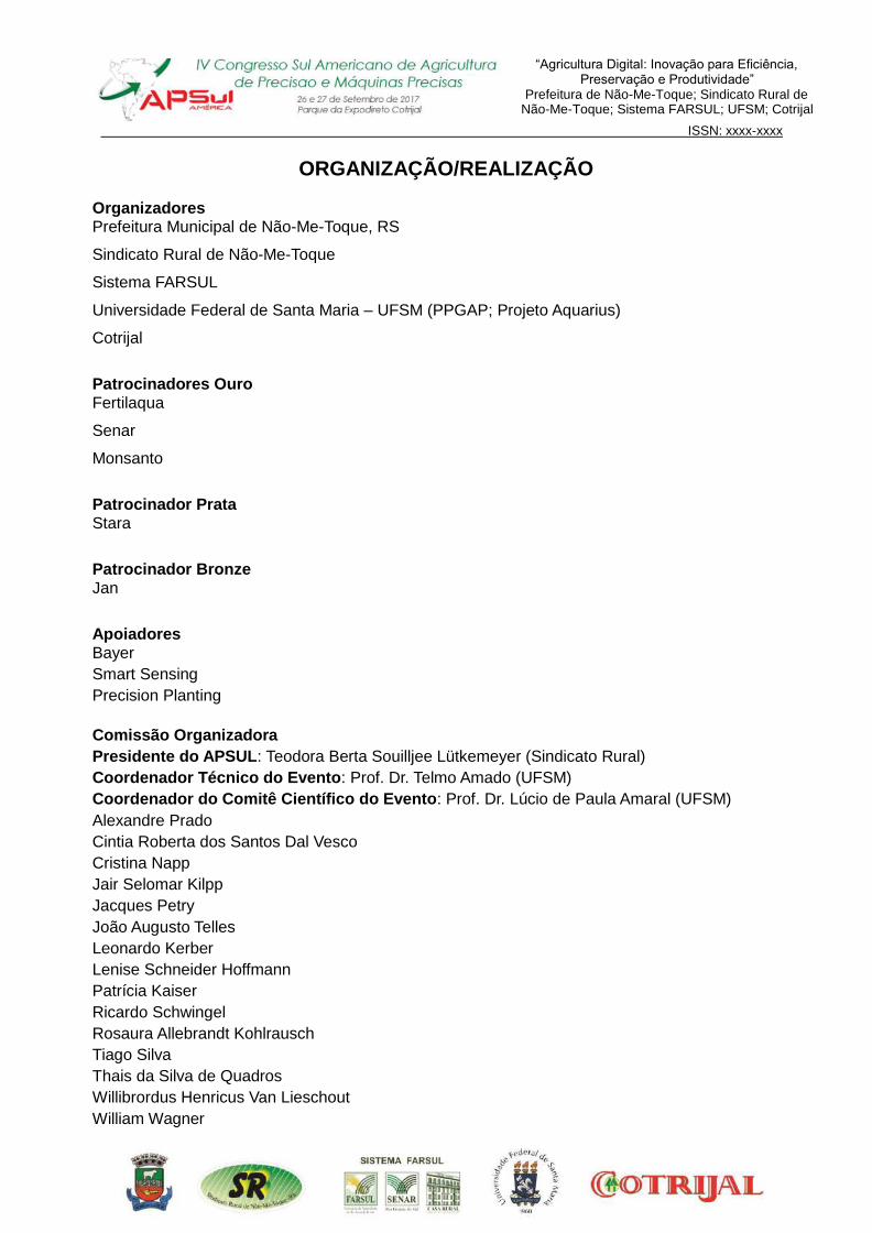
ORGANIZAÇÃO/REALIZAÇÃO Organizadores Prefeitura Municipal de Não-Me-Toque, RS
Sindicato Rural de Não-Me-Toque
Sistema FARSUL
Universidade Federal de Santa Maria – UFSM (PPGAP; Projeto Aquarius)
Cotrijal
Patrocinadores Ouro Fertilaqua
Senar
Monsanto
Patrocinador Prata Stara
Patrocinador Bronze Jan
Apoiadores Bayer
Smart Sensing
Precision Planting
Comissão Organizadora
Presidente do APSUL: Teodora Berta Souilljee Lütkemeyer (Sindicato Rural)
Coordenador Técnico do Evento: Prof. Dr. Telmo Amado (UFSM)
Coordenador do Comitê Científico do Evento: Prof. Dr. Lúcio de Paula Amaral (UFSM)
Alexandre Prado
Cintia Roberta dos Santos Dal Vesco
Cristina Napp
Jair Selomar Kilpp
Jacques Petry
João Augusto Telles
Leonardo Kerber
Lenise Schneider Hoffmann
Patrícia Kaiser
Ricardo Schwingel
Rosaura Allebrandt Kohlrausch
Tiago Silva
Thais da Silva de Quadros
Willibrordus Henricus Van Lieschout
William Wagner
“Agricultura Digital: Inovação para Eficiência, Preservação e Produtividade”
Prefeitura de Não-Me-Toque; Sindicato Rural de Não-Me-Toque; Sistema FARSUL; UFSM; Cotrijal
3
ISSN: xxxx-xxxx
Membros do Comitê Científico (Lista de Revisores e Pareceristas ad hoc) Alessandro Carvalho Miola; Professor Colégio Politécnico da UFSM; UFSM Alexandre Russini; Professor UNIPAMPA, Professor PPGAP; UNIPAMPA Antoninho João Pegoraro; Professor Colégio Politécnico da UFSM; UFSM Cássio Thomas da Silveira; Mestrando em AP-PPGAP; UFSM Christian Bredemeier; Professor UFRGS, Professor PPGAP; UFRGS Claire Delfini Viana Cardoso; Professora PPGAP/Colégio Politécnico da UFSM; UFSM Damáris Gonçalves Padilha; Professora CCR-DER, UFSM; UFSM Daniely Vaz Rodrigues da Silva; Mestranda em AP-PPGAP; UFSM Deivid Araujo Magano; Professor Faculdades Ideau, Faculdades IDEAU Dejales Fioresi; Mestrando em AP-PPGAP; UFSM Edgar Salis Brasil Neto; Mestrando em AP-PPGAP; UFSM Eduardo Leonel Bottega; Professor UFSM, Campus Cachoeira do Sul; UFSM Edvaldo Faour Coutinho da Silva; Mestrando em AP-PPGAP; UFSM Elisiane Alba; Doutoranda em EF-PPGEF; UFSM Elódio Sebem; Professor PPGAP/Colégio Politécnico da UFSM; UFSM Felipe Arthur Baron; Mestrando em AP-PPGAP; UFSM Felipe Pesini; Mestrando em AP-PPGAP; UFSM Fernanda Crestani da Silva; Mestranda em AP-PPGAP; UFSM Geovane Boschmann Reimche; Pós-doutorado-PPGCS/ Projeto Aquarius; UFSM Indiara Vânussa Cáceres Jacques; Mestranda em AP-PPGAP; UFSM Jackson Ernani Fiorin; Professor UNICRUZ, Colaborador PPGAP-UFSM; UNICRUZ Jaime Freiberger Júnior; Professor CCR-DER, UFSM; UFSM José Augusto Spiazzi Favarin; Mestrando EF-PPGEF; UFSM Juliana Marchesan; Doutoranda em EF-PPGEF; UFSM; UFSM Júlio Cesar Wincher Soares; Professor URI; URI Leandro de Mello Pinto; Professor CCR-DER, UFSM; UFSM Leandro Rampim; Professor UNICENTRO; UNICENTRO Luan Pierre Pott; Graduando em Agronomia/Projeto Aquarius; UFSM Luciano Zucuni Pes; Professor PPGAP/Colégio Politécnico da UFSM; UFSM Lúcio de Paula Amaral; Professor DER-CCR/UFSM, Professor PPGAP; UFSM Luiz Felipe Diaz de Carvalho; Professor Colégio Politécnico da UFSM; UFSM Maicon Roberto Ribeiro Machado; Mestrando-PPGF; UFPEL Marcieli Piccin; Mestranda-PPGCS/ Projeto Aquarius; UFSM Márcio da Silva Santos; Mestrando em AP-PPGAP; UFSM Marco Ivan Rodrigues Sampaio; Professor UNICRUZ, Colégio Politécnico da UFSM; UNICRUZ Mario Sassaki Hideo; Mestrando em AP-PPGAP; UFSM Mauricio Paulo Batistella Pasini; Professor no Curso de Agronomia; UNICRUZ Pablo Fernandes; Egresso PPGAP; Base Precisão na Agricultura Paulo Roberto Machado; Mestrando em AP-PPGAP; UFSM Rafael Motta; Mestrando em AP-PPGAP; UFSM Ravel Feron Dagios; Mestrando em AP-PPGAP; UFSM Roger Bohn; Mestrando em AP-PPGAP; UFSM Ropson Delavi Jendrzikowski; Mestrando em AP-PPGAP; UFSM Telmo Jorge Carneiro Amado; Professor PPGEA e PPGAP/CCR-DCS, UFSM Tiago De Gregori Teixeira; Doutorando-PPGCS/ Projeto Aquarius; UFSM Valdecir André Kirch; Mestrando em AP-PPGAP; UFSM Valmir Werner Professor; DER, CCR,NEMA, UFSM; UFSM Zanandra Boff de Oliveira; Professora Campus Cachoeira do Sul UFSM; UFSM “Os trabalhos aqui transcritos, bem como os conceitos emitidos, são de inteira responsabilidade de seus autores”.
“Agricultura Digital: Inovação para Eficiência, Preservação e Produtividade”
Prefeitura de Não-Me-Toque; Sindicato Rural de Não-Me-Toque; Sistema FARSUL; UFSM; Cotrijal
4
ISSN: xxxx-xxxx
UNIVERSIDADE FEDERAL DE SANTA MARIA PROGRAMA DE PÓS-GRADUAÇÃO EM AGRICULTURA DE PRECISÃO (PPGAP)
MESTRADO PROFISSIONAL COLÉGIO POLITÉCNICO DA UFSM
PROJETO AQUARIUS CENTRO DE CIÊNCIAS RURAIS
DEPARTAMENTO DE CIÊNCIA DO SOLO DEPARTAMENTO DE ENGENHARIA RURAL
Responsabilidade pela edição do Livro de Resumos: Coordenação do Programa de Pós-Graduação em Agricultura de Precisão - PPGAP Coordenação do Projeto Aquarius Endereço: Universidade Federal de Santa Maria – UFSM Colégio Politécnico da UFSM Cidade Universitária – Camobi Prédio 70, Bloco F, Sala 211-A Santa Maria, RS, Brasil, CEP 97.105-900 Telefone: (55) 3220 9419 (ramal 253)
e-mail: [email protected] RESERVADO PARA FICHA CATLOGRÁFICA
“Agricultura Digital: Inovação para Eficiência, Preservação e Produtividade”
Prefeitura de Não-Me-Toque; Sindicato Rural de Não-Me-Toque; Sistema FARSUL; UFSM; Cotrijal
5
ISSN: xxxx-xxxx
PREFÁCIO
A Agricultura de Precisão (AP) é uma constante tecnologia que já está presente no
Mundo, e que todos os agricultores devem ter acesso para ter economia nas aplicações e
incremento de produtividade com sustentabilidade.
A 4ª edição do Congresso Sul Americano de Agricultura de Precisão e Máquinas
Precisas tem por objetivo tornar a Agricultura de Precisão uma ferramenta ao alcance de todos os
produtores rurais, desde os pequenos até os grandes, foi o principal motivo que impulsionou Não-
Me-Toque, a Capital Nacional da Agricultura de Precisão, bem como seus parceiros,
patrocinadores e apoiadores, a apostar em um grande desafio, a realização da 4ª edição do
Apsul América, um congresso voltado para Agricultura de Precisão e Máquinas Precisas, que
rompe as fronteiras brasileiras e propicia o intercâmbio de conhecimento e interação entre
participantes da América do Sul.
Através do Congresso que acontece a cada dois anos, trazendo palestrantes e renomados
especialistas nas mais diversas áreas de pesquisa, o APSUL América oportuniza aos produtores
rurais o conhecimento das recentes tecnologias em nível de pesquisa e aplicação da Agricultura
de Precisão com eficiência e sustentabilidade, promovendo a integração entre instituições
governamentais, instituições de ensino, pesquisa e extensão, empresas fabricantes de máquinas e
softwares, prestadores de serviços, produtores rurais e demais interessados tudo isso, visando à
modernização e gerenciamento agrícola detalhado nas unidades de produção.
O tema escolhido neste ano “Agricultura Digital: Inovação para Eficiência, Preservação
e Produtividade” a fim de oportunizar aos produtores rurais o conhecimento das recentes
tecnologias em nível de pesquisa e aplicação da Agricultura de Precisão com eficiência e
sustentabilidade, através de palestras e oficinas com as melhores práticas agrícolas por meio do
avanço das mais diversas tecnologias em AP.
Nesta obra apresentamos o Livro de Resumos da 4º Congresso Sul Americano de
Agricultura de Precisão e Máquinas Precisas, disponibilizando os resumos dos trabalhos científicos
organizados em três áreas temáticas, Geotecnologias Aplicadas à Agricultura de Precisão,
Manejo Específico de Solo e Planta, e Sistemas Mecanizados em Agricultura de Precisão.
Não-Me-Toque, RS, Brasil, 26 de setembro de 2017.
Lúcio de Paula Amaral
Coordenador do Comitê Científico
Representando a Organização do 4º APSUL AMÉRICA
“Agricultura Digital: Inovação para Eficiência, Preservação e Produtividade”
Prefeitura de Não-Me-Toque; Sindicato Rural de Não-Me-Toque; Sistema FARSUL; UFSM; Cotrijal
6
ISSN: xxxx-xxxx
PREFACE
The Precision Agriculture (PA) is a constant technology that is already present in the
world, and that all farmers must have access to economize applications and increase productivity
with sustainability.
The 4th edition of the South American Congress of Precision Agriculture and
Precision Machinery aims to make Precision Agriculture a tool that is accessible to all rural
producers, from small to large, and was the main motive that drove Não-Me-Toque, the National
Capital of Precision Agriculture, as well as its partners, sponsors and supporters, to bet on a
great challenge, to hold the 4th edition of Apsul America, a congress focused on Precision
Agriculture and Precision Machinery, which breaks Brazil's borders and facilitates the exchange of
knowledge and interaction among participants from South America.
Through Congress that takes place every two years, bringing in speakers and renowned
specialists in various areas of research, the APSUL America backed the farmers the knowledge
of recent technologies research level and application of precision agriculture with efficiency and
sustainability, promoting integration among government institutions, educational institutions,
research and extension, machines and software companies, service providers, farmers and other
interested all of this aimed at modernizing and managing detailed agricultural production
units.
The theme chosen this year "Digital Agriculture: Innovation for Efficiency, Preservation
and Productivity" in order to give rural producers the knowledge of the latest technologies in
research and application of Precision Agriculture with efficiency and sustainability, through
lectures and workshops with the best agricultural practices through the advancement of the most
diverse technologies in PA.
In this work we present the Book of Abstracts of the 4th South American Congress of
Precision Agriculture and Precision Machinery, providing the abstracts of scientific papers
organized in three thematic areas, Geotechnology Applied to Precision Agriculture, Specific
Soil and Plant Management, and Mechanized Systems in Precision Agriculture.
Não-Me-Toque, RS, Brazil, september 26, 2017.
Lúcio de Paula Amaral
Coordinator of the Scientific Committee
Representing the Organization of the 4th APSUL AMERICA

“Agricultura Digital: Inovação para Eficiência, Preservação e Produtividade”
Prefeitura de Não-Me-Toque; Sindicato Rural de Não-Me-Toque; Sistema FARSUL; UFSM; Cotrijal
7
ISSN: xxxx-xxxx
SUMÁRIO
ÁREA TEMÁTICA: GEOTECNOLOGIAS APLICADAS Á AGRICULTURA DE PRECISÃO ........ 10
ANÁLISE COMPARATIVA DE ÁREAS MENSURADAS COM O USO DE SMARTPHONES ....... 11 ANÁLISE ESPACIAL ATRAVÉS DO USO DA GEOTECNOLOGIA EM UMA UNIDADE
AMOSTRAL NO PARQUE ESTADUAL DO ESPINILHO............................................................. 12 APICULTURA DIGITAL, A TRANSFORMAÇÃO TECNOLÓGICA DA APICULTURA ................. 13 CORRELAÇÃO DE IMAGENS MULTIESPECTRAIS PROVENIENTES DE AERONAVE
REMOTAMENTE PILOTADA COM DADOS DA PRODUTIVIDADE DE MILHO (ZEA MAYS L.) . 14 ESTIMATIVA DA PRODUTIVIDADE DO ALGODOEIRO POR MEIO DO PROCESSAMENTO DE
IMAGENS DIGITAIS ................................................................................................................... 15 GERAÇÃO DE UM BANCO DE DADOS GEOGRÁFICOS EM SISTEMA AGROFLORESTAL
SILVIBANANEIRO NO LITORAL NORTE DO RIO GRANDE DO SUL, BRASIL.......................... 16 INTERPOLADORES NA PREDIÇÃO DA DENSIDADE POPULACIONAL DE TIBRACA
LIMBATIVENTRIS ........................................................................................................................... 17 MAPAS TEMÁTICOS PARA O ÍNDICE DE CONE EM FUNÇÃO DA PRODUTIVIDADE ............ 18 MAPEAMENTO DA DISTRIBUIÇÃO LONGITUDINAL DE PLANTAS DE SOJA EM SISTEMA DE
INTEGRAÇÃO LAVOURA-PECUÁRIA ....................................................................................... 19 RELAÇÃO ENTRE ÍNDICES DE VEGETAÇÃO OBTIDOS POR SENSORIAMENTO ORBITAL E
ESPECTRORRADIOMETRIA DE CAMPO EM CULTIVO DE SOJA ........................................... 20 SENSORES ÓPTICOS NA AVALIAÇÃO DA RESPOSTA FENOLÓGICA DO ALGODOEIRO EM
FUNÇÃO DE DOSES DE REGULADOR DE CRESCIMENTO .................................................... 21 SENSORES PARA DETECÇÃO DE PLANTAS DANINHAS EM PÓS-EMERGÊNCIA NA
CULTURA DA SOJA .................................................................................................................. 22 UTILIZAÇÃO DE REFLECTÂNCIA DE ALVOS PARA DETECÇÃO DE PLANTAS DANINHAS EM
PRÉ-SEMEADURA .................................................................................................................... 23 USO DE AERONAVE REMOTAMENTE PILOTADA (ARP) PARA OBTENÇÃO DE
FOTOGRAFIAS AÉREAS E GERAÇÃO DE ORTOMOSAICO PARA A SILVICULTURA ............ 24 USO DE CÂMERA DIGITAL RGB EM SUBSTITUIÇÃO AO CLOROFILÔMETRO NA
RECOMENDAÇÃO DE ADUBAÇÃO NITROGENADA A TAXA VARIADA EM PASTAGENS ..... 25 USO DO SIMULADOR PHOENIX RC PARA NOÇÕES BÁSICAS DE PILOTAGEM PARA ARP
QUADRICÓPTERO (MULTIROTOR) ......................................................................................... 26 UTILIZAÇÃO DE IMAGENS DE SATÉLITE PARA DEFINIÇÃO DE ZONAS DE MANEJO .......... 27 UTILIZAÇÃO DE IMAGENS PARA DETERMINAÇÃO DE GNDVI NA CULTURA DO TRIGO ..... 28 VARIABILIDADE ESPACIAL DE EUSCHISTUS HEROS NA CULTURA DA SOJA ........................... 29 VARIABILIDADE ESPACIAL DE MACRONUTRIENTES E RECOMENDAÇÃO A TAXA VARIADA
EM UM GRAMADO DE FUTEBOL ............................................................................................. 30 VARIABILIDADE ESPACIAL DO ÍNDICE DE TEMPERATURA E UMIDADE EM CENÁRIOS DE
MUDANÇA CLIMÁTICA NO RS .................................................................................................. 31 VARIABILIDADE TEMPORAL DA COBERTURA VEGETAL DO MUNICÍPIO DE SÃO JOÃO –
PE, ATRAVÉS DE DADOS NDVI DO LANDSAT - 8 .................................................................... 32
ÁREA TEMÁTICA: MANEJO ESPECÍFICO DE SOLO E PLANTA .............................................. 33
ANÁLISE DA VARIABILIDADE ESPACIAL DE ATRIBUTOS DE SOLO E DE PLANTAS ............ 34 AVALIAÇÃO DO DESEMPENHO DE FUNÇÕES DE PEDOTRANSFERÊNCIA NA PREDIÇÃO
DA DENSIDADE DO SOLO ........................................................................................................ 35 COMPARAÇÃO DE TAXA FIXA E VARIÁVEL NAS APLICAÇÕES DE CACO3 E KCL EM
LATOSSOLO VERMELHO DISTRÓFICO NA REGIÃO CENTRO-SUL DE MG .......................... 36 COMPARAÇÃO DO ESTOQUE DE CARBONO ORGÂNICO NA TRANSIÇÃO DO SISTEMA DE
CAMPO NATIVO PARA O PLANTIO CONVENCIONAL ............................................................. 37 CONDUTIVIDADE ELÉTRICA APARENTE DO SOLO E SUA RELAÇÃO COM A
“Agricultura Digital: Inovação para Eficiência, Preservação e Produtividade”
Prefeitura de Não-Me-Toque; Sindicato Rural de Não-Me-Toque; Sistema FARSUL; UFSM; Cotrijal
8
PRODUTIVIDADE DE GRÃOS DE MILHO ................................................................................. 38 CORRELAÇÃO E VARIABILIDADE ESPACIAL DA ESTRUTURA DE NEOSSOLOS, SOB
CULTIVO DE SOJA EM PLANTIO CONVENCIONAL E SISTEMA DE PLANTIO DIRETO .......... 39 CORRELAÇÃO ENTRE CONDUTIVIDADE ELÉTRICA APARENTE E ATRIBUTOS DE UM
LATOSSOLO BRUNO ................................................................................................................ 40 DIFERENTES NÍVEIS DE COMPACTAÇÃO NA INCIDÊNCIA DE PLANTAS DANINHAS E NA
PRODUTIVIDADE DA CULTURA DA SOJA (GLYCINE MAX L.) ................................................ 41 IMPLICAÇÃO DO USO DE DIFERENTES GRADES AMOSTRAIS PARA DETERMINAÇÃO DA
RESISTÊNCIA DO SOLO À PENETRAÇÃO .............................................................................. 42 DESEMPENHO DA SOJA SOB DIFERENTES DOSES DE GESSO NA REGIÃO NOROESTE DO
RIO GRANDE DO SUL ............................................................................................................... 43 INFLUÊNCIA DA ESCARIFICAÇÃO DO SOLO NA PRODUTIVIDADE DE SOJA (GLYCINE MAX
(L.) MERR) E TRIGO (TRITICUM AESTIVUM L.) NA REGIÃO DE CRUZÁLIA-SP, ESTUDO DE CASO ................................................................................................................................................... 44 INFLUÊNCIA DE DIFERENTES PLANTAS DE COBERTURA DE INVERNO NA
PRODUTIVIDADE DA SOJA (GLYCINE MAX) EM SISTEMA DE PLANTIO DIRETO ..................... 45 INFLUÊNCIA NA DISPONIBILIDADE DE FÓSFORO NO SOLO E NA PRODUTIVIDADE DA
CULTURA DO MILHO (ZEA MAYS L.) EM RELAÇÃO A VARIABILIDADE ESPACIAL DA
ATIVIDADE MICORRÍZICA ........................................................................................................ 46 MAPEAMENTO DA PRODUTIVIDADE DO MILHO (ZEA MAYS L.) E NÍVEIS DE CLOROFILA EM
DIFERENTES DOSAGENS DE FERTILIZANTE EM NITOSSOLO VERMELHO SOB SISTEMA
PLANTIO DIRETO ...................................................................................................................... 47 PRODUTIVIDADE DE GRÃOS DE FEIJÃO SAFRINHA SOB PALHADA DE MILHO COM
INFLUÊNCIA DE PLANTAS DE COBERTURA DE INVERNO .................................................... 48 QUALIDADE DE FUNÇÕES DE PEDOTRANSFERÊNCIA PARA A PREDIÇÃO DA
RESISTÊNCIA MECÂNICA DO SOLO À PENETRAÇÃO ........................................................... 49 RELAÇÃO DA INCIDÊNCIA DE PLANTAS DANINHAS COM A RESISTÊNCIA DE UM
NITOSSOLO VERMELHO .......................................................................................................... 50 VARIABILIDADE DA PRODUÇÃO DE PALHA E SEU EFEITOS NA PRODUTIVIDADE DAS
CULTURAS ................................................................................................................................ 51 VARIABILIDADE ESPACIAL DA ACIDEZ POTENCIAL ESTIMADA PELO PH SMP EM
DIFERENTES SISTEMAS DE CULTIVO .................................................................................... 52 VARIABILIDADE ESPACIAL DA RESISTÊNCIA MECÂNICA DO SOLO À PENETRAÇÃO E
SUAS CORRELAÇÕES COM DIFERENTES PROPRIEDADES FÍSICAS DE NEOSSOLOS, SOB
CULTIVO CONVENCIONAL....................................................................................................... 53 VARIABILIDADE ESPACIAL DOS TEORES DE CARBONO ORGÂNICO TOTAL, POTÁSSIO E
FÓSFORO DISPONÍVEIS EM NEOSSOLOS E SUAS CORRELAÇÕES ESPACIAIS NUMA
ENCOSTA .................................................................................................................................. 54 VARIABILIDADE ESPACIAL E TEMPORAL DAS FRAÇÕES DA MATÉRIA ORGÂNICA DO
SOLO PÓS-INSERÇÃO DA CULTURA DA SOJA COM PLANTIO CONVENCIONAL SOB
CAMPO NATIVO ........................................................................................................................ 55 VARIABILIDADE VERTICAL DA RESISTÊNCIA DO SOLO À PENETRAÇÃO EM DIFERENTES
AMBIENTES DE PRODUTIVIDADE ........................................................................................... 56
ÁREA TEMÁTICA: SISTEMAS MECANIZADOS EM AGRICULTURA DE PRECISÃO ............... 57
ADOÇÃO DO TRÁFEGO CONTROLADO AGRÍCOLA E RESULTADOS PARA SOJA NO RS ... 58 AVALIAÇÃO DA VIDA ÚTIL E DOS EFEITOS DO DESGASTE DAS PONTAS HIDRÁULICAS
COM INDUÇÃO DE AR SOBRE A PULVERIZAÇÃO AGRÍCOLA ............................................... 59 MECANISMOS DOSADORES E SEU EFEITO SOBRE FERTILIZANTES SÓLIDOS ................. 60 PLANTABILIDADE DE MILHO SUBMETIDA A DIFERENTES COEFICIENTES DE VARIAÇÃO
NA LINHA DE SEMEADURA ...................................................................................................... 61 PROGRESSO DA FROTA BRASILEIRA DE TRATORES COM ATÉ 20 ANOS DE USO, DESDE
A INSTALAÇÃO DA INDÚSTRIA LOCAL ................................................................................... 62 QUALIDADE DE SEMEADURA DE UMA SEMEADORA PNEUMÁTICA EM FUNÇÃO DA
“Agricultura Digital: Inovação para Eficiência, Preservação e Produtividade”
Prefeitura de Não-Me-Toque; Sindicato Rural de Não-Me-Toque; Sistema FARSUL; UFSM; Cotrijal
9
DECLIVIDADE DO TERRENO ................................................................................................... 63 QUALIDADE DE SEMEADURA DE UMA SEMEADORA PNEUMÁTICA EM FUNÇÃO DA
VELOCIDADE DE DESLOCAMENTO ........................................................................................ 64 QUALIDADE DO CORTE DE BASE UMA COLHEDORA MULTILINHAS DE CANA-DE-AÇÚCAR
EM RELAÇÃO À DECLIVIDADE DO TERRENO ........................................................................ 65 RESISTÊNCIA À PENETRAÇÃO DO SOLO NO SISTEMA DE TRÁFEGO CONTROLADO DE
MÁQUINAS NA CULTURA DA SOJA ......................................................................................... 66 TEMPOS E MOVIMENTOS NO ARRANQUIO MECANIZADO DE AMENDOIM EM FORMATOS
DE TALHÕES DISTINTOS ......................................................................................................... 67 VARIABILIDADE DA ALTURA DO CORTE DE BASE UMA COLHEDORA MULTILINHAS DE
CANA-DE-AÇÚCAR EM RELAÇÃO À DECLIVIDADE DO TERRENO........................................ 68 VELOCIDADE DE SEMEADURA E SUA INFLUÊNCIA SOBRE A PRODUTIVIDADE DA
CULTURA DO MILHO ................................................................................................................ 69
“Agricultura Digital: Inovação para Eficiência, Preservação e Produtividade”
Prefeitura de Não-Me-Toque; Sindicato Rural de Não-Me-Toque; Sistema FARSUL; UFSM; Cotrijal
10
ISSN: xxxx-xxxxl
Área Temática: Geotecnologias Aplicadas á Agricultura de Precisão
“Agricultura Digital: Inovação para Eficiência, Preservação e Produtividade”
Prefeitura de Não-Me-Toque; Sindicato Rural de Não-Me-Toque; Sistema FARSUL; UFSM; Cotrijal
11
ISSN: xxxx-xxxxl
ANÁLISE COMPARATIVA DE ÁREAS MENSURADAS COM O USO DE
SMARTPHONES Comparative analysis of areas measured with the use of smartphones
Tiago Gonçalves Lopes 1, Lissara Polano Ody 2, Alcionei Brutti Dallaporta 3, Gessiele Possebom 4,
Bruno Zart 5, Airton dos Santos Alonço 6, Vilnei de Oliveira Dias 7
1,4,5,6 Universidade Federal de Santa Maria, Av. Roraima nº 1000, CEP 97105-900, Santa Maria - RS, Brasil,
[email protected] 2,3,7
Universidade Federal do Pampa, Av. Tiarajú nº 810, CEP 97546-550, Alegrete - RS, Brasil.
RESUMO
O presente trabalho objetiva avaliar a precisão de dispositivos móveis equipados com sistema de GPS assistido (A-GPS), como possível ferramenta alternativa para a realização de levantamentos planimétricos com finalidades agrícolas. Para isso, foram conduzidos experimentos de estimativa de áreas com distintas dimensões, avaliando quatro tipos de dispositivos para levantamento planimétrico: receptor GNSS L1 geodésico, receptor GNSS código C/A de navegação, smartphone com plataforma Android e smartphone com plataforma iOS, estes dois últimos equipados com aplicativo Planimeter GPS Area Measure e internet 3G. Com delineamento inteiramente casualizado (DIC) em esquema fatorial 4x5 (4 dispositivos x 5 áreas), com três repetições, totalizando 60 combinações de tratamento. Obtiveram-se resultados satisfatórios, alcançando precisões mínimas acima dos 98% em área total comparada, validando o uso dos smartphones avaliados como ferramenta para coleta de dados planimétricos em diversas atividades agrícolas do dia-a-dia do agricultor. Palavras-chave: A-GPS. Agricultura. Planimetria.
ABSTRACT The present work aims to evaluate the precision of mobile devices equipped with assisted GPS system (A-GPS), as a possible alternative tool for carrying out planimetric surveys with agricultural purposes. For this, experiments were performed to estimate areas with different dimensions, evaluating four types of planimetric survey devices: GNSS L1 geodetic receiver, GNSS receiver C/A navigation code, smartphone with Android platform and smartphone with iOS platform, the latter two equipped with Planimeter GPS Area Measure application and 3G internet. With a completely randomized design (CRD) in a 4x5 factorial scheme (4 devices x 5 areas), with three replications, totaling 60 treatment combinations. Satisfactory results were obtained, reaching minimum precision above 98% in total area compared, validating the use of smartphones evaluated as planimetric data collection tool in various agricultural activities of the farmer's daily life. Keywords: A-GPS. Agriculture. Planimetry.
“Agricultura Digital: Inovação para Eficiência, Preservação e Produtividade”
Prefeitura de Não-Me-Toque; Sindicato Rural de Não-Me-Toque; Sistema FARSUL; UFSM; Cotrijal
12
ISSN: xxxx-xxxxl
ANÁLISE ESPACIAL ATRAVÉS DO USO DA GEOTECNOLOGIA EM UMA UNIDADE AMOSTRAL NO PARQUE ESTADUAL DO ESPINILHO
Space analysis through the use of geotechnology in a sample unit in the Parque Estadual do Espinilho
Cássio Thomas da Silveira 1, Lucio de Paula Amaral 2, Luciano Farinha Watzlawick 3
1 UFSM/PPGAP, Av. Roraima, 1000 - Camobi, 97000-000, Santa Maria – RS, Brasil,
[email protected] 2 DER/CCR/UFSM, Campus Sede - Prédio 44J - 2º piso, 97105-900, Santa Maria – RS, Brasil,
[email protected] 3 PGA, UNICENTRO, Guarapuava, PR, Brasil, [email protected]
RESUMO O trabalho tem como objetivo, analisar espacialmente a distribuição de árvores nativas em uma unidade amostral permanente, através de um levantamento fitossociológico já realizado na Unidade de Conservação Parque Estadual do Espinilho, localizada no município de Barra do Quaraí, no extremo sudoeste do Rio Grande do Sul. Utilizando-se da geotecnologia como ferramenta principal de estudo, através da geração de mapas de densidade de Kernel. Obteve-se como resultado, mapas da distribuição espacial dos indivíduos florestais presentes no estudo e demonstrou-se o comportamento de padrões no levantamento, tanto das duas espécies mais ocorrentes, como do total de indivíduos arbóreos. Os resultados mostraram que este tipo de estudo é de extrema importância, pois permite identificar, através do levantamento fitossociológico e da geotecnologia, a distribuição espacial das árvores, gerando ainda, uma base de dados geográficos que poderão auxiliar futuros estudos, configurando o que hoje é conhecido como Floresta de Precisão, de maneira análoga à Agricultura de Precisão. Palavras-chave: Distribuição espacial. Floresta de precisão. Geotecnologia.
ABSTRACT The objective of this work is to analyze spatially the distribution of native trees in a permanent sampling unit, through a phytosociological survey already carried out at the Conservation Unit Parque Estadual do Espinilho, located in the municipality of Barra do Quaraí, at the extreme southwest of Rio Grande do Sul. Using geotechnology as the main study tool through the generation of kernel density maps. As a result, maps of the spatial distribution of the forest individuals present in the study were obtained and the behavior of patterns in the survey of both the most occurring species and the total number of arboreal individuals was demonstrated. The results showed that this type of study is extremely important because it allows to identify, through phytosociological and geotechnology surveys, the spatial distribution of trees, generating a geographic database that may help future studies, configuring what is now known as Precision Forest, in a manner analogous to Precision Agriculture. Keywords: Spatial distribution. Precision forest. Geotechnology.
“Agricultura Digital: Inovação para Eficiência, Preservação e Produtividade”
Prefeitura de Não-Me-Toque; Sindicato Rural de Não-Me-Toque; Sistema FARSUL; UFSM; Cotrijal
13
ISSN: xxxx-xxxxl
APICULTURA DIGITAL, A TRANSFORMAÇÃO TECNOLÓGICA DA APICULTURA
Digital Apiculture, the digital transformations of beekeeping
David Ferreira Mojaravscki 1
1 Universidade Federal de Santa Maria, Av. Roraima nº 1000, 97105-900, Santa Maria - RS, Brasil,
RESUMO Para alimentar 9 bilhões de pessoas em 2050, serão precisas ações que visem mais do que apenas minimizar a extinção das abelhas, será preciso aliar a tecnologia à apicultura, a apicultura digital, dentre outras ações. Com o sucesso da agricultura de precisão como referência, a apicultura de precisão e a apicultura digital surgem como novos modelos para redefinir os novos desafios para planejamento, gestão e controle no apiário com adoção de inovações tecnológicas, aplicada a coleta, processamento e envio de dados, que representam um papel fundamental da democratização da informação. A outra grande barreira será como essa transformação trará o apicultor para esta possível nova realidade. Palavras-chave: Extinção de abelhas. Controle da produção de mel. Apiários.
ABSTRACT Feed 9 billion people by 2050, mode needs to be done with bee extinguishing, technology is required for beekeeping, beekeeping digital. With the success of precision farming as a benchmark, beekeeping and digital precision beekeeping as the new models to redefine how new frontiers of technology in the apiary, through date, play a key role in the democratization of information and how this transformation will bring the beekeeper to a new reality. Keywords: Extinction of bees. Control of honey production. Apiary.

“Agricultura Digital: Inovação para Eficiência, Preservação e Produtividade”
Prefeitura de Não-Me-Toque; Sindicato Rural de Não-Me-Toque; Sistema FARSUL; UFSM; Cotrijal
14
ISSN: xxxx-xxxxl
CORRELAÇÃO DE IMAGENS MULTIESPECTRAIS PROVENIENTES DE AERONAVE REMOTAMENTE PILOTADA COM DADOS DA
PRODUTIVIDADE DE MILHO (ZEA MAYS L.) Correlation of multispectral images from aircraft remotely piloted with corn
productivity (zea mays l.)
Pablo Fernandes 1, Vinicius Henrique Fernandes 2, Jessica Hoch Boelter 3 1,2,3
Base Precisão na Agricultura, Osvaldo Zambonato,623 – Centro, 97195-000, Silveira Martins – RS, Brasil, [email protected]; [email protected];
RESUMO A agricultura de precisão tem buscado novas técnicas para aumentar a eficiência no sistema produtivo de grãos e, neste cenário, tecnologias como a RPA (Aeronave Remotamente Pilotada) tornam-se ferramentas com potencial para determinação da variabilidade espacial das lavouras. O estudo teve como objetivo avaliar a correlação da utilização de imagens multiespectrais provenientes de RPA para estimar a produtividade da cultura de milho (Zea mays L.). A pesquisa foi realizada em um talhão de 51,6 ha, localizado em São Martinho da Serra, Rio Grande do Sul. A cultura utilizada foi o híbrido de milho Pioneer 1630 hx, semeadura em 20/08/2014 e colheita em 20/01/2015. A captura de imagens do talhão ocorreu com a RPA modelo EI Asesor/5 equipado com dois sensores multiespectrais modelo Teracam ACD Micro e Flir Tau 2. Os dados de produtividade foram obtidos através do registro dos sensores de colheita da colhedora John Deere 9670. A banda do Infravermelho termal obteve maior correlação com os dados de produtividade de milho com R²= 0,68. Palavras-chave: RPA. Milho. Agricultura de Precisão.
ABSTRACT Precision farming has sought new techniques to increase efficiency in the grain production system and, in this scenario, technologies such as the Unmanned Aerial Vehicle (UAV) become tools with potential for determining the spatial variability of crops. The objective of this study was to evaluate the correlation of the use of multispectral images from UAVs to estimate maize crop productivity (Zea mays L.). The research was carried out in a field of 51.6 ha, located in São Martinho da Serra, Rio Grande do Sul. The crop used was the corn hybrid Pioneer 1630 hx, sown on 08/20/2014 and harvested on 01/20 / 2015. The image capture of the field occurred with the UAV Assessor EI Asesor / 5 equipped with two multispectral sensors model Teracam ACD Micro and Flir Tau 2. Productivity data were obtained through the harvest sensors register of the John Deere 9670 harvester. The thermal infrared obtained a higher correlation with the yield data of corn with R² = 0.68. Keywords: UAV. Mays. Precision Agriculture.

“Agricultura Digital: Inovação para Eficiência, Preservação e Produtividade”
Prefeitura de Não-Me-Toque; Sindicato Rural de Não-Me-Toque; Sistema FARSUL; UFSM; Cotrijal
15
ISSN: xxxx-xxxxl
ESTIMATIVA DA PRODUTIVIDADE DO ALGODOEIRO POR MEIO DO PROCESSAMENTO DE IMAGENS DIGITAIS Cotton yield estimation by digital image processing
Danilo Tedesco de Oliveira 1, Rouverson Pereira da Silva 1, Edson Massao Tanaka 2, Marco
José Bueno de Oliveira 2, Rafael de Graaf Correa 1, Marco Antônio Vrech 1, Luan Pereira de
Oliveira 1
1 Laboratório de Máquinas e Mecanização Agrícola – LAMMA, UNESP/FCAV, Via de Acesso Prof.
Paulo Donato Castellane, s/n, 14.884-900, Jaboticabal – SP, Brasil, [email protected]; [email protected]; [email protected]; [email protected];
[email protected] 2 Grupo de Estudos de Colheita Mecanizada – FATEC Pompeia, Av. Shunji Nishimura, 605, 17.580-
000, Pompeia – SP, Brasil, [email protected]; [email protected]
RESUMO As colhedoras de algodão cada vez mais estão com tecnologias embarcadas para automação da máquina e aquisição de dados, porém a máquina ainda não realiza uma colheita inteligente realizando regulagens de acordo com a produtividade da cultura, para isso seria necessário estimar a produtividade da cultura. Com base nesse contexto, teve por objetivo nesse trabalho utilizar técnicas de processamento de imagens digitais, para realizar contagem de capulhos de algodão e assim estimar a produtividade da cultura. As amostras de produtividade foram coletadas em 20 pontos amostrais, cada ponto foi composto por uma linha de 5 metros. As produtividades foram estimadas por três metodologias: direta, indireta e automatizada. Os resultados apresentaram que a metodologia automatizada pelo processamento de imagens digitais é tão eficiente quanto a metodologia indireta, onde foi possível realizar a contagem de capulhos de algodão e estimar a produtividade da cultura. Palavras-chave: Reconhecimento de Padrões. Colheita de Precisão.
ABSTRACT As cotton harvesters increasingly are with embedded machines for machine automation and data acquisition, but a machine is not yet a company that works with a crop yield, for this it is necessary to estimate a crop yield. Based on the context, the objective was to work using digital image processing techniques to perform counting of cotton chapters and thus estimate crop yield. As yield samples were collected at 20 points, each point was composed of a 5-meter line. As yield were estimated by three methodologies: direct, indirect and automated. The results presented an automated methodology for digital image processing and as efficient as an indirect methodology, where it was possible to count cotton chapters and estimate crop yield. Keywords: Pattern Recognition. Precision Harvesting.
“Agricultura Digital: Inovação para Eficiência, Preservação e Produtividade”
Prefeitura de Não-Me-Toque; Sindicato Rural de Não-Me-Toque; Sistema FARSUL; UFSM; Cotrijal
16
ISSN: xxxx-xxxxl
GERAÇÃO DE UM BANCO DE DADOS GEOGRÁFICOS EM SISTEMA AGROFLORESTAL SILVIBANANEIRO NO LITORAL NORTE DO RIO
GRANDE DO SUL, BRASIL Generation of a geographic database in agroforestry system on the
North Coast of Rio Grande do Sul, Brazil
Lúcio de Paula Amaral 1, Regiane Aparecida Fereira 2, Elódio Sebem 3, André Luis Rodrigues
Gonçalves 4, Cristiano Motter 5
1 PPGAP; DER-CCR/UFSM, Av, Roraima, n. 1000 – Prédio 44J. sala 213, 97105-900, Santa Maria –
RS, Brasil, [email protected] 2 Engenheira Florestal, Rua Cinco de Março, n. 104, 97105-300, Santa Maria – RS, Brasil,
[email protected] 3 PPGAP; Colégio Politécnico/UFSM, Av, Roraima. n. 1000 – Prédio 70. Sala 212, 97105-900, Santa
Maria – RS, Brasil, [email protected] 4 Centro Ecológico, Dom Pedro de Alcântara, RS; IFSC, Campus Sombrio – SC, Brasil,
[email protected] 5 Centro Ecológico, Rua Padre Jorge, n. 51, 95.568-000, Dom Pedro de Alcântara-RS, Brasil,
RESUMO O objetivo deste trabalho foi gerar um banco de dados geográficos (BDG) para sistema de informação geográfico (SIG), localizando as árvores de um sistema agroflorestal (SAF) silvibananeiro, em Três Cachoeiras, RS, Brasil. O limite do SAF foi obtido com receptor GNSS de navegação. Realizou-se inventário florestal pelo método da sexta árvore de Prodan, com 32 pontos amostrais (PA) georreferenciados. As distâncias dos PA até as árvores foram medidas com trena e o azimute com bússola, para realizar o transporte de coordenadas dos PA no plano topográfico, até as respectivas árvores. Nos PA foram identificadas as espécies e as famílias das árvores e mensurados suas circunferências a altura do peito (cap) e alturas totais. Os dados foram tabulados em planilha eletrônica e importados para o SIG Arc Map 10.1®, onde foram espacializados e criados shapefile de pontos. Com o limite gerou-se um shapefile de feição poligonal. O BDG criado foi considerado adequado e satisfatório para caracterizar o SAF no SIG. Em estudos posteriores serão estimadas e interpoladas as variáveis biomassa, estoque de carbono e diversidade de espécies, como serviços ambientais neste SAF. Palavras-chave: Floresta de precisão. Agricultura de precisão. Agroflorestas.
ABSTRACT The objective of this paper was to generate a geographic database for geographic information system (GIS), locating the trees of a agroforestry system, in Três Cachoeiras, RS, Brazil. The agroforestry limit was obtained with GNSS navigation receiver. A forest inventory was carried out using the Prodan sixth tree method, with 32 georeferenced sample points (SP). The distances from the SP to the trees were measured with tapeline and the azimuth with compass to carry the coordinates of the SP in the topographic plane, to the respective trees. In SP the species and the families of the trees were identified and their measured circumferences at breast height and total heights. The data were tabulated in spreadsheet and imported into the Arc Map 10.1® GIS, where spatial and point shapefile were created. With the agroforestry limit a shapefile of polygonal feature was generated. The geographic database created was considered adequate and satisfactory to characterize the agroforestry in the GIS. In later studies, the variables biomass, carbon stock and species diversity, as environmental services in this agroforestry, will be estimated and interpolated. Keywords: Precision forest. Precision agriculture. Agroforestry.
“Agricultura Digital: Inovação para Eficiência, Preservação e Produtividade”
Prefeitura de Não-Me-Toque; Sindicato Rural de Não-Me-Toque; Sistema FARSUL; UFSM; Cotrijal
17
ISSN: xxxx-xxxxl
INTERPOLADORES NA PREDIÇÃO DA DENSIDADE POPULACIONAL DE Tibraca limbativentris
Interpolation predicting Tibraca limbativentris density population estimate
Mauricio Paulo Batistella Pasini 1, Alessandro Dal’Col Lúcio 2, Eduardo Engel 1 1 Universidade de Cruz Alta – UNICRUZ, Rodovia Municipal Jacob Della Méa, km 5.6 - Parada Benito,
CEP 98005-972, Cruz Alta, Rio Grande do Sul, Brasil. E-mail: [email protected] 2 Universidade Federal de Santa Maria, Av. Roraima nº 1000, Cidade Universitária, Bairro Camobi,
Santa Maria – RS, Brasil, CEP: 97105-900, E-mail: [email protected]
RESUMO Este estudo teve por objetivo comparar a precisão dos métodos de interpolação krigagem ordinária e inverso da distância ponderada aplicados na espacialização da densidade populacional de Tibraca limbativentris no cultivo do arroz irrigado. Em Santa Maria, Rio Grande do Sul, Brasil, foram realizadas sete avaliações da densidade populacional de T. limbativentris, em duas áreas de cultivo com área de 1,3 e 6,2 ha, a partir da semeadura até a maturação. Nestas áreas os adultos de T. limbativentris foram quantificados e o somatório utilizado para a análise. Os valores foram submetidos aos interpoladores da krigagem ordinária em diferentes modelos de semivariogramas e do inverso da distância ponderada em diferentes ponderadores sendo os melhores, para cada avaliação, comparados por validação cruzada. Foi possível concluir que o método de interpolação krigagem ordinária apresenta melhor desempenho que o método do inverso da distância ponderada, sendo recomendada sua utilização na espacialização da densidade populacional de T. limbativentris no cultivo do arroz irrigado. Palavras-chave: Precisão. Oryza sativa. Percevejo-do-colmo.
ABSTRACT The aimed study to compare the ordinary kriging and inverse distance weighted interpolation methods, applied to the spatial distribution of population density of Tibraca limbativentris in irrigated rice. In Santa Maria, Rio Grande do Sul, Brazil, in two growing areas, with an area of 1.3 ha and 6.2, assessments of T. limbativentris population density were made from seeding to maturity, a total seven. In these areas the adults of T. limbativentris were quantified and the sum used for the analysis. The values were submitted to the ordinary kriging interpolation in different semivariogram models and inverse distance weighted in different weights being the best, for each assessment, compared by cross-validation. From the results it was concluded that the ordinary kriging interpolation method performs better than the method of inverse distance weighted, and recommended its use in spatial population density of T. limbativentris in irrigated rice. Keywords: Precision. Oryza sativa. Rice stink bug.
“Agricultura Digital: Inovação para Eficiência, Preservação e Produtividade”
Prefeitura de Não-Me-Toque; Sindicato Rural de Não-Me-Toque; Sistema FARSUL; UFSM; Cotrijal
18
ISSN: xxxx-xxxxl
MAPAS TEMÁTICOS PARA O ÍNDICE DE CONE EM FUNÇÃO DA PRODUTIVIDADE
Thematic maps for the cone index in the function of productivity
Matheus Anaan de Paula Borba 1, Tulio Marchi Bunhola 2, Danilo Tedesco de Oliveira 1,
Rafael De Graaf Corrêa 1, Luan Pereira de Oliveira 1, Cristiano Zerbato 1, Rouverson Pereira
da Silva 1
1 FCAV/UNESP, Via de Acesso Prof. Paulo Donato Castelane, s/n, 14870-300, Jaboticabal – SP,
Brasil, [email protected]; [email protected]; [email protected]; [email protected]; [email protected]; [email protected]
2 FAFRAM, R. Domingos Nunes Macedo, s/n, 14500-000, Ituverava – SP, Brasil,
RESUMO A produtividade do amendoim é afetada principalmente pela resistência do solo à penetração do ginóforo, acarretando grandes perdas. Sendo assim, objetivou-se neste trabalho avaliar a relação entre o índice de cone e a produtividade. O experimento foi conduzido na área experimental, à qual pertence à Fazenda de Ensino, Pesquisa e Extensão – FEPE, UNESP/FCAV, Jaboticabal – SP. Foi determinado o teor de água do solo, com auxílio de um trado holandês, posteriormente as amostras foram pesadas em balança de precisão portátil. Para quantificar a produtividade da cultura do amendoim, recolheu-se manualmente todo o material, após o arranquio mecanizado, para dentro de uma armação de 2m², posteriormente, as amostras foram transportadas para o LAMMA, retirando-se as vagens das plantas, pesando-as seguidamente em uma balança de precisão. Por meio da análise de correlação de Pearson, a altura da leira e as perdas visíveis no processo de recolhimento apresentaram uma correlação negativa. Com isso podemos afirmar que não houve neste trabalho relação entre o índice de cone e produtividade. Palavras-chave: Resistência do solo. Compactação. Rendimento.
ABSTRACT Peanut productivity is affected mainly by the resistance of the soil to the penetration of the gland, leading to heavy losses. Therefore, the objective of this study was to evaluate the relationship between cone index and productivity. The experiment was conducted in the experimental area, to which belongs to the Fazenda de Ensino, Pesquisa e Extensão - FEPE, UNESP / FCAV, Jaboticabal - SP. The water content of the soil was determined with the aid of a Dutch test, after which the samples were weighed in a portable precision scale. In order to quantify the productivity of the peanut crop, all the material was collected manually, after the mechanized startup, inside a 2 m 2 frame, after which the samples were transported to the LAMMA and the pods were removed from the plants and then weighed in a precision scale. Through Pearson's correlation analysis, the height of the loop and the visible losses in the recall process had a negative correlation. With this, we can affirm that there was no relation between the cone and productivity index in this work. Keywords: Soilstrength. Compaction. Yield.
“Agricultura Digital: Inovação para Eficiência, Preservação e Produtividade”
Prefeitura de Não-Me-Toque; Sindicato Rural de Não-Me-Toque; Sistema FARSUL; UFSM; Cotrijal
19
ISSN: xxxx-xxxxl
MAPEAMENTO DA DISTRIBUIÇÃO LONGITUDINAL DE PLANTAS DE SOJA EM SISTEMA DE INTEGRAÇÃO LAVOURA-PECUÁRIA
Soybean plant longitudinal distribution mapping in crop-livestock integration system
Eduardo Leonel Bottega 1, Daniel Alves da Veiga Grubert 2, Bruna Orsi 3 1 Universidade Federal de Santa Maria, campus de Cachoeira do Sul, Rua Ernesto Barros, 1345,
96506-322, Cachoeira do Sul – RS, Brasil, [email protected] 2,3
Escola Superior de Agricultura “Luiz de Queiroz” (ESALQ), Endereço, CEP, Piracicaba – SP, Brasil,
[email protected], [email protected]
RESUMO A operação de semeadura da soja tem grande importância no rendimento da cultura, pois a uniformidade da distribuição longitudinal de sementes pode contribuir para um adequado estande de plantas e melhoria da produtividade. Este trabalho objetivou estudar a variabilidade espacial da distribuição longitudinal entre plantas de soja, em sistema de integração lavoura-pecuária. Para isso, foi estabelecida uma malha composta por 66 pontos amostrais georreferenciados. A avaliação da distribuição longitudinal de plantas foi realizada com as plantas em estádio vegetativo V4. Em cada ponto amostral foi efetuada a contagem das plantas presentes em um metro, bem como mensurada a distância (X, cm) entre plantas na linha de cultivo. Os dados foram coletados em três linhas de um metro cada, em cada ponto. Avaliou-se a porcentagem de espaçamentos falhos (X>10,5), duplos (X<3,5) e normais (3,5<X<10,5). A dependência espacial foi avaliada pelo programa GS+, versão 9. A variabilidade espacial dos atributos espaçamentos falhos e espaçamentos normais apresentou dependência espacial moderada, com alcances de 84,9 e 96,5 metros, respectivamente. A classe de espaçamentos duplos e plantas por metro não apresentaram dependência espacial na distância entre pontos amostrais utilizada, indicando que suas distribuições são aleatórias. Palavras-chave: Glycine max. Variabilidade espacial. Geostatística.
ABSTRACT The sowing operation of soybean has great importance in crop yield, since the uniformity of the longitudinal distribution of seeds can contribute to an adequate plant stand and productivity improvement. This work aimed to study the spatial variability of the longitudinal distribution among soybean plants, in a crop - livestock integration system. For this, a mesh composed of 66 georeferenced sample points was established. The evaluation of the longitudinal distribution of plants was carried out with the plants in vegetative stage V4. At each sampling point, the plants were counted in a meter, as well as measured at distance (X, cm) between plants in the growing line. The data were collected in three lines of one meter each, at each point. The percentage of faulty (X>10.5), double (X<3.5) and normal (3.5<X<10.5) spacing was evaluated. The spatial dependence was evaluated by the GS+ program, version 9. The spatial variability of the attributes normal spacing and spacing showed moderate spatial dependence, with a range of 84.9 and 96.5 meters, respectively. The class of double spacing and plants per meter did not show spatial dependence on the distance between sample points used, indicating that their distributions are random. Keywords: Glycine max. Spatial variability. Geostatistics.

“Agricultura Digital: Inovação para Eficiência, Preservação e Produtividade”
Prefeitura de Não-Me-Toque; Sindicato Rural de Não-Me-Toque; Sistema FARSUL; UFSM; Cotrijal
20
ISSN: xxxx-xxxxl
RELAÇÃO ENTRE ÍNDICES DE VEGETAÇÃO OBTIDOS POR SENSORIAMENTO ORBITAL E ESPECTRORRADIOMETRIA DE CAMPO
EM CULTIVO DE SOJA Relationship between vegetation indices obtained by orbital sensoring and
spectrorradiometry of field in soybean cultivation
Daniely Vaz Rodrigues da Silva 1, Elódio Sebem 2, Letícia Daiane Pedrali 3, Marcos Augusto
Gomes dos Santos 4 1,2
PPGAP, Colégio Politécnico da UFSM, Av. Roraima n° 1000, Prédio 70, CEP 97.105-900, Santa Maria – RS, Brasil, [email protected], [email protected]
3,4 Colégio Politécnico da UFSM, Av. Roraima n° 1000, Prédio 70, CEP 97.105-900, Santa Maria – RS,
Brasil, [email protected], [email protected]
RESUMO Diante da necessidade de se produzir mais e em menor espaço de tempo a agricultura digital apresenta-se consolidada no presente e futuro da agricultura, sendo as técnicas de sensoriamento remoto extremamente úteis para o crescimento da mesma. A aplicação do sensoriamento remoto à agricultura permite a otimização da coleta de dados, dentre as principais informações geradas estão os índices de vegetação, salientando-se seu uso para inferir e monitorar o vigor da vegetação. O objetivo deste trabalho foi estudar a correlação e a variabilidade espacial dos índices de vegetação NDVI, SAVI e EVI obtidos por espectrorradiometria de campo e por sensor orbital. Como resultados, obteve-se correlação significativa para o índice NDVI x NDVI Sentinel. O índice NDVI derivado de espectrorradiometria obteve correlação moderada e significativa para todos os índices derivados da imagem Sentinel. Para a geoestatística, optou-se pelo Inverso da distância e não a Krigagem, pois o ajuste variográfico apresentou-se com R² baixo e próximo de zero. Portanto, os sensores mostram-se importantes no monitoramento das áreas agrícolas, possibilitando a geração de mapas e análises de informações geoespaciais de forma mais efetiva, precisa. Palavras-chave: Agricultura de precisão. Agricultura digital. Índices de vegetação.
ABSTRACT Under the need to produce even more in less time, digital agriculture is consolidated in the present and future of agriculture, and remote sensing techniques are extremely useful for its growth. The application of remote sensing to agriculture allows the optimization of data collection, among the main information generated are the vegetation indexes, among its numerous uses, it is emphasized its use to infer and monitor the vigor of the vegetation. The objective of this work was to study the correlation and spatial variability of vegetation indices NDVI, SAVI and EVI obtained by field spectroradiometry and by orbital sensor. As results, a significant correlation was obtained for the NDVI x NDVI Sentinel index. The NDVI index derived from spectroradiometry obtained a moderate and significant correlation for all indexes derived from the Sentinel image. For geostatistics, we chose the Inverse of the distance and not the Kriging, because the variographic adjustment was presented with R² low and close to zero. Therefore, the sensors are important in the monitoring of the agricultural areas, enabling the generation of maps and analyzes of geospatial information in a more effective and precise way. Keywords: Precision agriculture. Digital agriculture. Indexes of vegetation.
“Agricultura Digital: Inovação para Eficiência, Preservação e Produtividade”
Prefeitura de Não-Me-Toque; Sindicato Rural de Não-Me-Toque; Sistema FARSUL; UFSM; Cotrijal
21
ISSN: xxxx-xxxxl
SENSORES ÓPTICOS NA AVALIAÇÃO DA RESPOSTA FENOLÓGICA DO ALGODOEIRO EM FUNÇÃO DE DOSES DE REGULADOR DE
CRESCIMENTO Optical sensors in the evaluation of the phenological response of
cotton in the function of doses of growth regulator
Diego Lima Gasparelli 1, Marco Antônio Vrech de Souza 2, Luan Pereira de Oliveira 3,
Fernando Henrique Queiroz Souza 4, Victor Silva Pereira 5, Fábio Henrique Rojo Baio 6,
Danilo Tedesco de Oliveira 7, Rafael De Graaf Corrêa 8
1,4,5,6 Universidade Federal de Mato Grosso do Sul, Rodovia MS 306 Km 105, CEP 79560-000,
Chapadão do Sul-MS, Brasil, [email protected]; [email protected]; [email protected]
2,3,7,8 Universidade Estadual Paulista ‘Júlio Mesquita Filho’ Via de Acesso Prof. Paulo Donato
Castellane s/n, CEP 14884-900, Jaboticabal-SP, Brasil, [email protected]; [email protected]; [email protected]; [email protected]
RESUMO O regulador de crescimento é dosado em função do crescimento da cultura, que por sua vez pode ser mensurado utilizando técnicas de sensoriamento remoto por índices de vegetação. O presente estudo teve como objetivo a avaliação da resposta fenológica do algodoeiro pela variação de doses do regulador de crescimento aplicado em VRT e sua correlação valores dos índices de vegetação de sensores óticos passivos e ativos. O regulador foi aplicado no estádio fenológico F5. Todas as doses do regulador (tratamentos) foram aplicadas em VRT nas três classes de índice de vegetação (NDVI) regionalizadas no talhão: alto NDVI (plantas de alto vigor, maior taxa fotossintética e maior porte); médio NDVI (médio vigor); e baixo NDVI (plantas de baixo vigor). A maior correlação positiva entre a altura da planta e o índice de vegetação foi obtida pelo uso do sensor passivo por câmera multiespectral. A aplicação do regulador de crescimento em VRT permitiu uniformizar a altura das plantas do algodoeiro, diminuindo a taxa de crescimento nas zonas de elevado índice de vegetação. Palavras-chave: Índice de vegetação. Vigor. Aplicação em VRT.
ABSTRACT The growth regulator is dosed as a function of crop growth, which in turn can be measured using techniques of remote sensing by vegetation indices. The present study had as objective the evaluation of the phenological response of the cotton by the variation of doses of the growth regulator applied in VRT and its correlation values of vegetation indices of passive and active optical sensors. The regulator was applied at the F5 phenological stage. All doses of the regulator (treatments) were applied in VRT in the three vegetation index classes (NDVI) regionalized in the field: high NDVI (high vigor plants, higher photosynthetic rate and greater size); mean NDVI (medium vigor); and low NDVI (low vigor plants). The highest positive correlation between plant height and vegetation index was obtained by the use of passive multispectral camera. The application of the growth regulator in VRT allowed to standardize the height of cotton plants, reducing the growth rate in areas with high vegetation index. Keywords: Vegetation index. Vigor. VRT application.
“Agricultura Digital: Inovação para Eficiência, Preservação e Produtividade”
Prefeitura de Não-Me-Toque; Sindicato Rural de Não-Me-Toque; Sistema FARSUL; UFSM; Cotrijal
22
ISSN: xxxx-xxxxl
SENSORES PARA DETECÇÃO DE PLANTAS DANINHAS EM PÓS-EMERGÊNCIA NA CULTURA DA SOJA
Sensors for weed detection in post-emergency in soybean crop
Luan Pierre Pott 1, Telmo Jorge Carneiro Amado 2, Elodio Sebem 3, Marcos Santos 4,
Geovane Boschmann Reimche 5
1,2,3,4,5 Universidade Federal de Santa Maria, Av. Roraima nº 1000, 97105-900, Santa Maria – RS,
Brasil, [email protected]; [email protected]; [email protected]; [email protected];
RESUMO O objetivo deste trabalho foi avaliar curvas espectrais de plantas daninhas e da cultura da soja com intuito de selecionar comprimentos de ondas com maiores amplitudes de diferenciação destas. Foi utilizado o espectrorradiômetro HandHeld 2, ASD
®, com comprimentos de onda de 325-1075nm, para
realizar leituras das curvas espectrais de espécies de plantas daninhas: Euphorbia heterrophylla, Ipomoea grandifolia e Panicum sp. e da cultura da soja em dois estádios de desenvolvimento. Os resultados obtidos comprovaram a efetividade de certos comprimentos de onda na diferenciação dos alvos analisados. Para determinados estágios de desenvolvimento das plantas, a amplitude de diferenciação é modificada, podendo utilizar índices para obter esta diferenciação com maior precisão. Estas distinções entre plantas daninhas e a cultura da soja possibilitam a automação de máquinas agrícolas com sensores embarcados, os quais são capazes de identificar e pulverizar plantas daninhas de forma dirigida em pós-emergência, on-the-go. Palavras-chave: Plantas daninhas. Sensores. Pós-emergência.
ABSTRACT The objective of this study was to evaluate spectral curves of weeds and soybean in order to select wavelengths with higher amplitudes of differentiation. We used the spectroradiometer HandHeld 2, ASD® with wavelengths 325-1075nm to perform readings of the spectral curves of weed species: Euphorbia heterrophylla, Ipomoea grandifolia and Panicum sp, and soybean in two stages of development. The results proved the effectiveness of determined wavelengths in differ the targets in this study. For certain plant development stages, the extent of differentiation is modified and can use indexes for this differentiation with greater precision. These distinctions between weeds and soybean enable automation of agricultural machinery with embedded sensors, which are able to identify and spray weeds so directed in post-emergence, on-the-go. Keywords: Weeds. Sensor. Post-emergence.
“Agricultura Digital: Inovação para Eficiência, Preservação e Produtividade”
Prefeitura de Não-Me-Toque; Sindicato Rural de Não-Me-Toque; Sistema FARSUL; UFSM; Cotrijal
23
ISSN: xxxx-xxxxl
UTILIZAÇÃO DE REFLECTÂNCIA DE ALVOS PARA DETECÇÃO DE PLANTAS DANINHAS EM PRÉ-SEMEADURA
Use of reflectance of targets for weed detection in pre-sowing
Luan Pierre Pott 1, Telmo Jorge Carneiro Amado 2, Nelson Diehl Kruse 3, Elodio Sebem 4, Darlan
Preuss 5 1,2,3,4,5
Universidade Federal de Santa Maria, Av. Roraima nº 1000, 97105-900, Santa Maria – RS, Brasil, [email protected], [email protected], [email protected],
[email protected], [email protected]
RESUMO O objetivo deste trabalho foi avaliar curvas espectrais de alvos bióticos e abióticos com intuito de selecionar comprimentos de ondas com maiores amplitudes de diferenciação de vegetação de outros elementos presentes em uma pulverização em pré-semeadura (dessecação). Foi utilizado o espectrorradiômetro HandHeld 2, ASD
®, com comprimentos de onda de 325-1075 nm, para realizar
leituras das curvas espectrais de espécies de plantas daninhas: Amaranthus hybridus, Bidens pilosa, Brachiaria spp., e elementos abióticos: solo, palha e concreto. Os comprimentos de onda referentes a faixa do verde, amarelo e vermelho apresentaram maior capacidade de distinção. Também foi observado boa capacidade de distinção a partir da análise derivativa das curvas espectrais. Estas distinções entre plantas daninhas e outros elementos comuns em pulverizações possibilitam a automação de máquinas agrícolas com sensores embarcados, os quais são capazes de identificar e pulverizar plantas daninhas de forma dirigida em pré-semeadura, on-the-go. Palavras-chave: Comprimento de onda. Sensores. Reflectância.
ABSTRACT The objective of this study is to evaluate spectral curves of biotic and abiotic targets in order to select wavelengths with more differentiation with vegetation of other elements present in a spray in pre-sowing.The spectroradiometer used was HandHeld 2 ASD® with wavelengths 325-1075nm, to make assay of spectral curves of this species: Amaranthus hybridus, Bidens pilosa, Brachiaria spp. and abiotic factors: soil, straw and concrete. The wavelength band concerning the green, yellow and red showed higher capacity of differention. The derivative spectral was other method with good capacity to distinguish. These distinctions between weeds and other common elements in sprays make possible the automation of agricultural machinery with embedded sensors, which are able to identify and spray weeds so directed in pre-seeding, on-the-go. Keywords: Wave length. Sensors. Reflectance.
“Agricultura Digital: Inovação para Eficiência, Preservação e Produtividade”
Prefeitura de Não-Me-Toque; Sindicato Rural de Não-Me-Toque; Sistema FARSUL; UFSM; Cotrijal
24
ISSN: xxxx-xxxxl
USO DE AERONAVE REMOTAMENTE PILOTADA (ARP) PARA OBTENÇÃO DE FOTOGRAFIAS AÉREAS E GERAÇÃO DE
ORTOMOSAICO PARA A SILVICULTURA Use of remotely piloted aircraft (RPA) for obtaining air photographs and
generating orthomosaic for silviculture
Lúcio de Paula Amaral 1, Deoclides de Oliveira Neto 2, Dionatas Henrique Honnef 3, Guilherme
Silveira de Oliveira 3, Vilmar Ferando Kunz de Santana 3
1 UFSM, DER-CCR; PPGAP, Av. Roraima 1000 – Prédio 44J, Sala 213, 97105-900, Santa Maria – RS,
Brasil, [email protected] 2 Dron Geotecnologia Ltda, Tupanciretã – RS, Brasil, [email protected]
3 UFSM, Curso de Graduação em Engenharia Florestal, CCR, Av. Roraima 1000 – Prédio 42, 97105-900,
Santa Maria – RS, Brasil, [email protected], [email protected], [email protected]
RESUMO Este estudo descreve o uso de aeronave remotamente pilotada (ARP) para coleta de fotografias aéreas e geração de ortomosaico para floresta plantada (Silvicultura). A empresa DRON Geotecnologia Ltda realizou o trabalho para uma empresa do setor florestal no Rio Grande do Sul. As fotografias aéreas foram obtidas com uma câmera RGB transportada por ARP de asa fixa, o Maptor fabricado pela Horus. O planejamento do voo foi feito no software Mission Planner. As fotografias foram processadas com o software PIX4D, serviço realizado pela Horus, que o disponibiliza a quem adquiri seus ARP. O ortomosaico apresentou resolução espacial de 6,86 cm/pixel, atendendo a exigência da contratante de ter resolução melhor que 10 cm/pixel, para que seu corpo técnico realizasse estudos de volumetria. Conclui-se que o trabalho realizado pode atender as necessidades das empresas e produtores que exploram a silvicultura, podendo ser gerados ortomosaicos de alta resolução produzidos por aerolevantamentos utilizando ARP, dos quais podem ser obtidos dados da floresta, além de dados de planimetria e altimetria. Palavras-chave: VANT. Silvicultura de precisão. Fotogrametria digital.
ABSTRACT This study describes the use of remotely piloted aircraft (ARP) or Unmanned Aerial Vehicle (UAVs), to collect aerial photographs and generate orthomosaic for planted forest (Silviculture). The company DRON Geotecnologia Ltda carried out the work for a company of the forestry sector in Rio Grande do Sul. Aerial photographs were obtained with an RGB camera transported by ARP of fixed wing, the Maptor manufactured by Horus. Flight planning was done in Mission Planner software. The photos were processed with PIX4D software, a service provided by Horus, which makes it available to those who purchased their ARPs. The orthomosaic presented a spatial resolution of 6.86 cm/pixel, meeting the contractor's requirement to have a resolution better than 10 cm/pixel, so that its technical staff performed volumetric studies. It can be concluded that the work carried out can meet the needs of companies and producers that exploit forestry, and high-resolution orthomosaics produced by aerial surveys using ARP from which forest data can be obtained, as well as planimetry and altimetry data. Keywords: Drone. Precision forestry. Digital photogrammetry.
“Agricultura Digital: Inovação para Eficiência, Preservação e Produtividade”
Prefeitura de Não-Me-Toque; Sindicato Rural de Não-Me-Toque; Sistema FARSUL; UFSM; Cotrijal
25
ISSN: xxxx-xxxxl
USO DE CÂMERA DIGITAL RGB EM SUBSTITUIÇÃO AO CLOROFILÔMETRO NA RECOMENDAÇÃO DE ADUBAÇÃO
NITROGENADA A TAXA VARIADA EM PASTAGENS Use of a conventional digital camera RGB in replacement to the chlorophyll
meter to variable rate nitrogen recommendation in pastures
Lucas de Paula Corrêdo 1, Francisco de Assis de Carvalho Pinto 2, Domingos Savio Queiroz 3,
Domingos Sárvio Magalhães Valente 2
1,2 Universidade Federal de Viçosa, Avenida Peter Henry Rolfs, s/n - Campus Universitário, 36570-000,
Viçosa – Minas Gerais, Brasil, [email protected] 3 Empresa de Pesquisa Agropecuária de Minas Gerais, Vila Gianneti, 46 – Campus Universitário, 36570-000,
Viçosa – Minas Gerais, Brasil
RESUMO Diversos estudos têm sido realizados aplicando técnicas de sensoriamento remoto com o objetivo de otimizar o processo de produção de diversas culturas agrícolas, entretanto o manejo de fertilizantes em pastagens ainda carece de pesquisas com esse fim. A proposta desse trabalho foi avaliar a possibilidade de uso de uma câmera digital na avaliação do status de nitrogênio (N) em pastagens de Xaraés (Brachiaria brizantha). O experimento foi conduzido em delineamento inteiramente casualizado, com cinco tratamentos e seis repetições. Realizou-se o monitoramento da radiação fotossinteticamente ativa (PAR), e aos 75% e 85% de interceptação de PAR pelo dossel, foram realizadas leituras com um clorofilômetro SPAD e imagens com uma câmera RGB. As imagens foram então processadas, aplicando índices de vegetação, avaliada sua correlação com as leituras de SPAD e o número de vezes que a tomada de decisão com base em ambos os aparelhos coincidiu. Entre os índices testado, o NDI apresentou correlação significativa para todos os períodos avaliados, coincidindo a tomada de decisão de ambos os métodos de coleta de dados em mais de 85% das vezes. Palavras-chave: Sensores óticos. Índices de vegetação. Agricultura de Precisão.
ABSTRACT Several studies have been carried out applying remote sensing techniques with the objective of optimizing the production process of several agricultural crops, however the management of fertilizers in pastures still needs to be researched for this purpose. The proposal of this work was to evaluate the possibility of using a conventional digital camera in the evaluation of nitrogen (N) status in Xaraés (Brachiaria brizantha) pastures. The experiment was conducted in a randomized design with five treatments and six replicates. The photosynthetically active radiation (PAR) was monitored, and at 75% and 85% of PAR interception by the canopy, readings were performed with a SPAD chlorophyll meter and images with a conventional camera. The images were then processed, applying vegetation indexes, evaluated their correlation with the SPAD readings and the number of times that the decision making based on both devices coincided. Among the indexes tested, the NDI showed a significant correlation for all the evaluated periods, agreeing the decision making of both methods of data collection in more than 85% of the time. Keywords: Optical sensors. Vegetation indices. Precision Agriculture.
“Agricultura Digital: Inovação para Eficiência, Preservação e Produtividade”
Prefeitura de Não-Me-Toque; Sindicato Rural de Não-Me-Toque; Sistema FARSUL; UFSM; Cotrijal
26
ISSN: xxxx-xxxxl
USO DO SIMULADOR PHOENIX RC PARA NOÇÕES BÁSICAS DE PILOTAGEM PARA ARP QUADRICÓPTERO (MULTIROTOR)
Phoenix RC simulator usage for piloting basics for uav quadricopter (multirotor)
Lúcio de Paula Amaral 1, Vilmar Fernando Kunz de Santana 2, Dionatas Henrique Honnef 2,
Guilherme Silveira de Oliveira 2
1 UFSM, DER-CCR; PPGAP, Av. Roraima 1000 – Prédio 44J, Sala 213, 97105-900, Santa Maria –
RS, Brasil, [email protected] 2 UFSM, Curso de Graduação em Engenharia Florestal, CCR, Av. Roraima 1000 – Prédio 42, Sala,
97105-900, Santa Maria – RS, Brasil, [email protected]; [email protected]; [email protected]
RESUMO O uso de aeronaves remotamente pilotadas (ARP) é cada vez maior para diversas aplicações e usuários de perfis variados. Em comum tem-se a demanda pela pilotagem dos ARP. Para o início da formação de pilotos de ARP podem ser utilizados simuladores virtuais com radio controle com modo de interação entre usuário e simulador. O objetivo deste trabalho foi apresentar e descrever, na forma de estudo de caso, a opção de simulador Phoenix RC para pilotagem de ARP do tipo asa rotativa (quadricóptero), bem como descrever as características dos ARP disponíveis por este simulador. Foram descritos três modelos de ARP, bem como os cenários, configuração de rádio controle e comandos básico para pilotagem. Ao considerar os pontos positivos do uso de simuladores (baixo preço; segurança de uso para piloto, pessoas e ARP; possibilidades de variar situações diversas; dentre outros) e ponto negativo (ARP com baixa ou nenhuma rotação de motor planar por muito tempo, divergindo do comportamento) o simulador Phoenix RC foi considerado adequado para experiências inicias em pilotagem de ARP asa rotativa. Palavras-chave: Aeronave remotamente pilotadas. Simulador de voo.
ABSTRACT The use of remotely piloted aircraft (RPA) is increasing for diverse applications and users of varied profile. In common there is the demand for the piloting of RPA. For the beginning of the training of pilots of RPA can be used virtual simulators with radio control with mode of interaction between user and simulator. The objective of this work was to present and describe, in the form of a case study, the option of Phoenix RC simulator for pilot piloting RPA (quadricopter), as well as to describe the characteristics of the RPA available by this simulator. Three models of RPA have been described, as well as scenarios, radio control configuration and basic commands for piloting. When considering the positive points of using simulators (low price, safety of use for pilot, people and RPA, possibilities to vary various situations, among others) and negative point (RPA with low or no engine rotation for a long time, diverging of the behavior) the Phoenix RC simulator was considered suitable for early experiments in RPA rotary wing piloting. Keywords: Remotely piloted aircraft. Flight simulator.
“Agricultura Digital: Inovação para Eficiência, Preservação e Produtividade”
Prefeitura de Não-Me-Toque; Sindicato Rural de Não-Me-Toque; Sistema FARSUL; UFSM; Cotrijal
27
ISSN: xxxx-xxxxl
UTILIZAÇÃO DE IMAGENS DE SATÉLITE PARA DEFINIÇÃO DE ZONAS DE MANEJO
Use of satellite images for definition of management zones
Alencar Zachi da Fonseca 1, Antônio Luis Santi 2, Leonardo Burin Cocco 3, Renata Candaten 4,
Ezequiel Zibetti Fornari 5, Diandra Pinto Della Flora 6, Pedro Arnaldo Duarte Barcellos 7
1 Universidade Federal de Santa Maria, Rua do Comércio nº1131 ap. 102, CEP 98410-000, Taquaruçu do
Sul – Rio Grande do Sul, Brasil, [email protected] 2 Universidade Federal de Santa Maria, Linha 7 de Setembro, s/n, CEP 98400-000, Frederico Westphalen -
RS – Rio Grande do Sul, Brasil, [email protected] 3,5,6
Universidade Federal de Santa Maria, Rua Luiz Brugini nº1007, CEP 98130-000, Júlio de Castilhos – Rio Grande do Sul, Brasil, [email protected], [email protected],
[email protected] 4 Universidade Federal de Santa Maria, Linha 21 de Abril, s/n, CEP 98400-000, Frederico Westphalen – Rio
Grande do Sul, Brasil, [email protected] 7 Universidade Federal de Santa Maria, Rua Frederico Westphalen nº11, CEP 98300-000, Palmeira das
Missões – Rio Grande do Sul, Brasil, [email protected]
RESUMO A agricultura de precisão (AP) é uma ferramenta que permite de forma racional manejar a variabilidade espacial e temporal do solo com objetivo de melhorar eficientemente o uso das áreas agrícolas, através da necessária evolução da AP em buscar alternativas e ferramentas para que possamos definir zonas de manejo. Entre eles, o Índice de Vegetação por Diferença Normalizada (NDVI) é um dos mais utilizados. Este trabalho teve como objetivo avaliar a definição de zonas de manejo na região central do Rio Grande do Sul com a utilização de ferramentas de AP. No trabalho conduzido, utilizou-se a cultura do milho ano agrícola 2014/15, em área de 15,1 hectares no município de Júlio de Castilhos, RS, sob irrigação por pivô central. A variabilidade espacial de atributos de solo e de plantas caracterizou-se com base na coleta de informações em malha amostral de 0,5 ha, totalizando 32 pontos na área experimental. As imagens de satélite Landsat (NDVI) com resolução espacial de 30x30 m após processadas possibilitaram a confecção de mapa de produtividade e a definição de zonas de manejo da área, onde as imagens de satélites definiram diferentes zonas de manejo. Palavras-chave: Agricultura de precisão. Variabilidade. NDVI.
ABSTRACT Precision agriculture (AP) is a tool that allows a rational way to manage the spatial and temporal variability of the soil with the objective of efficiently improving the use of the agricultural areas, through the necessary evolution of the PA in search of alternatives and tools so that we can define zones of management. Among them, the Normalized Difference Vegetation Index (NDVI) is one of the most used. This work aimed to evaluate the definition of management zones in the central region of Rio Grande do Sul using AP tools. In the work carried out, the maize crop was used for the 2014/15 crop year, in an area of 15.1 hectares in the municipality of Júlio de Castilhos, RS, under central pivot irrigation. The spatial variability of soil and plant attributes was characterized based on the collection of information in a sample of 0.5 ha, totaling 32 points in the experimental area. The Landsat satellite images (NDVI) with spatial resolution of 30x30 m after processed, enabled the creation of a map of productivity and the definition of areas of management of the area, where the satellite images defined different management zones. Keywords: Precision agriculture. Variability. NDVI.

“Agricultura Digital: Inovação para Eficiência, Preservação e Produtividade”
Prefeitura de Não-Me-Toque; Sindicato Rural de Não-Me-Toque; Sistema FARSUL; UFSM; Cotrijal
28
ISSN: xxxx-xxxxl
UTILIZAÇÃO DE IMAGENS PARA DETERMINAÇÃO DE GNDVI NA CULTURA DO TRIGO
Utilization of imagens to determination of GNDVI in the Wheat
Carolina Trentin 1, Christian Bredemeier 2, André Luis Vian 3, Cecília Paz Giordano 4, Maicon
Andreo Drum 5, Tiago Antônio Morais 6
1,2,3,4,5,6 Universidade Federal do Rio Grande do Sul, Av. Bento Gonçalves, 7712 - CEP 91540-000,
Porto Alegre – RS, Brasil, [email protected]; [email protected], [email protected], [email protected]; [email protected],
RESUMO A cultura do trigo possui destaque na alimentação humana e animal. Os incrementos na produtividade da cultura estão relacionados aos avanços na mecanização e ao melhor manejo de adubação. O objetivo foi avaliar a relação existente entre o índice de vegetação GNDVI obtido a partir de imagens de VANT, com diferentes dosagens de adubação nitrogenada na cultura do trigo. O experimento foi conduzido na EEA UFRGS, localizada em Eldorado do Sul, durante o ano de 2016. O delineamento utilizado foi o de blocos ao acaso, com três repetições. Os tratamentos consistiam em adubação de base (0, 15 e 60 Kg ha
-1 de
N) e de cobertura (0, 20, 40, 60 e 80 Kg ha-1
de N). As avaliações de GNDVI foram realizadas com um VANT Phantom. As curvas de regressão apresentaram r² superiores a 0,86, havendo aumento nos valores do índice quando se aumentavam as doses de adubação. Conclui-se que há alta relação entre o GNDVI e as doses de N. Palavras-chave: Agricultura de precisão. Sensoriamento remoto. Triticum aestivum.
ABSTRACT The culture of wheat is highlighted in feed of human and animals. Increases in crop production are associated to advances in mechanization and better management of fertilization. The objective was to evaluate the relationship between the GNDVI vegetation index obtained from VANT images, with different nitrogen fertilization rates in the wheat crop. The experiment was conducted in EEA UFRGS, located in Eldorado do Sul, during the year 2015. The experimental design was a randomized block design, with three replications. The treatments consisted of fertilization in the basis (0, 15 and 60 Kg ha
-1 of N) and in
the roof (0, 20, 40, 60 and 80 Kg ha-1
of N). GNDVI evaluations were performed with a Phantom VANT. The regression curves showed r ² higher than 0.86, with an increase in the index values when the fertilization rates were increased. It is concluded that there is a high relation between GNDVI and N doses. Keywords: Precision agriculture. Remote sensing. Triticum aestivum
“Agricultura Digital: Inovação para Eficiência, Preservação e Produtividade”
Prefeitura de Não-Me-Toque; Sindicato Rural de Não-Me-Toque; Sistema FARSUL; UFSM; Cotrijal
29
ISSN: xxxx-xxxxl
VARIABILIDADE ESPACIAL DE Euschistus heros NA CULTURA DA SOJA
Spatial variability of Euschistus heros in soybean
Mauricio Paulo Batistella Pasini 1, Aline Hesel¹, Eduardo Engel 1, Daniele Hörz 1, Sabrina
Lago Dalla Nora 1, Carolina Vincensi 1, Aurélia Bento Pereira 1, Tales Pedroti 1, Gustavo
Calegaro 1
1 Universidade de Cruz Alta – UNICRUZ, Rodovia Municipal Jacob Della Méa, km 5.6 - Parada Benito,
CEP 98005-972, Cruz Alta, Rio Grande do Sul, Brasil. E-mail: [email protected]
RESUMO Na cultura da soja a ação de insetos-praga afeta direta e indiretamente os componentes de rendimento, gerando perdas significativas quando estes não são controlados. O trabalho teve por objetivo definir a variabilidade espacial de Euschistus heros (Hemiptera: Pentatomidae) na cultura da soja nos diferentes estádios desenvolvimento. A pesquisa foi conduzida na Área Experimental da Universidade de Cruz Alta (Fuso 22, 244138; 6835737, UTM), Cruz Alta, Rio Grande do Sul, Brasil. A população de Euschistus heros (Hemiptera: Pentatomidae), embora esteja presente na lavoura, tende a se concentrar próximo a borda em maior população do que nas áreas que fazem limite com a cultura da soja. A infestação de E. heros inicia a partir do estádio VC, chagando ao seu pico populacional no estádio R7. A partir da definição da variabilidade espacial de E. heros é possível definir regiões na área de cultivo para se estabelecer medidas de supressão populacional. Palavras-chave: Dinâmica populacional. Percevejo-marrom. Variáveis regionalizadas.
ABSTRACT In the soybean, the action of insect pests affects the yield components, generating significant losses when they are not controlled. The objective of this work was to define the spatial variability of Euschistus heros (Hemiptera: Pentatomidae) in the soybean at different development stages. The research was conducted in the Experimental Area of Cruz Alta University (Fuso 22, 244138; 6835737, UTM), Cruz Alta, Rio Grande do Sul, Brazil. The Euschistus heros (Hemiptera: Pentatomidae) population, although present in the crop, tends to concentrate near the border in a larger population than in the areas that limit soybean cultivation. Infestation of E. heros begins from the VC stage, reaching its population peak at the R7 stage. From the definition of the spatial variability of E. heros it is possible to define regions in the cultivation area to establish measures of population suppression. Keywords: Brown stink bug. Population dynamics. Regionalized variables.
“Agricultura Digital: Inovação para Eficiência, Preservação e Produtividade”
Prefeitura de Não-Me-Toque; Sindicato Rural de Não-Me-Toque; Sistema FARSUL; UFSM; Cotrijal
30
ISSN: xxxx-xxxxl
VARIABILIDADE ESPACIAL DE MACRONUTRIENTES E RECOMENDAÇÃO A TAXA VARIADA EM UM GRAMADO DE FUTEBOL Space variability of macronutrients and recommendation of the variable rate
in a football layer
Diandra Pinto Della Flora 1, Antônio Luis Santi 2, Andervan Amaral 3, Alencar Zachi da Fonseca 4,
Luís Felipe Rossetto Gerlach 5, Eduardo Somavilla Manfio 6, Ezequiel Zibetti Fornari 7
1,2,6,7 Universidade Federal de Santa Maria, Linha 7 de setembro s/n, 98400-000, Frederico Westphalen –
RS, Brasil, [email protected], [email protected], [email protected], [email protected]
3 Universidade Federal de Santa Maria, Linha Mambuca, 98290-000, Condor – RS, Brasil, ap@agroplan-
rs.com.br 4 Universidade Federal de Santa Maria, Rua do Comercio 1131, 98410-000, Taquaruçu do Sul – RS, Brasil,
[email protected] 5 Universidade Federal de Santa Maria, Av. São João Batista 1190, 98330-000, Novo Barreiro – RS, Brasil,
RESUMO A agricultura de precisão permite a caracterização dos diferentes atributos do solo de forma detalhada no espaço e no tempo. Entretanto, essa tecnologia não se limita apenas a agronomia, podendo ser aplicada a outras áreas como a esportiva na caracterização da fertilidade do solo em gramados de futebol. O presente trabalho teve por objetivo a aplicação a taxa variada de fertilizantes em um gramado de futebol. O estudo foi conduzido no gramado do Esporte Clube Itapagé, a área foi dividida em um grid amostral de 10x7 m, totalizando 100 pontos amostrais, onde foram realizadas as coletas de solo. Os atributos do solo analisados foram fósforo (P) e potássio (K). Para à caracterização espacial, foram gerados mapas temáticos dos atributos do solo e mapas de correção para P e K. A utilização de ferramentas de AP foi útil para a caracterização dos atributos do solo no gramado de futebol previamente estabelecidos e a aplicação de fertilizantes a taxa variada foi satisfatória. P e K apresentaram alta e média variabilidade espacial respectivamente, necessitando de correção em taxa variável. As ações resultantes desta pesquisa podem contribuir para o manejo dos gramados de futebol do Brasil. Palavras-chave: Agricultura de precisão. Mapas de correção. Variabilidade.
ABSTRACT Precision agriculture allows the characterization of the different soil attributes in a detailed way in space and time. However, this technology is not only limited to agronomy, but can be applied to other areas such as sports in the characterization of soil fertility in soccer lawns. The objective of this work was to apply variable rates of fertilizers on a soccer lawn. The study was conducted on the lawn of Esporte Clube Itapagé and the area was divided into grids sampling of 10x7 m, totaling 100 sampling points, where the soil samples were collected. The soil attributes analyzed were phosphorus (P) and potassium (K). For spatial characterization were generated thematic maps of soil attributes and maps for P and K correction. The use of AP tools were useful for the characterization of soil attributes in the soccer lawn previously established and the variable rate application of fertilizer was satisfactory. P and K presented high and medium spatial variability respectively, requiring a variable rate correction. The actions resulting from this research can contribute to the management of soccer lawns in Brazil. Keywords: Precision agriculture. Correction maps. Varied.
“Agricultura Digital: Inovação para Eficiência, Preservação e Produtividade”
Prefeitura de Não-Me-Toque; Sindicato Rural de Não-Me-Toque; Sistema FARSUL; UFSM; Cotrijal
31
ISSN: xxxx-xxxxl
VARIABILIDADE ESPACIAL DO ÍNDICE DE TEMPERATURA E UMIDADE EM CENÁRIOS DE MUDANÇA CLIMÁTICA NO RS
Spatial variability of temperature and moisture index in climate change scenarios in RS
Zanandra Boff de Oliveira 1, Eduardo Leonel Bottega 2, Clarissa Moraes da Silva 3, Irajá
Jantsch de Souza 4, Tiago Tondolo Link 5 1,2,3,4,5
Universidade Federal de Santa Maria, campus de Cachoeira do Sul, Rua Ernesto Barros, 1345, 96506-322, Cachoeira do Sul – RS, Brasil, [email protected]
RESUMO O presente trabalho teve como objetivo calcular o Índice de Temperatura e Umidade (ITU) e analisar a sua variabilidade nas diferentes regiões do RS, em cenários de mudança climática. Os dados meteorológicos utilizados como referência para o “cenário atual” foram medidos em 27 municípios do estado, no período entre 1961 a 1990, obtidos do Instituto Nacional de Meteorologia (INMET). Para a criação dos cenários de mudança climática, foram acrescentados 0,5º, 1,5º e 3º C, na temperatura máxima (Tmax) (médias do período de 1961-1990), para os meses de verão (dezembro, janeiro, fevereiro e março). O ITU apresentou dependência espacial com correlação significativa negativa entre os valores de altitude, indicando que, locais de menor altitude apresentam maiores valores do índice. O estresse térmico por calor (ITU>74) atinge uma área superior a 70% do RS, que pode aumentar para 100%, se houver o acréscimo de 1,5 e 3ºC na temperatura do ar, conforme os prognósticos de mudança climática global. Diante disso, a espacialização do ITU nas diferentes regiões, pode ser usada como um indicativo para a adoção de medidas de acondicionamento térmico ambiental no estado do Rio Grande do Sul, que propiciem um melhor conforto térmico animal. Palavras-chave: Índices de conforto térmico. Variabilidade espacial. Geostatística.
ABSTRACT The present work had as objective to calculate the Temperature and Humidity Index (ITU) and to analyze its variability in the different RS regions, in scenarios of climate change. The meteorological data used as reference for the "current scenario" were measured in 27 municipalities of the state, from 1961 to 1990, obtained from the National Institute of Meteorology (INMET). For the creation of climate change scenarios, 0.5º C, 1.5º and 3º C were added at the maximum temperature (Tmax) (averages from the period 1961-1990), for the summer months (december, january, february and march). The ITU presented spatial dependence with a significant negative correlation between the altitude values, indicating that, at lower altitude, higher values of the index. Heat stress (ITU> 74) reaching an area greater than 70% of RS, which can increase to 100% if there is an increase of 1.5 and 3 °C in air temperature, according to the forecasts of global climate change. Therefore, the spatialisation of the ITU in the different regions can be used as an indicator for the adoption of environmental thermal conditioning measures in the state of Rio Grande do Sul, which provide better thermal comfort. Keywords: Thermal comfort indexes. Spatial variability. Geostatistics.
“Agricultura Digital: Inovação para Eficiência, Preservação e Produtividade”
Prefeitura de Não-Me-Toque; Sindicato Rural de Não-Me-Toque; Sistema FARSUL; UFSM; Cotrijal
32
ISSN: xxxx-xxxxl
VARIABILIDADE TEMPORAL DA COBERTURA VEGETAL DO MUNICÍPIO DE SÃO JOÃO – PE, ATRAVÉS DE DADOS NDVI DO LANDSAT - 8
Temporal variability of vegetation cover in the municipality of São João – PE, through NDVI data from LANDSAT - 8
Anderson Santos da Silva 1, Micael Costa dos Santos 2, Iuri Andrade de Melo 3, Márcio da
Silva Santos 4, Mário Melquíades Silva dos Anjos 5
1,2,3,5 Universidade Federal Rural de Pernambuco, Avenida Bom Pastor, s/n.º, Bairro Boa Vista, CEP:
55292-270, Garanhuns – PE, Brasil, [email protected]; [email protected]; [email protected]; [email protected]
4 Universidade Federal de Santa Maria, UFSM. Avenida Roraima n.º 1000. Bairro Camobí, Santa
Maria – RS, Brasil, [email protected]
RESUMO O objetivo deste trabalho foi avaliar o comportamento da vegetação em dois períodos distintos em função das condições climáticas no município de São João – PE e demonstrar o potencial da biomassa vegetal em um dos maiores produtores de mandioca, feijão e pastagem para alimentação animal. Utilizando um software livre, o QGIS, foi realizado todo o processamento digital das imagens LANDSAT-8 e computado todos os valores espectrais do NDVI, observando assim na variabilidade temporal uma perda da vegetação devido ao recesso hídrico ocorrido nos últimos anos, mais de 50% do território foi afetado e consequentemente comprometendo as atividades econômicas do município. Em relação às duas épocas, para os valores do NDVI máximo, houve um acréscimo de 12,22% em relação aos anos de 2016 e 2017. A redução da biomassa vegetativa é resultado do crescimento imobiliário e ao grande período de estiagem nos últimos anos ocasionado pela má distribuição pluviométrica que vem ocorrendo na região e exploração ilegal da vegetação. Palavras-chave: Índices. Clima. Geoprocessamento.
ABSTRACT The objective of this work was to evaluate the vegetation behavior in two distinct periods as a function of the climatic conditions in the municipality of São João - PE and to demonstrate the potential of the vegetal biomass in one of the largest producers of cassava, beans and pasture for animal feed. Using a free software, the QGIS, all the digital processing of the LANDSAT-8 images and all the spectral values of the NDVI were computed, thus observing in the temporal variability a loss of vegetation due to the water recession occurred in the last years, more than 50% of the territory was affected and consequently compromising the economic activities of the municipality. In relation to the two seasons, for the NDVI maximum values, there was an increase of 12.22% in relation to the years 2016 and 2017. The reduction of vegetative biomass is a result of real estate growth and the great dry season in recent years due to the poor rainfall distribution that has been occurring in the region and illegal exploitation of vegetation. Keywords: Index. Climate. Geoprocessing.
“Agricultura Digital: Inovação para Eficiência, Preservação e Produtividade”
Prefeitura de Não-Me-Toque; Sindicato Rural de Não-Me-Toque; Sistema FARSUL; UFSM; Cotrijal
33
ISSN: xxxx-xxxxl
Área Temática: Manejo Específico de Solo e Planta
“Agricultura Digital: Inovação para Eficiência, Preservação e Produtividade”
Prefeitura de Não-Me-Toque; Sindicato Rural de Não-Me-Toque; Sistema FARSUL; UFSM; Cotrijal
34
ISSN: xxxx-xxxxl
ANÁLISE DA VARIABILIDADE ESPACIAL DE ATRIBUTOS DE SOLO E DE PLANTAS
Analysis of space variability of soil and plant attributes
Luís Felipe Rossetto Gerlach1, Antônio Luis Santi2, Leonardo Burin Cocco 3, Alexandre
Wahlbrinck Volz4, Bruno Henrique Rodrigues Sangiovo5, Alencar Zachi da Fonseca6,
Diandra Pinto Della Flora7. Emerson Brignoni Costa Junior8 1,2,3,4,5,6,7,8
Universidade Federal de Santa Maria, Linha 7 de Setembro, s/n, Frederico Westphalen - RS, 98400-000 – Rio Grande do Sul, Brasil, [email protected],
[email protected], [email protected], [email protected], [email protected], [email protected], [email protected],
RESUMO A agricultura de precisão (AP) é uma pratica que tem por objetivo maximizar o uso das áreas agrícolas através de ferramentas que nos permite de forma racional manejar a variabilidade espacial e temporal do solo. Sendo assim, objetivou-se com este trabalho, utilizar ferramentas de AP para avaliar a variabilidade de atributos do solo e de plantas na região central do Rio Grande do Sul. O trabalho foi conduzido no ano agrícola 2014/15, em uma área de 15,1 ha no município de Júlio de Castilhos, RS. Utilizou-se uma malha amostral de 0,5 ha, totalizando 32 pontos na área experimental para avaliar a variabilidade espacial de atributos de solo e de plantas. Obteve-se como resultados para os atributos do solo uma alta variância no desvio padrão (S) e coeficiente de variação (CV%) do fósforo, potássio. Já a correlação linear de Pearson foi significativa positivamente para produtividade de grãos de milho a qual indicou a argila, saturação por bases, cálcio, índice SMP e magnésio; massa seca indicou matéria orgânica, índice SMP, CTC pH 7 e magnésio. Palavras-chave: Agricultura de precisão. Atributos químicos do solo.
ABSTRACT Precision agriculture (AP) is a practice that aims to maximize the use of agricultural areas through tools that allow us to reasonably manage the spatial and temporal variability of the soil. Thus, the objective of this work was to use AP tools to evaluate the variability of soil and plant attributes in the central region of Rio Grande do Sul. The work was conducted in the agricultural year 2014/15, in an area of 15,1 ha in the municipality of Júlio de Castilhos, RS. A sample net of 0.5 ha was used, totaling 32 points in the experimental area to evaluate the spatial variability of soil and plant attributes. A high variance in the standard deviation (S) and coefficient of variation (CV %) of phosphorus, potassium, were obtained as soil attributes. Pearson's linear correlation was positively significant for maize grain yield, which indicated clay, base saturation, calcium, SMP and magnesium; dry mass indicated organic matter, SMP index, CTC pH 7 and magnesium. Keywords: Precision agriculture. Chemical attributes of soil.
“Agricultura Digital: Inovação para Eficiência, Preservação e Produtividade”
Prefeitura de Não-Me-Toque; Sindicato Rural de Não-Me-Toque; Sistema FARSUL; UFSM; Cotrijal
35
ISSN: xxxx-xxxxl
AVALIAÇÃO DO DESEMPENHO DE FUNÇÕES DE PEDOTRANSFERÊNCIA NA PREDIÇÃO DA DENSIDADE DO SOLO
Performance evaluation of pedotransfer functions in the prediction of soil density
Nádia Mariane Mucha 1, Júlio Cesar Wincher Soares 2, Claiton Ruviaro 2, Thiago Floriano Cardoso 1, Daniel Nunes Krum 1, Guilherme Fávero Rosado 1, Lenon Vaz 1, Gustavo Lamana 1,
Thaylana da Rosa de Souza 1, Jéssica Santi Boff 1, Higor Machado de Freitas 1
1 Graduanda (o) em Agronomia, Laboratório de Solos da Universidade Regional Integrada do Alto Uruguai e
das Missões - URI - Campus Santiago, Avenida Batista Bonoto Sobrinho, 97700-000, Santiago – RS, Brasil, [email protected]
2 Professor Dr. do Curso de Agronomia. Laboratório de Solos da Universidade Regional Integrada do Alto
Uruguai e das Missões - URI - Campus Santiago, Avenida Batista Bonoto Sobrinho, 97700-000,
Santiago – RS, Brasil, [email protected]
RESUMO Uma das limitações do Mapeamento Digital dos Solos (MDS) é a descrição da estrutura do solo, sendo que a densidade do solo (DS) é um importante indicador da qualidade dos mesmos. No entanto, a DS é raramente relatada em levantamentos pedológicos. Uma alternativa para obter a DS, para regiões de dados escassos é a predição a partir de covariáveis menos dispendiosas que utilizam Funções de Pedotransferência (FPT). Este estudo teve como objetivo avaliar a acurácia de diferentes FPT’s para predizer a DS. No levantamento pedométrico foram utilizados 96 pontos de prospecção, de uma grade com intervalos regulares de 15 m (camada de 0-0,2 m). Para esse efeito, comparou-se a acurácia de FPT’s com a densidade do solo real (DSr). A DSr ajustou-se ao modelo esférico, com grau de dependência espacial classificado como moderado. A FPT de Bernoux et al. (1998) demonstrou maior acurácia e proximidade com os valores e com a distribuição espacial da DSr, no pedoambiente amostrado. Esta FPT se propõe como uma alternativa para a predição da DS. Palavras-chave: Mapeamento Digital dos Solos. Krigagem ordinária. Estrutura do solo.
ABSTRACT The limitations of Digital Mapping Soil (MDS) is a description of soil structure, and the bulk density (DS) is an important indicator of soil quality. DS is rarely reported in soil survey. The alternative for DS, for data scarce regions is the prediction from covariates using Pedotransfer functions (PTF). This study aims to evaluate PTF's through easily measured soil properties. In survey were used 96 points of prospecting, a grid intervals of 15 m (layer 0 to 0.20 m). To this end, it compared the PTF's performance with the actual soil density (DS r). The spherical model was adjusted for DSr, with degree of spatial dependence classified as moderate. The PTF Bernoux demonstrated greater acuracy and proximity to the values and the spatial distribution of DSr, at the pedoenvironment sampled. And this PTF is proposed an alternative for predicting the DS. Keywords: Digital Soil Mapping. Ordinary kriging. Soil structure.

“Agricultura Digital: Inovação para Eficiência, Preservação e Produtividade”
Prefeitura de Não-Me-Toque; Sindicato Rural de Não-Me-Toque; Sistema FARSUL; UFSM; Cotrijal
36
ISSN: xxxx-xxxxl
COMPARAÇÃO DE TAXA FIXA E VARIÁVEL NAS APLICAÇÕES DE CaCO3 E KCL EM LATOSSOLO VERMELHO DISTRÓFICO NA REGIÃO
CENTRO-SUL DE MG Comparison of Fixed and Variable Rate in The Applications of CaCO3
and KCL in Dissolved Red Latosolo
Mailson Freire de Oliveira 1, Pedro Clemente Castro 1, Marco Antonio Vrech de Souza 1,
Rafael de Graaf Corrêa 1, Cristiano Zerbato 1
1 Universidade Estadual Paulista (UNESP), Via de Acesso Prof. Paulo Donato Castellani s/n, 14884-
900, Jaboticabal-SP, Brasil, [email protected]
RESUMO O avanço na Agricultura de Precisão vem tornando as práticas agrícolas mais sustentáveis e menos honeráveis. Sendo assim, objetivou-se neste trabalho avaliar o consumo de KCL e Calcário em duas estratégias de adubação sendo a fertilização em taxa variável e convencional. O experimento foi conduzido em um talhão da fazenda Campo Alegre no município de Bambuí, MG. Para a amostragem de solo foi utilizado uma sonda acoplada a um quadriciclo com sistema de geoposicionamento. Para análise e processamento dos dados foi utilizado o software HGIS e para a geração de mapas interpolados de fertilidade e prescrição de corretivos e fertilizantes foi utilizado o software SMS Advanced. O trabalho mostrou que a utilização da agricultura de precisão fornece um estudo mais preciso da variabilidade espacial dos fatores de fertilidade do solo, sendo assim, possível se fazer a distribuição dos insumos em taxa variável. Em comparação das duas técnicas de condução do preparo do solo, a agricultura de precisão proporciona uma redução na quantidade de insumos utilizados, ao contrário da agricultura convencional que não leva em conta a variabilidade dos atributos químicos em relação ao espaço. Palavras-chave: Agricultura de precisão. Amostragem. Taxa variável.
ABSTRACT Therefore, the objective of this work was to evaluate the consumption of KCL and limestone in two fertilization strategies, with variable and conventional rate fertilization. The experiment was conducted in a field farm Campo Alegre in the municipality of Bambuí, MG. For soil sampling, a probe was coupled to a quadricycle with a system of geo-positioning. The HGIS software was used to analyze and process the data, and the SMS software was used for the generation of interpolated fertility maps and prescription of correctives and fertilizers.The work showed that the use of precision agriculture provides a more precise study of the spatial variability of soil fertility factors, thus, it is possible to make the distribution of inputs at variable rates.In comparison to the two techniques of soil preparation, precision farming provides a reduction in the amount of inputs used, as opposed to conventional farming that does not take into account the variability of chemical attributes in relation to space. Keywords: Precision agriculture, Sampling, Variable rate.
“Agricultura Digital: Inovação para Eficiência, Preservação e Produtividade”
Prefeitura de Não-Me-Toque; Sindicato Rural de Não-Me-Toque; Sistema FARSUL; UFSM; Cotrijal
37
ISSN: xxxx-xxxxl
COMPARAÇÃO DO ESTOQUE DE CARBONO ORGÂNICO NA TRANSIÇÃO DO SISTEMA DE CAMPO NATIVO PARA O PLANTIO
CONVENCIONAL Comparison of carbon stock at converting of natural grassland for
conventional tillage
Lenon Lourenço Vaz 1, Júlio César Wincher Soares 2, Claiton Ruviaro 2, Thiago Floriano Cardoso 1, Daniel Nunes Krum 1, Guilherme Fávero Rosado 1, Nádia Mariane Mucha 1, Gustavo Lamana 1,
Jéssica Santi Boff 1, Pedro Maurício Santos dos Santos1, Higor Machado de Freitas 1
1 Graduando (a) em Agronomia, Laboratório de Solos da Universidade Regional Integrada do Alto Uruguai e
das Missões - URI - Campus Santiago, Avenida Batista Bonoto Sobrinho, 97700-000, Santiago – RS, Brasil, [email protected]
2 Professor Dr. do Curso de Agronomia. Laboratório de Solos da Universidade Regional Integrada do Alto
Uruguai e das Missões - URI - Campus Santiago, Avenida Batista Bonoto Sobrinho, 97700-000, Santiago – RS, Brasil, [email protected]
RESUMO O solo é um importante compartimento do ciclo global de carbono, e seu estoque pode ser alterado conforme a prática de manejo do solo adotada na área cultivada. Com a transformação do campo nativo para o plantio convencional (PC), o estoque de carbono orgânico (SOC) é alterado, devido às práticas de revolvimento do solo, o que desfavorece o acúmulo do carbono orgânico no solo. O trabalho teve por objetivo avaliar a variabilidade espaço-temporal do SOC, na transição do campo nativo para o PC. A análise espaço-temporal do SOC demonstrou um valor médio de 87,04 Mg ha
-1, sob campo nativo e para o plantio
convencional o valor médio foi de 60,06 Mg ha-1
. Após essa transição o balanço (saldo) resultou em uma média de perdas de 26,98 Mg ha
-1. A desestruturação dos agregados do solo ocasionou perdas do SOC no
terço inferior da encosta (Catena), e uma redistribuição do carbono que estava estocado no terço superior para a meia encosta. As técnicas de simulação espaço-temporais demonstraram uma ótima performance para o monitoramento das alterações no SOC, após a transformação de um sistema natural estável para o sistema de cultivo, com alto revolvimento do solo. Palavras-chave: Conservação do solo. Sequestro de carbono orgânico. Mapeamento Digital de solos.
ABSTRACT Soil is an important compartment of the global carbon cycle, and its stock can be altered according to the soil management practice adopted in the cultivated area. With the transformation from the native field to the conventional tillage, the organic carbon stock (SOC) is altered due to the practices of soil revolving, which detracts from the accumulation of organic carbon in the soil. The objective of this study was to evaluate the spatiotemporal variability of SOC in the transition from the native field to the tillage. The spatial-temporal analysis of SOC showed an average value of 87.04 Mg ha
-1, under native field and for conventional tillage
the mean value was 60.06 Mg ha-1
. After this transition, the balance resulted in an average loss of 26.98 Mg ha
-1. Deterioration of soil aggregates resulted in SOC losses in the lower hill (Catena), and a redistribution of
the carbon that was stored in the upper third to the half hill. The spatiotemporal simulation techniques demonstrated an excellent performance for the monitoring of the changes in SOC, after the transformation of a stable natural system to the crop system, with high soil plowing. Keywords: Soil conservation. Carbon sequestration. Digital Soil Mapping.
“Agricultura Digital: Inovação para Eficiência, Preservação e Produtividade”
Prefeitura de Não-Me-Toque; Sindicato Rural de Não-Me-Toque; Sistema FARSUL; UFSM; Cotrijal
38
ISSN: xxxx-xxxxl
CONDUTIVIDADE ELÉTRICA APARENTE DO SOLO E SUA RELAÇÃO COM A PRODUTIVIDADE DE GRÃOS DE MILHO
Electrical conductivity of soil and its relation to the productivity of corn grains
Luan Pierre Pott 1, Telmo Jorge Carneiro Amado 2, Antônio Gutheil 3, Brian Silveira Trindade 4,
Tiago De Gregori Teixeira 5, Darlan Preuss 6
1,2,4,5,6 Universidade Federal de Santa Maria, Av. Roraima nº 1000, 97105-900, Santa Maria – RS, Brasil, [email protected], [email protected], [email protected],
[email protected], [email protected] 3 Engenheiro Agrônomo Profissional RTV Dekalb, Rua do Comércio, 98700-972, Ijuí – RS, Brasil,
RESUMO O presente trabalho teve como objetivo determinar a condutividade elétrica aparente de um solo e relacionar esse atributo com a produtividade de grãos da cultura do milho. A área estudada era sob pivô central com manejo do CLUBE DA IRRIGAÇÃO. As avaliações foram realizadas durante a safra agrícola de 2013/14 e 2014/2015 ambos anos com o cultivo de milho. A análise de correlação dos atributos trabalhados demonstrou-se que há correlação positiva entre condutividade elétrica do solo e a produtividade de grãos safra 2013/2014 como também com a produtividade de grãos da safra 2014/2015, com valores de 0,5199 e 0,5711 respectivamente. Também pode-se observar a similaridade da variabilidade espacial da produtividade da cultura do milho nas duas safras estudadas, com coeficiente de correlação de 0,675. Desta forma pode-se concluir que o mapeamento da condutividade elétrica aparente do solo tem alto potencial para delinear a variabilidade espacial da produtividade de grãos da cultura do milho. Palavras-chave: Agricultura de precisão. Condutividade elétrica. Variabilidade espacial.
ABSTRACT The present work had as objective to determine the apparent electrical conductivity of a soil and to relate this attribute with grain yield of the corn crop. The area studied was under the central pivot of management of the CLUBE DA IRRIGAÇÃO. The evaluation was carried out in 2013/14 and 2014/2015 both years with the cultivation of corn. A correlation analysis of the attributes worked showed that there is a positive correlation between soil electrical conductivity and crop yield 2013/2014 as well as grain yield of the 2014/2015 crop, with values of 0.5199 and 0.5711, respectively. It is also possible to observe a similarity of spatial variability of maize crop productivity in the two harvests studied, with a correlation coefficient of 0.675. Then, it can be concluded that the mapping of the apparent electric conduction of the soil has high potential to delineate the spatial variability of grain yield of maize crop. Keywords: Precision agriculture. Electrical conductivity. Spatial variability.
“Agricultura Digital: Inovação para Eficiência, Preservação e Produtividade”
Prefeitura de Não-Me-Toque; Sindicato Rural de Não-Me-Toque; Sistema FARSUL; UFSM; Cotrijal
39
ISSN: xxxx-xxxxl
CORRELAÇÃO E VARIABILIDADE ESPACIAL DA ESTRUTURA DE NEOSSOLOS, SOB CULTIVO DE SOJA EM PLANTIO CONVENCIONAL E
SISTEMA DE PLANTIO DIRETO Correlation and space variability of Neosols structure, under soybean
cultivation in conventional plants and direct plants
Gustavo Lamana 1, Júlio César Wincher Soares 2, Claiton Ruviar 2, Daniel Nunes Krum 1, Guilherme Fávero Rosado 1, Thaylana da Rosa de Souza 1, Lenon Vaz 1, Nádia Mariane Mucha 1, Guilherme
Guerin Munareto 1, Jéssica Santi Boff 1 1 Universidade Regional Integrada do Alto Uruguai e das Missões – URI – Campus Santiago, Avenida
Batista Bonoto Sobrinho, Santiago-RS, 97700-00, Brasil, [email protected] 1 Universidade Regional Integrada do Alto Uruguai e das Missões – URI – Campus Santiago, Avenida
Batista Bonoto Sobrinho, Santiago-RS, 97700-000, Brasil, [email protected]
RESUMO As propriedades físicas ligadas à estrutura dos solos possuem estreita afinidade. Diante disto, objetivou-se avaliar a variabilidade e a correlação das propriedades estruturais de NEOSSOLOS, sob cultivo da soja em plantio convencional (PC) e sistema de plantio direto (SPD). Foram coletadas amostras para a determinação da densidade do solo (DS), da porosidade total (PT), da macroporosidade (MACRO) e da microporosidade (MICRO). Os resultados das propriedades avaliadas indicam distribuição normal dos dados. A DS apresentou valor médio de 1,21 g cm
-3 em PC e 1,44 g cm
-3 no SPD, não comprometendo a produtividade
dos solos agrícolas. Foram observadas correlações entre os diferentes componentes da estrutura dos solos, que se relacionaram no espaço. Os diferentes solos estudados apresentaram boa fertilidade física nos dois sistemas de manejo. Palavras chave: Qualidade estrutural do solo. Geoestatística. Agricultura de precisão.
ABSTRACT The physical properties related to the soil structure have close affinity. The objective of this study was to evaluate the variability and correlation of the structural properties of NEOSOLOS under conventional soybean cultivation (PC) and no-tillage system (SPD). Samples were collected to determine the soil density (DS), of total porosity (PT), macroporosity (MACRO) and microporosity (MICRO). The evaluated properties results indicate a normal data distribution. DS presented a mean value of 1.21 g.cm-3 in PC and 1.44 g.cm-3 in SPD, without compromising the productivity of agricultural soils. Correlations were observed between the different components of the soil structure, which were related in space. The different soils studied presented good physical fertility in both management systems. Keywords: Soil structural quality. Geostatistics. Precision agriculture
“Agricultura Digital: Inovação para Eficiência, Preservação e Produtividade”
Prefeitura de Não-Me-Toque; Sindicato Rural de Não-Me-Toque; Sistema FARSUL; UFSM; Cotrijal
40
ISSN: xxxx-xxxxl
CORRELAÇÃO ENTRE CONDUTIVIDADE ELÉTRICA APARENTE E ATRIBUTOS DE UM LATOSSOLO BRUNO
Correlation between apparent electrical conductivity and attributes of a brown latosol (Haplohumox)
Eduardo Leonel Bottega 1*, Zanandra Boff de Oliveira 1, Clarissa Moraes da Silva 1, Irajá
Jantsch de Souza 1
1 Universidade Federal de Santa Maria, campus de Cachoeira do Sul, Rua Ernesto Barros, 1345,
96506-322, Cachoeira do Sul – RS, Brasil, *[email protected]
RESUMO O mapeamento da variabilidade espacial dos atributos do solo proporciona ao produtor um controle específico e localizado de variáveis que afetam a produtividade das culturas. No entanto, uma boa precisão no mapeamento demanda uma grade amostral densa, o que apresenta elevado custo com análises laboratoriais. Neste cenário, técnicas que visam caracterizar a variabilidade existente no campo de produção a baixo custo vêm sendo estudadas, o mapeamento da condutividade elétrica aparente do solo (CEa) é uma delas. O objetivo deste trabalho foi estudar a correlação existente entre atributos de um LATOSSOLO BRUNO e sua condutividade elétrica aparente. O trabalho foi desenvolvido em uma área destinada à produção comercial de cebola, alho e sementes de soja, totalizando 13 ha. Utilizou-se malha amostral composta por 50 pontos. Amostrou-se solo a uma profundidade de 0,0-0,2 metros e mensurou-se a CEa em cada ponto. Foi observado existência de correlações significativas entre a condutividade elétrica aparente e atributos do solo, o que indica que esta variável apresenta potencial para ser utilizada como discretizador de zonas com diferentes teores de nutrientes, podendo ser empregada como indicador da variabilidade do solo para amostragens direcionais. Palavras-chave: Agricultura de precisão. Variabilidade espacial. Geostatística.
ABSTRACT Mapping the spatial variability of soil attributes provides the producer with specific and localized control of variables that affect crop productivity. However, good mapping precision demands a dense sampling grid, which presents a high cost with laboratory analysis. In this scenario, techniques that aim to characterize the existing variability in the field of production at low cost have been studied, the mapping of the apparent electrical conductivity of the soil (ECa) is one of them. The objective of this work was to study the correlation between attributes of a Brown Latosol (Haplohumox) and its apparent electrical conductivity. The work was developed in an area dedicated to the commercial production of onion, garlic and seeds soybean, totaling 13 ha. A sample mesh composed of 50 points was used. Soil was sampled at a depth of 0.0-0.2 meters and ECa measured at each point. Significant correlations between apparent electrical conductivity and soil attributes were observed, indicating that this variable has the potential to be used as a discretization of zones with different nutrient contents and can be used as an indicator of soil variability for directional sampling. Keywords: Precision agriculture. Spatial variability. Geostatistics.

“Agricultura Digital: Inovação para Eficiência, Preservação e Produtividade”
Prefeitura de Não-Me-Toque; Sindicato Rural de Não-Me-Toque; Sistema FARSUL; UFSM; Cotrijal
41
ISSN: xxxx-xxxxl
DIFERENTES NÍVEIS DE COMPACTAÇÃO NA INCIDÊNCIA DE PLANTAS DANINHAS E NA PRODUTIVIDADE DA CULTURA DA SOJA (GLYCINE
MAX L.) Different levels of compaction in the incidence of weed and the productivity of
soybean (Glycine max L.)
Marcos Longaretti 1, Cecilia Agostini Gazola 2, João Edison Gubiani 2, Ricardo Borelli 2, David Peres
da Rosa 3 1 Acadêmico em Agronomia, Bolsista PROBIC-Fapergs, Instituto Federal de Educação, Ciência e Tecnologia
do Rio Grande do Sul - Campus Sertão Rodovia RS 135, Km 25, Distrito Eng. Luiz Englert, CEP: 99170-000, Sertão/RS, Brasil, [email protected]
2 Acadêmico em Agronomia, Instituto Federal de Educação, Ciência e Tecnologia do Rio Grande do Sul - Campus Sertão, Rodovia RS 135, Km 25, Distrito Eng. Luiz Englert, CEP: 99170-000, Sertão/RS, Brasil,
[email protected], [email protected], [email protected] 3 Professor do Instituto Federal de Educação, Ciência e Tecnologia do Rio Grande do Sul - Campus Sertão
Rodovia RS 135, Km 25, Distrito Eng. Luiz Englert, CEP: 99170-000, Sertão/RS, Brasil, [email protected]
RESUMO A implantação do sistema plantio direto trouxe inúmeros benefícios para a conservação do solo, porém a ausência do revolvimento do solo acabou causando problemas relacionados a compactação do solo, causando diminuição do rendimento das culturas e aumento de plantas daninhas. Em vista disso, este estudo teve como objetivos avaliar os efeitos de diferentes níveis de compactação e o aumento da incidência de plantas daninhas na área e os seus efeitos no rendimento final da soja (Glycine max L.). O experimento foi realizado em 4 blocos com parcelas de 8,0 x 21,0 m. Os níveis de compactação foram feitos através de simulação de tráfego de máquinas (2, 4 e 8 passadas) com trator+pulverizador (5,6 Mg). Para mensurar a incidência de plantas daninhas foram realizadas amostragens aleatórias por parcela, sendo que a área avaliada foi de 1 m². A produtividade foi feita a partir da colheita de 2 m² e após foi efetuado a pesagem de cada parcela. Onde foi constatado que os índices de compactação não afetaram no rendimento da soja, mas influenciaram no aumento das plantas daninhas e consequente redução de rendimento da cultura, chegando a 36% de redução. Palavras-chave: Agricultura de precisão. Compactação induzida. Resistência a penetração.
ABSTRACT The adoption of the no-tillage system brought innumerable benefits to the conservation of the soil, but the absence of the soil tillage ended up causing problems related to soil compaction, causing a decrease in crop yield and weed growth. This study had the objectives to test the effects of levels of compaction and the raise of the incidence of weeds in the plot and the effects in the final yield of soybean (Glycine max L.). The experiment was made in four blocks with plot of 8,0 x 21,0 m. The levels of compaction were made by the simulation of the traffic by agricultural machinery (2, 4 and 8 laps) with a tractor+sprayer (5,6 Mg). For the incidence of weeds, was made random samplings by plot in an area of one square meters. The experiment showed that the levels of compaction did not have influence in the yield response of soybeans, but increased the weeds occurrence and by that yield loss, achieving 36% of reduction. Keywords: Precision agriculture. Induced compaction. Penetration resistance.

“Agricultura Digital: Inovação para Eficiência, Preservação e Produtividade”
Prefeitura de Não-Me-Toque; Sindicato Rural de Não-Me-Toque; Sistema FARSUL; UFSM; Cotrijal
42
ISSN: xxxx-xxxxl
IMPLICAÇÃO DO USO DE DIFERENTES GRADES AMOSTRAIS PARA DETERMINAÇÃO DA RESISTÊNCIA DO SOLO À PENETRAÇÃO
Implication of the use of different sample grids to determine soil resistance to penetration
Jhonatan Spliethoff 1, Leandro Rampim 2
1 Estadual do Centro-Oeste do Paraná - UNICENTRO, Rua Simeão Varela de Sá, 3, 85040-080,
Guarapuava – Paraná, Brasil, [email protected] 2 Estadual do Centro-Oeste do Paraná - UNICENTRO, Rua Simeão Varela de Sá, 3, 85040-080,
Guarapuava – Paraná, Brasil, [email protected]
RESUMO O objetivo com este estudo foi avaliar a variabilidade espacial da resistência à penetração de um Latossolo Bruno, na região Centro-Oeste do Paraná. Foi utilizado área experimental de 0,2 ha e grid amostral de 4 x 4 m, totalizando 120 leituras de resistência à penetração. Os dados foram submetidos à análise simulado pela exclusão de pontos amostrais distribuídos uniformemente pela área, sendo obtido grid amostral de 4 x 4 m, 4 x 8 m e 4 x 40 m. A resistência à penetração foi determinada utilizando um penetrógrafo com haste de 60 cm. A camada compreendida entre a faixa de 0,05 e 0,2 m apresentou maior média dos valores de resistência à penetração em relação às demais camadas estudadas. Para realizar manejo motomecanizado a taxa fixa em toda a área, a malha 4x40 pode ser utilizada. Para executar manejo a taxa variada, a malha ideal é 4 x 4 m, sendo possível uso da malha 4 x 8 m. Palavras-chave: Penetrógrafo. Malha amostral. Agricultura de precisão.
ABSTRACT The objective of this study was to evaluate the spatial variability of penetration resistance of a Bruno Latosol, in Center-West, Paraná. It was realized in 0.2 ha experimental area and 4 x 4 m sampling grid were used, totaling 120 resistance readings. The data were submitted to statistical analysis, performed for different sampling intensities, simulated by the exclusion of sample points distributed evenly in the area, and a sampling grid of 4 x 4 m, 4 x 8 m and 4 x 40 m. Penetration resistance was determined using a 60 cm rod penetrograph. The layer comprised between 0.05 and 0.2 m presented higher mean values of resistance to penetration in relation to the other layers studied. To carry out mechanized mechanization at a fixed rate throughout the area, the 4x40 mesh can be used. To carry out handling at a variable rate, the ideal mesh is 4 x 4 m, being possible to use the 4 x 8 m. Keywords: Penetrograph. Sampling grid. Precision agriculture.

“Agricultura Digital: Inovação para Eficiência, Preservação e Produtividade”
Prefeitura de Não-Me-Toque; Sindicato Rural de Não-Me-Toque; Sistema FARSUL; UFSM; Cotrijal
43
ISSN: xxxx-xxxxl
DESEMPENHO DA SOJA SOB DIFERENTES DOSES DE GESSO NA REGIÃO NOROESTE DO RIO GRANDE DO SUL
Performance of soybeans under different doses of plaster in the northwest region of Rio Grande do Sul
Tassiana Dacás 1, Antônio Luis Santi 2, Fagner Augusto Rontani 3, Isaura Luiza Donati Linck
4, Cleonice Inês Jung 5, Vinícius da Silva Miguel 6
1,2,3,4,5,6 Universidade Federal de Santa Maria, RS, Linha 7 de Setembro, 98400-000, Frederico
Westphalen – RS, Brasil, [email protected], [email protected], [email protected], [email protected], [email protected],
RESUMO Objetivou-se avaliar o efeito da aplicação de diferentes doses de gesso sobre determinadas características de interesse agronômico bem como a produtividade de grãos da soja (Glycine max) cultivada na Região Noroeste do Rio Grande do Sul em Sistema Plantio Direto. O solo da área experimental foi classificado como Latossolo Vermelho Distroférrico de textura argilosa. O delineamento experimental utilizado foi de blocos ao acaso, com 6 tratamentos de diferentes doses de gesso, sendo: 0; 1000; 2000; 3000; 4000 e 5000 kg ha-1, com quatro repetições. A área de cada parcela foi de 31,5 m², e espaçamento entre linha de 0,45 m. Não houve diferença significativa entre os tratamentos para os parâmetros: número total de legumes, número total de grão, peso de mil sementes e produtividade. Novas avaliações deverão ser realizadas, para que se obtenha resultados mais consolidados quanto as doses e a viabilidade do uso de gesso agrícola para o cultivo de soja no noroeste do estado do Rio Grande do Sul. Palavras-chave: Glycine Max (L.) Merrill. Produtividade. Solo
ABSTRACT The objective of this study was to evaluate the effect of the application of different doses of gypsum on certain characteristics of agronomic interest as well as soybean (Glycine max) yield cultivated in the Northwest Region of Rio Grande do Sul under no-tillage system. The soil of the experimental area was classified as a Dystroferric Red Latosol with a clayey texture. The experimental design was randomized blocks, with 6 treatments of different doses of gypsum, being them: 0; 1,000; 2,000; 3,000; 4,000 and 5,000 kg ha-1, with four replications. The area of each plot was 31.5 m² and the spacing of the rows was 0.45 m. There was no significant difference between the treatments for the parameters: total number of pods, total number of grains, thousand kernel weight and yield. New evaluations should be carried out in order to obtain more consolidated results regarding the doses and viability of the use of agricultural gypsum for soybean cultivation in the northwest of the state of Rio Grande do Sul. Keywords: Glycine Max (L.) Merrill. Yield. Soil.

“Agricultura Digital: Inovação para Eficiência, Preservação e Produtividade”
Prefeitura de Não-Me-Toque; Sindicato Rural de Não-Me-Toque; Sistema FARSUL; UFSM; Cotrijal
44
ISSN: xxxx-xxxxl
INFLUÊNCIA DA ESCARIFICAÇÃO DO SOLO NA PRODUTIVIDADE DE SOJA (Glycine max (L.) Merr) E TRIGO (Triticum aestivum L.) NA
REGIÃO DE CRUZÁLIA-SP, ESTUDO DE CASO Influence of soil scarification in soybean productivity (glycine max (l.) merr.)
and wheat (triticum aestivum l.) in the Cruzália-SP region, case study
Ingra Nantes Vasconcelos ¹, Lara Marie Guanais Santos 1, Edson Massao Tanaka 2, Douglas Baio
Sanseverino 3
1 Dicente do curso de Mecanização em Agricultura de Precisão, FATEC Pompéia, Shunji Nishimura,
Pompeia-SP, [email protected], [email protected] 2 Me. Docente do curso de Mecanização em Agricultura de Precisão, FATEC Pompéia, Shunji Nishimura,
Pompeia-SP, [email protected] 3 Tecnólogo em Mecanização em Agricultura de Precisão, FATEC Pompéia, Shunji Nishimura, Pompeia-SP,
RESUMO O sistema plantio direto (PD) é uma técnica de manejo do solo eficiente para minimizar a erosão, reduzindo as perdas de solo, no entanto o seu não-revolvimento, junto com o tráfego de máquinas, reduzem a porosidade do solo deixando o mais denso e mais resistente a penetração. O trabalho foi realizado na fazenda A’LIRI no município de Cruzália-SP e teve por objetivo avaliar a produtividade em uma área com sistema de plantio direto convencional (PD) e sistema de plantio direto escarificado (PDE), onde foi implantado com a cultivar soja 6410 Monsoy e a cultivar de trigo TBIO toruk. O índice de cobertura obteve um aumento após a escarificação. A resistência a penetração reduziu após o ensaio. A produtividade dos tratamentos escarificados teve uma diferença significativa a mais que a testemunha. Palavras-chave: Agricultura de precisão. Plantio direto. Mecanização.
ABSTRACT The no-tillage system (PD) is an efficient soil management technique to minimize soil erosion, reducing soil loss, but its non-tillage system, together with machine traffic, reduces soil porosity, leaving the soil denser and more resistant to penetration. The work was carried out at the A'LIRI farm in the city of Cruzália, SP, Brazil. The objective was to evaluate the productivity in an area with conventional no-tillage system (PD) and scarified no-tillage system (PDE), where it was planted with the cultivar soybean 6410 Monsoy and the wheat cultivar TBIO toruk. The coverage index increased after scarification. The penetration resistance reduced after the test. The productivity of the scarification treatments had a significant difference more than the control. Keywords: Precision agriculture, No-tillage, Mechanization.
“Agricultura Digital: Inovação para Eficiência, Preservação e Produtividade”
Prefeitura de Não-Me-Toque; Sindicato Rural de Não-Me-Toque; Sistema FARSUL; UFSM; Cotrijal
45
ISSN: xxxx-xxxxl
INFLUÊNCIA DE DIFERENTES PLANTAS DE COBERTURA DE INVERNO NA PRODUTIVIDADE DA SOJA (Glycine max) EM SISTEMA DE PLANTIO
DIRETO Influence of different winter cover crops on soybean yield (Glycine max)
under no-tillage system
Tairon Thiel 1, Antônio Luis Santi 2, Dejales Fioresi 3, Fagner Augusto Rontani 4, Felipe
Arthur Baron 5, Renan Tonin Martini 6, Romano Augusto Martini Dal Bello 7
1 Universidade Federal de Santa Maria, Rua Maurício Cardoso nº630 ap. 104, 98400-000, Frederico
Westphalen – Rio Grande do Sul, Brasil, [email protected] 2 Universidade Federal de Santa Maria, Linha 7 de Setembro, s/n, Frederico Westphalen - RS, 98400-000 –
Rio Grande do Sul, Brasil, [email protected] 3 Universidade Federal de Santa Maria, Linha Pitol - Pinhal/RS, CEP 98345-000,– Rio Grande do Sul, Brasil,
[email protected] 4 Universidade Federal de Santa Maria, Linha Faguense, CEP 98400-000, Frederico Westphalen – Rio
Grande do Sul, Brasil, [email protected] 5 Universidade Federal de Santa Maria, Linha Raiz, Condor, CEP 98290-000 – Rio Grande do Sul, Brasil,
[email protected] 6 Linha Bressan, Constantina, CEP 99680-000, Frederico Westphalen – Rio Grande do Sul, Brasil,
[email protected] 7 Universidade Federal de Santa Maria, Rua Maurício Cardoso nº616 ap. 104, 98400-000, Frederico
Westphalen – Rio Grande do Sul, Brasil, [email protected]
RESUMO O sistema plantio direto é uma prática conservacionista que envolve várias técnicas para aumentar a produtividade e a conservação do solo. Uma destas técnicas é a utilização de plantas de cobertura do solo. O objetivo deste trabalho foi avaliar a influência de diferentes plantas de cobertura, cultivadas no período de inverno, em sistema solteiro e consorciado, na produtividade da cultura da soja (Glycine max) em condições de plantio direto. Os tratamentos utilizados em foram: aveia branca (Avena sativa), aveia preta (Avena strigosa), azevém (Lolium multiflorum), centeio (Secale cereale), nabo (Raphanus raphanistrum), ervilhaca (Vicia sativa), tremoço (Lupinus albus), aveia preta + nabo, aveia preta + ervilhaca e aveia preta + nabo + ervilhaca. Utilizou-se o delineamento de blocos ao acaso, com quatro repetições, implantado em um Latossolo Vermelho, na condição de uma zona de alta produtividade. Foi avaliada a produtividade da soja em função da planta de cobertura antecessora. Observou-se que não houve diferença significativa na produtividade da soja, pelo Teste de Tukey a 5%, em relação às plantas de cobertura avaliadas. Palavras-chave: Glycine max. Plantas de cobertura. Plantio direto.
ABSTRACT The no-tillage system is a conservationist practice that involves several techniques to increase productivity and soil conservation. One of these techniques is the use of cover crops. The objective of this work was to evaluate the influence of different cover crops grown in the winter in a single and intercropped system on soybean yield (Glycine max) under no-tillage conditions. The treatments were common oat (Avena sativa), black oat (Avena strigosa), Italian rye-grass (Lolium multiflorum), rye (Secale cereal), wild radish (Raphanus raphanistrum), common vetch (Vicia sativa), white lupin (Lipinus albus), black oat + wild radish, black oat + common vetch, and black oat + wild radish + common vetch. The experimental was implanted in a Red Latosol under condition of a zone of high yield, using a randomized block design with four replications. The soybean yield was evaluated according to the preceding cover crop. No statistical difference by the 5% tukey test was observed on soybean yield under cover crops. Keywords: Glycyne max. cover crops. no-tillage.
“Agricultura Digital: Inovação para Eficiência, Preservação e Produtividade”
Prefeitura de Não-Me-Toque; Sindicato Rural de Não-Me-Toque; Sistema FARSUL; UFSM; Cotrijal
46
ISSN: xxxx-xxxxl
INFLUÊNCIA NA DISPONIBILIDADE DE FÓSFORO NO SOLO E NA PRODUTIVIDADE DA CULTURA DO MILHO (ZEA MAYS L.) EM
RELAÇÃO A VARIABILIDADE ESPACIAL DA ATIVIDADE MICORRÍZICA Influence on soil phosphorus availability and maize crop yield in
relation to spatial variability of mycorrhizal activity
Fernanda Marcolan de Souza 1, Elias Abel Barboza 2, Antônio Luis Santi 3, Pedro Felipe
Brum de Bastos 4, Renata Candaten 5, Isaura Luiza Donati Linck 6, Fagner Augusto Rontani 7 1,2,3,4,5,6,7
Universidade Federal de Santa Maria, Linha 7 de Setembro - BR 386 Km 40, 98400-000, Frederico Westphalen – RS, Brasil, [email protected], [email protected], [email protected], [email protected], [email protected],
[email protected], [email protected]
RESUMO A exigência nutricional da cultura do milho aliada a variabilidade de fósforo (P) no solo, é um entrave encontrado na maioria das áreas cultivadas da região sul do Brasil. A fim de se verificar meios de aproveitar a absorção deste nutriente pela planta, faz-se necessário o estudo de formas que demonstram a relação do P com associações do solo, como é o caso dos fungos micorrízicos. O objetivo deste trabalho foi diagnosticar a variabilidade dos teores de fósforo no solo e as suas relações com a porcentagem de infecção micorrízica na cultura do milho (Zea mays), verificando o impacto desta associação com a produtividade. O tamanho da grade amostral foi de 0,33 hectare com 24 pontos amostrais. Após a aquisição dos dados utilizou-se a estatística descritiva para analisá-los, sendo utilizada a correlação de Pearson para diagnosticar as relações entre as variáveis e a geração de mapas temáticos para correlacioná-los. Foi verificada grande similaridade entre a variabilidade de fósforo no solo e a variabilidade de infecção micorrízica, consequentemente, na produtividade da cultura do milho. Palavras-chave: Colonização. Fungos. Zea mays.
ABSTRACT The nutritional requirement of maize crop combined with phosphorus (P) variability in soil is an obstacle present in most cultivated areas of southern Brazil. In order to verify the means to take advantage of the absorption of this nutrient by the plant, it is necessary to study forms that demonstrate the relation of P with soil associations, as is the case of mycorrhizal fungi. The objective of this work was to diagnose the variability of phosphorus levels in the soil and its relation with the percentage of Mycorrhizal infection in the maize crop (Zea mays), verifying the impact of this association with yield. The grid sampling size was 0.33 hectares with 24 sampling points. After the data acquisition, descriptive statistics were used to analyze them, using Pearson's correlation to diagnose the relation between the variables and the generation of thematic maps to correlate them. It was verified a great similarity between the soil phosphorus variability and the variability of mycorrhizal infection and consequently, in the maize crop yield. Keywords: Colonization. Fungi. Zea mays.
“Agricultura Digital: Inovação para Eficiência, Preservação e Produtividade”
Prefeitura de Não-Me-Toque; Sindicato Rural de Não-Me-Toque; Sistema FARSUL; UFSM; Cotrijal
47
ISSN: xxxx-xxxxl
MAPEAMENTO DA PRODUTIVIDADE DO MILHO (ZEA MAYS L.) E NÍVEIS DE CLOROFILA EM DIFERENTES DOSAGENS DE FERTILIZANTE
EM NITOSSOLO VERMELHO SOB SISTEMA PLANTIO DIRETO Corn (Zea mays L.) yield mapping and chlorophyll levels in different
fertilizer dosages in Nitossolo Vermelho under no-tillage system
Eduarda Piroli 1, Alisson Alves 2, Ana Paula Scarparo 3, Daniele Samara Post 4, Dionis Guidini 5, Douglas Dal Moro 6, David Peres da Rosa 7
1,2,3,4,5,6,7 Instituto Federal de Educação, Ciência e Tecnologia do Rio Grande do Sul - Campus Sertão
Rodovia RS 135, Km 25, Distrito Eng. Luiz Englert, CEP: 99170-000, Sertão/RS, Brasil, [email protected], [email protected], [email protected], dani-
[email protected], [email protected], [email protected], ³[email protected]
RESUMO Com o crescente incremento global de demanda por alimentos, se faz necessário tecnologias que busquem aprimorar técnicas de ganho de produtividade. A agricultura de precisão é um importante aliado neste contexto. O teor de clorofila pode representar um indicativo de nutrição das plantas, e a aplicação de fertilizantes tem influência sobre este. Neste sentido o objetivo deste trabalho foi avaliar os teores de clorofila e produtividade sob diferentes doses de fertilizante mineral em Nitossolo Vermelho na cultura do milho. Foram coletados os teores de clorofila total no estágio de R4-R5, mensuradas as produtividades no final do ciclo e gerado mapas destes parâmetros. Os parâmetros avaliadores não apresentaram diferença estatística quando comparados com as diferentes dosagens de fertilizante mineral. Palavras-chave: Adubação. Clorofilômetro. Produção.
ABSTRACT With the growing global increase in demand for food, it is necessary to seek technologies that improve productivity gain techniques. Precision agriculture is an important ally in this context. The chlorophyll content may represent an indicator of plant nutrition and fertilizer application influences this. In this sense the objective of this study was to assess the chlorophyll content and productivity under different doses of mineral fertilizer in Red Nitosol in maize. The total chlorophyll contents were collected in the R4-R5 stage, the measured yields at the end of the cycle and generated maps of these parameters. Evaluators parameters showed no statistical difference when compared with the different doses of mineral fertilizer. Keywords: Fertilization. Chlorophyll meter. Yield.
“Agricultura Digital: Inovação para Eficiência, Preservação e Produtividade”
Prefeitura de Não-Me-Toque; Sindicato Rural de Não-Me-Toque; Sistema FARSUL; UFSM; Cotrijal
48
ISSN: xxxx-xxxxl
PRODUTIVIDADE DE GRÃOS DE FEIJÃO SAFRINHA SOB PALHADA DE MILHO COM INFLUÊNCIA DE PLANTAS DE COBERTURA DE INVERNO
Production Of Grains beans under wheat of corn with influence of winter coverage plants
Romano Augusto Martini Dal Bello 1, Antônio Luis Santi 2, Isaura Luiza Donati Linck 3,
Tassiana Dacás 4, Dejales Fioresi 5 Felipe Arthur Baron 6, Renan Tonin Martini 7 1,2,3,4
Universidade Federal de Santa Maria, Linha 7 de setembro s/n, 98400-000, Frederico Westphalen – RS, Brasil, [email protected]; [email protected];
[email protected]; [email protected] 5 Universidade Federal de Santa Maria, Linha Pitol s/n, 98345-000, Pinhal – RS, Brasil,
[email protected] 6 Universidade Federal de Santa Maria, Linha Raiz s/n, 98290-000, Condor – RS, Brasil,
[email protected] 7 Engenheiro Agrônomo, Linha Bressan s/n, 99680-000, Constantina – RS, Brasil,
RESUMO O sistema de plantio direto apresenta reflexos positivos na produtividade das culturas por melhorar a qualidade do solo sendo considerado um sistema de produção sustentável. O cultivo de plantas forrageiras na entressafra tem acarretado em melhorias do SPD. A cultura do feijoeiro é de ciclo curto, sistema radicular superficial, exigente em nutrientes, que produz pouca palha e de fácil decomposição. Para tanto, objetivou-se avaliar a influência de diferentes plantas de cobertura de inverno na produtividade do feijão safrinha em sucessão ao cultivo do milho. O experimento foi realizado em uma área comercial irrigada no município de Boa Vista das Missões, RS, onde se avaliou 11 diferentes sistemas de cobertura na entressafra. A semeadura da cultura foi sob resteva de milho safra em duas áreas em um mesmo talhão na zona de baixa produtividade. Nas duas áreas não houve diferença estatística para a produtividade nem para o PMS. Pode-se destacar os tratamentos com ervilhaca e tremoço branco (área 1 e 2 consecutivamente), que obteram os maiores valores de produtividade. As plantas de cobertura de inverno não influenciaram estatisticamente na produtividade e PMS de feijão safrinha cultivado sobre resteva de milho safra no Rio Grande do Sul. Palavras-chave: Feijão. Plantas de cobertura. Sistema de plantio direto.
ABSTRACT The no-tillage system has positive effects on crop productivity by improving soil quality and is considered a sustainable production system. The cultivation of forage plants in the off season has led to SPD improvements. The bean crop is a short cycle, a superficial, nutrient-demanding root system that produces little straw and easy decomposition. The objective of this study was to evaluate the influence of different winter cover crops on yield of the bean crop in succession to maize cultivation. The experiment was conducted in an irrigated commercial area in the city of Boa Vista Mission, RS, which evaluated 11 different roofing systems in the off season. The sowing of the crop was under resteva of maize crop in two areas in a same field in the zone of low productivity. In both areas there was no statistical difference for productivity or for SMP. we can highlight the treatments with vetch and white lupine (area 1 and 2 consecutively), which obtained the highest values of productivity. The winter cover plants did not influence statistically the productivity and PMS of safrinha bean cultivated on leaves of maize crop in Rio Grande do Sul. Keywords: Bean. Coverage plants. No-tillage system.
“Agricultura Digital: Inovação para Eficiência, Preservação e Produtividade”
Prefeitura de Não-Me-Toque; Sindicato Rural de Não-Me-Toque; Sistema FARSUL; UFSM; Cotrijal
49
ISSN: xxxx-xxxxl
QUALIDADE DE FUNÇÕES DE PEDOTRANSFERÊNCIA PARA A PREDIÇÃO DA RESISTÊNCIA MECÂNICA DO SOLO À PENETRAÇÃO
Quality of pedotransfer functions in the prediction of mechanical resistance of soil to penetration
Nádia Mariane Mucha 1, Júlio Cesar Wincher Soares 2, Claiton Ruviaro 2, Thiago Floriano Cardoso 1, Gustavo Lamana 1, Lenon Vaz 1, Daniel Nunes Krum 1, Guilherme Fávero Rosado 1, Jéssica
Santi Boff 1, Thaylana da Rosa de Souza 1, Pedro Maurício Santos dos Santos 1
1 Graduanda (o) em Agronomia, Laboratório de Solos da Universidade Regional Integrada do Alto Uruguai e
das Missões - URI - Campus Santiago, Avenida Batista Bonoto Sobrinho, 97700-000, Santiago – RS, Brasil, [email protected]
2 Professor Dr. do Curso de Agronomia. Laboratório de Solos da Universidade Regional Integrada do Alto
Uruguai e das Missões - URI - Campus Santiago, Avenida Batista Bonoto Sobrinho, 97700-000,
Santiago – RS, Brasil, [email protected]
RESUMO Como indicador da qualidade física do solo a resistência mecânica à penetração (RP) é uma propriedade que permite identificar a compactação ou adensamento do solo, fatores que podem comprometer o aprofundamento das raízes. Embora a RP possa ser mensurada através da penetrometria, o método é limitado pelo conteúdo de água no solo o que pode alterar a interpretação da RP. Para a predição da RP podem ser testadas Funções de Pedotransferência (FPT’s) que possibilitam a predição de tal propriedade, a partir de outras propriedades mensuradas. O trabalho teve por objetivo mensurar a acurácia de diferentes FPT’s para a predição da RP, comparando com os valores da resistência à penetração real (RPr). A descrição pedométrica contou com 96 pontos de prospecções, de uma grade com intervalos regulares de 15 m, na camada 0-0,2 m. Na análise geoestatística os valores de RPr e preditos pelas FPT’s, obtiveram um ajuste semivariográfico ao modelo teórico stable. A RP não foi predita satisfatoriamente pelas FPT’s analisadas para os solos estudados. Palavras-chave: Penetrometria. Estrutura do solo. Mapeamento Digital de Solos.
ABSTRACT As an indicator of the soil physical quality and a mechanical resistance to penetration (RP) is a property that allows the identification of soil compaction or soil densification, factors that are limiting the deepening of the roots. Although it is a problem, you can change an interpretation of RP. To estimate the RP Pedotransfer functions (PTF’s) that allow a prediction of property, from other properties measured. The objective of this work was to measure the accuracy of different PTF's for the prediction of RP, comparing with the values of the resistance to real penetration (RPr). A pedometer description had 96 prospecting points, of a series with regular intervals of 15 m, in the layer 0-0,2 m. In the geostationary analysis of RPr values and predicted by PTF, they obtained a semivariographic adjustment to the stable theoretical model. RP was not predicted satisfactorily by the PTF analyzes for the sampled soil. Keywords: Penetrometer. Soil structure. Digital Soil Mapping.
“Agricultura Digital: Inovação para Eficiência, Preservação e Produtividade”
Prefeitura de Não-Me-Toque; Sindicato Rural de Não-Me-Toque; Sistema FARSUL; UFSM; Cotrijal
50
ISSN: xxxx-xxxxl
RELAÇÃO DA INCIDÊNCIA DE PLANTAS DANINHAS COM A RESISTÊNCIA DE UM NITOSSOLO VERMELHO
Relationship between weed plant incidence with resistance of Oxisol red
Bianca Oliveira Machado 1, Carlos Ribeiro dos Santos 2, David Peres da Rosa 3
1,2 Instituto Federal de Educação, Ciência e Tecnologia do Rio Grande do Sul, Rodovia RS 135 Km 25
Distrito Eng. Luiz Englert, 99170-000, Sertão – RS, Brasil, [email protected], [email protected]
3 Instituto Federal de Educação, Ciência e Tecnologia do Rio Grande do Sul, Rodovia RS 135 Km 25
Distrito Eng. Luiz Englert, 99170-000, Sertão – RS, Brasil, [email protected]
RESUMO O experimento teve como objetivo relacionar a incidência de plantas daninhas em seus diferentes grupos de plantas, com a resistência mecânica do solo à penetração. O experimento foi realizado em uma área de 3,45ha, foi realizada a coleta das informações em uma grade amostral de 34 pontos, amostrado em um Nitossolo Vermelho sob sistema plantio direto. Foi mensurado a resistência mecânica do solo à penetração (RP) e incidência de plantas daninhas monocotiledôneas e dicotiledôneas. A RP variou ao longo do perfil, no entanto, não foi encontrado valor restritivo (< 2000 kPa) até os 20cm profundidade. A umidade variou na área, sendo que onde teve menor RP teve maior umidade, e, por sua vez, nas áreas com menor RP teve maior fluxo de plantas daninhas mono e dicotiledôneas, demonstrando desta forma uma relação entre esta propriedade física com a incidência de plantas daninhas. Palavras-chave: Atributos do solo. Dinâmica populacional. Variabilidade espacial.
ABSTRACT The aim of this experiment it was relate the incidence of monocotyledonous and dicotyledonous weeds, with mechanical resistance penetration of the soil. The experiment it was conducted in an area of 3.45 ha, and it was sampled in a grid of 34 points, in a Red Nitosol under no - tillage system. The mechanical resistance of the soil the penetration (RP) and the incidence of monocotyledonous and dicotyledonous weeds were measured. The RP varied throughout the profile, however, no restrictive value (<2000kPa) it was found in the area up to 20cm depth. Humidity varied in the area, where in the lower RP it had higher humidity, and, in turn, in the areas with lower RP had a higher flow of mono and dicotyledonous weeds, thus demonstrating a relation between this physical property and the incidence of weeds. Keywords: Soil attributes. Population dynamics. Spatial variability.
“Agricultura Digital: Inovação para Eficiência, Preservação e Produtividade”
Prefeitura de Não-Me-Toque; Sindicato Rural de Não-Me-Toque; Sistema FARSUL; UFSM; Cotrijal
51
ISSN: xxxx-xxxxl
VARIABILIDADE DA PRODUÇÃO DE PALHA E SEU EFEITOS NA PRODUTIVIDADE DAS CULTURAS
Variability of straw production and its effects on the productivity of cultures
Pedro Felipe Brum de Bastos 1, Antônio Luis Santi 2, Diandra Pinto Della Flora 3, Renata Candaten 4, Taiana Cezar Milani 5, Eduardo Somavilla Manfio 6, Henrique Luiz Santi Schmatz 7
1,2,3,6
Universidade Federal de Santa Maria, Linha 7 de setembro s/n, 98400-000, Frederico Westphalen – RS, Brasil, [email protected], [email protected], [email protected],
[email protected] 4 Universidade Federal de Santa Maria, Linha 21 de abril, 98400-000, Frederico Westphalen – RS, Brasil,
[email protected] 5 Universidade Federal de Santa Maria, Rua Garibaldi 255, 98400-000, Frederico Westphalen – RS, Brasil,
[email protected] 7 Universidade Federal de Santa Maria, Esquina Bender Interior, 98595-000, São Valério do Sul – RS,
Brasil, [email protected]
RESUMO O sistema de plantio direto está alicerçado em princípios como, o não revolvimento do solo, rotação de culturas, semeadura em nível, utilização de práticas agrícolas complementares como as curvas de níveis e manutenção de uma cobertura de palha sobre o solo. Entretanto ao longo dos anos as práticas de rotação de culturas e a manutenção da cobertura dos solos, estão limitadas a monocultura da soja e do trigo. Nos últimos anos tem-se intensificado a prática da rotação de culturas ao longo das áreas produtivas do Brasil, o que contribuiu nos aumentos da produtividade das culturas da soja e do milho, juntamente com as demais práticas e com o melhoramento genético. Esta prática favorece também a manutenção dos biopóros no solo, e principalmente ao aumento do teor de matéria orgânica do solo, o que muitos trabalhos tem apontado como sendo o determinante para altas produtividades, sendo as maiores produtividades encontradas em áreas com os altos teores de matéria orgânica. Neste sentido o estudo da variabilidade da produção de palha ao longo dos talhões e de suma importância visto que é a primeira entre outras estratégias que se pode lançar mão a fim de diminuir a variabilidade da qualidade do solo ao longo da área. Palavras-chave: Plantio direto. Variabilidade da palha. Produtividade das culturas.
ABSTRACT The no-till system is based on principles such as the tickler not soil, crop rotation, seeding level, use of complementary agricultural practices as the curves of levels and maintaining a cover of straw on the ground. However over the years the practice of crop rotation and the maintenance of soil cover, are limited to monoculture of soybean and wheat. In recent years has intensified the practice of crop rotation along the productive areas of Brazil, which contributed in crop productivity increases in soya and maize, along with other practices and with the genetic improvement. This practice also favours the maintenance of biopóros in soil, and especially the increase in soil organic matter content, which many studies have pointed to as being the determinant for high yields, being the largest productivity found in areas with high levels of organic matter. In this sense the study of variability of the straw over the production sites and of the utmost importance since it is the first among other strategies you can use in order to reduce the variability of soil quality throughout the area. Keywords: Zero tillage. Variability of straw. Productivity of cultures.
“Agricultura Digital: Inovação para Eficiência, Preservação e Produtividade”
Prefeitura de Não-Me-Toque; Sindicato Rural de Não-Me-Toque; Sistema FARSUL; UFSM; Cotrijal
52
ISSN: xxxx-xxxxl
VARIABILIDADE ESPACIAL DA ACIDEZ POTENCIAL ESTIMADA PELO PH SMP EM DIFERENTES SISTEMAS DE CULTIVO
Variability of potencial acidity estimated by ph smp in different crop systems
Guilherme Guerin Munareto 1, Júlio Cesar Wincher Soares 2, Claiton Ruviaro 3, Daniel Nunes
Krum 1, Jessica Santi Boff 1, Lenon Vaz 1, Gustavo Lamana 1, Nádia Mariane Mucha 1,
Thaylana da Rosa de Souza 1, Guilherme Fávero Rosado1 1 Graduando em Agronomia, Laboratório de Solos da Universidade Regional Integrada do Alto
Uruguai e das Missões – URI – Campus Santiago. Avenida Batista Bonoto Sobrinho, Santiago-RS, 97700-000. [email protected]
2 Professor do curso de Agronomia. Universidade Regional Integrada do Alto Uruguai e das Missões –
URI – Campus Santiago. Avenida Batista Bonoto Sobrinho, n° 733, Santiago-RS, 97700-000. [email protected]
3 Professor Coord. Dr. do Curso de Agronomia. Universidade Regional Integrada do Alto Uruguai e das Missões – URI – Campus Santiago. Avenida Batista Bonoto Sobrinho, n° 733, Santiago-RS,
97700-000. [email protected]
RESUMO O conhecimento da variabilidade das propriedades químicas do solo permite aumentar a precisão do manejo da fertilidade, a fim de suprir a necessidade das culturas. Nesse sentido, objetivou-se avaliar a variabilidade espacial da acidez potencial estimada pelo pH SMP em diferentes sistemas de cultivo. O trabalho foi realizado na fazenda escola da URI Campus Santiago, RS. Para a realização do estudo foram coletadas amostras de solo na profundidade de 0,00-0,20 m em 52 pontos na área de Preparo convencional em grid com malha de 15x15 m e 23 pontos na área de Sistema Plantio Direto, em grid com malha de 14x14 m, nas quais avaliou-se: pH SMP, acidez potencial (H+Al) e a necessidade de calagem. Todas as variáveis apresentaram dependência espacial forte, indicando que o número de amostras foi suficiente para mapear a área em estudo, utilizando-se técnicas de geoestatística. O uso da mesma para elaboração dos mapas de isolinhas por krigagem permitem a visualização das zonas de manejo da fertilidade do solo onde pode-se fazer diagnósticos da recomendação de fertilizantes e corretivos de acordo com a variabilidade dos atributos químicos do solo. Palavras-chave: Fertilidade química. Manejo e conservação do solo. Agricultura de precisão.
ABSTRACT The knowledge of the variability of the chemical properties of the soil allows to increase the precision of the management of the fertility, in order to supply the need of the cultures. In this sense, the objective was to evaluate the spatial variability of the potential acidity estimated by the SMP pH in different culture systems. The work was carried out at the school farm of URI Campus Santiago, RS. For the study, soil samples were collected at a depth of 0.00-0.20 m in 52 points in the area of conventional preparation in grid with mesh of 15x15 m and 23 points in the area of Direct Planting System, in grid with mesh of 14x14 m, where it was evaluated: pH SMP, potential acidity (H + Al) and the need for liming. All variables presented strong spatial dependence, indicating that the number of samples was enough to map the area under study, using geostatistics techniques. The use of the same to elaborate the maps of isolines by kriging allow the visualization of the zones of management of the fertility of the soil where it is possible to make diagnoses of the recommendation of fertilizers and correctives according to the variability of the chemical attributes of the soil. Keywords: Chemical Fertility. Soil management and conservation. Precision agriculture.
“Agricultura Digital: Inovação para Eficiência, Preservação e Produtividade”
Prefeitura de Não-Me-Toque; Sindicato Rural de Não-Me-Toque; Sistema FARSUL; UFSM; Cotrijal
53
ISSN: xxxx-xxxxl
VARIABILIDADE ESPACIAL DA RESISTÊNCIA MECÂNICA DO SOLO À PENETRAÇÃO E SUAS CORRELAÇÕES COM DIFERENTES PROPRIEDADES FÍSICAS DE NEOSSOLOS, SOB CULTIVO
CONVENCIONAL Spatial variability of mechanical resistance of soil to penetration and its correlations with different physical properties in Neossolos, under
conventional tillage
Jéssica Santi Boff 1, Júlio Cesar Wincher Soares 2, Claiton Ruviaro 3, Daniel Nunes Krum 4,
Nádia Mariane Mucha 5, Guilherme Fávero Rosado 6, Guilherme Guerin Munareto 7, Gustavo
Lamana 8, Lenon Vaz 9, Thaylana da Rosa de Souza 10, Pedro Maurício Santos dos Santos11
1,2,3,4,5,6,7,8,9,10,11 Laboratório de Solos da Universidade Regional Integrada do Alto Uruguai e das
Missões - URI Campus Santiago. Avenida Batista Bonoto Sobrinho, n° 733, Santiago - RS, CEP 97700-000. [email protected], [email protected]
RESUMO A resistência mecânica do solo à penetração (RP) pode limitar o crescimento do sistema radicular e a produtividade das plantas, sendo um bom indicador de compactação e/ou adensamento do solo. A RP possui relação com diferentes propriedades físicas dentre elas a textura/argila, a matéria orgânica (MOS), e a umidade gravimétrica (UG). A hipótese do trabalho pressupõe que a variabilidade espacial da RP está relacionada com diferentes propriedades físicas do solo. Desta maneira, tem-se como objetivo avaliar a variabilidade espacial da RP e sua correlação com diferentes propriedades físicas do solo, numa encosta com NEOSSOLOS, com cultivo convencional de soja. Foram amostrados 52 pontos numa grade amostral de 15 x 15 m. Posteriormente, foi realizada a análise estatística descritiva, de correlação e a geoestatística dos dados, em seguida procedeu-se com a elaboração dos mapas utilizando o algoritmo de krigagem ordinária. A densidade amostral foi de grande importância para a definição das variáveis com exatidão. A variabilidade espacial da RP apresentou correlação inversa com a umidade gravimétrica. Palavras-chave: Estrutura do solo. Pedometria. Manejo e conservação do solo.
ABSTRACT The mechanical resistance of soil to penetration (RP) can limit the growth of the root system and the productivity of the plants, is a good indicator of soil compaction and/or densification. The RP has relation with different physical properties among them the texture/clay, the organic matter (SOM), and the gravimetric moisture (MG). The hypothesis of the work assumes that the spatial variability of RP is related to different physical properties of the soil. In this way, the objective is to evaluate the spatial variability of RP and its correlation with different physical properties of the soil, in a hill with NEOSSOLOS, with conventional soybean tillage. Fifty-two points were sampled in a 15 x 15 m grid. Subsequently, we performed the descriptive statistical analysis, correlation and geostatistics of the data, then proceeded with the elaboration of maps using the ordinary kriging algorithm. The sampling density was of great importance for the definition of the variables with accuracy. The spatial variability of RP presented inverse correlation with gravimetric moisture. Keywords: Soil structure. Pedometric. Soil management and conservation.
“Agricultura Digital: Inovação para Eficiência, Preservação e Produtividade”
Prefeitura de Não-Me-Toque; Sindicato Rural de Não-Me-Toque; Sistema FARSUL; UFSM; Cotrijal
54
ISSN: xxxx-xxxxl
VARIABILIDADE ESPACIAL DOS TEORES DE CARBONO ORGÂNICO TOTAL, POTÁSSIO E FÓSFORO DISPONÍVEIS EM NEOSSOLOS E SUAS
CORRELAÇÕES ESPACIAIS NUMA ENCOSTA Spatial variability of total organic carbon, potassium and phosphorus
available they neosssolos and yours spatial correlation in hillside
Thaylana da Rosa de Souza 1, Júlio Cesar Wincher Soares 2, Nádia Mariane Mucha 1, Claiton
Ruviaro 3, Lenon Vaz 1, Gustavo Lamana 1, Daniel Nunes Krum 1, Guilherme Fávero Rosado
1, Pedro Maurício Santos dos Santos 1, Jessica Santi Boff 1, Higor Machado de Freitas 1
1 Graduando em Agronomia, Laboratório de Solos da Universidade Regional Integrada do Alto
Uruguai e das Missões – URI – Campus Santiago. Avenida Batista Bonoto Sobrinho, Santiago-RS, 97700-000. [email protected]
2 Professor Dr. do Curso de Agronomia. Universidade Regional Integrada do Alto Uruguai e das
Missões – URI – Campus Santiago. [email protected] 3 Professor Dr. Coord. do Curso de Agronomia. Universidade Regional Integrada do Alto Uruguai e
das Missões – URI – Campus Santiago. [email protected]
RESUMO O solo é um corpo natural que se desenvolve na superfície terrestre, constituído por materiais minerais e orgânicos. Durante o seu desenvolvimento, as perdas de nutrientes podem ocorrer por processos naturais e antrópicos. Dentre os nutrientes propensos a perdas, encontra-se o carbono orgânico (CO), o fósforo (P) e o potássio (K). Sabendo-se que o CO é considerado um importante indicador para determinar a qualidade do solo, em função da sua relação com a disponibilidade de P e K disponível, o presente trabalho teve como objetivo avaliar a variabilidade espacial dos teores de COT, K e P e as suas correlações na superfície de uma encosta (Catena). O teor de COT ficou concentrado no topo da área e no terço inferior. Para o K, os resultados mostraram uma distribuição em toda a área, apresentando uma diminuição apenas no terço superior da encosta. Os maiores teores de P disponível encontram-se terço inferior da encosta e os menores valores no terço médio, onde os processos erosivos são mais intensos. A densidade amostral foi de grande importância para a definição das variáveis com exatidão. Palavras-chave: Fertilidade química. Conservação do solo. Mapeamento digital de solo.
ABSTRACT The soil is a natural body that develops on the earth's surface, consisting of mineral and organic materials. During their development, nutrient losses can occur through natural and man-made processes. Among the nutrients prone to losses are organic carbon (CO), phosphorus (P) and potassium (K). Considering that CO is considered an important indicator to determine the quality of the soil, due to its relation with the availability of available P and K, the present work had as objective to evaluate the spatial variability of the TOC, K and P and their correlations on the surface of a hillside (Catena). The TOC content was concentrated at the top of the area and at the bottom third. For K, the results showed a distribution throughout the area, showing a decrease only in the upper third of the slope. The highest levels of P available are lower third of the slope and the lowest values in the middle third, where the erosive processes are more intense. The sampling density was of great importance for the definition of the variables with accuracy. Keywords: Chemical fertility. Soil conservation. Digital soil mapping.

“Agricultura Digital: Inovação para Eficiência, Preservação e Produtividade”
Prefeitura de Não-Me-Toque; Sindicato Rural de Não-Me-Toque; Sistema FARSUL; UFSM; Cotrijal
55
ISSN: xxxx-xxxxl
VARIABILIDADE ESPACIAL E TEMPORAL DAS FRAÇÕES DA MATÉRIA ORGÂNICA DO SOLO PÓS-INSERÇÃO DA CULTURA DA SOJA COM
PLANTIO CONVENCIONAL SOB CAMPO NATIVO Space and temporal variability of fractions of organic matter of soil post-insertion of soybean culture in conventional planting system
under native field
Daniel Nunes Krum 1, Júlio Cesar Wincher Soares 2, Claiton Ruviaro 2, Guilherme Fávero
Rosado 1, Thiago Floriano Cardoso 1, Lenon Vaz 1, Gustavo Lamana 1, Nádia Mariane Mucha
1, Guilherme Guerin Munareto 1, Jessica Santi Boff 1, Higor Machado de Freitas 1
1 Graduando em Agronomia, Laboratório de Solos da Universidade Regional Integrada do Alto
Uruguai e das Missões – URI – Campus Santiago. Avenida Batista Bonoto Sobrinho, Santiago-RS, 97700-000. [email protected]
2 Professor Dr. do Curso de Agronomia. Universidade Regional Integrada do Alto Uruguai e das
Missões – URI – Campus Santiago 3 Professor Coord. Dr. do Curso de Agronomia. Universidade Regional Integrada do Alto Uruguai e
das Missões – URI – Campus Santiago
RESUMO A matéria orgânica do solo resulta da decomposição dos restos vegetais, é composta por diferentes frações, que são de grande importância no que diz respeito à qualidade do solo. Objetivou-se neste estudo avaliar a variabilidade espacial e temporal das frações da matéria orgânica do solo pós-inserção da cultura da soja com plantio convencional, sob campo nativo. Foram utilizados 52 pontos de prospecção, com uma malha amostral de 15 x 15 m. A analise estatística descritiva e a geoestatística, através da krigagem ordinária, foram de grande valia para a compreensão da variabilidade espaço-temporal das frações da matéria orgânica. A densidade amostral foi de grande importância para a determinação das variáveis com acurácia, houve um decréscimo significativo nas frações da matéria orgânica do solo após o plantio convencional e também a redistribuição destas frações na área de estudo. Palavras-chave: Indicador de qualidade do solo. Espaço-temporal. Pedometria.
ABSTRACT The soil organic matter is the result of the decomposition of the vegetal remains and is composed of different fractions, which are of great importance with regard to the quality of the soil. The objective of this study was to evaluate the spatial and temporal variability of soil organic matter fractions after soybean crop insertion under conventional field system under native field. Were used 52 prospecting points, with a sample mesh of 15 x 15 m. The descriptive statistical analysis and also the geostatistics, through ordinary kriging, were of great value for the understanding of the obtained results. The sampling density was of great importance for the determination of the variables with exactness, there was a significant decrease in the fractions of the organic matter of the soil after the system of conventional planting and also the redistribution of these fractions in the study area. Keywords: Indicator of soil quality. Spatiotemporal. Pedometry.
“Agricultura Digital: Inovação para Eficiência, Preservação e Produtividade”
Prefeitura de Não-Me-Toque; Sindicato Rural de Não-Me-Toque; Sistema FARSUL; UFSM; Cotrijal
56
ISSN: xxxx-xxxxl
VARIABILIDADE VERTICAL DA RESISTÊNCIA DO SOLO À PENETRAÇÃO EM DIFERENTES AMBIENTES DE PRODUTIVIDADE
Vertical variability of soil resistance to penetration under different yield environments
Carlos Augusto Bonini Pires 1, Telmo Jorge Carneiro Amado 2, Raí Schwalbert 3, Felipe
Bonini da Luz 4, Marcos André Bonini Pires 5, Daniel Aquino de Borba 5, Geomar Mateus
Corassa 6, Tiago de Gregori Teixeira 7
1 Mestrando PPGCS, Universidade Federal de Santa Maria, Avenida Roraima nº1000, CEP 97105-
900, Santa Maria – RS, Brasil, e-mail: [email protected] 2 Professor departamento de Solos, Universidade Federal de Santa Maria, Avenida Roraima nº1000,
CEP 97105-900, Santa Maria – RS, Brasil, e-mail: [email protected] 3 Doutorando PPGEA, Universidade Federal de Santa Maria, Avenida Roraima nº1000, CEP 97105-
900, Santa Maria – RS, Brasil, e-mail: [email protected] 4 Mestre em Agronomia: Agricultura e Ambiente, Universidade Federal de Santa Maria campus Frederico Westphalen, Linha 7 de Setembro, s/n BR 386 Km 40, CEP 98400-900, Frederico
Westphalen – RS, Brasil, e-mail: [email protected] 5 Acadêmico de Agronomia, Universidade Federal de Santa Maria campus Frederico Westphalen,
Linha 7 de Setembro, s/n BR 386 Km 40, CEP 98400-900, Frederico Westphalen – RS, Brasil, e-mail: [email protected]; [email protected]
6 Doutorando PPGEA, Universidade Federal de Santa Maria, Avenida Roraima nº1000, CEP 97105-
900, Santa Maria – RS, Brasil, e-mail: [email protected] 7 Doutorando PPGCS, Universidade Federal de Santa Maria, Avenida Roraima nº1000, CEP 97105-
900, Santa Maria – RS, Brasil, e-mail: [email protected]
RESUMO Através do uso de ferramentas de agricultura de precisão, é possível identificar locais, dentro dos campos produtivos, com alta heterogeneidade, permitindo uma caracterização detalhada da variabilidade das propriedades do solo nesses ambientes. Nesse caso, podemos definir ambientes com diferente potencial produtivo dentro de uma área agrícola, possibilitando o manejo diferenciado de cada ambiente de acordo com o seu potencial produtivo. Uma caracterização eficiente é preponderante à futuras intervenções visando à maximização do rendimento das culturas. Simultaneamente, o sistema plantio direto associado ao tráfego intenso de pesadas máquinas agrícolas, vem promovendo uma densificação em subsuperfície nos solos onde essas práticas são adotadas por longos períodos continuamente, fazendo com que haja um aumento da resistência do solo à penetração, reduzindo a continuidade de poros, disponibilidade de água e diminuindo o potencial produtivo dos solos. Este estudo teve por objetivo caracterizar a variabilidade vertical da resistência do solo à penetração em ambientes com diferentes potenciais produtivos definidos através do uso de ferramentas de agricultura de precisão. Palavras-chave: Física do solo. Compactação do solo. Mapas de produtividade.
ABSTRACT Precision agriculture tools allow identifying within-field sections with high heterogeneity, making possible a detailed characterization of the soil attributes variability in these environments. Moreover, it allows delineating different yield potential environments and taking agronomic decision based on those environments. An efficient characterization is preponderant to future interventions aiming at crop yield increments. Simultaneously, the no-till system associated to intensive traffic of heavy agricultural machinery has been promoting a soil sub-surface densification, when these practices are adopted continuously for a long time. Furthermore, it promotes an increase in the soil resistance to penetration, a decrease in the pores continuity and water availability, reducing the soil potential productive. This study aimed to characterize the vertical variability of soil resistance to penetration in environments with different yield potential defined through the precision agriculture tools. Keywords: Soil physics. Soil compaction. Yield maps.

“Agricultura Digital: Inovação para Eficiência, Preservação e Produtividade”
Prefeitura de Não-Me-Toque; Sindicato Rural de Não-Me-Toque; Sistema FARSUL; UFSM; Cotrijal
57
ISSN: xxxx-xxxxl
Área Temática: Sistemas Mecanizados em Agricultura de Precisão
“Agricultura Digital: Inovação para Eficiência, Preservação e Produtividade”
Prefeitura de Não-Me-Toque; Sindicato Rural de Não-Me-Toque; Sistema FARSUL; UFSM; Cotrijal
58
ISSN: xxxx-xxxxl
ADOÇÃO DO TRÁFEGO CONTROLADO AGRÍCOLA E RESULTADOS PARA SOJA NO RS
Adoption of controlled traffic farming and results for soybeans in RS
Tiago De Gregori Teixeira 1, Telmo Jorge Carneiro Amado 2, Geovane Boschmann Reimche
3, Darlan Preuss 4, Emanuel Roggia 5, Luan Pierre Pott 6, Carlos Augusto Bonini Pires 7
1 Doutorando PPGCS, Universidade Federal de Santa Maria, Avenida Roraima nº1000, CEP 97105-
900, Santa Maria – RS, Brasil, e-mail [email protected] 2 Professor departamento de Solos, Universidade Federal de Santa Maria, Avenida Roraima nº1000,
CEP 97105-900, Santa Maria – RS, Brasil, e-mail [email protected] 3 Pós doutorando departamento de Solos, Universidade Federal de Santa Maria, Avenida Roraima nº1000, CEP 97105-900, Santa Maria – RS, Brasil, e-mail [email protected]
4,5 Graduando em Agronomia, Universidade Federal de Santa Maria, Avenida Roraima nº1000, CEP
97105-900, Santa Maria – RS, Brasil, e-mail [email protected]; [email protected]
6 Mestrando PPGEA, Universidade Federal de Santa Maria, Avenida Roraima nº1000, CEP 97105-
900, Santa Maria – RS, Brasil, e-mail [email protected] 7 Mestrando PPGCS, Universidade Federal de Santa Maria, Avenida Roraima nº1000, CEP 97105-
900, Santa Maria – RS, Brasil, e-mail [email protected]
RESUMO Os sistemas de manejo em todas as áreas produtiva vem se modernizando, o sistema ne controle de tráfego acompanha as demais áreas. Para isso é necessário observar como são realizados os deslocamentos dos implementos atualmente, o tráfego tradicional é realizado de forma aleatória fazendo que safra após safra ocorra a mudança das passadas por não existir um planejamento ou controle dos locais já trafegados. Os passes aleatórios sob a superfície do solo acabam compactando aleatoriamente toda a área, aumentando a densidade do solo, diminuindo a infiltração de água e provocando redução dos tetos produtivos. Este estudo de caso foi conduzido com o objetivo demonstrar a implantação do sistema de tráfego controlado agrícola e resultados sobre a produtividade da cultura da soja após um ano. A área experimental está no município de Carazinho – RS, seu solo é classificado como um Latossolo Vermelho Distrófico típico e o clima tipo Cfa. Os resultados apontam maiores rendimento da cultura da soja quando da utilização do sistema de tráfego controlado, sendo superior em 10% ao tradicional, logo quando comparado aos locais livres de tráfego sua produtividade é 16% maior. Palavras-chave: Agricultura de precisão. Compactação do solo. Plantio direto.
ABSTRACT The management systems in all productive areas have been modernizing, the system of traffic control accompanies the other areas. For this it is necessary to observe how the displacements of the implements are realized today, the traditional traffic is carried out of random form doing that crop after harvest happens the change of the passes because there is no planning or control of the already traveled places. Random passes beneath the soil surface randomly compacting the entire area, increasing soil density, decreasing water infiltration, and reducing production ceilings. This case study was conducted with the objective of demonstrating the implementation of the controlled traffic farming system and results on soybean crop productivity after one year. The experimental area is in the municipality of Carazinho - RS, its soil is classified as a dystrophic Red Oxisol and the type Cfa climate. The results indicate higher yields of the soybean crop when using the controlled traffic system, being 10% higher than the traditional one, so when compared to free traffic places its productivity is 16% higher. Keywords: Precision agriculture. Soil compaction. No-tillage.
“Agricultura Digital: Inovação para Eficiência, Preservação e Produtividade”
Prefeitura de Não-Me-Toque; Sindicato Rural de Não-Me-Toque; Sistema FARSUL; UFSM; Cotrijal
59
ISSN: xxxx-xxxxl
AVALIAÇÃO DA VIDA ÚTIL E DOS EFEITOS DO DESGASTE DAS PONTAS HIDRÁULICAS COM INDUÇÃO DE AR SOBRE A
PULVERIZAÇÃO AGRÍCOLA Evaluation of useful life and effects of hydraulic tips wearing with air
induction on agricultural spraying.
Alex Rogers Aguiar Zanin 1, Marco Antônio Vrech de Souza 2, Eder Eujácio da Silva 3,
Fernando Henrique Queiroz Souza 4, Victor Silva pereira 5, Fábio Henrique Rojo Baio 6
1,3,4,5,6 Universidade Federal de Mato Grosso do Sul, Rodovia MS 306 Km 105, CEP 79560-000, Chapadão do Sul-MS, Brasil, [email protected]; [email protected]; [email protected]; [email protected]; [email protected]
2 Universidade Estadual Paulista ‘Júlio Mesquita Filho’ Via de Acesso Prof. Paulo Donato Castellane
s/n, CEP 14884-900, Jaboticabal-SP, Brasil, [email protected]
RESUMO A utilização das pontas de um pulverizador conduz ao seu desgaste e sua depreciação depende dos fatores: do material de fabricação das pontas, pressão de trabalho, qualidade da água, formulação dos produtos, cuidados de operação e manutenção das máquinas responsáveis pelas aplicações. O objetivo é avaliar desgaste de ponta pulverizadora com indução a ar, ao longo de sua vida útil sobre o tamanho das gotas, na qualidade da distribuição das gotas e no volume de aplicação. As pontas hidráulicas foram submetidas ao ensaio de desgaste acelerado e seus efeitos mensurados em seis momentos até a finalização do desgaste com 50h, sendo elas avaliadas de 10 em 10 horas, simulando o uso no campo. Foram utilizados três modelos de pontas de jato plano, em leque dos modelos AIXR-110-02, DG-110-02, JSF-110-02, enquanto foi adotado o delineamento inteiramente casualizado, sendo os tratamentos constituídos por horas de desgaste, com frequência de cinco repetições em cada tratamento, dos quais foram avaliados os seguintes parâmetros: diâmetro mediano volumétrico (µm); a percentagem de gotas menores que 100 µm; vazão (L s-1); e índice de amplitude relativa (SPAN). Palavras-chave: Desgaste acelerado. Diâmetro mediano volumétrico. Vazão.
ABSTRACT The use of sprayer tips lead to the sprayer’s wear and its depreciation depends on the following elements: the material used in manufacturing the tips, the working pressure, the water quality, the product formulation, the care of operation and maintenance of machines responsible for applications. The aim of this study is to evaluate the wear of a sprayer tip with air induction, along its life over the size of the drops, the quality of the drop distribution and the application volume. An experiment was carried out in the agricultural spraying laboratory of the Federal University of Mato Grosso do Sul, Chapadão do Sul Campus. The hydraulic tips were submitted to the accelerated wear test and its effects measured in six moments until the end of the 50h wear. They were evaluated every 10 hours, simulating the use in the field. Three models of flat jet tips were used, AIXR-110-02, DG-110-02, JSF-110-02. It was adopted a completely randomized design, with treatments consisting of hours of wear (10h, 20h, 30h, 40h, 50h for each tip model), with the frequency of five replicates in each treatment, of which the following parameters were evaluated: volumetric median diameter (μm); a percentage of droplets less than 100 μm; flow rate (L s-1); and relative amplitude index (SPAN). Keywords: Accelerated wear. Volumetric median diameter. Flow rate.

“Agricultura Digital: Inovação para Eficiência, Preservação e Produtividade”
Prefeitura de Não-Me-Toque; Sindicato Rural de Não-Me-Toque; Sistema FARSUL; UFSM; Cotrijal
60
ISSN: xxxx-xxxxl
MECANISMOS DOSADORES E SEU EFEITO SOBRE FERTILIZANTES SÓLIDOS
Dosing mechanisms and their effect on solid fertilizers
Mauricio Paulo Batistella Pasini 1, Jackson Ernani Fiorin 1, Kurt Arns 1, José Luiz Tragnago 1,
João Fernando Zamberlan 1, Rafael Pivotto Bortolotto 1, Marcos Junior Benachio 1, Guilherme
Prevedello Bronzatti 1, Aline Hesel 1, Eduardo Engel 1 1 Universidade de Cruz Alta – UNICRUZ, Rodovia Municipal Jacob Della Méa, km 5.6 - Parada Benito,
CEP 98005-972, Cruz Alta, Rio Grande do Sul, Brasil. E-mail: [email protected]
RESUMO O trabalho teve por objetivo avaliar o desempenho de mecanismos dosadores de fertilizante sólidos, tipo helicoidal, submetidos a trabalho em diferentes ângulos de nivelamento (inclinação). A pesquisa foi conduzida no Setor Experimental da Área Experimental da Universidade de Cruz Alta, RS, Brasil. Quatro tipos de fertilizantes sólidos foram submetidos individualmente a três dosadores de adubo comerciais em diferentes ângulos de inclinação. O mecanismo dosador de fertilizante sólido ToPlanting apresenta maior uniformidade de distribuição que os mecanismos dosadores modelo Prometer e Auto-Lub AP NG. Nos mecanismos dosadores modelo Prometer e Auto-Lub AP NG o ângulo de inclinação longitudinal influencia na vazão dos fertilizantes sólidos avaliados. No mecanismo dosador modelo ToPlanting o ângulo de inclinação longitudinal não influencia a vazão dos fertilizantes sólidos avaliados. Palavras-chave: Adubação. Precisão. Uniformidade.
ABSTRACT The objective of this study was to evaluate the performance of solid fertilizer fertilizer mechanisms, submitted to work at different angles of leveling (inclination). The research was conducted Experimental Sector of the Experimental Area of the University of Cruz Alta, RS, Brazil. Four types of solid fertilizers were individually submitted to three commercial fertilizer feeders at different angles of slope. The ToPlanting solid fertilizer dosing mechanism exhibits greater uniformity of distribution than the Prometer and Auto-Lub AP NG dosing mechanisms. In the Prometer and Auto-Lub AP NG dosing mechanisms, the angle of longitudinal slope influences the flow of the evaluated solid fertilizers. In the dosing mechanism model ToPlanting the angle of longitudinal slope does not influence the flow of the evaluated solid fertilizers. Keywords: Fertilizing. Precision. Uniformity.
“Agricultura Digital: Inovação para Eficiência, Preservação e Produtividade”
Prefeitura de Não-Me-Toque; Sindicato Rural de Não-Me-Toque; Sistema FARSUL; UFSM; Cotrijal
61
ISSN: xxxx-xxxxl
PLANTABILIDADE DE MILHO SUBMETIDA A DIFERENTES COEFICIENTES DE VARIAÇÃO NA LINHA DE SEMEADURA
Maize plantability submitted to different coefficients of variation in the sowling line
Fagner Augusto Rontani 1, Antônio Luis Santi 2, Diecson Ruy Orsolin da Silva 3, Tassiana Dacás 4,
Tairon Thiel 5, Fábio Miguel Knapp 6, Isaura Luiza Donati Linck 7
1,3,4,5,6,7 Universidade Federal de Santa Maria, RS, Linha Faguênse, 98400-000, Frederico Westphalen – RS,
Brasil, [email protected] [email protected], [email protected], [email protected], [email protected], [email protected]
2 Universidade Federal de Santa Maria, RS, Linha Sete de Setembro, 98400-000, Frederico Westphalen –
RS, Brasil, [email protected]
RESUMO A distribuição eficiente e uniforme das sementes de milho é um fator que está relacionado diretamente com a produtividade, pois dependendo do híbrido, fertilidade do solo e até mesmo a disponibilidade hídrica do período de cultivo são parâmetros importantes para a escolha da densidade de semeadura e estande final de plantas. Assim, o trabalho teve como objetivo avaliar a produtividade da cultura do milho submetido a diferentes populações e variações na distribuição longitudinal das sementes de milho na linha de semeadura. O delineamento experimental foi blocos casualizados, com quatro repetições. O arranjo fatorial foi 2 x 5, sendo duas populações de milho (55000 e 75000 plantas por hectare) e cinco coeficiente de variação de distribuição de sementes (0, 25, 50, 75 e 100 %). As duas populações testadas tiveram diminuição na produtividade de acordo com o aumento do CV (%), porém não houve diferença estatística entre os tratamentos. Conclui-se que a variação na distribuição longitudinal teve influência direta na produtividade e que se faz necessária a realização de mais trabalhos nessa linha de estudo. Palavras-chave: Zea mays. qualidade de estande. produtividade.
ABSTRACT The efficient and uniform distribution of corn seeds is a factor that is directly related to productivity, because depending on the hybrid, soil fertility and even the water availability of the cultivation period are important parameters for the selection of seeding density and final plant stand. Thus, the objective of this work was to evaluate the maize crop productivity submitted to different populations and variations in the longitudinal distribution of maize seeds in the sowing line. The experimental design was randomized blocks, with four replications. The factorial arrangement was 2 x 5, with two maize populations (55,000 and 75,000 plants per hectare) and five seeds distribution coefficient (0, 25, 50, 75 and 100%). The two populations tested had a decrease in productivity according to the increase in Coefficient of Variation – CV (%), but there was no statistical difference between the treatments. It is concluded that the variation in the longitudinal distribution had a direct influence on productivity and that it is necessary to perform more work in this line of study. Keywords: Zea mays. Stand quality. Productivity.
“Agricultura Digital: Inovação para Eficiência, Preservação e Produtividade”
Prefeitura de Não-Me-Toque; Sindicato Rural de Não-Me-Toque; Sistema FARSUL; UFSM; Cotrijal
62
ISSN: xxxx-xxxxl
PROGRESSO DA FROTA BRASILEIRA DE TRATORES COM ATÉ 20 ANOS DE USO, DESDE A INSTALAÇÃO DA INDÚSTRIA LOCAL
Progress of Brazilian tractors fleet up to 20 year of usage, since local industry installation
Sabrina Dalla Corte Bellochio 1, Francieli de Vargas 2, Marília Boff de Oliveira 3, Airton dos
Santos Alonço 4
1,2,3,4 Universidade Federal de Santa Maria (UFSM), Avenida Roraima, 1000, CEP 97105-900,
Santa Maria – RS, Brasil, [email protected], [email protected], [email protected], [email protected]
RESUMO O Brasil é um dos maiores produtores mundiais de grãos, o que torna a agricultura fundamental para o desenvolvimento econômico e social do país. Desta forma, desde que os primeiros tratores foram produzidos através da indústria local, em 1960, a mecanização agrícola brasileira foi fomentada, permitindo ampliar as áreas cultivadas ou a escala de produção. Assim, as atividades agrícolas, passaram a incorporar novas técnicas e equipamentos mais produtivos, tendo foco principal a eficiência operacional. O objetivo deste estudo foi calcular e demonstrar a evolução anual da composição da frota brasileira de tratores, por faixas de tempo de uso, desde a instalação da indústria de tratores no país até o ano de 2016, considerando uma vida útil de 20 anos. Para esta composição, foram utilizados os dados anuais de vendas de tratores agrícolas no país, divulgados pela ANFAVEA. A análise demonstrou que as vendas acompanham os ciclos econômicos, apresentando picos na década de 70 e de 2010. Ainda é possível observar que o Brasil apresenta aproximadamente 715 mil unidades de tratores com até 20 anos de uso e atualmente, possui a frota mais jovem dos últimos 30 anos, a qual iniciou sua renovação a partir do ano 2000, a partir de políticas de acesso ao crédito. Palavras-chave: Agricultura. Frota. Anos de uso.
ABSTRACT Brazil is one of the world's largest grain producers, which makes agriculture an essential part of the country's economic and social development. Thus, from the 1960s, a Brazilian agricultural mechanization was fostered, allowing to expand as cultivated areas or the production scale. Then, the agricultural activities began to incorporate new techniques and equipment more productive, having a main focus to operational efficiency. This study aims to calculate and demonstrate the evolution of the Brazilian fleet tractors composition, by time of use, from the installation of the tractor industry in the country until the year 2016, considering a lifetime of 20 years. For this composition, was used the Brazilian annual sales data of agricultural tractors, published by ANFAVEA. The analysis has demonstrated that sales accompanied the economic cycles, with peaks in the 70's and 2010. It is still possible to observe that Brazil presents almost 715 thousand tractors and current, has a newest fleet of the last 30 years, which began its renovation from the year 2000, by access to credit policies. Keywords: Agriculture. Fleet. Usage.

“Agricultura Digital: Inovação para Eficiência, Preservação e Produtividade”
Prefeitura de Não-Me-Toque; Sindicato Rural de Não-Me-Toque; Sistema FARSUL; UFSM; Cotrijal
63
ISSN: xxxx-xxxxl
QUALIDADE DE SEMEADURA DE UMA SEMEADORA PNEUMÁTICA EM FUNÇÃO DA DECLIVIDADE DO TERRENO
Sowing quality of a pneumatic seeder in the function of the terrain slope
Rafael De Graaf Corrêa 1, Luan Pereira de Oliveira 2, Danilo Tedesco de Oliveira 3, Marco
Antonio Vrech de Souza 4, Matheus Anaan de Paula Borba 5, Cristiano Zerbato 6 1,2,3,4,5,6
UNESP – FCAV, Via de Acesso Prof.Paulo Donato Castellane s/n 14884-900 - Jaboticabal, SP, Brasil, [email protected], [email protected], [email protected], [email protected], [email protected], [email protected]
RESUMO A qualidade do processo de semeadura se caracteriza principalmente pela uniformidade nos espaçamentos entre as sementes depositadas. Esse parte da premissa que a declividade do terreno influencia negativamente na deposição de sementes, e consequentemente na qualidade da operação. Objetivou-se por meio desse trabalho avaliar por meio do controle estatístico de processo o efeito do aumento da declividade do terreno sobre uma semeadora pneumática com sistema de dosagem de sementes eletro-hidráulico sobre a distribuição longitudinal de sementes. No experimento utilizou-se uma semeadora pneumática com dosagem de sementes por mecanismo eletro-hidráulico. Observa-se nas cartas de controle que nas 4 linhas da semeadora os piores resultados foram encontrados quando a semeadora estava na declividade de -23%, onde o dosador estava posicionado de forma inclinada, fazendo com que as sementes se acumulassem do lado contrário do disco. A declividade do terreno influencia na distribuição longitudinal de sementes realizada pelo disco dosador. Palavras-chave: Semeadura. Dosador. Controle estatístico de processo.
ABSTRACT The quality of the sowing process is characterized mainly by the uniformity in the spacings between the deposited seeds. This part of the premise that the declivity of the terrain negatively influences the seed deposition, and consequently the quality of the operation. The objective of this work was to evaluate, by means of statistical process control, the effect of increasing the slope of the ground on a pneumatic seed drill with an electro-hydraulic seed dosing system on the longitudinal distribution of seeds. In the experiment, a pneumatic seeder with seed dosage was used by electrohydraulic mechanism. It is observed in the control charts that in the 4 rows of the sowing machine the worst results were found when sowing was in the slope of -23%, where the doser was positioned in an inclined way, causing the seeds to accumulate on the opposite side of the disc. The slope of the terrain influences the longitudinal distribution of seeds by the metering disc. Keywords: Sowing. Doser. Statistical process control.
“Agricultura Digital: Inovação para Eficiência, Preservação e Produtividade”
Prefeitura de Não-Me-Toque; Sindicato Rural de Não-Me-Toque; Sistema FARSUL; UFSM; Cotrijal
64
ISSN: xxxx-xxxxl
QUALIDADE DE SEMEADURA DE UMA SEMEADORA PNEUMÁTICA EM FUNÇÃO DA VELOCIDADE DE DESLOCAMENTO
Sowing quality of a pneumatic seeder in the function of the operation speed
Rafael De Graaf Corrêa 1, Marco Antonio Vrech de Souza 2, Luan Pereira de Oliveira 3,
Danilo Tedesco de Oliveira 4, Túlio Marchi Bunhola 5, Carlos Eduardo Angeli Furlani 6
1,2,3,4,6 UNESP – FCAV, Via de Acesso Prof.Paulo Donato Castellane s/n 14884-900 - Jaboticabal, SP, Brasil,
[email protected], [email protected], [email protected], [email protected], [email protected] 5 FAFRAM, Ituverava, SP, Brasil, [email protected]
RESUMO A semeadura é uma das etapas mais importantes no processo agrícola, e a variabilidade nessa fase é prejudicial ao desenvolvimento das lavouras. Objetivou-se por meio desse trabalho avaliar por meio do controle estatístico de processo o efeito do aumento da velocidade de deslocamento de uma semeadora com sistema de dosagem de sementes eletro-hidráulico sobre a distribuição longitudinal de sementes. No experimento utilizou-se uma semeadora pneumática com dosagem de sementes por mecanismo eletro-hidráulico com auxílio de GNSS para detecção da velocidade de deslocamento. O experimento foi em faixas, coletando-se um total de 54 amostras de espaçamento entre sementes. Observou-se que o aumento da velocidade de 6 para 9 Km h
-1 não foi prejudicial à qualidade do processo de semeadura,
que deve obter 90% dos espaçamentos dentro dos limites que os caracterizam como aceitáveis, no entanto ao elevar a velocidade para 12 Km h
-1 o processo apresentou alta instabilidade com poucos
espaçamentos aceitáveis, inviabilizando a utilização de tal velocidade. Recomenda-se semear à 9 Km h-1
pois mantém a mesma qualidade de deposição de sementes que a velocidade de 6 Km h
-1 mas com
aumento de 50% no rendimento operacional. Palavras-chave: Semeadura. Qualidade. Carta de controle.
ABSTRACT Sowing is one of the most important stages in the agricultural process, and the variability at this stage is detrimental to the development of the crops. The objective of this study was to evaluate by means of statistical process control the effect of increasing the speed of movement of a seeder With electrohydraulic seed dosage system on the longitudinal distribution of seeds. In the experiment a pneumatic seeder with seed dosage was used by electrohydraulic mechanism with the aid of GNSS to detect the displacement velocity. The experiment was carried out in bands, collecting a total of 54 seed spacing samples. It was observed that increasing the speed from 6 to 9 Km h
-1 was not detrimental to the
quality of the sowing process, which should obtain 90% Of the spacings within the limits that characterize them as acceptable, however, when raising the speed to 12 Km h
-1 the process presented high instability
with few acceptable spacings, making the use of such speed impossible. It is recommended to seed at 9 Km h
-1 because it maintains the same quality of seed distribuction as the speed of 6 Km h
-1 but with a
50% increase in the operational yield. Keywords: Sowing. Quality. Control Charts.

“Agricultura Digital: Inovação para Eficiência, Preservação e Produtividade”
Prefeitura de Não-Me-Toque; Sindicato Rural de Não-Me-Toque; Sistema FARSUL; UFSM; Cotrijal
65
ISSN: xxxx-xxxxl
QUALIDADE DO CORTE DE BASE UMA COLHEDORA MULTILINHAS DE CANA-DE-AÇÚCAR EM RELAÇÃO À DECLIVIDADE DO TERRENO
Basal cut quality of a multi-row sugar cane harvester in relation to the slope of the terrain
Luan Pereira de Oliveira 1, Danilo Tedesco de Oliveira 2, Artur Sverzut da Silva Tufi 3, Rafael
De Graaf Correa 4, Leonardo Bernache 5, Marco Antonio Vrech de Souza 6, Rouverson
Pereira da Silva 7
1,2,3,4,5,6,7 UNESP – FCAV, Via de acesso Prof. Paulo Donato Castellane s/n 14884-900 – Jaboticabal,
SP, Brasil, [email protected]; [email protected]; [email protected]; [email protected]; [email protected]; [email protected];
[email protected]; [email protected]
RESUMO O aumento constante na mecanização para a colheita de cana-de-açúcar deve-se em maior parte as leis ambientais que proíbem a queima dos canaviais em áreas mecanizáveis e não mecanizáveis. Um dos maiores problemas da colheita mecanizada da cana são os danos e abalos causados ao canavial, estes são provenientes do sistema de corte basal das colhedoras, que na maioria das vezes não consegue acompanhar de maneira satisfatória a declividade do terreno, fazendo com que o processo de colheita apresente muita variação e pior qualidade no processo. Diante disso, objetivou-se por meio deste trabalho avaliar a qualidade do corte de base de uma colhedora multilinhas em relação a declividade do terreno. Foram utilizadas ferramentas de controle estatístico de processo (CEP) e gerados mapas interpolados IDW. Os indicadores de qualidade foram os índices de danos e abalos às soqueiras em relação à declividade do terreno. Concluiu-se com os resultados obtidos que a declividade influenciou para a variabilidade de corte nos indicadores de qualidade danos, abalos às soqueiras. Palavras-chave: Colheita mecanizada. Danos e abalos às soqueiras.
ABSTRACT The constant increasement in mechanization for the sugar cane harvest is due in large part to the environmental laws that prohibit the burning of the cane fields in mechanizable and non-mechanizable areas. One of the major problems of mechanized harvesting of sugarcane is the damages and shaking caused to the sugarcane ratoon, these come from the system of basal cut of the harvesters, that in the majority of the times it is not able to follow satisfactorily the slope of the ground, causing in the harvesting process a lot of variation and worse quality in the process. Therefore, the objective with this work was to evaluate the damages and shocks of a mulled harvester's rams in relation to the slope of the terrain. Statistical process control (CEP) tools were used and IDW interpolated maps were generated. The indicators of quality were the indices of damages and strikes to the rams in relation to the slope of the terrain. It was concluded with the results that the slope influenced for the variability of cut in the indicators of quality damages and ratoon shaking. Keywords: Mechanized harversting. Damage and ratoon shaking.
“Agricultura Digital: Inovação para Eficiência, Preservação e Produtividade”
Prefeitura de Não-Me-Toque; Sindicato Rural de Não-Me-Toque; Sistema FARSUL; UFSM; Cotrijal
66
ISSN: xxxx-xxxxl
RESISTÊNCIA À PENETRAÇÃO DO SOLO NO SISTEMA DE TRÁFEGO CONTROLADO DE MÁQUINAS NA CULTURA DA SOJA
Resistance of soil penetration in the controlled traffic system of machinery in soybean culture
Darlan Preuss 1, Telmo Jorge Carneiro Amado 2, Tiago De Gregori Teixeira 3, Luan Pierre
Pott 4, Emanuel Roggia 5
1 Aluno de Agronomia, Universidade Federal de Santa Maria, Santa Maria CEP;97150970 – RS,
Brasil, [email protected] 2 Professor, Universidade Federal de Santa Maria, Santa Maria, CEP:97105900 – RS, Brasil,
[email protected] 3 Doutorando em Ciência do Solo, Universidade Federal de Santa Maria, CEP: 97105900 – RS, Brasil,
[email protected] 4 Mestrando em Engenharia Agrícola, Universidade Federal de Santa Maria, Av. Roraima nº 1000,
97105-900, Santa Maria – RS, Brasil, [email protected] 5 Aluno de Agronomia, Universidade Federal de Santa Maria, Santa Maria CEP;97150970 – RS,
Brasil, [email protected]
RESUMO A relação do peso das máquinas e o constante tráfego das mesmas na lavoura vem ocasionando o fenômeno da compactação das camadas do solo. Umas das maneiras de proporcionar uma melhoria desse problema é utilização do sistema de tráfego controlado. O tráfego controlado de máquinas permite a circulação ou transito de máquinas seja direcionado em linhas/locais pré-definidos, restringindo a compactação em locais específicos. Este estudo foi conduzido com o objetivo de avaliar as modificações ocorridas pelo tráfego controlado de máquinas na resistência do solo á penetração e na produtividade da soja. O solo do local é classificado como Latossolo Vermelho Distrófico Típico. Os tratamentos investigados são: Tráfego mínimo, Tráfego Médio e Tráfego Máximo de máquinas na lavoura. Foi observado pequeno aumento na resistência a penetração do solo nas avaliações no florescimento da cultura e após a colheita relacionado ao aprofundamento das camadas do solo. A produtividade analisada no experimento não foi influenciada pelo tráfego controlado de máquinas agrícolas nos tratamentos de tráfego mínimo e médio, mas para o tráfego máximo teve uma redução da produtividade. A produtividade média geral da área manejada com tráfego controlado foi superior à média de soja do Estado do Rio Grande do Sul na safra 2016/17. Palavras-chave: Compactação do solo. Peso de máquinas. Agricultura de precisão.
ABSTRACT The relation of the weight of the machines and the constant traffic of the same ones in the farming have been causing the phenomenon of the compactation of the layers of the soil. One of the ways to provide an improvement of this problem is to use the controlled traffic system. The controlled traffic of machines allows the circulation or traffic of machines to be directed in pre-defined lines / places, restricting the compaction in specific places. This study was conducted with the objective of evaluating the changes occurred by controlled traffic of machines in soil resistance to penetration and soybean yield. The soil of the site is classified as Typical Red Dystrophic Latosol. The treatments investigated are: Minimum traffic, Medium traffic and Maximum traffic of machines in the field. It was observed a small increase in resistance to soil penetration in the evaluations on the flowering of the crop and after harvest related to the deepening of the soil layers. The productivity analyzed in the experiment was not influenced by the controlled traffic of agricultural machines in the treatments of minimum and medium traffic, but for the maximum traffic it had a reduction of the productivity. The general average productivity of the area managed with controlled traffic was higher than the average soybean of the State of Rio Grande do Sul in the 2016/17 harvest. Keywords: Soil compaction. Weight of machines. Precision agriculture.
“Agricultura Digital: Inovação para Eficiência, Preservação e Produtividade”
Prefeitura de Não-Me-Toque; Sindicato Rural de Não-Me-Toque; Sistema FARSUL; UFSM; Cotrijal
67
ISSN: xxxx-xxxxl
TEMPOS E MOVIMENTOS NO ARRANQUIO MECANIZADO DE AMENDOIM EM FORMATOS DE TALHÕES DISTINTOS
Times and movements on machining archangel of peanuts in formats of different tiles
Matheus Anaan de Paula Borba 1, Tulio Marchi Bunhola 2, Danilo Tedesco de Oliveira 1,
Rafael De Graaf Corrêa 1, Luan Pereira de Oliveira 1, Cristiano Zerbato 1, Rouverson Pereira
da Silva 1
1 FCAV/UNESP, Via de Acesso Prof. Paulo Donato Castelane, s/n, 14870-300, Jaboticabal – SP,
Brasil, [email protected]; [email protected]; [email protected]; [email protected]; [email protected]; [email protected]
2 FAFRAM, Rua Domingos Nunes Macedo, s/n, 14500-000, Ituverava – SP, Brasil,
RESUMO Objetivou-se neste trabalho avaliar os tempos e movimentos no arranquio mecanizado de amendoim em diferentes formatos de talhões. O experimento foi realizado no município de Jaboticabal – SP localizado nas coordenadas geodésicas latitude 21º 15' S e longitude 48º 16' WO. Em ambos os talhões, utilizou-se o conjunto mecanizado composto por um trator e arrancador-invertedor. Os talhões avaliados pertenciam à mesma propriedade, entretanto, com diferentes formatos. O talhão um assemelhava-se a um trapézio, o talhão dois a um retângulo. O delineamento experimental seguiu as premissas do controle estatístico de processos, aplicando para cada variável cartas de controle de valores individuais. Monitoraram-se os tempos e movimentos na operação de arranquio sendo divididos em: eficiência gerencial, colheita, tempo perdido e tempo de manobra; sendo calculadas por meio destes as capacidades operacionais e eficiências da operação de arranquio. O dimensionamento dos talhões teve influência na capacidade operacional. O talhão um teve melhores resultados que o talhão dois devidos menores tempos de manobra, de operação, resultando em uma melhor eficiência. Palavras-chave: Arrancador-invertedor. Controle estatístico de processo. Desempenho de máquinas.
ABSTRACT The objective of this work was to evaluate the times and movements in the mechanized peanut cutter in different stands. The experiment was carried out in the municipality of Jaboticabal - SP located at latitude 21º 15 'S and longitude 48º 16' WO. In both plots, the mechanized set consisting of a tractor and starter-inverter was used. The studs evaluated belonged to the same property, however, with different formats. Field 1 resembled a trapezoid, field 2 to a rectangle. The experimental design followed the assumptions of statistical process control, applying for each variable control charts of individual values. Time and movement were monitored in the ripple operation, divided into: management efficiency, harvesting, time lost and maneuver time; the operational capacities and efficiencies of the startup operation being calculated. The size of the plots had an influence on the operational capacity. Field 1 had better results than field 2 due to shorter operating times, resulting in better efficiency. Keywords: Digging-inverter. Statistical process control. Machine performance.

“Agricultura Digital: Inovação para Eficiência, Preservação e Produtividade”
Prefeitura de Não-Me-Toque; Sindicato Rural de Não-Me-Toque; Sistema FARSUL; UFSM; Cotrijal
68
ISSN: xxxx-xxxxl
VARIABILIDADE DA ALTURA DO CORTE DE BASE UMA COLHEDORA MULTILINHAS DE CANA-DE-AÇÚCAR EM RELAÇÃO À DECLIVIDADE
DO TERRENO Variability of base cut height of a multi-row sugar cane harvester in
relation to the slope of the terrain
Luan Pereira de Oliveira 1, Rafael De Graaf Correa 2, Artur Sverzut da Silva Tufi 3, Danilo
Tedesco de Oliveira 4, Leonardo Bernache 5, Marco Antonio Vrech de Souza 6, Matheus
Anaan de Paula Borba 7, Rouverson Pereira da Silva 8
1,2,3,4,5,6,7,8 UNESP – FCAV, Via de acesso Prof. Paulo Donato Castellane s/n 14884-900 – Jaboticabal,
SP, Brasil, [email protected]; [email protected]; [email protected]; [email protected]; [email protected]; [email protected];
[email protected]; [email protected]
RESUMO Um dos maiores problemas provenientes da colheita mecanizada de cana-de-açúcar são as perdas que são causadas por diversos fatores ligados ao processo. As perdas do tipo toco e pedaço fixo estão diretamente ligadas ao mecanismo de corte basal da colhedora, pois quando o mesmo não segue corretamente o perfil do solo pode causar cortes muito além da altura estipulada. Diante disso, objetivou-se por meio deste trabalho avaliar a variabilidade espacial da altura de corte de uma colhedora de duas linhas em relação à declividade do terreno. Foram gerados mapas interpolados por IDW e foram utilizadas ferramentas de Controle Estatístico de Processo (CEP), sendo avaliados pontos coletados em linhas de colheita (A e B) ao longo do tempo de operação. O indicador de qualidade avaliado foi a altura de corte considerando-se a declividade do terreno. Concluiu-se que a declividade influenciou a variabilidade do indicador de qualidade altura de corte. Palavras-chave: Colheita mecanizada. Corte basal.
ABSTRACT One of the major problems arising from mechanized harvesting of sugarcane is the losses that are caused by several factors linked to the process. The stump and fixed piece losses are directly connected to the harvester's basal cutting mechanism, because when it does not follow the soil profile correctly it can cause cuts well beyond the cutting height stipulated by the plant. Therefore, the objective with this work was to evaluate the variability of cutting height of a two-row harvester in relation to the terrain slope. For this purpose, maps were interpolated by IDW were generated and Statistical Process Control (CEP) tools were used, and points collected in harvest lines (A and B) were evaluated throughout the operation time. The quality indicator evaluated was the cutting height in relation to the terrain slope. It was concluded that the slope influenced the variability of the cutting height quality indicator. Keywords: Mechanized harverst. Basal cut.
“Agricultura Digital: Inovação para Eficiência, Preservação e Produtividade”
Prefeitura de Não-Me-Toque; Sindicato Rural de Não-Me-Toque; Sistema FARSUL; UFSM; Cotrijal
69
ISSN: xxxx-xxxxl
VELOCIDADE DE SEMEADURA E SUA INFLUÊNCIA SOBRE A PRODUTIVIDADE DA CULTURA DO MILHO
Planting speed and its influence on productivity in corn
Lara Marie Guanais Santos 1, Ingra Nantes Vasconcelos 1, Edson Massao Tanaka 1, Edson
Felipe Kolachinski 1, Rafael de Graaf Correa 2, Marco Antônio Vrech 2, Luan Pereira de
Oliveira 2
1 Grupo de Estudos de Colheita Mecanizada – FATEC Pompeia, Av. Shunji Nishimura, 605, 17.580-
000, Pompeia – SP, Brasil, [email protected], [email protected], [email protected], [email protected]
2 Laboratório de Máquinas e Mecanização Agrícola – LAMMA, UNESP/FCAV, Via de Acesso Prof. Paulo Donato Castellane, s/n, 14.884-900, Jaboticabal – SP, Brasil, [email protected],
[email protected], [email protected]
RESUMO No plantio mecanizado de milho, vários fatores que podem interferir no estande final da cultura, consequentemente, na produtividade e no que mais importa para o agricultor, nos lucros. E uma das principais variáveis é de acordo com a velocidade de plantio. O presente trabalho apresenta variáveis importantes na semeadura do milho, como a deposição de sementes, profundidade de deposição de semente, distribuição de sementes de milho por metro linear e produtividade em diferentes velocidades de semeadura. O experimento com três diferentes velocidades de plantio, V1 = 5 km h
-1, V2 = 6 km h
-1 e
V3 = 7 km h-1
, para cada velocidade foram realizadas 4 repetições, totalizando 12 parcelas com 3 amostragens duas linhas de 5 metros para cada parcela, de tal modo que de acordo com os parâmetros analisados com a velocidade de semeadura, coeficiente de variação da produtividade, profundidade real de plantio, foi verificado qual velocidade de plantio proporcionou maiores benefícios. Palavras-chave: Rendimento operacional. Zea mays. Produtividade
ABSTRACT In maize mechanized planting, several factors that can interfere in the final stand of the crop, consequently, in the productivity and what matters most to the farmer, in the profits. And one of the main variables is according to the speed of planting. The present work presents important variables in maize sowing, such as seed deposition, depth of seed deposition, distribution of maize seeds per linear meter and productivity at different sowing speeds. The experiment with three different planting speeds, V1 = 5 km h
-1, V2 = 6 km h
-1 and V3 = 7 km h
-1, four replications were performed for each velocity, totaling 12
plots with 3 samplings two lines of 5 meters for each plot, so that according to the parameters analyzed with sowing speed, coefficient of variation of productivity, real depth of planting, it was verified which planting speed provided greater benefits. Keywords: Operating income. Zea mays. Productivity.