guia "paisaje cultural valle del jerte" ingles
DESCRIPTION
El Valle del Jerte es una comarca natural situada en el extremo noreste de la provincia de Cáceres, en la vertiente sur de la sierra de Gredos, y enmarcado al norte por la provincia de Ávila y el cacereño valle del Ambroz y al sur por la comarca de La Vera y Plasencia. De forma rectangular, la comarca queda perfectamente definida por el relieve que la circunda, pues se trata de un valle abierto por el que discurre el río Jerte en su zona más baja, flanqueado a ambos lados por las recias y protectoras sierras de Tormantos y Traslasierra. El relieve es protagonista de excepción, pues con 40 kilómetros de longitud, unos 10 de anchura y altitudes entre los 350 y 2.400 metros, el Valle del Jerte es fácilmente visible en cualquier mapa e incluso en las actuales fotografías desde satélite.TRANSCRIPT
1
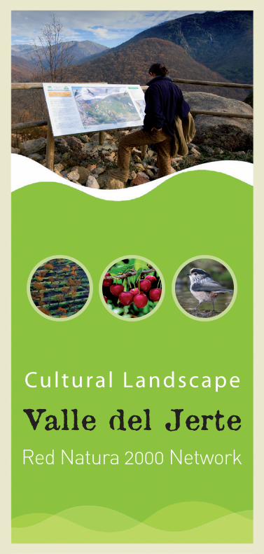
Valle del JerteRed Natura 2000 Network
Cultural Landscape
2
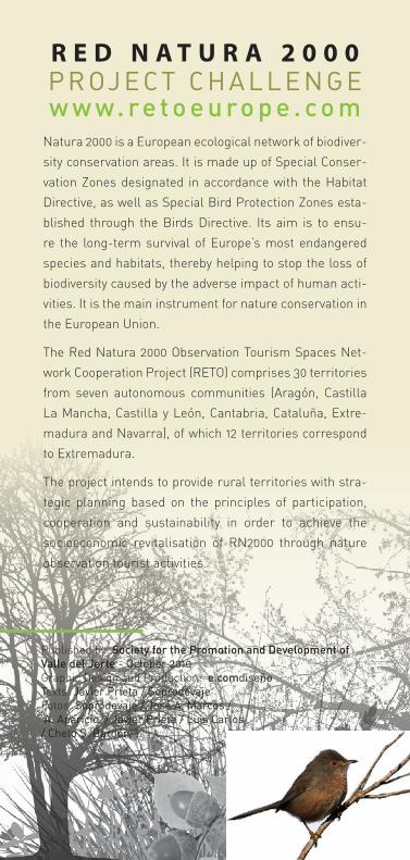
R E D N A T U R A 2 0 0 0P R OJ E CT C H A L L E N G Ew w w. re t o e u ro p e . c o m
Natura 2000 is a European ecological network of biodiver-
sity conservation areas. It is made up of Special Conser-
vation Zones designated in accordance with the Habitat
Directive, as well as Special Bird Protection Zones esta-
blished through the Birds Directive. Its aim is to ensu-
re the long-term survival of Europe’s most endangered
species and habitats, thereby helping to stop the loss of
biodiversity caused by the adverse impact of human acti-
vities. It is the main instrument for nature conservation in
the European Union.
The Red Natura 2000 Observation Tourism Spaces Net-
work Cooperation Project (RETO) comprises 30 territories
from seven autonomous communities (Aragón, Castilla
La Mancha, Castilla y León, Cantabria, Cataluña, Extre-
madura and Navarra), of which 12 territories correspond
to Extremadura.
The project intends to provide rural territories with stra-
tegic planning based on the principles of participation,
cooperation and sustainability in order to achieve the
socioeconomic revitalisation of RN2000 through nature
observation tourist activities.
Published by: Society for the Promotion and Development ofValle del Jerte - October 2010Graphic Design and Production: e.comdiseñoTexts: Javier Prieta / SoprodevajeFotos: Soprodevaje / José A. Marcos / A. Aparicio / Javier Prieta / Luis Carlos / Chelo S. Bardón.
3
0. Introduction.............................................. 04
1. Protected Natural Spaces............................. 06
2. Jerte River Network ................................ 08
3. Indigenous Forests................................... 12
4. Cultivated Landscape............................... 14
5. Birds......................................................... 18
6. Unique Vegetation................................. 20
7. Viewpoints of the Valley........................... 22
8. High Mountain Area.................................... 24
ÍNDEX
3
4
INTRODUCTION
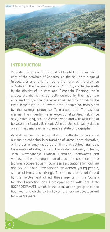
Valle del Jerte is a natural district located in the far north-east of the province of Cáceres, on the southern slope of Gredos sierra, and is framed to the north by the province of Ávila and the Cáceres Valle del Ambroz, and to the south by the district of La Vera and Plasencia. Rectangular in shape, the district is perfectly defined by the mountain surrounding it, since it is an open valley through which the river Jerte runs in its lowest area, flanked on both sides by the strong, protective Tormantos and Traslasierra sierras. The mountain is an exceptional protagonist, since at 25 miles long, around 6 miles wide and with altitudes of between 1,148 and 7,874 feet, Valle del Jerte is easily visible on any map and even in current satellite photographs.
As well as being a natural district, Valle del Jerte stands out for its cohesion in a number of areas: administrative, with a community made up of 11 municipalities (Barrado, Cabezuela del Valle, Cabrero, Casas del Castañar, El Torno, Jerte, Navaconcejo, Piornal, Rebollar, Tornavacas and Valdastillas) with a population of around 12,000; economic: (agrarian cooperativism, business associations for tourism and SMEs); social: (association for women, young people, senior citizens and hiking). This structure is reinforced by the involvement of all these agents in the Society for the Promotion and Development of Valle del Jerte (SOPRODEVAJE), which is the local action group that has been working on the district’s comprehensive development for over 20 years.
4
View of the valley in bloom from Tornavacas
5
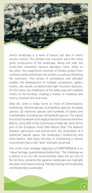
Jerte’s landscape is a work of nature, but also of man’s secular activity. The climate and mountain were the initial great constructors of the landscape. Along one side, the south-east orientation favours abundant rains, while on the other, the magnificent summits of Gredos protect from northerly winds and temper the winters, as well as refreshing the summers. This variety of orientations and altitudes enables the development of multiple ecosystems: gallery forests, oak woods, scrubland and high mountain pastures. On this basis, the inhabitants of the valley have left indelible marks on the territory, creating a mosaic of meadows and cherry, chestnut and olive trees.
Valle del Jerte is today home to most of Extremadura’s biodiversity: 150 bird species, 15 amphibian species, 23 reptile species, 56 mammal species and hundreds of plants and invertebrates, including over 100 butterfly species. The logical fruit of all this wealth is the legal protection of almost the entire district, since 95% of the Community of Valle del Jerte forms part of the European Union Red Natura 2000. The balance between agriculture and environment, the declaration of a protected natural space, the landscape’s biodiversity and other factors, have been the keys to maintaining a natural environment that is still “alive” and well conserved.
One of the main strategic objectives of SORPODEVAJE is to “value heritage, guaranteeing biodiversity.” The challenge as a district is to turn the environmental value into an icon of the territory, preserve the agrarian landscape and highlight the water and natural setting, thereby making cherry growing and biodiversity sustainable.
5
6
PROTECTED NATURAL SPACES
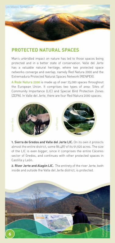
Man’s unbridled impact on nature has led to those spaces being protected and in a better state of conservation. Valle del Jerte has a valuable natural heritage, where two protected space networks converge and overlap, namely Red Natura 2000 and the Extremadura Protected Natural Spaces Network (RENPEX).
A Rede Natura 2000 is made up of over 25,000 spaces throughout the European Union. It comprises two types of area: Sites of Community Importance (LIC) and Special Bird Protection Zones (ZEPA). In Valle del Jerte, there are four Red Natura 2000 spaces:
1. Sierra de Gredos and Valle del Jerte LIC. On its own it protects almost the entire district, some 86,487 of its 91,920 acres. The size of the LIC is even bigger, since it comprises the entire Cáceres sector of Gredos, and continues with other protected spaces in Castilla y León.
2. River Jerte and Alagón LIC. The entirety of the river Jerte, both inside and outside the Valle del Jerte district, is protected.
Iber
ian
Ibex
.
6
Los
Pilo
nes
Gar
gan
ta d
e lo
s In
fiern
os
Nat
ura
l Res
erve
Los Sillares. Tornavacas
7
3. River Tiétar LIC. The entire river Tiétar in Cáceres and some of its tributary ravines are protected, including Jerte’s El Obispo ravine in Barrado.
4. Tiétar river and pine groves ZEPA. See above.
Extremadura Protected Natural Spaces Network:
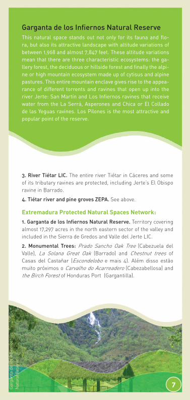
1. Garganta de los Infiernos Natural Reserve. Territory covering almost 17,297 acres in the north eastern sector of the valley and included in the Sierra de Gredos and Valle del Jerte LIC.
2. Monumental Trees: Prado Sancho Oak Tree (Cabezuela del Valle), La Solana Great Oak (Barrado) and Chestnut trees of Casas del Castañar (Escondelobo e mais 4). Além disso estão muito próximos o Carvalho do Acarreadero (Cabezabellosa) and the Birch Forest of Honduras Port (Gargantilla).
Garganta de los Infiernos Natural Reserve This natural space stands out not only for its fauna and flo-ra, but also its attractive landscape with altitude variations of between 1,968 and almost 7,847 feet. These altitude variations mean that there are three characteristic ecosystems: the ga-llery forest, the deciduous or hillside forest and finally the alpi-ne or high mountain ecosystem made up of cytisus and alpine pastures. This entire mountain enclave gives rise to the appea-rance of different torrents and ravines that open up into the river Jerte: San Martín and Los Infiernos ravines that receive water from the La Serrá, Asperones and Chica or El Collado de las Yeguas ravines. Los Pilones is the most attractive and popular point of the reserve.
7Gar
gan
ta d
e lo
s In
fiern
os
Nat
ura
l Res
erve
8
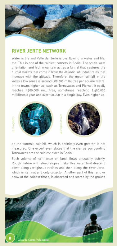
RIVER JERTE NETWORK Water is life and Valle del Jerte is overflowing in water and life, too. This is one of the rainiest corners in Spain. The south-west orientation and high mountain act as a funnel that captures the humid storms that come in from the Atlantic; abundant rains that increase with the altitude. Therefore, the mean rainfall in the valley’s low zones is around 800,000 millilitres per square metre. In the towns higher up, such as Tornavacas and Piornal, it easily reaches 1,500,000 millilitres, sometimes reaching 2,400,000 millilitres a year and over 100,000 in a single day. Even higher up,
on the summit, rainfall, which is definitely even greater, is not measured. One expert even states that the sierras surrounding Tornavacas are the rainiest place in Spain.
Such volume of rain, once on land, flows unusually quickly. Rough nature with steep slopes make this water first descend down along vertiginous ravines and then along the river Jerte, which is its final and only collector. Another part of this rain, or snow at the coldest times, is absorbed and stored by the ground
8 Cascada Caozo. Valdastillas
Las
No
gal
eas
La V
irg
en S
trea
m
9
of the summits for months. It will then be gradually released in summer, thereby maintaining streams and sources of cold crystal clear water all year round.
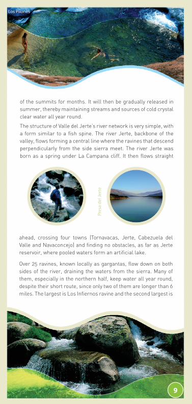
The structure of Valle del Jerte’s river network is very simple, with a form similar to a fish spine. The river Jerte, backbone of the valley, flows forming a central line where the ravines that descend perpendicularly from the side sierra meet. The river Jerte was born as a spring under La Campana cliff. It then flows straight
ahead, crossing four towns (Tornavacas, Jerte, Cabezuela del Valle and Navaconcejo) and finding no obstacles, as far as Jerte reservoir, where pooled waters form an artificial lake.
Over 25 ravines, known locally as gargantas, flow down on both sides of the river, draining the waters from the sierra. Many of them, especially in the northern half, keep water all year round, despite their short route, since only two of them are longer than 6 miles. The largest is Los Infiernos ravine and the second largest is
9
Los Pilones
Pres
a d
el J
erte
10
Bonal ravine, both on the southern side. Other outstanding ravines are Becedas, Papúos, Buitres and Nogaleas on the northern side and San Martín and Marta on the southern side. These are home to some of the valley’s most beautiful landscapes, such as Caozo waterfall (Bonal ravine) and Chorerro de la Virgen waterfall (Los Pilones Route).
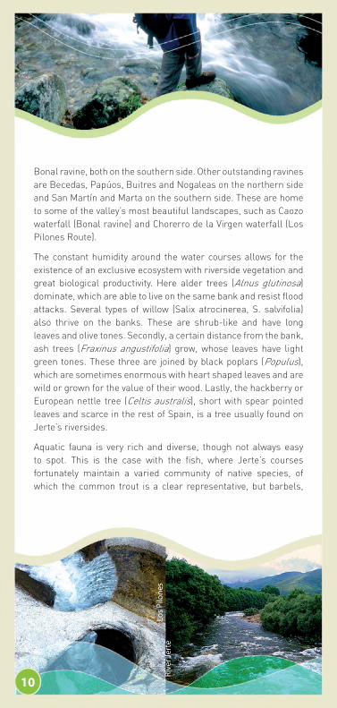
The constant humidity around the water courses allows for the existence of an exclusive ecosystem with riverside vegetation and great biological productivity. Here alder trees (Alnus glutinosa) dominate, which are able to live on the same bank and resist flood attacks. Several types of willow (Salix atrocinerea, S. salvifolia) also thrive on the banks. These are shrub-like and have long leaves and olive tones. Secondly, a certain distance from the bank, ash trees (Fraxinus angustifolia) grow, whose leaves have light green tones. These three are joined by black poplars (Populus), which are sometimes enormous with heart shaped leaves and are wild or grown for the value of their wood. Lastly, the hackberry or European nettle tree (Celtis australis), short with spear pointed leaves and scarce in the rest of Spain, is a tree usually found on Jerte’s riversides.
Aquatic fauna is very rich and diverse, though not always easy to spot. This is the case with the fish, where Jerte’s courses fortunately maintain a varied community of native species, of which the common trout is a clear representative, but barbels,
10
Riv
er J
erte
Los
Pilo
nes
11
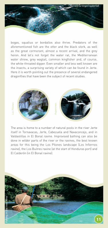
bogas, squalius or bordallos also thrive. Predators of the aforementioned fish are the otter and the black stork, as well as the great cormorant, almost a recent arrival, and the grey heron. And let’s not forget the water rat, the Mediterranean water shrew, grey wagtail, common kingfisher and, of course, the white-throated dipper. Even smaller and less well known are the insects, a surprising variety of which can be found in Jerte. Here it is worth pointing out the presence of several endangered dragonflies that have been the subject of recent studies.
The area is home to a number of natural pools in the river Jerte itself in Tornavacas, Jerte, Cabezuela and Navaconcejo, and in Valdastillas in El Bonal ravine. Improvised bathing can also be done in wilder parts of the river or the ravines, the best known areas for this being the Los Pilones landscape (Los Infiernos ravine), the Los Buitres ravine (at the start of Honduras port) and El Calderón (in El Bonal ravine).
11
Fish
ing
in t
he
rive
r Jer
te
Los
Pilo
nes
Asp
ero
nes
Chorrero la Virgen waterfall
12
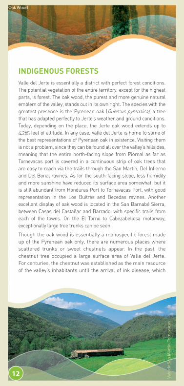
INDIGENOUS FORESTSValle del Jerte is essentially a district with perfect forest conditions. The potential vegetation of the entire territory, except for the highest parts, is forest. The oak wood, the purest and more genuine natural emblem of the valley, stands out in its own right. The species with the greatest presence is the Pyrenean oak (Quercus pyrenaica), a tree that has adapted perfectly to Jerte’s weather and ground conditions. Today, depending on the place, the Jerte oak wood extends up to 4,265 feet of altitude. In any case, Valle del Jerte is home to some of the best representations of Pyrenean oak in existence. Visiting them is not a problem, since they can be found all over the valley’s hillsides, meaning that the entire north-facing slope from Piornal as far as Tornevacas port is covered in a continuous strip of oak trees that are easy to reach via the trails through the San Martín, Del Infierno and Del Bonal ravines. As for the south-facing slope, less humidity and more sunshine have reduced its surface area somewhat, but it is still abundant from Honduras Port to Tornavacas Port, with good representation in the Los Buitres and Becedas ravines. Another excellent display of oak wood is located in the San Barnabé Sierra, between Casas del Castañar and Barrado, with specific trails from each of the towns. On the El Torno to Cabezabellosa motorway, exceptionally large tree trunks can be seen.
Though the oak wood is essentially a monospecific forest made up of the Pyrenean oak only, there are numerous places where scattered trunks or sweet chestnuts appear. In the past, the chestnut tree occupied a large surface area of Valle del Jerte. For centuries, the chestnut was established as the main resource of the valley’s inhabitants until the arrival of ink disease, which
12
Oak Wood
Vale
de
San
Mar
tín
. To
rnav
acas

13
devastated practically all the chestnut trees. Today, almost all of Jerte’s chestnut trees were created by man, with two main types, depending on their use. Firstly there are chestnut trees for wood production, with the reboldo de Jerte standing out at the beginning of the route to Los Pilones, a thick forest formed of fine regrowth stalks that grow after regular logging. Secondly, there are chestnut trees for harvesting chestnuts, with larger trees, some enormous, in orchards carefully tended around all the towns. There are examples of centuries-old chestnut trees that still survive in remote places, such as those in Escondelobos with its own route that starts at Casas del Castañar.
Oak wood fauna is very varied, from large mammals, such as wild boar and, locally speaking, deer (between Piornal and Tornavacas), to small rodents. The roe deer, a species that disappeared in the mid-20th century, has started to slowly recolonise the valley. Small carnivores (fox, common genet, beech marten, European badger, European polecat and wildcat) are frequently found, as well as some birds of prey (booted eagle, short-toed snake eagle, European honey buzzard, common buzzard) and a multitude of medium and small birds (Eurasian jay, common nightingale, oropendula, common chaffinch and many others).
13
El Reboldo. Chestnut ForestO
ak W
oo
d w
ith
Cas
tifr
ío a
t th
e b
ack
14
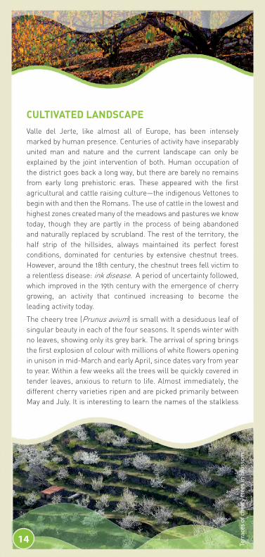
CULTIVATED LANDSCAPEValle del Jerte, like almost all of Europe, has been intensely marked by human presence. Centuries of activity have inseparably united man and nature and the current landscape can only be explained by the joint intervention of both. Human occupation of the district goes back a long way, but there are barely no remains from early long prehistoric eras. These appeared with the first agricultural and cattle raising culture—the indigenous Vettones to begin with and then the Romans. The use of cattle in the lowest and highest zones created many of the meadows and pastures we know today, though they are partly in the process of being abandoned and naturally replaced by scrubland. The rest of the territory, the half strip of the hillsides, always maintained its perfect forest conditions, dominated for centuries by extensive chestnut trees. However, around the 18th century, the chestnut trees fell victim to a relentless disease: ink disease. A period of uncertainty followed, which improved in the 19th century with the emergence of cherry growing, an activity that continued increasing to become the leading activity today.
The cheery tree (Prunus avium) is small with a desiduous leaf of singular beauty in each of the four seasons. It spends winter with no leaves, showing only its grey bark. The arrival of spring brings the first explosion of colour with millions of white flowers opening in unison in mid-March and early April, since dates vary from year to year. Within a few weeks all the trees will be quickly covered in tender leaves, anxious to return to life. Almost immediately, the different cherry varieties ripen and are picked primarily between May and July. It is interesting to learn the names of the stalkless
14
Terr
aces
of c
her
ry t
rees
in b
loss
om

15
varieties, the famous ones and the indigenous picota ones, as well as those with stalks, which are usually earlier. The picota cherries that have a denomination of origin certificate are the ambrunés, pico colorado, pico negro and pico limón, while only one cherry with a stalk, the navalinda, has been given this honour. After harvest, the end of summer shows dark green cherry trees waiting for October and especially November to bring us a new chromatic spectacle: cherry trees covered in red, orange and yellow leaves. This is not as famous as the blossom, but is just as beautiful. Once December rolls round, each cherry tree is left without its leaves again.
Despite the predominance of the cherry tree on Jerte’s landscape—it is estimated that a million cherries grow on Jerte land—local agriculture is varied. Amongst the oak trees and cherry trees are olive trees, the only trees that keep their dead leaves once winter comes. Other fruit trees are also worth mentioning, such as fig, plum and, to a lesser extent, quince, orange and lemon trees. More modern crops that diversify the valley’s produce even more are raspberries and kiwis, among others. And let’s not forget foraging for wild produce, such as mushrooms, blackberries and asparagus. Mushrooms, primarily picked in chestnut and oak forests in different amounts, depending on the amount of rain each
15Terr
aces
of c
her
ry t
rees
in a
utu
mn
16
autumn, are very much appreciated both as a resource for the local population and a tourist attraction. The variety is enormous, with outstanding edible ones including the famous bolete (Boletus edulis y aereus), Caeser’s mushroom (Amanita caesarea) and chantarelle (Chantarellus cybarius).
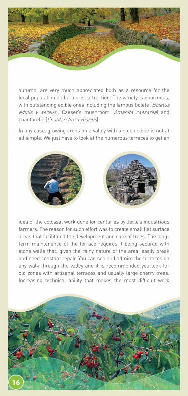
In any case, growing crops on a valley with a steep slope is not at all simple. We just have to look at the numerous terraces to get an
idea of the colossal work done for centuries by Jerte’s industrious farmers. The reason for such effort was to create small flat surface areas that facilitated the development and care of trees. The long-term maintenance of the terrace requires it being secured with stone walls that, given the rainy nature of the area, easily break and need constant repair. You can see and admire the terraces on any walk through the valley and it is recommended you look for old zones with artisanal terraces and usually large cherry trees. Increasing technical ability that makes the most difficult work
16
17
easier has also had a negative effect on the landscape, since new crops usually lack traditional stone terraces.
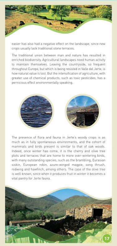
The traditional union between man and nature has resulted in enriched biodiversity. Agricultural landscapes need human activity to maintain themselves. Leaving the countryside, so frequent throughout Europe, but which is being resisted in Valle del Jerte, is how natural value is lost. But the intensification of agriculture, with greater use of chemical products, such as toxic pesticides, has a pernicious effect environmentally speaking.
The presence of flora and fauna in Jerte’s woody crops is as much as in fully spontaneous environments, and the cohort of mammals and birds present is similar to that of oak woods. Indeed, once winter has come, it is the cherry and olive tree plots and terraces that are home to more over-wintering birds, with many outstanding species, such as the brambling, Eurasian siskin, European robin, azure-winged magpie, song thrush, redwing and hawfinch, among others. The case of the olive tree is well known, since when it produces fruit in winter it becomes a vital pantry for Jerte fauna.
17
Her
d o
f go
ats
18
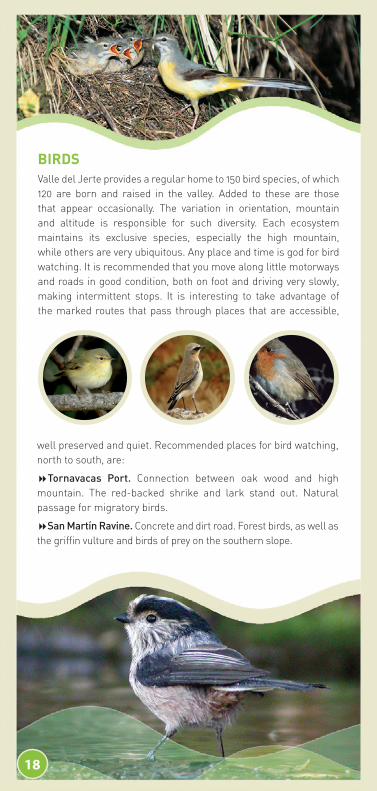
BIRDSValle del Jerte provides a regular home to 150 bird species, of which 120 are born and raised in the valley. Added to these are those that appear occasionally. The variation in orientation, mountain and altitude is responsible for such diversity. Each ecosystem maintains its exclusive species, especially the high mountain, while others are very ubiquitous. Any place and time is god for bird watching. It is recommended that you move along little motorways and roads in good condition, both on foot and driving very slowly, making intermittent stops. It is interesting to take advantage of the marked routes that pass through places that are accessible,
well preserved and quiet. Recommended places for bird watching, north to south, are:
8Tornavacas Port. Connection between oak wood and high mountain. The red-backed shrike and lark stand out. Natural passage for migratory birds.
8San Martín Ravine. Concrete and dirt road. Forest birds, as well as the griffin vulture and birds of prey on the southern slope.
18
19
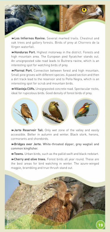
8Los Infiernos Ravine. Several marked trails. Chestnut and oak trees and gallery forests. Birds of prey at Chorrero de la Virgen waterfall.
8Honduras Port. Highest motorway in the district. Forests and high mountain area. The European pied flycatcher stands out. An unsignposted side road leads to Buitrera ravine, which is an interesting spot for watching birds of prey.
8Piornal Port. Connection between forest and high mountain. Small pine groves with different species. A paved section and then a dirt track lead to the reservoir and to Peña Negra, which is an interesting spot for scrub and mountain birds.
8Villavieja Cliffs. Unsignposted concrete road. Spectacular rocks, ideal for rupicolous birds. Good density of forest birds of prey.
8Jerte Reservoir Tail. Only wet zone of the valley and easily accessible. Better in autumn and winter. Black stork, herons, cormorants and shorebirds.
8Bridges over Jerte. White-throated dipper, grey wagtail and common kingfisher.
8Towns. Urban birds, such as the pallid swift and black redstart.
8Cherry and olive trees. Forest birds all year round. These are the best areas for bird watching in winter. The azure-winged magpie, brambling and true thrush stand out.
19
Go
lden
eag
le
Sho
rt-t
oed
sn
ake
eag
le
Gri
ffo
n v
ult
ure
20
SINGULAR VEGETATIONValle del Jerte is even richer in vegetation than in fauna. The weather conditions are ideal for its development. It is rich in both well-conserved singular plant communities and exceptional individuals, so-called monumental trees.
Forest Formations of Interest:
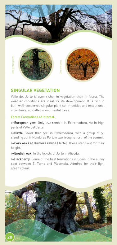
8European yew. Only 250 remain in Extremadura, 90 in high parts of Valle del Jerte.
8Birch. Fewer than 500 in Extremadura, with a group of 50 standing out in Honduras Port, in two troughs north of the summit.
8Cork oaks at Buitrera ravine (Jerte). These stand out for their height.
8English oak. In the tickets of Jerte in Aliseda.
8Hackberry. Some of the best formations in Spain in the sunny spot between El Torno and Plasencia. Admired for their light green colour.
20
Ch
estn
ut
gro
ve
Ch
erry
tre
es
Ch
estn
ut
tree
. C
asas
de
Cas
tañ
arR
om
anej
o o
ak t
ree
21
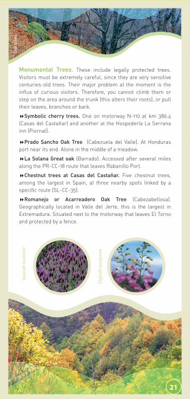
Monumental Trees. These include legally protected trees. Visitors must be extremely careful, since they are very sensitive centuries-old trees. Their major problem at the moment is the influx of curious visitors. Therefore, you cannot climb them or step on the area around the trunk (this alters their roots), or pull their leaves, branches or bark.
8Symbolic cherry trees. One on motorway N-110 at km 386.4 (Casas del Castañar) and another at the Hospedería La Serrana inn (Piornal).
8Prado Sancho Oak Tree (Cabezuela del Valle). At Honduras port near its end. Alone in the middle of a meadow.
8La Solana Great oak (Barrado). Accessed after several miles along the PR-CC-18 route that leaves Rabanillo Port.
8Chestnut trees at Casas del Castañar. Five chestnut trees, among the largest in Spain, at three nearby spots linked by a specific route (SL-CC-35).
8Romanejo or Acarreadero Oak Tree (Cabezabellosa). Geographically located in Valle del Jerte, this is the largest in Extremadura. Situated next to the motorway that leaves El Torno and protected by a fence.
21
Span
ish
lave
nd
er
Dig
ital
is p
urp
ure
a
Oak
tre
es

22
VALLEY VIEWPOINTSJerte’s mountain, shaped like an enormous natural amphitheatre, provides a multitude of places where the landscape can be admired. Visitors can stop and enjoy beautiful panoramic views anywhere: the secondary motorway routes half way up the hillside are highly recommended. The northern part is home to those that ascend and connect El Torno with Rebollar, as well as Honduras Port. On the southern side, several motorways arrive at Valdastillas, Cabrero, Casas del Castañar and Piornal. The locality of Barrado, located on the Tiétar slope, notably expands the perspectives. And let’s not forget the ascent to Tornavacas Port. Given that it is an agricultural district with a multitude of smallholdings and a very rainy climate, an extensive network of agricultural roads has been created, many of which are concrete and some even paved. These allow more independent visitors to seek out their own routes, making sure to remember that they are not motorways, so do not usually appear on maps.
Recommended Viewpoints:
8Tornavacas Port. In the far north. A must-see, where all the towns and ecosystems can be made out. On clear days you can easily see the entire valley as far as Plasencia and beyond.
8Viewpoints in towns. Some localities provide excellent panoramic views. Barrado, Piornal, Casas del Castañar, Cabrero, Valdastillas, Navaconcejo, Rebollar and El Torno all have zones set up as viewpoints. However, some inns and restaurants have unbeatable views.
22 Alt
o d
e G
arg
anta
Ho
nd
aN
atu
ral R
eser
ve
23
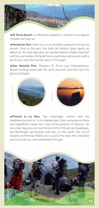
8El Torno Ascent. La Memoria viewpoint. Located in a sculpture complex half way up.
8Honduras Port. Each turn is an excellent viewpoint during the ascent. Once at the port, the Valle del Ambroz plain opens up before us. On clear days you can see the Gabriel y Galán reservoir and the Las Hurdes, Peña de Francia and Gata sierras and, with a bit of luck, even the Estrela sierra in Portugal.
8San Gamello Port. Between El Torno and Cabezabellosa. Boasts striking views over the Jerte reservoir and then over the plains of Alagón.
8Piornal to La Vera. Two motorways connect with the neighbouring district. In its highest part, from some points there are magnificent views over most of the province of Cáceres. On very clear days you can see the summits of Villuercas-Guadalupe, the Monfragüe serrezuelas and also, to the south, the city of Cáceres and the San Pedro sierra, and to the west, the Cañaveral and Coria sierras, and sometimes Portugal.
23
Vie
w o
f th
e va
lley
Hoy
amo
ros
Vie
w o
f El T
orn
oC
uer
dal
del
Tu
rmal

24
HIGH MOUNTAINValle del Jerte’s high summits, thanks to their inaccessibility, boast a well preserved wild nature. Human activity is barely perceptible, with the exception of cattle in summer. It can be said that the high mountain area protects itself and, except for mountaineers and shepherds, remains on the margins of human presence and activity.
7,877 feet is the figure that marks the ceiling of Extremadura, the maximum regional altitude. This summit has several names, the correct one being El Torreón, but the one most often used on maps is Calvitero Peak, the meeting point of Cáceres, Salamanca and Ávila. It is located north-west of Tornavacas Port and is accessed by the El Rebeco Route. On the other side of the port stands another giant of a similar size, just 6 feet lower: La Covacha Peak which stands at 7,871 feet and is Extremadura’s second summit. It is accessed via another high mountain route, the High Extremadura Way.
The hill ranges, Traslasierra to the north and Tormantos to the south, progressively descend from the two large vantage points that crown the valley. The first is home to the Valdeamor (6,070 ft), El Camocho (5,988 ft) and Las Calamochas (4,888 ft, over El Torno) summits. It is also possible to ascend to the high mountain landscape via Honduras Port, the motorway with the highest altitude in the district. On the Tormantos side, the
24
Portilla Talamanca. El Rebeco-Torreón Route
Ruta
Alt
a Ex
trem
adu
ra
25
26

27
2828
29
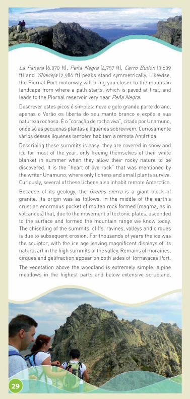
La Panera (6,070 ft), Peña Negra (4,757 ft), Cerro Bullón (3,609 ft) and Villavieja (2,986 ft) peaks stand symmetrically. Likewise, the Piornal Port motorway will bring you closer to the mountain landcape from where a path starts, which is paved at first, and leads to the Piornal reservoir very near Peña Negra.
Descrever estes picos é simples: neve e gelo grande parte do ano, apenas o Verão os liberta do seu manto branco e expõe a sua natureza rochosa. É o “coração de rocha viva”, citado por Unamuno, onde só as pequenas plantas e líquenes sobrevivem. Curiosamente vários desses líquenes também habitam a remota Antártida.
Describing these summits is easy: they are covered in snow and ice for most of the year, only freeing themselves of their white blanket in summer when they allow their rocky nature to be discovered. It is the “heart of live rock” that was mentioned by the writer Unamuno, where only lichens and small plants survive. Curiously, several of these lichens also inhabit remote Antarctica.
Because of its geology, the Gredos sierra is a giant block of granite. Its origin was as follows: in the middle of the earth’s crust an enormous pocket of molten rock formed (magma, as in volcanoes) that, due to the movement of tectonic plates, ascended to the surface and formed the mountain range we know today. The chiselling of the summits, cliffs, ravines, valleys and cirques is due to subsequent erosion. For thousands of years the ice was the sculptor, with the ice age leaving magnificent displays of its natural art in the high summits of the valley. Remains of moraines, cirques and gelifraction appear on both sides of Tornavacas Port.
The vegetation above the woodland is extremely simple: alpine meadows in the highest parts and below extensive scrubland,
29
30
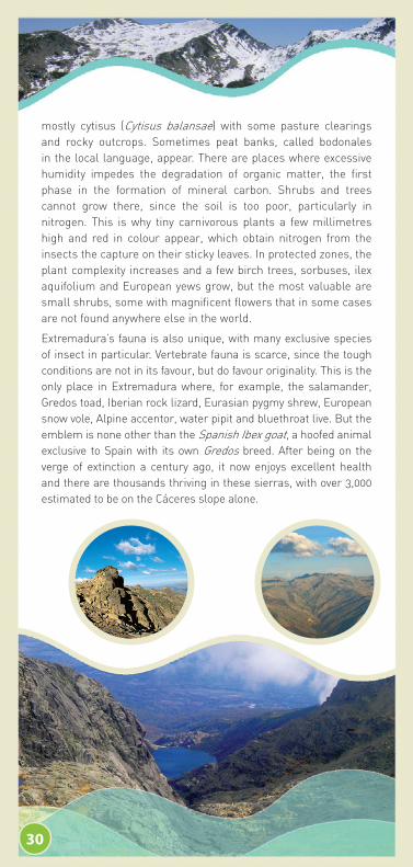
mostly cytisus (Cytisus balansae) with some pasture clearings and rocky outcrops. Sometimes peat banks, called bodonales in the local language, appear. There are places where excessive humidity impedes the degradation of organic matter, the first phase in the formation of mineral carbon. Shrubs and trees cannot grow there, since the soil is too poor, particularly in nitrogen. This is why tiny carnivorous plants a few millimetres high and red in colour appear, which obtain nitrogen from the insects the capture on their sticky leaves. In protected zones, the plant complexity increases and a few birch trees, sorbuses, ilex aquifolium and European yews grow, but the most valuable are small shrubs, some with magnificent flowers that in some cases are not found anywhere else in the world.
Extremadura’s fauna is also unique, with many exclusive species of insect in particular. Vertebrate fauna is scarce, since the tough conditions are not in its favour, but do favour originality. This is the only place in Extremadura where, for example, the salamander, Gredos toad, Iberian rock lizard, Eurasian pygmy shrew, European snow vole, Alpine accentor, water pipit and bluethroat live. But the emblem is none other than the Spanish Ibex goat, a hoofed animal exclusive to Spain with its own Gredos breed. After being on the verge of extinction a century ago, it now enjoys excellent health and there are thousands thriving in these sierras, with over 3,000 estimated to be on the Cáceres slope alone.
30
31
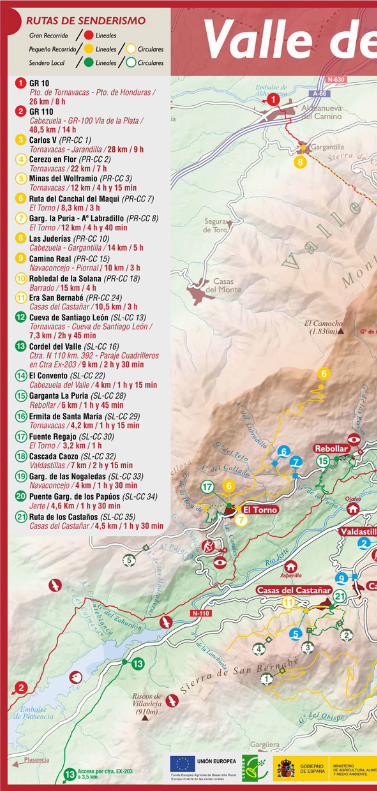
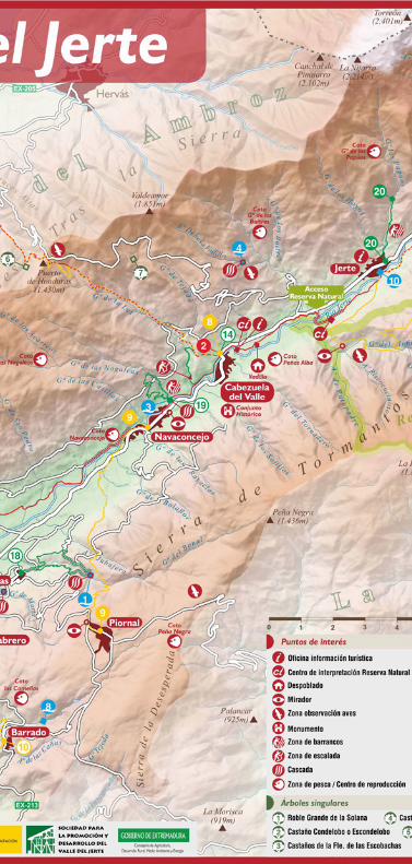
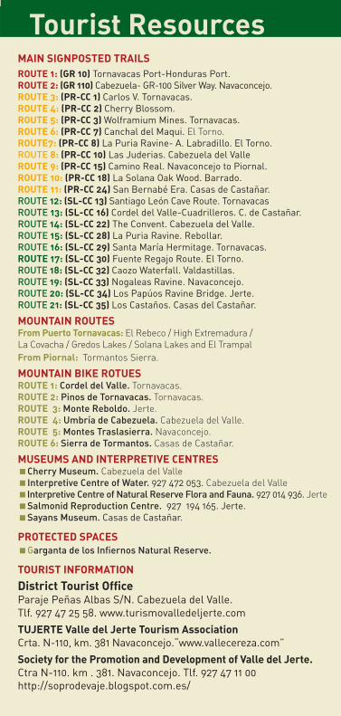
MAIN SIGNPOSTED TRAILSROUTE 1: (GR 10) Tornavacas Port-Honduras Port.ROUTE 2: (GR 110) Cabezuela- GR-100 Silver Way. Navaconcejo.ROUTE 3: (PR-CC 1) Carlos V. Tornavacas.ROUTE 4: (PR-CC 2) Cherry Blossom.ROUTE 5: (PR-CC 3) Wolframium Mines. Tornavacas.ROUTE 6: (PR-CC 7) Canchal del Maqui. El Torno.ROUTE7: (PR-CC 8) La Puria Ravine- A. Labradillo. El Torno.ROUTE 8: (PR-CC 10) Las Juderias. Cabezuela del ValleROUTE 9: (PR-CC 15) Camino Real. Navaconcejo to Piornal.ROUTE 10: (PR-CC 18) La Solana Oak Wood. Barrado.ROUTE 11: (PR-CC 24) San Bernabé Era. Casas de Castañar.ROUTE 12: (SL-CC 13) Santiago León Cave Route. TornavacasROUTE 13: (SL-CC 16) Cordel del Valle-Cuadrilleros. C. de Castañar.ROUTE 14: (SL-CC 22) The Convent. Cabezuela del Valle.ROUTE 15: (SL-CC 28) La Puria Ravine. Rebollar.ROUTE 16: (SL-CC 29) Santa María Hermitage. Tornavacas.ROUTE 17: (SL-CC 30) Fuente Regajo Route. El Torno.ROUTE 18: (SL-CC 32) Caozo Waterfall. Valdastillas.ROUTE 19: (SL-CC 33) Nogaleas Ravine. Navaconcejo.ROUTE 20: (SL-CC 34) Los Papúos Ravine Bridge. Jerte.ROUTE 21: (SL-CC 35) Los Castaños. Casas del Castañar.
MOUNTAIN ROUTESFrom Puerto Tornavacas: El Rebeco / High Extremadura / La Covacha / Gredos Lakes / Solana Lakes and El TrampalFrom Piornal: Tormantos Sierra.
MOUNTAIN BIKE ROTUESROUTE 1: Cordel del Valle. Tornavacas.ROUTE 2: Pinos de Tornavacas. Tornavacas.ROUTE 3: Monte Reboldo. Jerte.ROUTE 4: Umbría de Cabezuela. Cabezuela del Valle.ROUTE 5: Montes Traslasierra. Navaconcejo.ROUTE 6: Sierra de Tormantos. Casas de Castañar.
MUSEUMS AND INTERPRETIVE CENTRES<Cherry Museum. Cabezuela del Valle<Interpretive Centre of Water. 927 472 053. Cabezuela del Valle<Interpretive Centre of Natural Reserve Flora and Fauna. 927 014 936. Jerte<Salmonid Reproduction Centre. 927 194 165. Jerte. <Sayans Museum. Casas de Castañar.
PROTECTED SPACES<Garganta de los Infiernos Natural Reserve.
TOURIST INFORMATION
District Tourist OfficeParaje Peñas Albas S/N. Cabezuela del Valle. Tlf. 927 47 25 58. www.turismovalledeljerte.com
TUJERTE Valle del Jerte Tourism AssociationCrta. N-110, km. 381 Navaconcejo.“www.vallecereza.com”
Society for the Promotion and Development of Valle del Jerte. Ctra N-110. km . 381. Navaconcejo. Tlf. 927 47 11 00http://soprodevaje.blogspot.com.es/
Tourist Resources
32
Valle del JerteRed Natura 2000
Network
Cultural Landscape