convÊnio cprm / anp · seleÇÃo e exportaÇÃo das linhas sÍsmicas 2d e 3d por bacias...
TRANSCRIPT
CONVÊNIO CPRM / ANP
SUPERINTENDÊNCIA DE GESTÃO E OBTENÇÃO DE DADOS TÉCN ICOS
NOVA VERSÃO DO WEB MAPS DO BANCO DE DADOS DE EXPLOR AÇÃO E
PRODUÇÃO – BDEP
EQUIPES QUE SE EMPENHARAM NESTE TRABALHO
NÚCLEO DE INFORMÁTICA-ANP/BDEP GEOPROCESSAMENTO-BDEP
(SOFTWARE UTILIZADO FOI ARCGIS)
José Francisco Ladeira Neto – CPRM Layout e Estrutura dos Arquivos
João Paulo da Costa Gusso – BDEP (Publicação na WEB)
Data 04/07/08

2
Introdução: A nova versão do Web Maps, têm como objetivo melhorar o acesso as informações dos dados armazenados no BDEP e também download dos arquivos disponíveis. Foram inseridas algumas layers com informações importantes como: geologia das bacias sedimentares terrestres, massa d’água, limites intermunicipais, hipsometria, curvas de nível, curvas batimétricas, batimetria polígono e mapa índice.
3
Índice: Montar estrutura de diretórios.....................................................................04 Recorte das bacias sedimentares terrestres...............................................05 - 07 Seleção e exportação das linhas sísmicas 2D e 3D por bacia....................08 - 19 Criação do arquivo MXD..............................................................................20 - 60 Exemplo da estrutura de diretório com arquivos shapefile(s)......................61 Display da nova versão do Web Maps.........................................................62
4
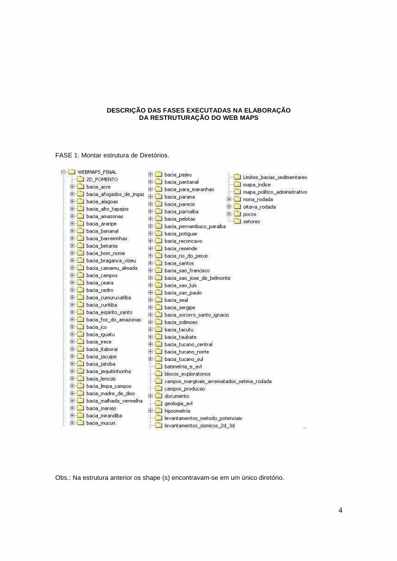
DESCRIÇÃO DAS FASES EXECUTADAS NA ELABORAÇÃO DA RESTRUTURAÇÃO DO WEB MAPS
FASE 1: Montar estrutura de Diretórios.
Obs.: Na estrutura anterior os shape (s) encontravam-se em um único diretório.
5
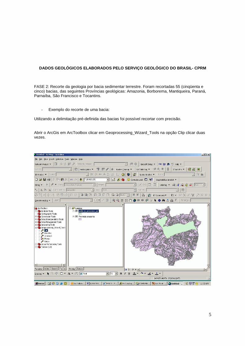
DADOS GEOLÓGICOS ELABORADOS PELO SERVIÇO GEOLÓGICO DO BRASIL- CPRM
FASE 2: Recorte da geologia por bacia sedimentar terrestre. Foram recortadas 55 (cinqüenta e cinco) bacias, das seguintes Províncias geológicas: Amazonia, Borborema, Mantiqueira, Paraná, Parnaíba, São Francisco e Tocantins.
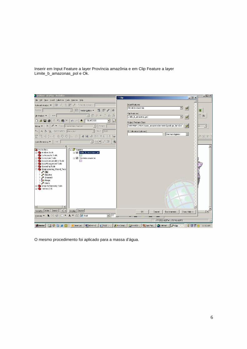
- Exemplo do recorte de uma bacia: Utilizando a delimitação pré-definida das bacias foi possível recortar com precisão. Abrir o ArcGis em ArcToolbox clicar em Geoprocessing_Wizard_Tools na opção Clip clicar duas vezes.
6
Inserir em Input Feature a layer Província amazônia e em Clip Feature a layer Limite_b_amazonas_pol e Ok.
O mesmo procedimento foi aplicado para a massa d’água.
7
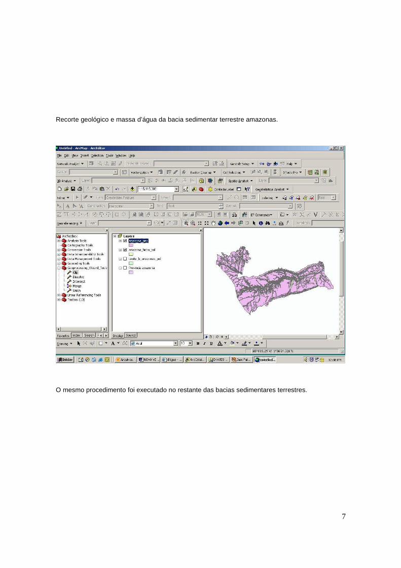
Recorte geológico e massa d’água da bacia sedimentar terrestre amazonas.
O mesmo procedimento foi executado no restante das bacias sedimentares terrestres.
8
SELEÇÃO E EXPORTAÇÃO DAS LINHAS SÍSMICAS 2D E 3D PO R BACIAS SEDIMENTARES
TERRESTRES E MARÍTIMAS
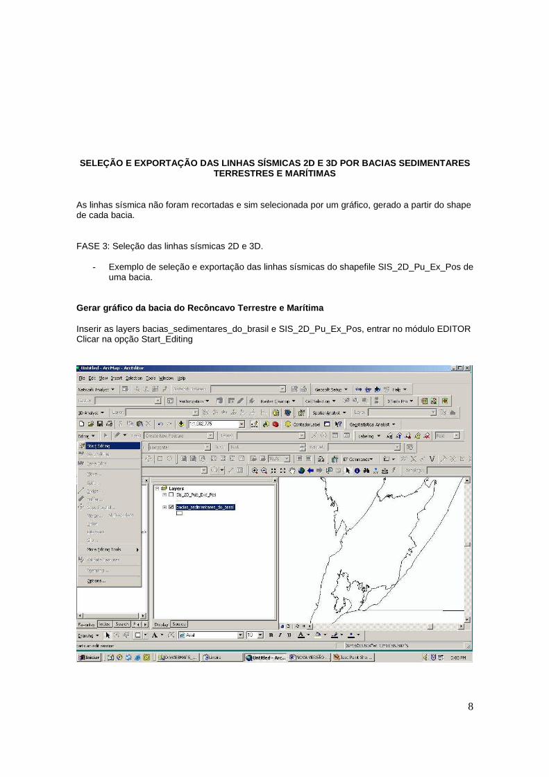
As linhas sísmica não foram recortadas e sim selecionada por um gráfico, gerado a partir do shape de cada bacia. FASE 3: Seleção das linhas sísmicas 2D e 3D.
- Exemplo de seleção e exportação das linhas sísmicas do shapefile SIS_2D_Pu_Ex_Pos de uma bacia.
Gerar gráfico da bacia do Recôncavo Terrestre e Mar ítima Inserir as layers bacias_sedimentares_do_brasil e SIS_2D_Pu_Ex_Pos, entrar no módulo EDITOR Clicar na opção Start_Editing
9
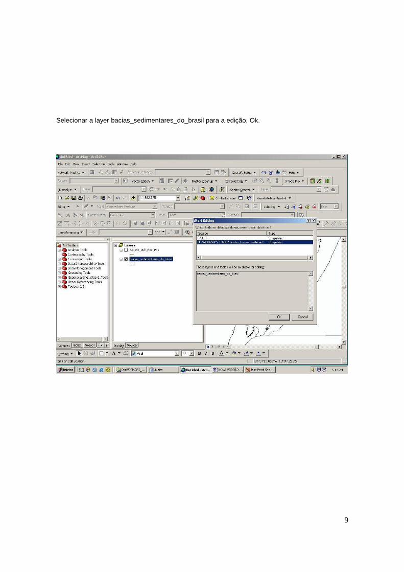
Selecionar a layer bacias_sedimentares_do_brasil para a edição, Ok.
10
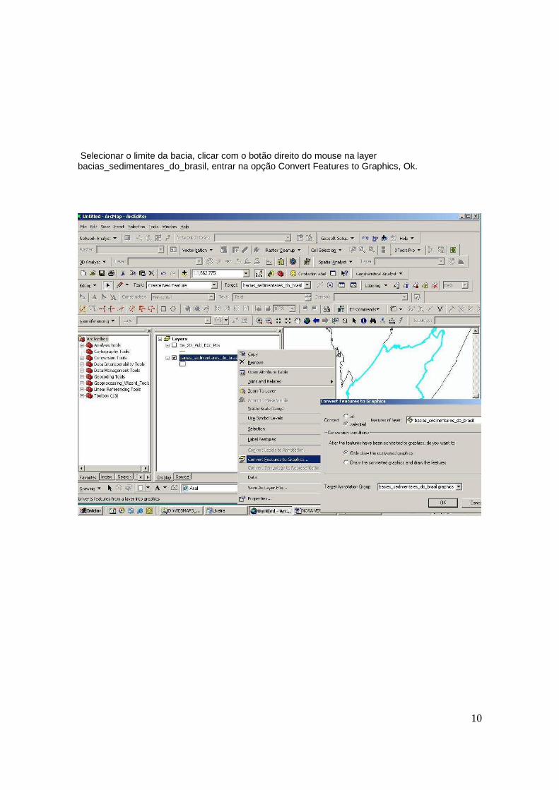
Selecionar o limite da bacia, clicar com o botão direito do mouse na layer bacias_sedimentares_do_brasil, entrar na opção Convert Features to Graphics, Ok.
11
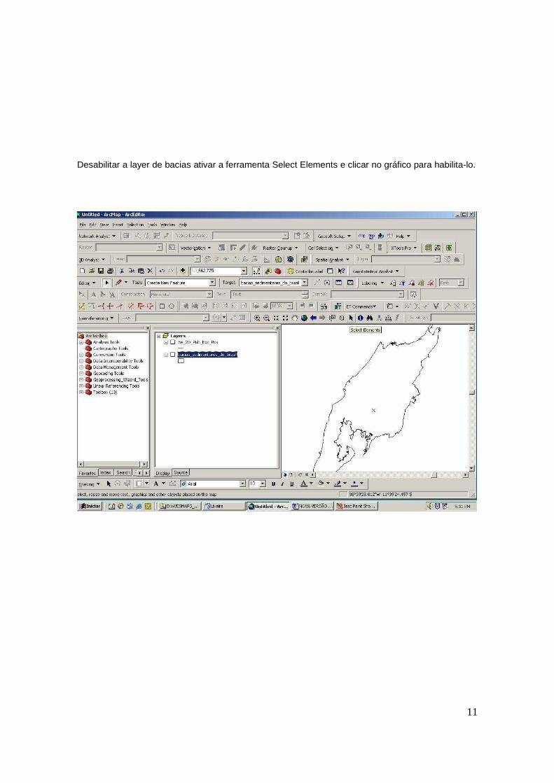
Desabilitar a layer de bacias ativar a ferramenta Select Elements e clicar no gráfico para habilita-lo.
12
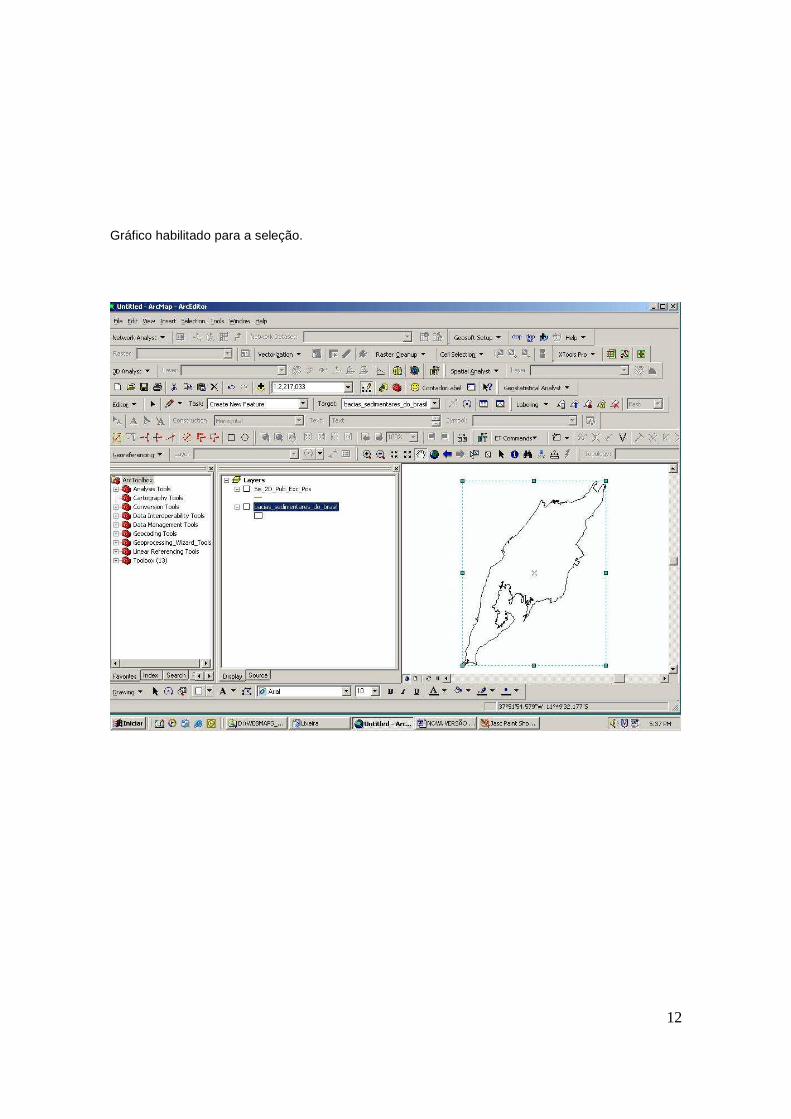
Gráfico habilitado para a seleção.
13
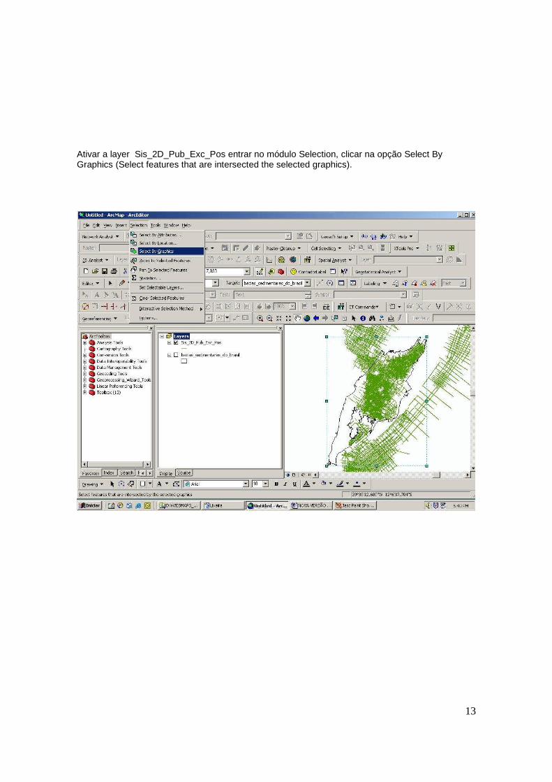
Ativar a layer Sis_2D_Pub_Exc_Pos entrar no módulo Selection, clicar na opção Select By Graphics (Select features that are intersected the selected graphics).
14
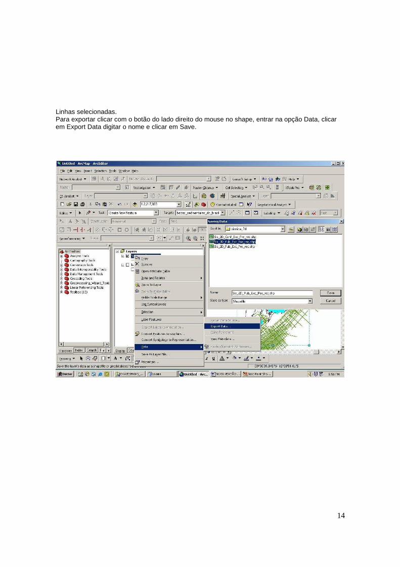
Linhas selecionadas. Para exportar clicar com o botão do lado direito do mouse no shape, entrar na opção Data, clicar em Export Data digitar o nome e clicar em Save.
15
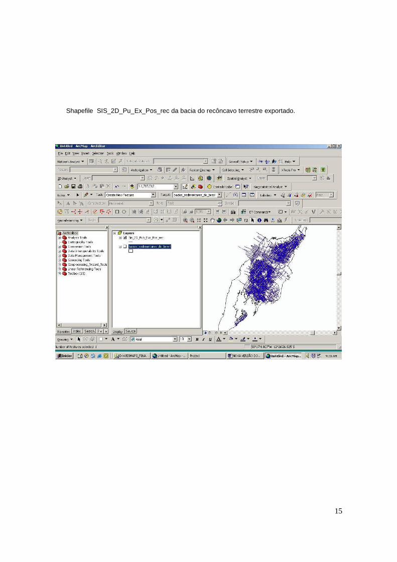
Shapefile SIS_2D_Pu_Ex_Pos_rec da bacia do recôncavo terrestre exportado.
16
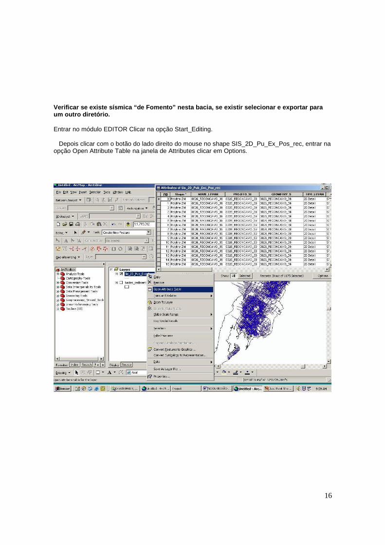
Verificar se existe sísmica “de Fomento” nesta baci a, se existir selecionar e exportar para um outro diretório. Entrar no módulo EDITOR Clicar na opção Start_Editing. Depois clicar com o botão do lado direito do mouse no shape SIS_2D_Pu_Ex_Pos_rec, entrar na opção Open Attribute Table na janela de Attributes clicar em Options.
17
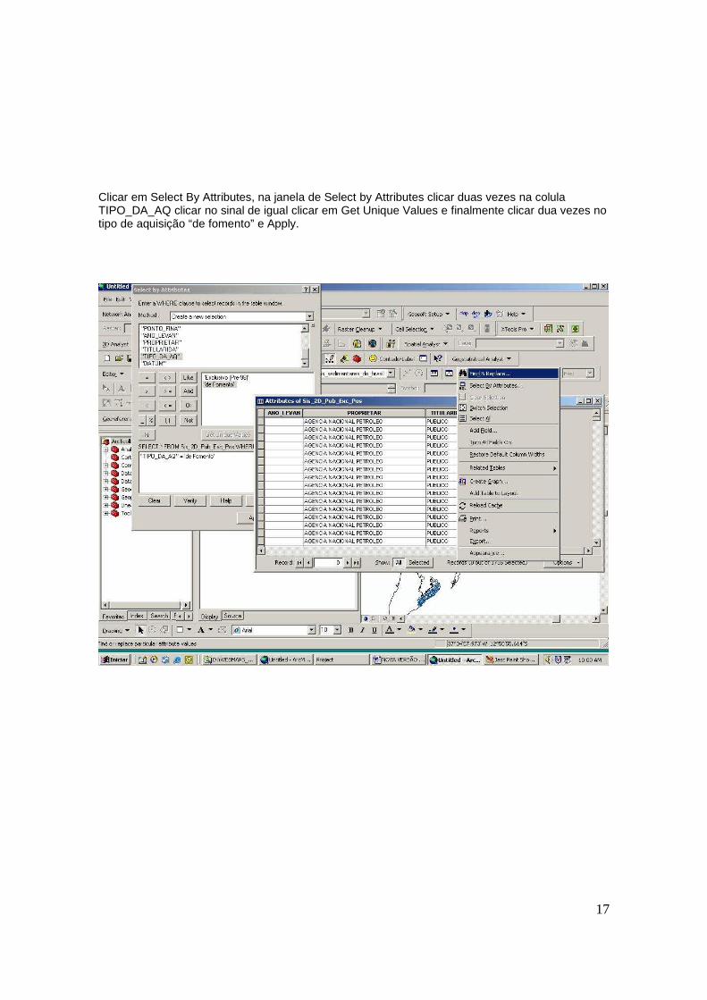
Clicar em Select By Attributes, na janela de Select by Attributes clicar duas vezes na colula TIPO_DA_AQ clicar no sinal de igual clicar em Get Unique Values e finalmente clicar dua vezes no tipo de aquisição “de fomento” e Apply.
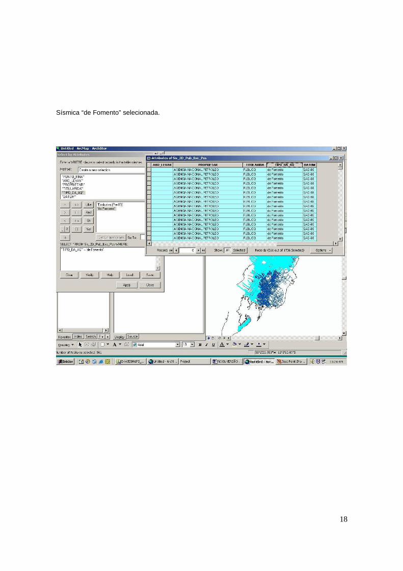
18
Sísmica “de Fomento” selecionada.
19
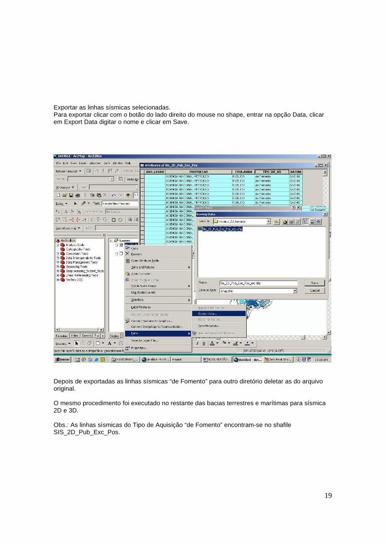
Exportar as linhas sísmicas selecionadas. Para exportar clicar com o botão do lado direito do mouse no shape, entrar na opção Data, clicar em Export Data digitar o nome e clicar em Save.
Depois de exportadas as linhas sísmicas “de Fomento” para outro diretório deletar as do arquivo original. O mesmo procedimento foi executado no restante das bacias terrestres e marítimas para sísmica 2D e 3D. Obs.: As linhas sísmicas do Tipo de Aquisição “de Fomento” encontram-se no shafile SIS_2D_Pub_Exc_Pos.
20
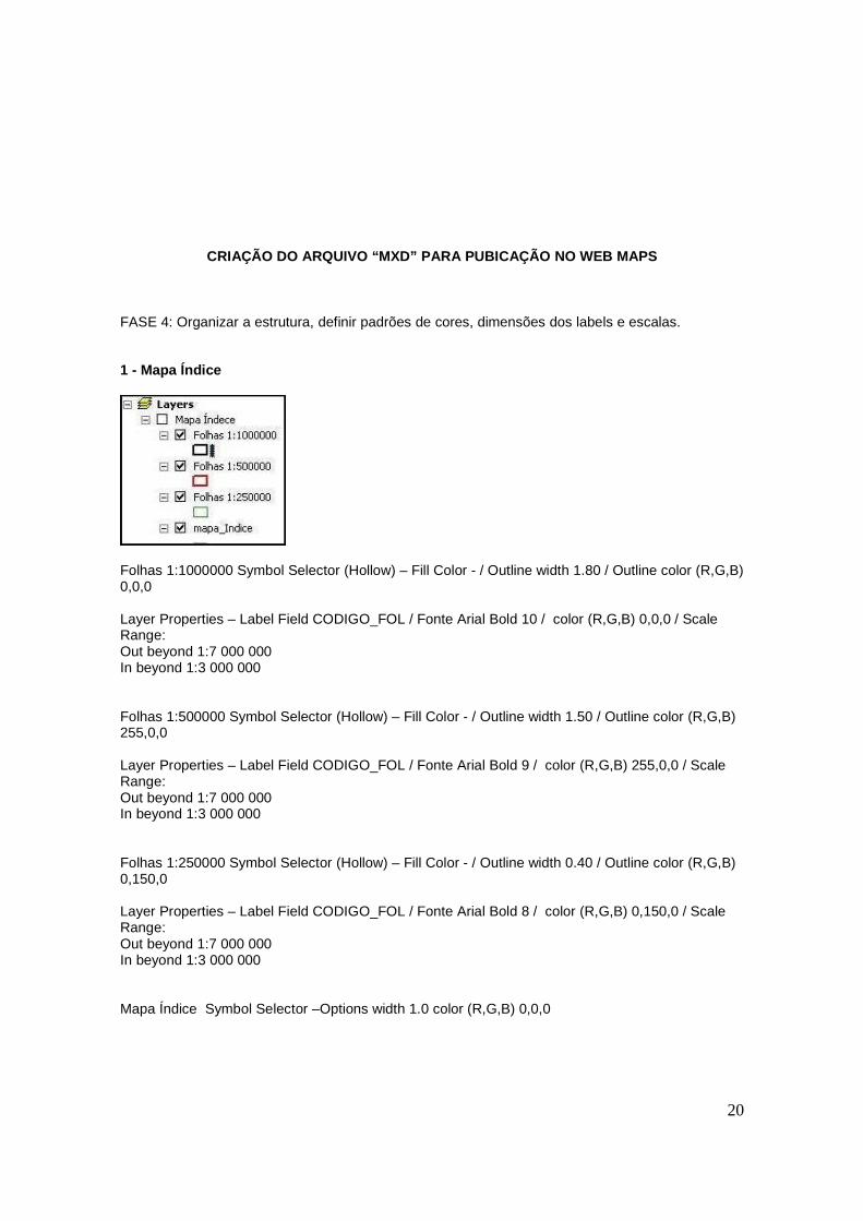
CRIAÇÃO DO ARQUIVO “MXD” PARA PUBICAÇÃO NO WEB MAPS FASE 4: Organizar a estrutura, definir padrões de cores, dimensões dos labels e escalas. 1 - Mapa Índice
Folhas 1:1000000 Symbol Selector (Hollow) – Fill Color - / Outline width 1.80 / Outline color (R,G,B) 0,0,0 Layer Properties – Label Field CODIGO_FOL / Fonte Arial Bold 10 / color (R,G,B) 0,0,0 / Scale Range: Out beyond 1:7 000 000 In beyond 1:3 000 000 Folhas 1:500000 Symbol Selector (Hollow) – Fill Color - / Outline width 1.50 / Outline color (R,G,B) 255,0,0 Layer Properties – Label Field CODIGO_FOL / Fonte Arial Bold 9 / color (R,G,B) 255,0,0 / Scale Range: Out beyond 1:7 000 000 In beyond 1:3 000 000 Folhas 1:250000 Symbol Selector (Hollow) – Fill Color - / Outline width 0.40 / Outline color (R,G,B) 0,150,0 Layer Properties – Label Field CODIGO_FOL / Fonte Arial Bold 8 / color (R,G,B) 0,150,0 / Scale Range: Out beyond 1:7 000 000 In beyond 1:3 000 000 Mapa Índice Symbol Selector –Options width 1.0 color (R,G,B) 0,0,0
21
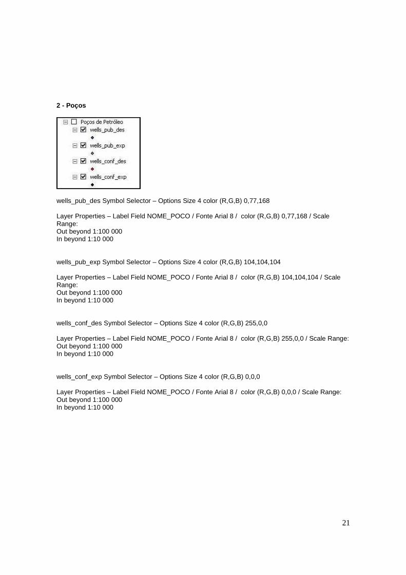
2 - Poços
wells_pub_des Symbol Selector – Options Size 4 color (R,G,B) 0,77,168 Layer Properties – Label Field NOME_POCO / Fonte Arial 8 / color (R,G,B) 0,77,168 / Scale Range: Out beyond 1:100 000 In beyond 1:10 000 wells_pub_exp Symbol Selector – Options Size 4 color (R,G,B) 104,104,104 Layer Properties – Label Field NOME_POCO / Fonte Arial 8 / color (R,G,B) 104,104,104 / Scale Range: Out beyond 1:100 000 In beyond 1:10 000 wells_conf_des Symbol Selector – Options Size 4 color (R,G,B) 255,0,0 Layer Properties – Label Field NOME_POCO / Fonte Arial 8 / color (R,G,B) 255,0,0 / Scale Range: Out beyond 1:100 000 In beyond 1:10 000 wells_conf_exp Symbol Selector – Options Size 4 color (R,G,B) 0,0,0 Layer Properties – Label Field NOME_POCO / Fonte Arial 8 / color (R,G,B) 0,0,0 / Scale Range: Out beyond 1:100 000 In beyond 1:10 000
22
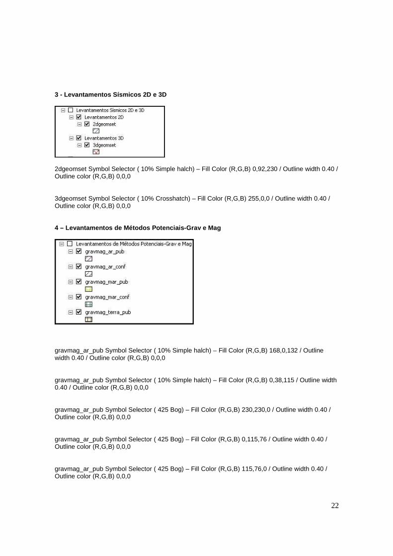
3 - Levantamentos Sísmicos 2D e 3D
2dgeomset Symbol Selector ( 10% Simple halch) – Fill Color (R,G,B) 0,92,230 / Outline width 0.40 / Outline color (R,G,B) 0,0,0 3dgeomset Symbol Selector ( 10% Crosshatch) – Fill Color (R,G,B) 255,0,0 / Outline width 0.40 / Outline color (R,G,B) 0,0,0 4 – Levantamentos de Métodos Potenciais-Grav e Mag
gravmag_ar_pub Symbol Selector ( 10% Simple halch) – Fill Color (R,G,B) 168,0,132 / Outline width 0.40 / Outline color (R,G,B) 0,0,0 gravmag_ar_pub Symbol Selector ( 10% Simple halch) – Fill Color (R,G,B) 0,38,115 / Outline width 0.40 / Outline color (R,G,B) 0,0,0 gravmag_ar_pub Symbol Selector ( 425 Bog) – Fill Color (R,G,B) 230,230,0 / Outline width 0.40 / Outline color (R,G,B) 0,0,0 gravmag_ar_pub Symbol Selector ( 425 Bog) – Fill Color (R,G,B) 0,115,76 / Outline width 0.40 / Outline color (R,G,B) 0,0,0 gravmag_ar_pub Symbol Selector ( 425 Bog) – Fill Color (R,G,B) 115,76,0 / Outline width 0.40 / Outline color (R,G,B) 0,0,0
23
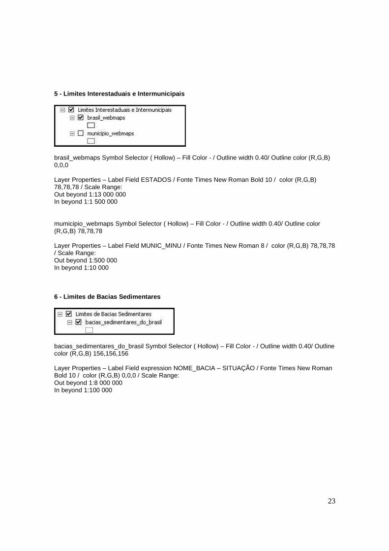
5 - Limites Interestaduais e Intermunicipais
brasil_webmaps Symbol Selector ( Hollow) – Fill Color - / Outline width 0.40/ Outline color (R,G,B) 0,0,0 Layer Properties – Label Field ESTADOS / Fonte Times New Roman Bold 10 / color (R,G,B) 78,78,78 / Scale Range: Out beyond 1:13 000 000 In beyond 1:1 500 000 mumicipio_webmaps Symbol Selector ( Hollow) – Fill Color - / Outline width 0.40/ Outline color (R,G,B) 78,78,78 Layer Properties – Label Field MUNIC_MINU / Fonte Times New Roman 8 / color (R,G,B) 78,78,78 / Scale Range: Out beyond 1:500 000 In beyond 1:10 000 6 - Limites de Bacias Sedimentares
bacias_sedimentares_do_brasil Symbol Selector ( Hollow) – Fill Color - / Outline width 0.40/ Outline color (R,G,B) 156,156,156 Layer Properties – Label Field expression NOME_BACIA – SITUAÇÃO / Fonte Times New Roman Bold 10 / color (R,G,B) 0,0,0 / Scale Range: Out beyond 1:8 000 000 In beyond 1:100 000
24
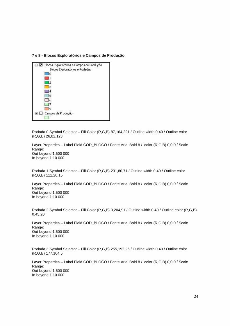
7 e 8 - Blocos Exploratórios e Campos de Produção
Rodada 0 Symbol Selector – Fill Color (R,G,B) 87,164,221 / Outline width 0.40 / Outline color (R,G,B) 26,82,123 Layer Properties – Label Field COD_BLOCO / Fonte Arial Bold 8 / color (R,G,B) 0,0,0 / Scale Range: Out beyond 1:500 000 In beyond 1:10 000 Rodada 1 Symbol Selector – Fill Color (R,G,B) 231,80,71 / Outline width 0.40 / Outline color (R,G,B) 111,20,15 Layer Properties – Label Field COD_BLOCO / Fonte Arial Bold 8 / color (R,G,B) 0,0,0 / Scale Range: Out beyond 1:500 000 In beyond 1:10 000 Rodada 2 Symbol Selector – Fill Color (R,G,B) 0,204,91 / Outline width 0.40 / Outline color (R,G,B) 0,45,20 Layer Properties – Label Field COD_BLOCO / Fonte Arial Bold 8 / color (R,G,B) 0,0,0 / Scale Range: Out beyond 1:500 000 In beyond 1:10 000 Rodada 3 Symbol Selector – Fill Color (R,G,B) 255,192,26 / Outline width 0.40 / Outline color (R,G,B) 177,104,5 Layer Properties – Label Field COD_BLOCO / Fonte Arial Bold 8 / color (R,G,B) 0,0,0 / Scale Range: Out beyond 1:500 000 In beyond 1:10 000
25
Rodada 4 Symbol Selector – Fill Color (R,G,B) 166,136,198 / Outline width 0.40 / Outline color (R,G,B) 58,48,88 Layer Properties – Label Field COD_BLOCO / Fonte Arial Bold 8 / color (R,G,B) 0,0,0 / Scale Range: Out beyond 1:500 000 In beyond 1:10 000 Rodada 5 Symbol Selector – Fill Color (R,G,B) 170,213,213 / Outline width 0.40 / Outline color (R,G,B) 52,105,105 Layer Properties – Label Field COD_BLOCO / Fonte Arial Bold 8 / color (R,G,B) 0,0,0 / Scale Range: Out beyond 1:500 000 In beyond 1:10 000 Rodada 6 Symbol Selector – Fill Color (R,G,B) 255,221,221 / Outline width 0.40 / Outline color (R,G,B) 0,0,0 Layer Properties – Label Field COD_BLOCO / Fonte Arial Bold 8 / color (R,G,B) 0,0,0 / Scale Range: Out beyond 1:500 000 In beyond 1:10 000 Rodada 7 Symbol Selector – Fill Color (R,G,B) 191,255,191 / Outline width 0.40 / Outline color (R,G,B) 0,0,0 Layer Properties – Label Field COD_BLOCO / Fonte Arial Bold 8 / color (R,G,B) 0,0,0 / Scale Range: Out beyond 1:500 000 In beyond 1:10 000 Rodada 9 Symbol Selector – Fill Color (R,G,B) 255,163,120 / Outline width 0.40 / Outline color (R,G,B) 110,110,110 Layer Properties – Label Field COD_BLOCO / Fonte Arial Bold 8 / color (R,G,B) 0,0,0 / Scale Range: Out beyond 1:500 000 In beyond 1:10 000 Campos de Produção Symbol Selector – Fill Color (R,G,B) 240,255,240 / Outline width 0.40 / Outline color (R,G,B) 0,221,0 Layer Properties – Label Field NOM_CAMPO / Fonte Arial Bold 8 / color (R,G,B) 0,0,0 / Scale Range: Out beyond 1:500 000 In beyond 1:10 000
26
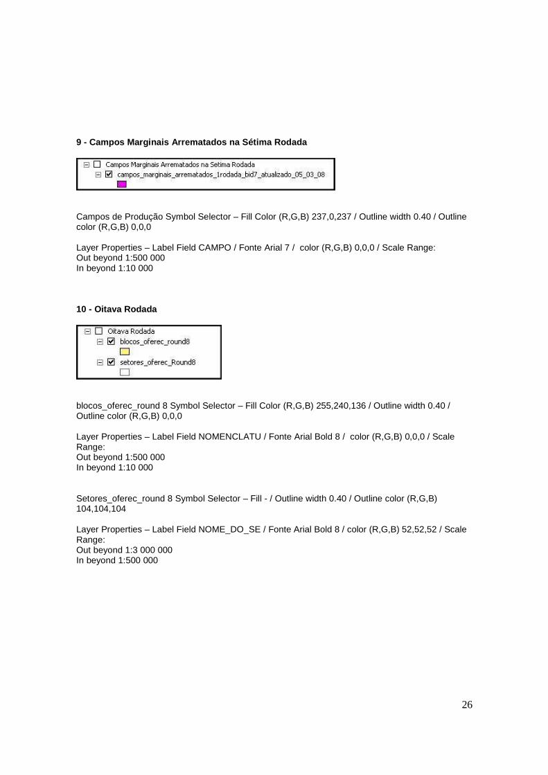
9 - Campos Marginais Arrematados na Sétima Rodada
Campos de Produção Symbol Selector – Fill Color (R,G,B) 237,0,237 / Outline width 0.40 / Outline color (R,G,B) 0,0,0 Layer Properties – Label Field CAMPO / Fonte Arial 7 / color (R,G,B) 0,0,0 / Scale Range: Out beyond 1:500 000 In beyond 1:10 000 10 - Oitava Rodada
blocos_oferec_round 8 Symbol Selector – Fill Color (R,G,B) 255,240,136 / Outline width 0.40 / Outline color (R,G,B) 0,0,0 Layer Properties – Label Field NOMENCLATU / Fonte Arial Bold 8 / color (R,G,B) 0,0,0 / Scale Range: Out beyond 1:500 000 In beyond 1:10 000 Setores_oferec_round 8 Symbol Selector – Fill - / Outline width 0.40 / Outline color (R,G,B) 104,104,104 Layer Properties – Label Field NOME_DO_SE / Fonte Arial Bold 8 / color (R,G,B) 52,52,52 / Scale Range: Out beyond 1:3 000 000 In beyond 1:500 000
27
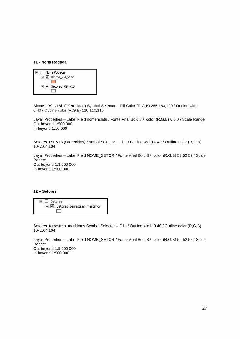
11 - Nona Rodada
Blocos_R9_v16b (Oferecidos) Symbol Selector – Fill Color (R,G,B) 255,163,120 / Outline width 0.40 / Outline color (R,G,B) 110,110,110 Layer Properties – Label Field nomenclatu / Fonte Arial Bold 8 / color (R,G,B) 0,0,0 / Scale Range: Out beyond 1:500 000 In beyond 1:10 000 Setores_R9_v13 (Oferecidos) Symbol Selector – Fill - / Outline width 0.40 / Outline color (R,G,B) 104,104,104 Layer Properties – Label Field NOME_SETOR / Fonte Arial Bold 8 / color (R,G,B) 52,52,52 / Scale Range: Out beyond 1:3 000 000 In beyond 1:500 000 12 – Setores
Setores_terrestres_marítimos Symbol Selector – Fill - / Outline width 0.40 / Outline color (R,G,B) 104,104,104 Layer Properties – Label Field NOME_SETOR / Fonte Arial Bold 8 / color (R,G,B) 52,52,52 / Scale Range: Out beyond 1:5 000 000 In beyond 1:500 000
28
SEGUEM ABAIXO OS PARÂMETROS UTILIZADOS NA SÍSMICA 2 D E 3D, GEOLOGIA E HIDROGRAFIA DAS BACIAS SEDIMENTARES TERRESTRES E MA RÍTIMAS
Sísmica 2D: SIS_2D_Pub_Exc_Pos Symbol Selector – Options width 1.0 color (R,G,B) 0,0,0 Layer Properties – Label Field SEGMENTO / Fonte Arial 8 / color (R,G,B) 0,0,0 / Scale Range: Out beyond 1:500 000 In beyond 1:100 000 SIS_2D_Pub_Exc_Pre Symbol Selector – Options width 1.0 color (R,G,B) 197,0,255 Layer Properties – Label Field SEGMENTO / Fonte Arial 8 / color (R,G,B) 197,0,255 / Scale Range: Out beyond 1:500 000 In beyond 1:100 000 SIS_2D_Conf_Exc_Pos Symbol Selector – Options width 1.0 color (R,G,B) 115,76,0 Layer Properties – Label Field SEGMENTO / Fonte Arial 8 / color (R,G,B) 115,76,0 / Scale Range: Out beyond 1:500 000 In beyond 1:100 000 SIS_2D_Conf_Exc_Pre Symbol Selector – Options width 1.0 color (R,G,B) 255,0,197 Layer Properties – Label Field SEGMENTO / Fonte Arial 8 / color (R,G,B) 255,0,197 / Scale Range: Out beyond 1:500 000 In beyond 1:100 000 SIS_2D_Conf_No_Exc_Pos Symbol Selector – Options width 1.0 color (R,G,B) 0,112,255 Layer Properties – Label Field SEGMENTO / Fonte Arial 8 / color (R,G,B) 0,112,255 / Scale Range: Out beyond 1:500 000 In beyond 1:100 000 SIS_2D_Conf_No_Exc_Pre Symbol Selector – Options width 1.0 color (R,G,B) 255,0,0 Layer Properties – Label Field SEGMENTO / Fonte Arial 8 / color (R,G,B) 255,0,0 / Scale Range: Out beyond 1:500 000 In beyond 1:100 000
29
Sísmica 3D: SIS_3D_Pub_Exc_Pos Symbol Selector – Options width 1.0 color (R,G,B) 0,230,169 SIS_3D_Pub_Exc_Pre Symbol Selector – Options width 1.0 color (R,G,B) 158,148,0 SIS_3D_Conf_Exc_Pos Symbol Selector – Options width 1.0 color (R,G,B) 128,55,0 SIS_3D_Conf_Exc_Pre Symbol Selector – Options width 1.0 color (R,G,B) 35,0,130 SIS_3D_Conf_No_Exc_Pos Symbol Selector – Options width 1.0 color (R,G,B) 0,115,76 SIS_3D_Conf_No_Exc_Pos Symbol Selector – Options width 1.0 color (R,G,B) 0,110,135 Províncias Geológicas do Brasil: Amazônia.avl, Borborema.avl, Mantiqueira.avl, Paraná.avl, Parnaíba.avl, São Francisco.avl e Tocantins.avl (arquivos de cores). Hidrigrafia:
*_hidro* Symbol Selector – Fill Color (R,G,B) 190,232,255 / Outline width 0.40 / Outline color (R,G,B) 0,197,255
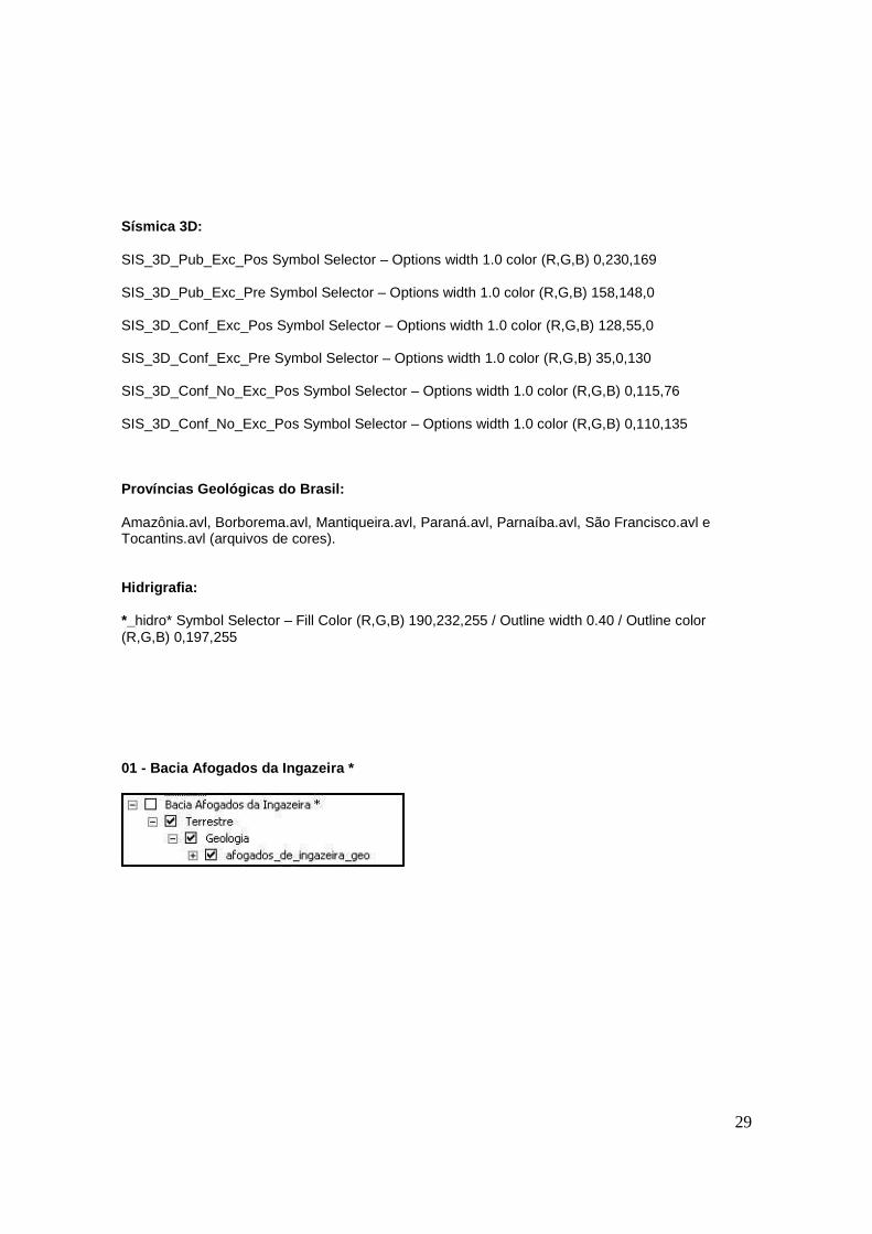
01 - Bacia Afogados da Ingazeira *
30
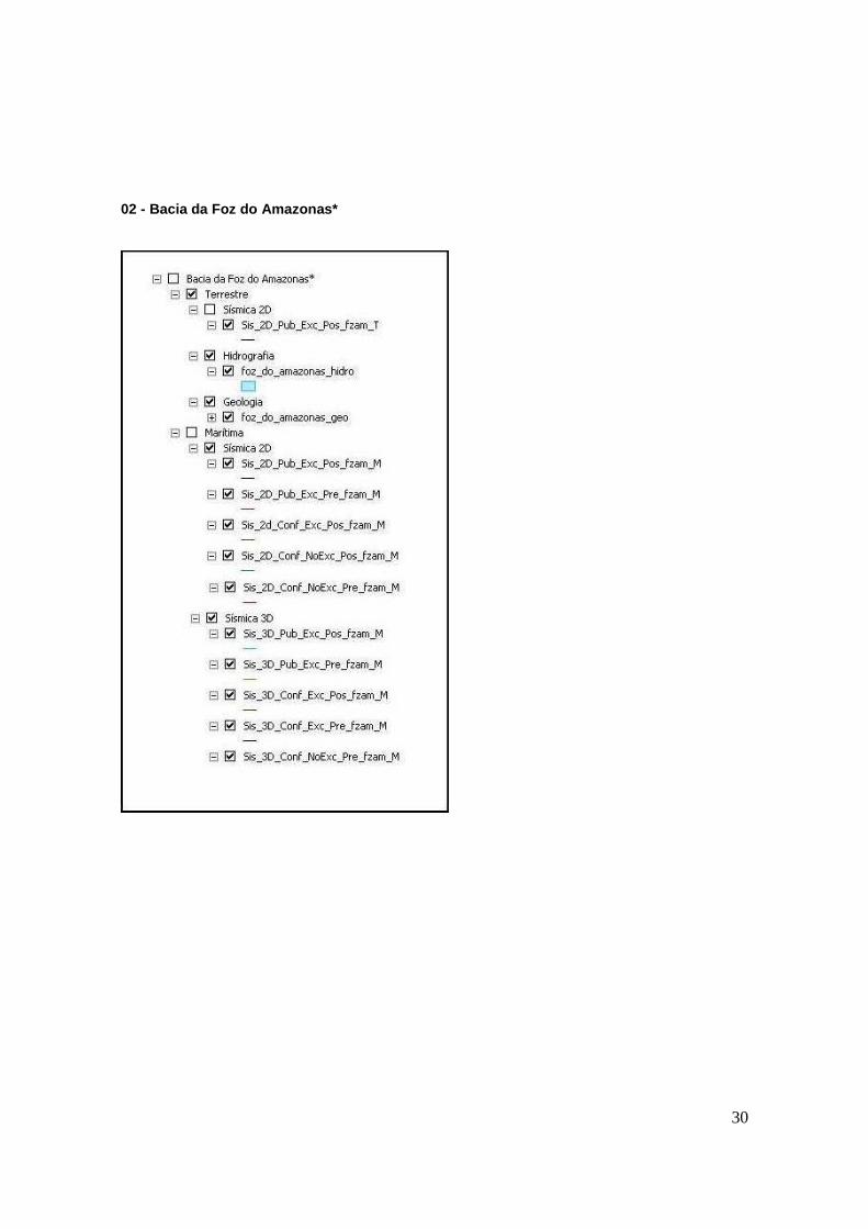
02 - Bacia da Foz do Amazonas*
31
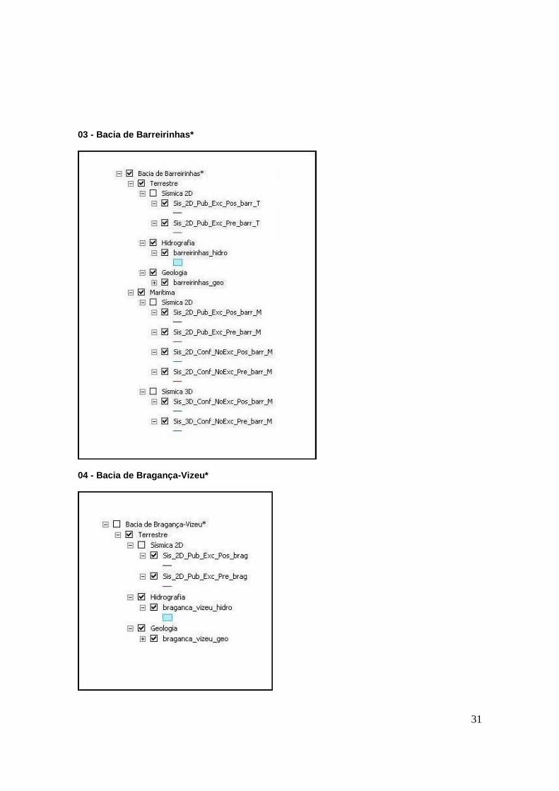
03 - Bacia de Barreirinhas*
04 - Bacia de Bragança-Vizeu*
32
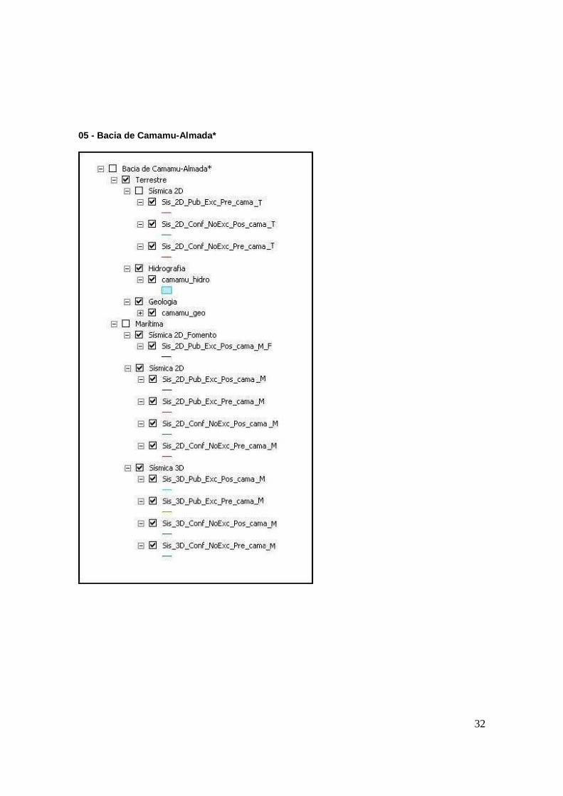
05 - Bacia de Camamu-Almada*
33
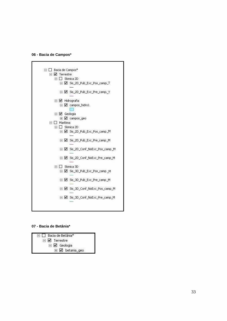
06 - Bacia de Campos*
07 - Bacia de Betânia*
34
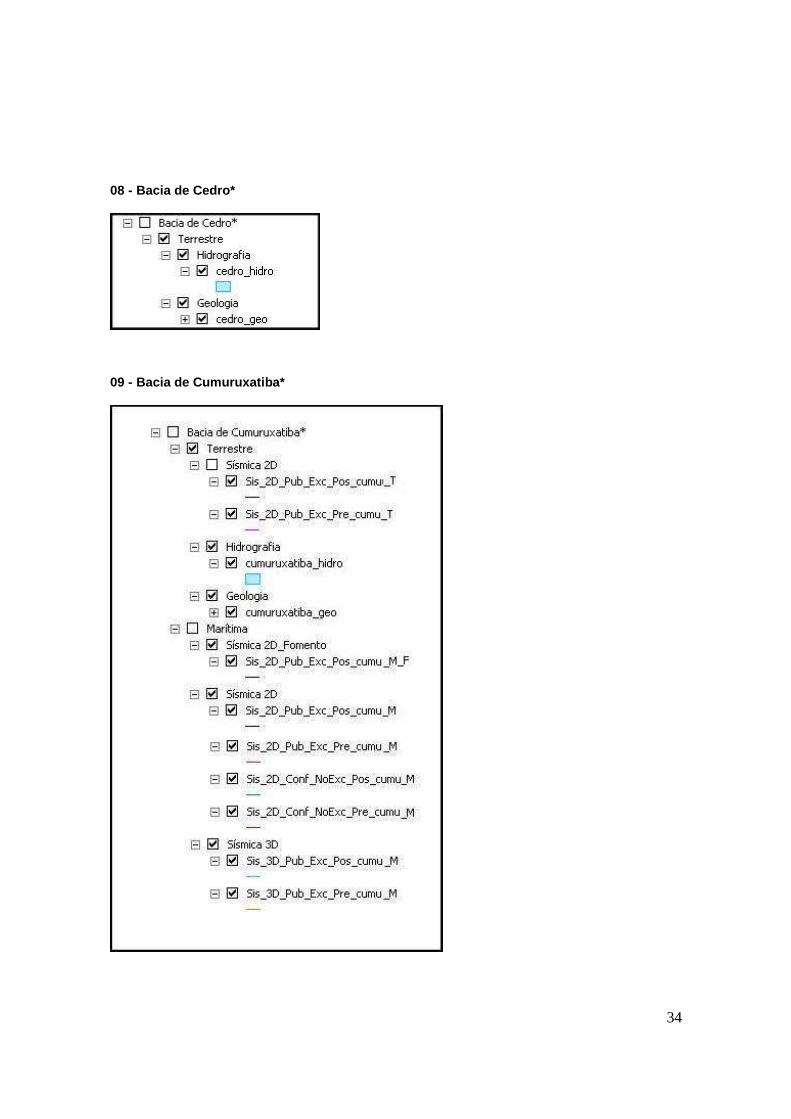
08 - Bacia de Cedro*
09 - Bacia de Cumuruxatiba*
35
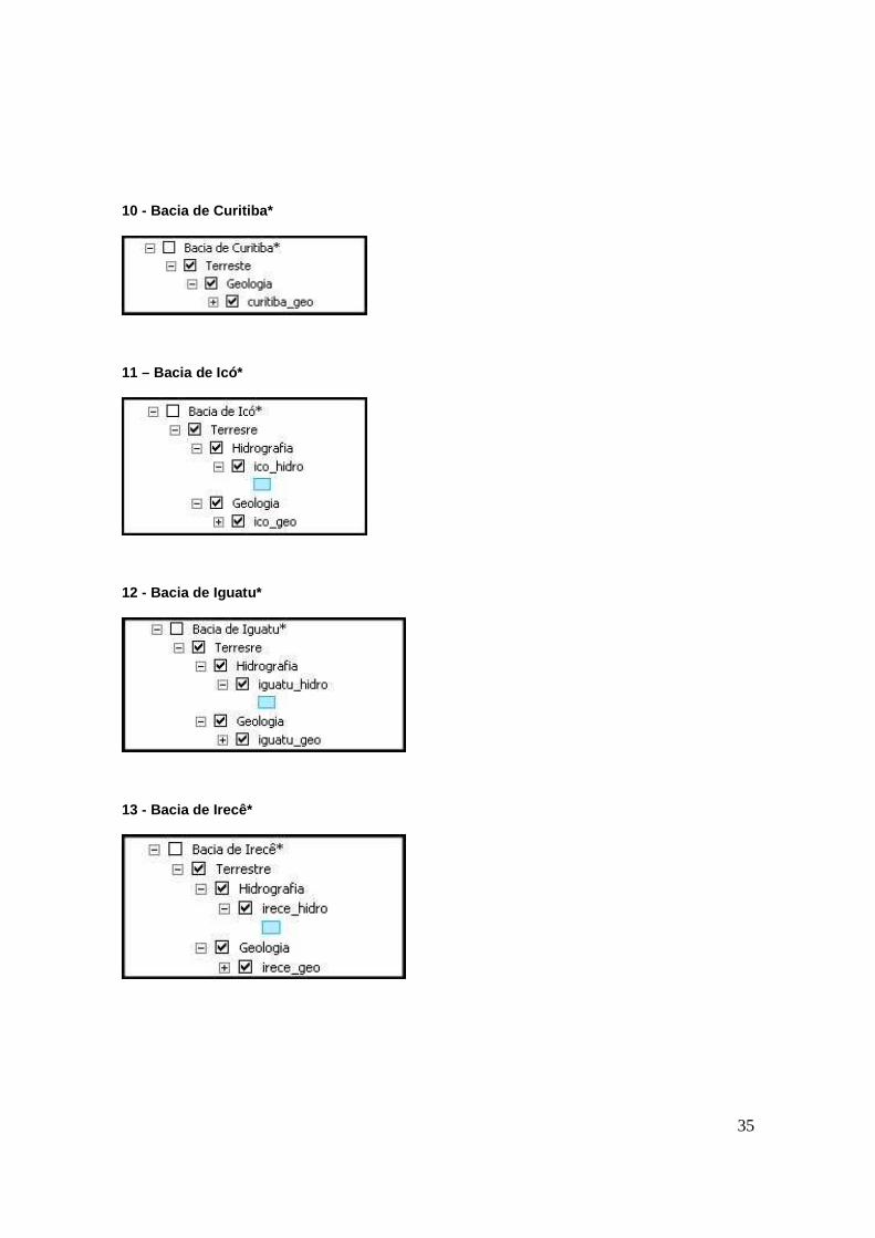
10 - Bacia de Curitiba*
11 – Bacia de Icó*
12 - Bacia de Iguatu*
13 - Bacia de Irecê*
36
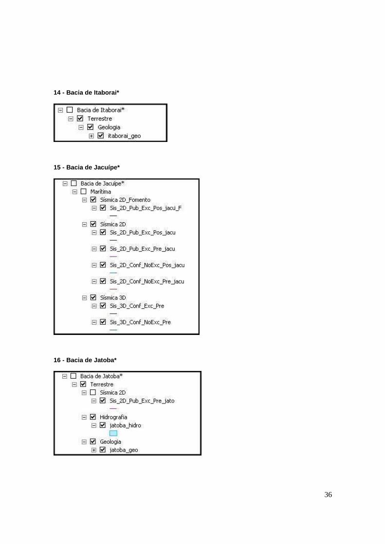
14 - Bacia de Itaborai*
15 - Bacia de Jacuípe*
16 - Bacia de Jatoba*
37
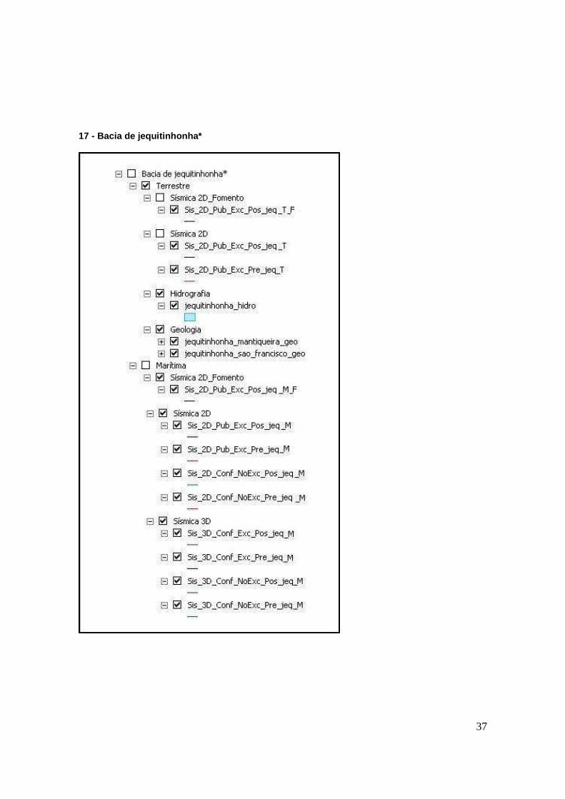
17 - Bacia de jequitinhonha*
38
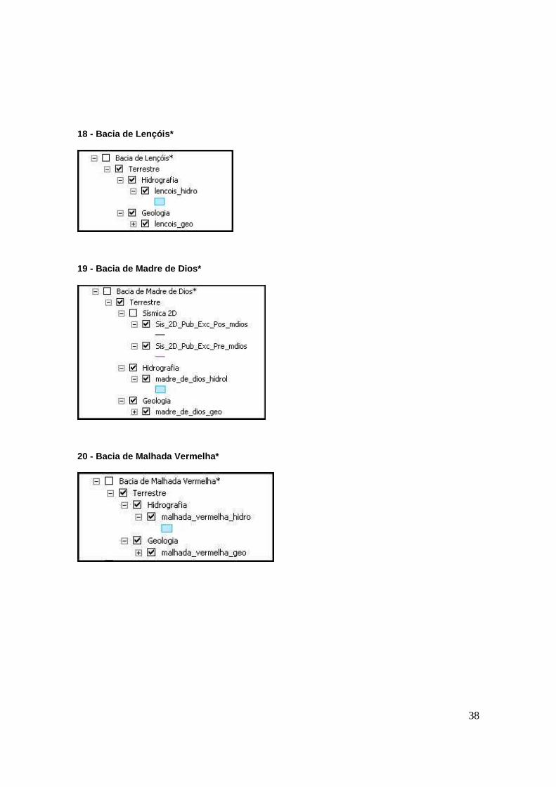
18 - Bacia de Lençóis*
19 - Bacia de Madre de Dios*
20 - Bacia de Malhada Vermelha*
39
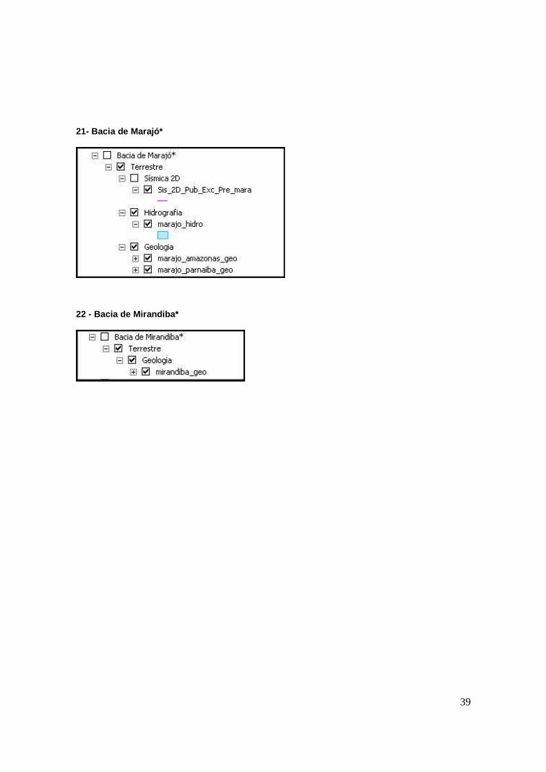
21- Bacia de Marajó*
22 - Bacia de Mirandiba*
40
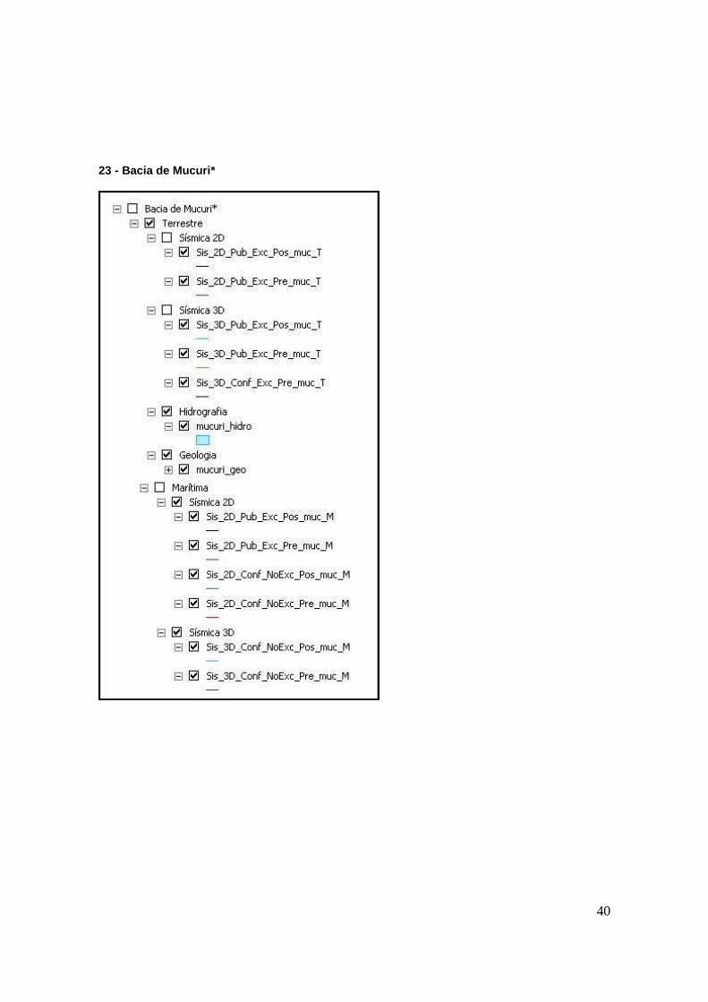
23 - Bacia de Mucuri*
41
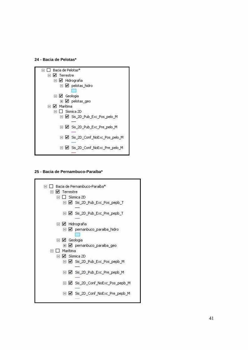
24 - Bacia de Pelotas*
25 - Bacia de Pernambuco-Paraíba*
42
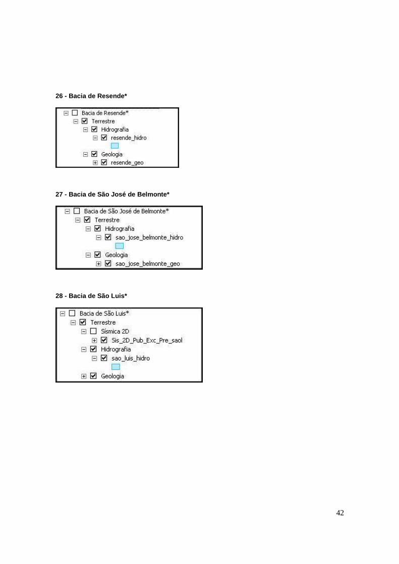
26 - Bacia de Resende*
27 - Bacia de São José de Belmonte*
28 - Bacia de São Luis*
43
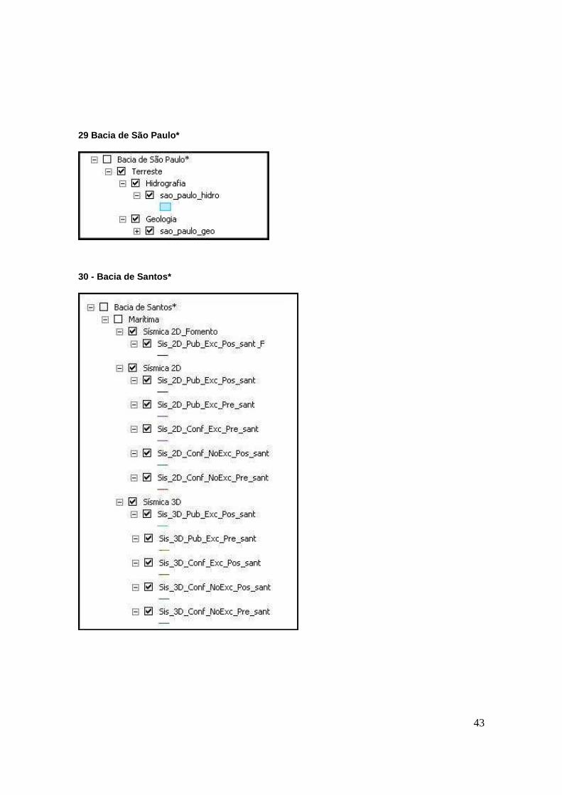
29 Bacia de São Paulo*
30 - Bacia de Santos*
44
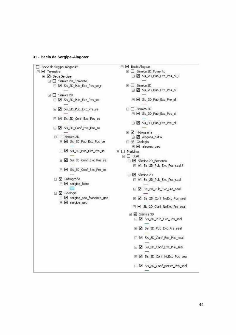
31 - Bacia de Sergipe-Alagoas *
45
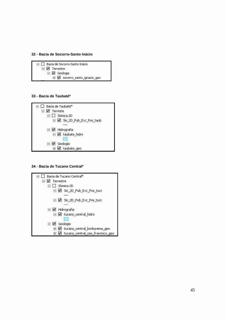
32 - Bacia de Socorro-Santo Inácio
33 - Bacia de Taubaté*
34 - Bacia de Tucano Central*
46
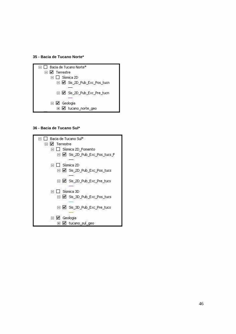
35 - Bacia de Tucano Norte*
36 - Bacia de Tucano Sul*
47
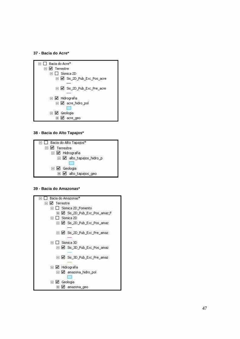
37 - Bacia do Acre*
38 - Bacia do Alto Tapajos*
39 - Bacia do Amazonas*
48
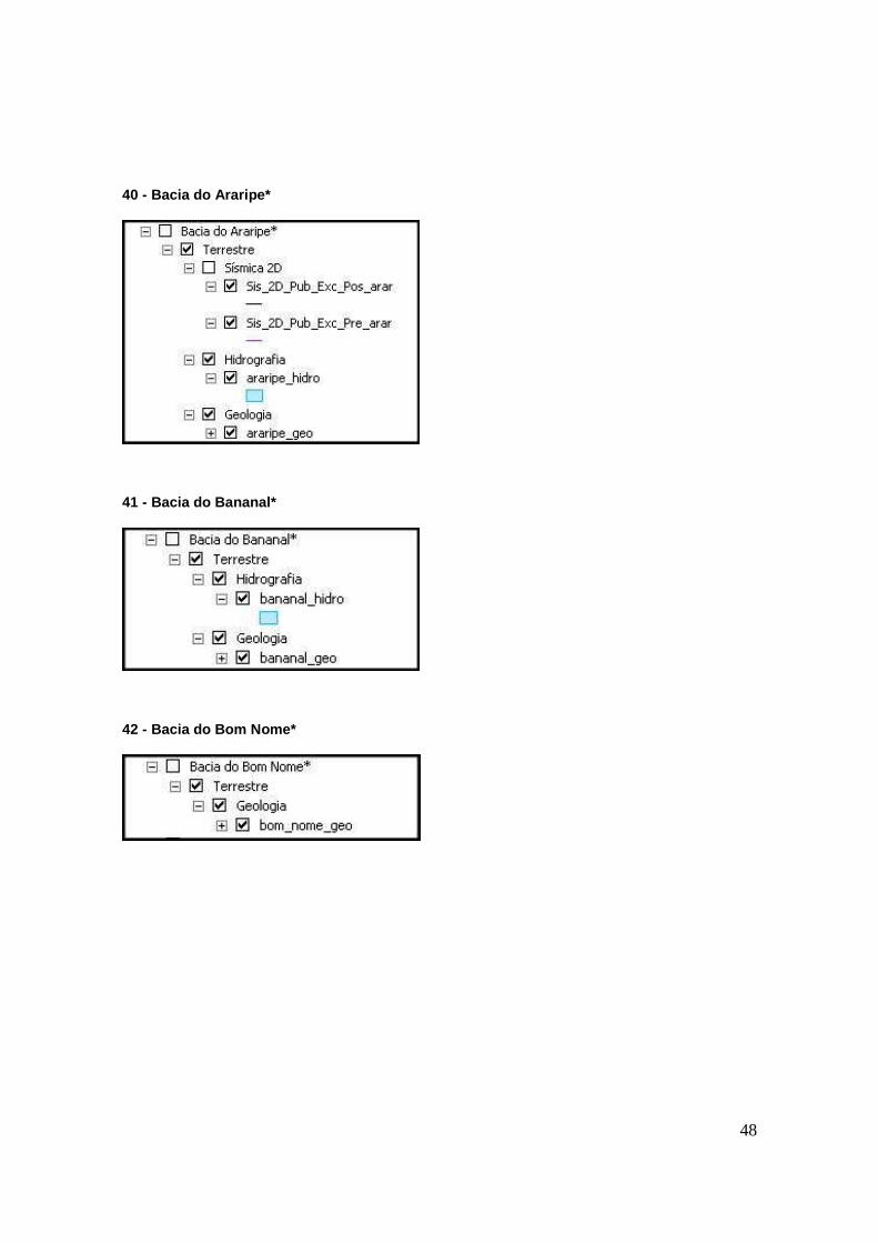
40 - Bacia do Araripe*
41 - Bacia do Bananal*
42 - Bacia do Bom Nome*
49
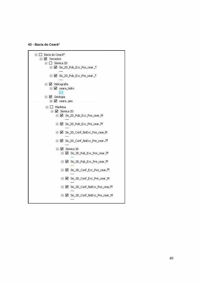
43 - Bacia do Ceará*
50
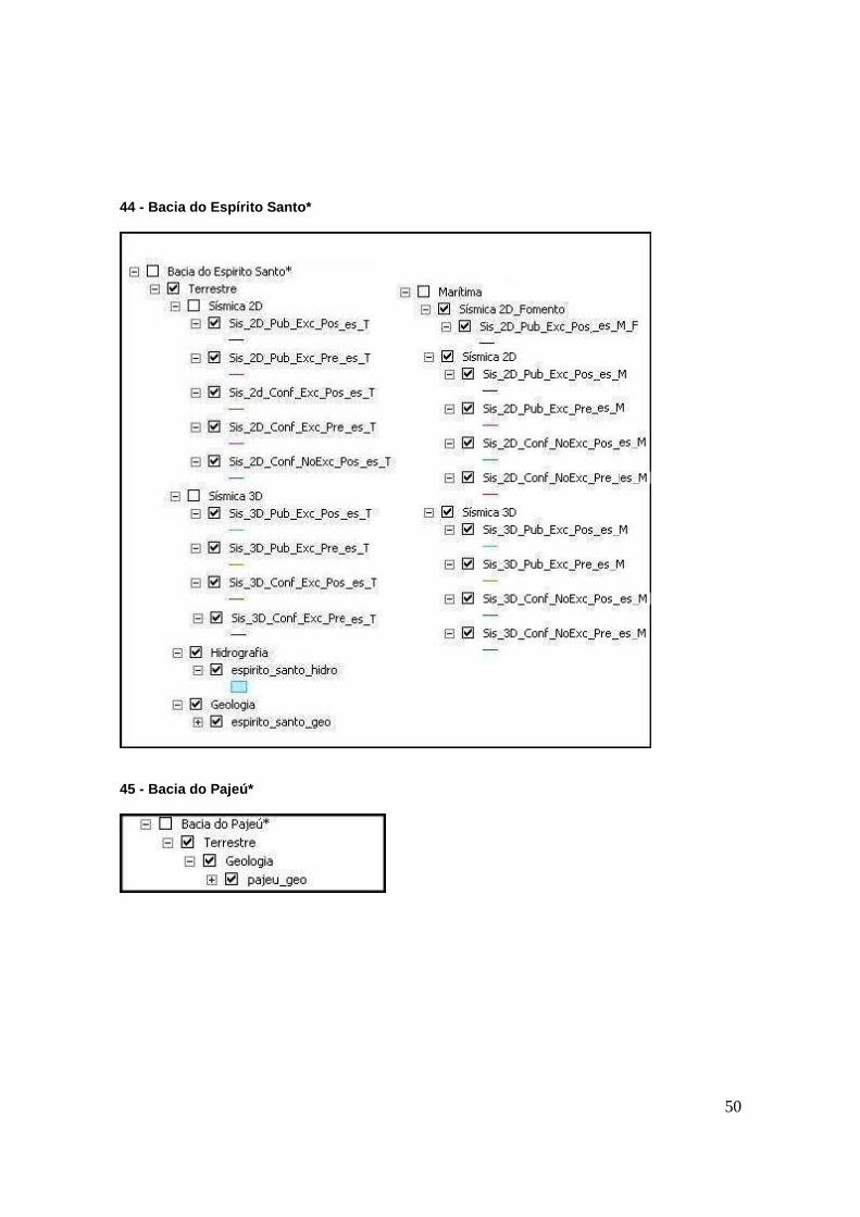
44 - Bacia do Espírito Santo*
45 - Bacia do Pajeú*
51
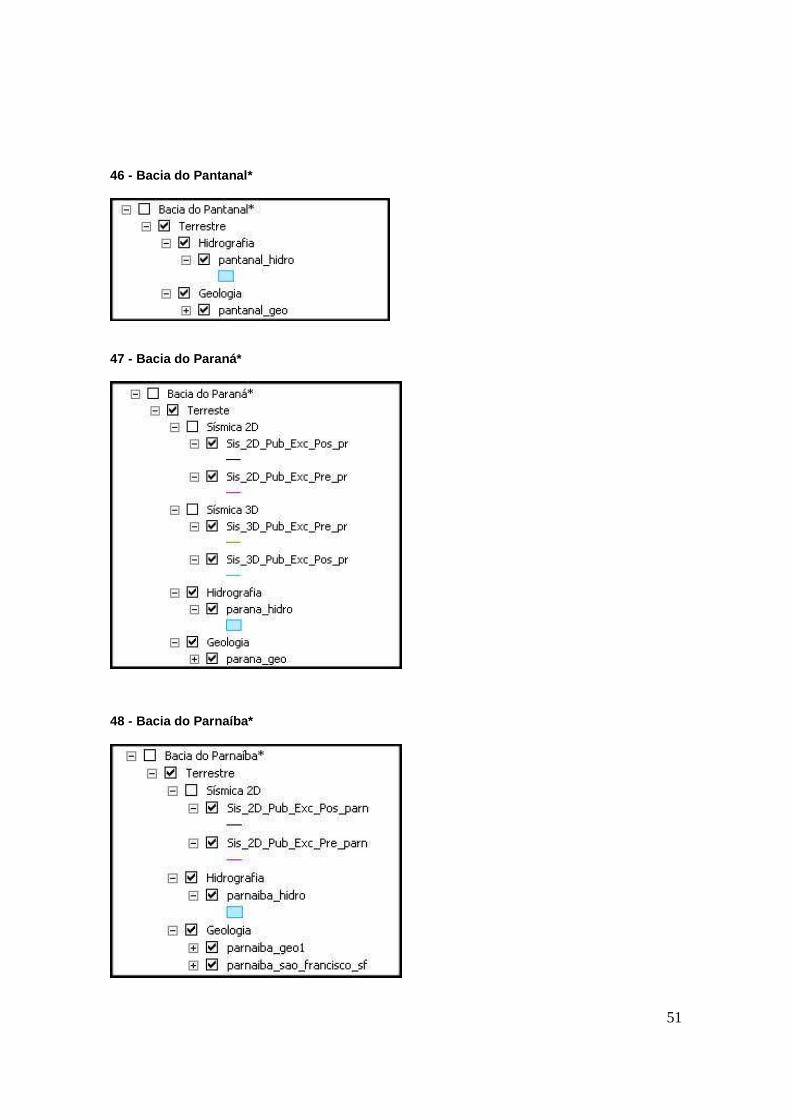
46 - Bacia do Pantanal*
47 - Bacia do Paraná*
48 - Bacia do Parnaíba*
52
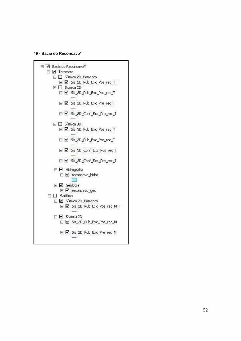
49 - Bacia do Recôncavo*
53
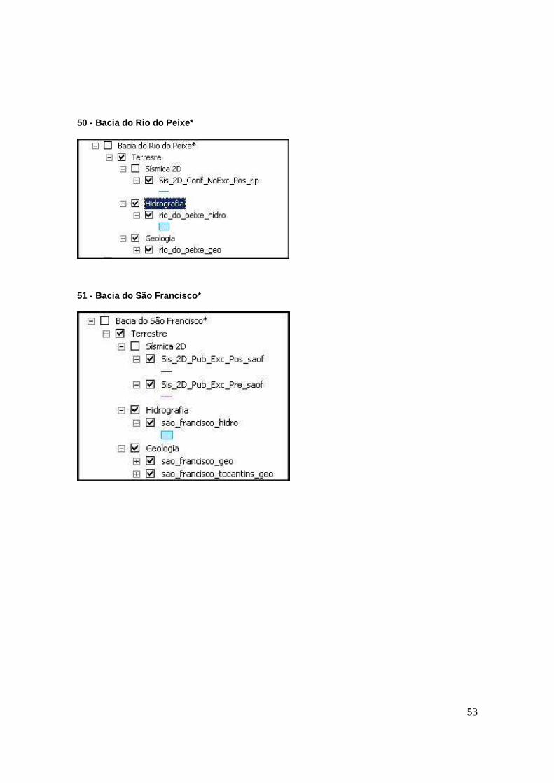
50 - Bacia do Rio do Peixe*
51 - Bacia do São Francisco*
54
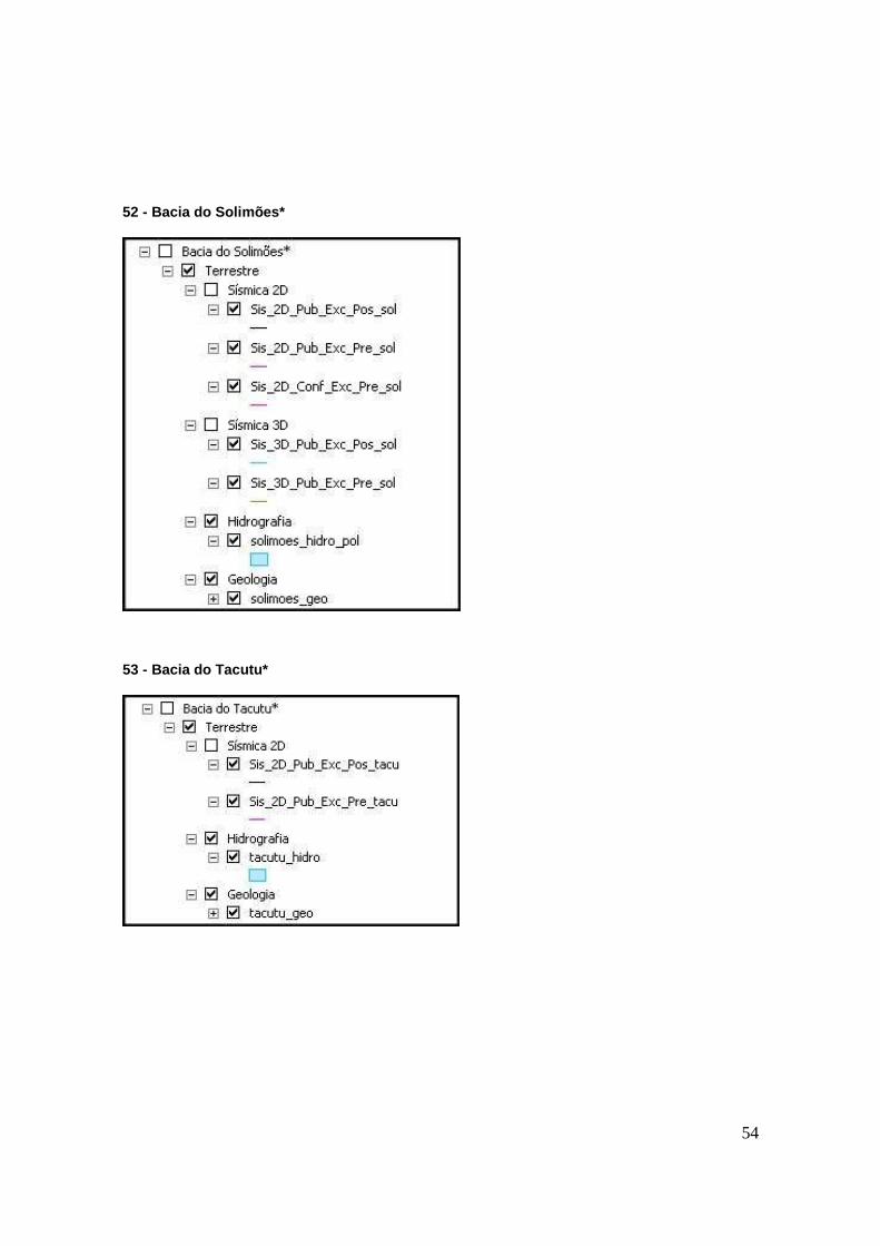
52 - Bacia do Solimões*
53 - Bacia do Tacutu*
55
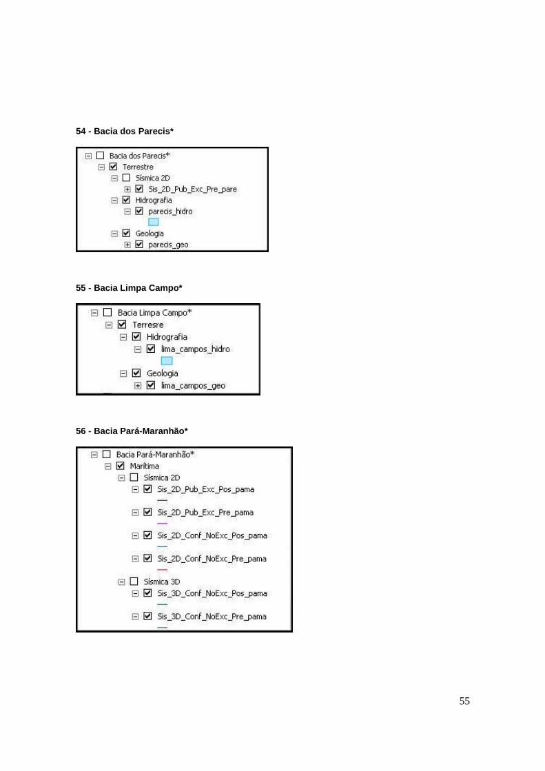
54 - Bacia dos Parecis*
55 - Bacia Limpa Campo*
56 - Bacia Pará-Maranhão*
56
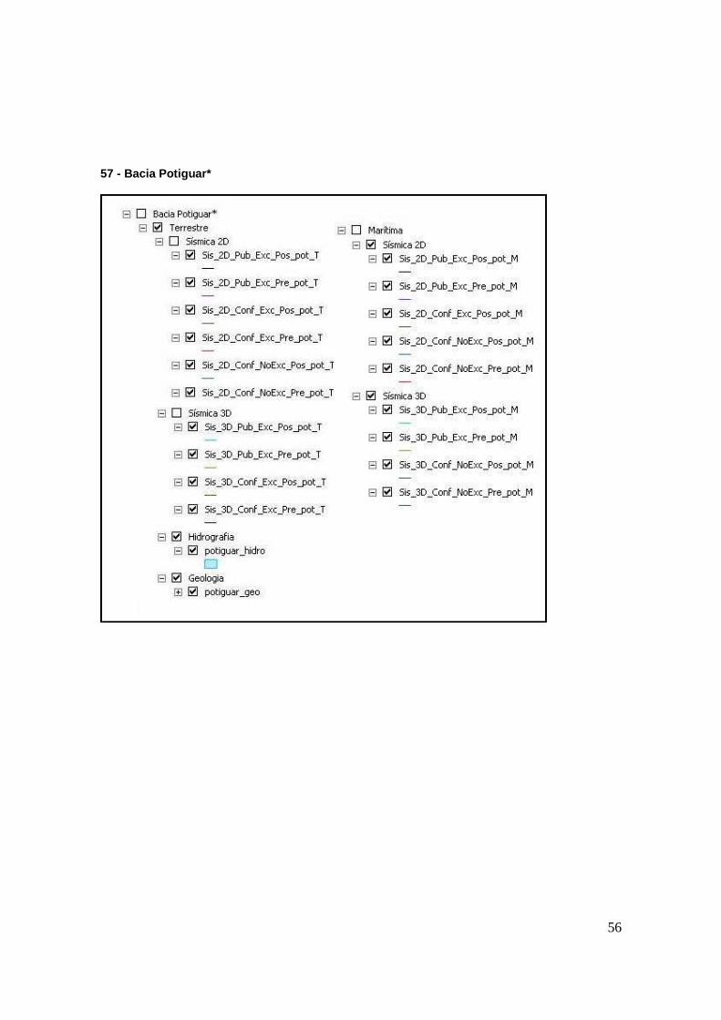
57 - Bacia Potiguar*
57
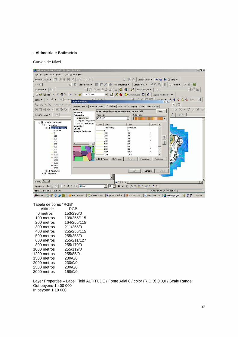
- Altimetria e Batimetria Curvas de Nível
Tabela de cores “RGB” Altitude RGB 0 metros 153/230/0 100 metros 109/255/115 200 metros 164/255/115 300 metros 211/255/0 400 metros 255/255/115 500 metros 255/255/0 600 metros 255/211/127 800 metros 255/170/0 1000 metros 255/119/0 1200 metros 255/85/0 1500 metros 230/0/0 2000 metros 230/0/0 2500 metros 230/0/0 3000 metros 168/0/0 Layer Properties – Label Field ALTITUDE / Fonte Arial 8 / color (R,G,B) 0,0,0 / Scale Range: Out beyond 1:400 000 In beyond 1:10 000
58
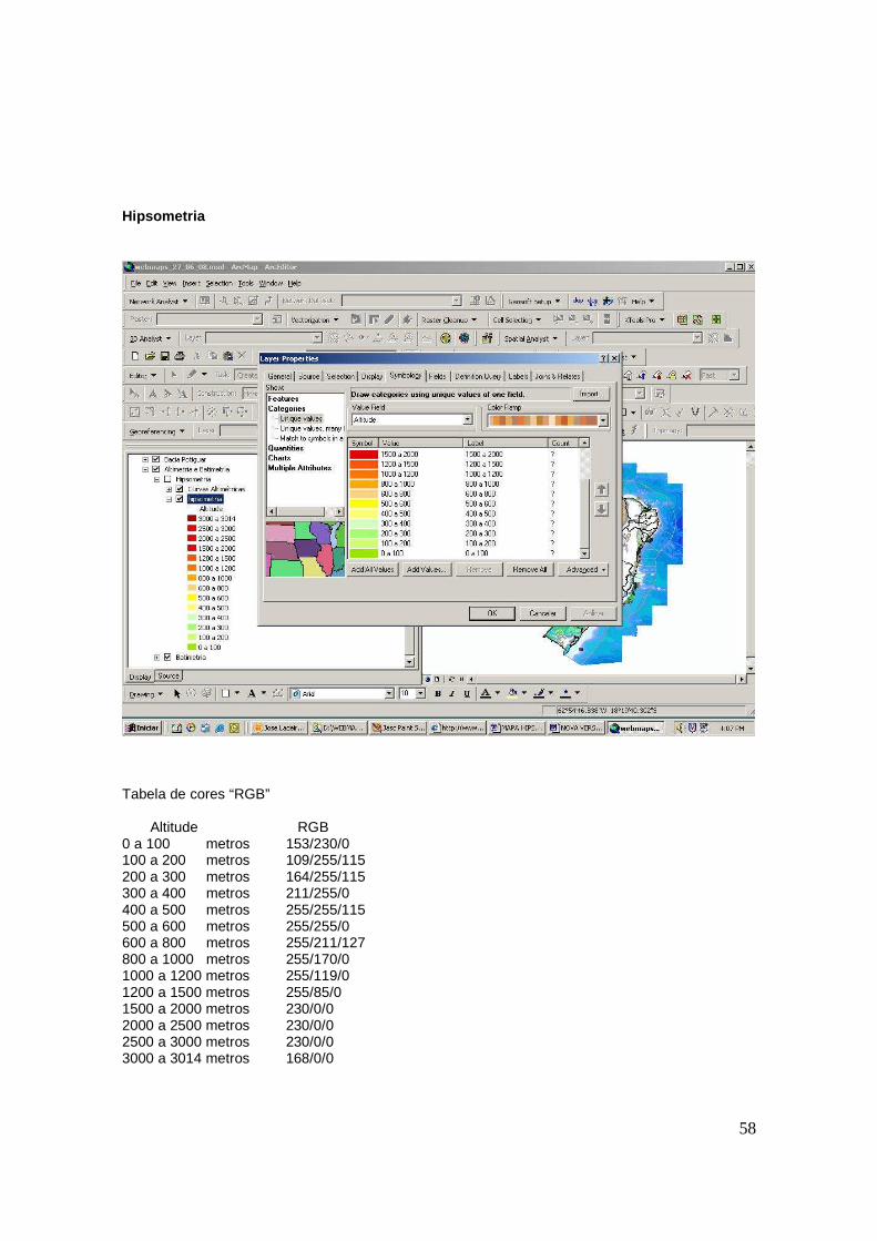
Hipsometria
Tabela de cores “RGB” Altitude RGB 0 a 100 metros 153/230/0 100 a 200 metros 109/255/115 200 a 300 metros 164/255/115 300 a 400 metros 211/255/0 400 a 500 metros 255/255/115 500 a 600 metros 255/255/0 600 a 800 metros 255/211/127 800 a 1000 metros 255/170/0 1000 a 1200 metros 255/119/0 1200 a 1500 metros 255/85/0 1500 a 2000 metros 230/0/0 2000 a 2500 metros 230/0/0 2500 a 3000 metros 230/0/0 3000 a 3014 metros 168/0/0
59
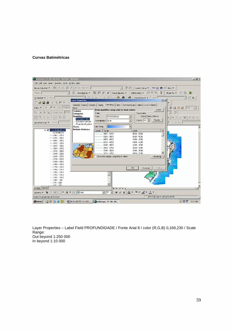
Curvas Batimétricas
Layer Properties – Label Field PROFUNDIDADE / Fonte Arial 8 / color (R,G,B) 0,169,230 / Scale Range: Out beyond 1:250 000 In beyond 1:10 000
60
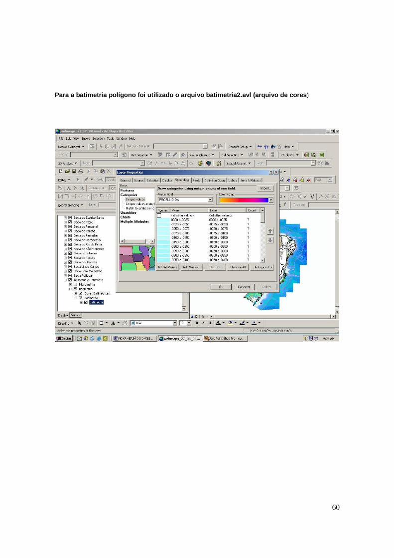
Para a batimetria polígono foi utilizado o arquivo batimetria2.avl (arquivo de cores )
61
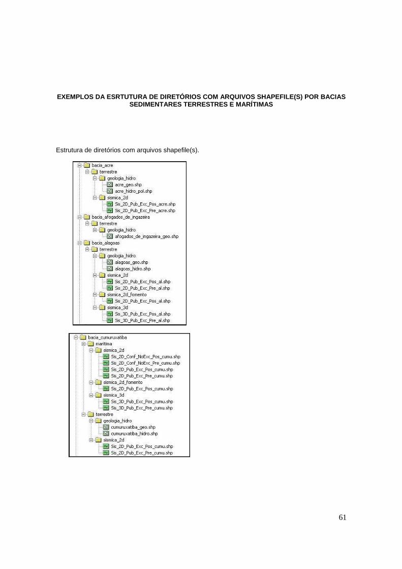
EXEMPLOS DA ESRTUTURA DE DIRETÓRIOS COM ARQUIVOS SH APEFILE(S) POR BACIAS
SEDIMENTARES TERRESTRES E MARÍTIMAS Estrutura de diretórios com arquivos shapefile(s).
62
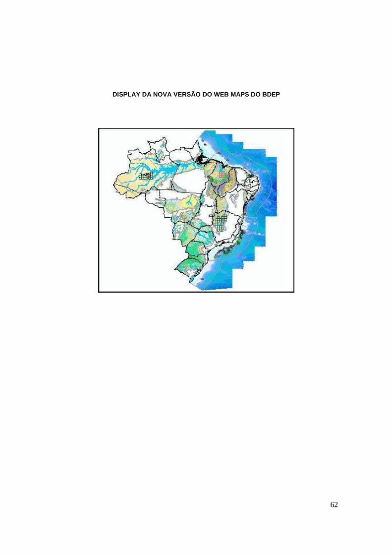
DISPLAY DA NOVA VERSÃO DO WEB MAPS DO BDEP