rostok hydro 2010 apresentação definitiva 10 years dam · •the pre-processing and...
TRANSCRIPT

13/12/2010
1
AUTORS
JOSÉ BARTOLOMEU FERREIRA FONTES (GEO TAG Engenharia & Consultoria, Projetos e Serviços Ltda / Brazil / bartolomeu@geotagbatimetria com br)Projetos e Serviços Ltda. / Brazil / [email protected])
JOSÉ CARLOS de OLIVEIRA (Vale / Brazil / [email protected] )
ORJANA CARVALHO ALCANTARA SILVA (GEO TAG Engenharia & Consultoria, Projetos e Serviços Ltda. / Brazil / [email protected])

13/12/2010
2
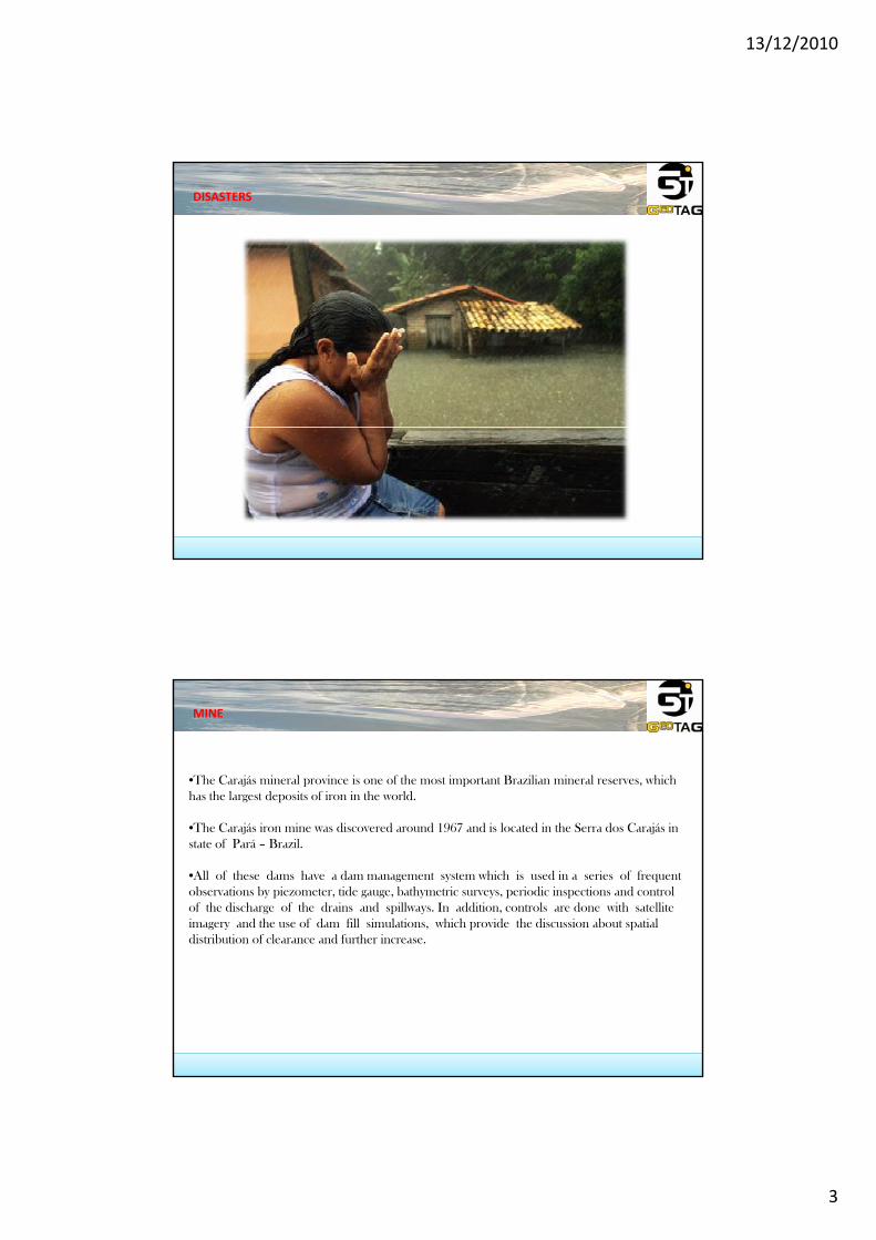
DISASTERS
DISASTERS
13/12/2010
3
DISASTERS
MINE
•The Carajás mineral province is one of the most important Brazilian mineral reserves, which has the largest deposits of iron in the world.
•The Carajás iron mine was discovered around 1967 and is located in the Serra dos Carajás in state of Pará – Brazil.
•All of these dams have a dam management system which is used in a series of frequent observations by piezometer, tide gauge, bathymetric surveys, periodic inspections and control of the discharge of the drains and spillways. In addition, controls are done with satellite imagery and the use of dam fill simulations, which provide the discussion about spatial distribution of clearance and further increase.

13/12/2010
4
MINE
MINE
13/12/2010
5
DAM
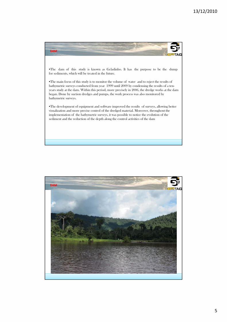
•The dam of this study is known as Geladinho. It has the purpose to be the dump for sediments, which will be treated in the future.
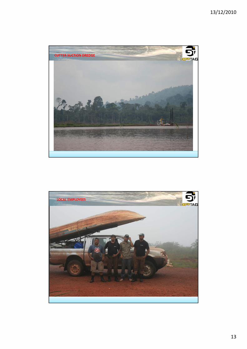
•The main focus of this study is to monitor the volume of water and to reject the results of bathymetric surveys conducted from year 1999 until 2009 by condensing the results of a ten-years study at the dam. Within this period, more precisely in 2006, the dredge works at the dam began. Done by suction dredges and pumps, the work process was also monitored by bathymetric surveys.
•The development of equipment and software improved the results of surveys, allowing better visualization and more precise control of the dredged material Moreover throughout the visualization and more precise control of the dredged material. Moreover, throughout the implementation of the bathymetric surveys, it was possible to notice the evolution of the sediment and the reduction of the depth along the control activities of the dam
DAM
13/12/2010
6
DAM
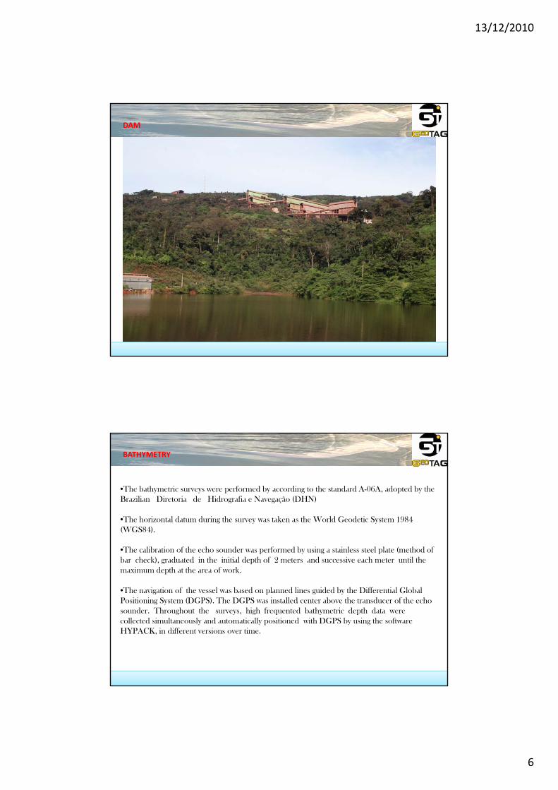
•The bathymetric surveys were performed by according to the standard A-06A, adopted by the Brazilian Diretoria de Hidrografia e Navegação (DHN)
Th h i l d d i h k h W ld G d i S 1984
BATHYMETRY
•The horizontal datum during the survey was taken as the World Geodetic System 1984 (WGS84).
•The calibration of the echo sounder was performed by using a stainless steel plate (method of bar check), graduated in the initial depth of 2 meters and successive each meter until the maximum depth at the area of work.
•The navigation of the vessel was based on planned lines guided by the Differential Global Positioning System (DGPS) The DGPS was installed center above the transducer of the echo Positioning System (DGPS). The DGPS was installed center above the transducer of the echo sounder. Throughout the surveys, high frequented bathymetric depth data were collected simultaneously and automatically positioned with DGPS by using the software HYPACK, in different versions over time.

13/12/2010
7
BATHYMETRY
•The pre-processing and post-processing of the hydrographic project was done by HYPACK software.
D i h d i h di i l fil d i h h hi h
BATHYMETRY
•During the data processing, the digital profiles were compared with those, which were recorded by the analog echogram (echo sounder paper registration), and eliminated all spurious data, including the dense characterized vegetation that distort the calculations of water volume.
•After edit the data in pre-processing, the final processing was performed to consist of scaled and edited depths from the echogram, the selection of sounding and the production of bathymetric charts.
13/12/2010
8
BATHYMETRY
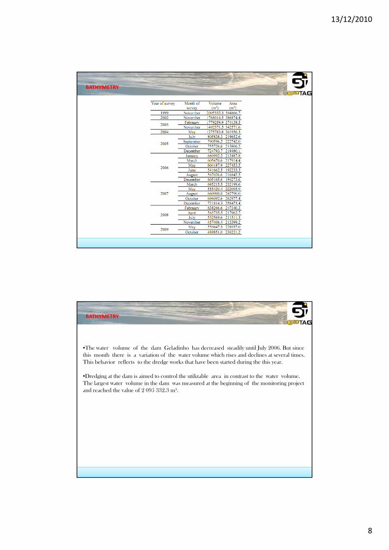
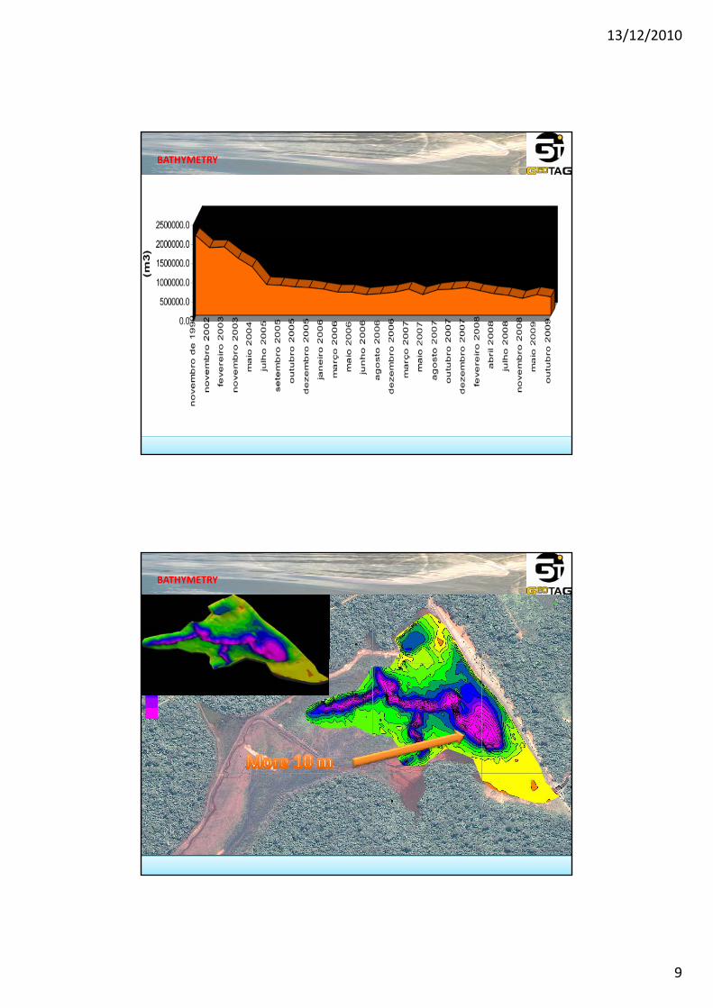
•The water volume of the dam Geladinho has decreased steadily until July 2006. But since this month there is a variation of the water volume which rises and declines at several times. Thi b h i fl h d d k h h b d d i h hi
BATHYMETRY
This behavior reflects to the dredge works that have been started during the this year.
•Dredging at the dam is aimed to control the utilizable area in contrast to the water volume. The largest water volume in the dam was measured at the beginning of the monitoring project and reached the value of 2 095 332.3 m³.
13/12/2010
9
BATHYMETRY
BATHYMETRY

13/12/2010
10
BATHYMETRY
BATHYMETRY

13/12/2010
11
BATHYMETRY
BATHYMETRY

13/12/2010
12
BATHYMETRY
DISASTER
13/12/2010
13
CUTTER SUCTION DREDGE
LOCAL EMPLOYEES
13/12/2010
14
ENVIRONMENTAL SOLUTION
DISASTER