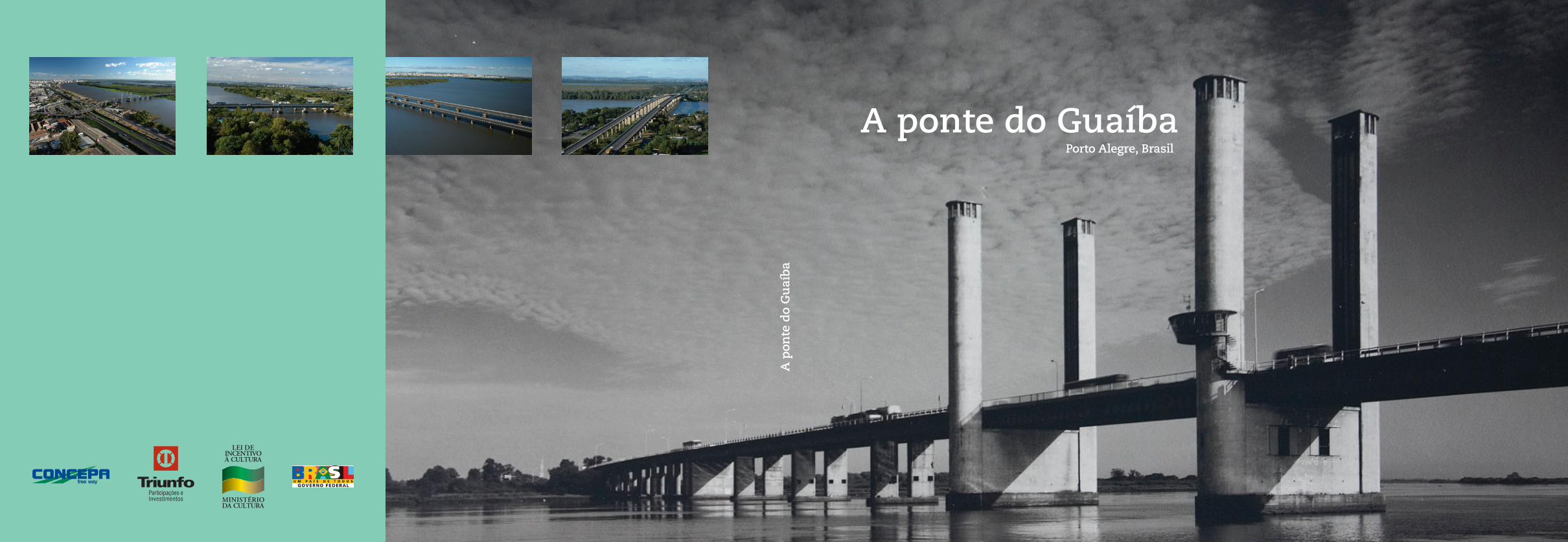
a ponte do guaìba, porto alegre, brasil
DESCRIPTION
Art direction, graphic design and electronic editoration for the book "A ponte do Guaíba" celebrating 50 years of the first movable bridge built Brazil. The bridge is one of the postcards of Porto Alegre, Brazil.The graphic project is very clean and concise and reflects the modernist architectural and engineering project of the bridge, developed by Leonhardt, Andrä und Partner – Stuttgart, Germany.TRANSCRIPT
A p
onte
do
Gu
aíba
A ponte do GuaíbaPorto Alegre, Brasil

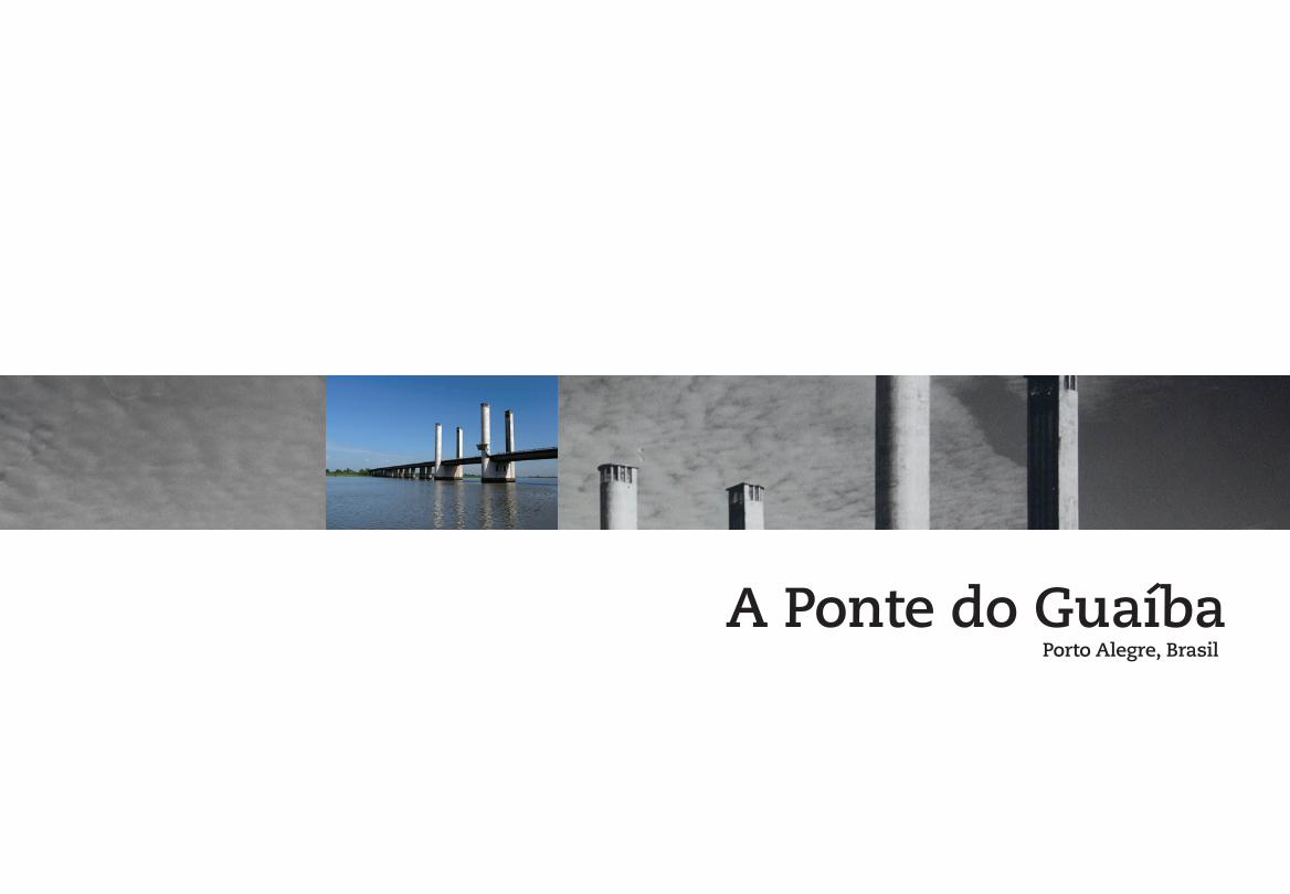
Porto Alegre, Brasil
A Ponte do Guaíba
A ponte do Guaíba / Coordenação editorial Maria
Cristina Wolff de Carvalho ; editoria Beatriz Blay,
Maria Cristina Wolff de Carvalho. São Paulo :
M. Carrilho Arquitetos, 2007.
96 p.
ISBN 978-85-60897-00-1
1. Pontes em concreto protendido. 2. Pontes móveis.
3. Engenharia - história. 4. Arquitetura - história. I.
Carvalho, Maria Cristina Wolff de. II. Blay, Beatriz.
CDU:624.21:693.56
Copyright © 2007 by Marcos Carrilho Arquitetos
Todos os direitos reservados a All rights reserved to
Marcos Carrilho Arquitetos Ltda.
Av. Higienópolis, 318, ap. 4, Higienópolis
01238-000, São Paulo, SP, Brasil
Tel.: + 55 11 3666 5519
e-mail: [email protected]
Printed in Brazil
Todos os direitos reservados e protegidos pela Lei nº 9.610 de 19 de fevereiro de 1998. É proibida a reprodução total ou parcial sem autorização, por escrito, da editora e dos autores.All rights reserved and protected by Law 9 610 of Feb. 19th 1998. No part of this publication may be reproduced without permission in writing from the publisher and authors.
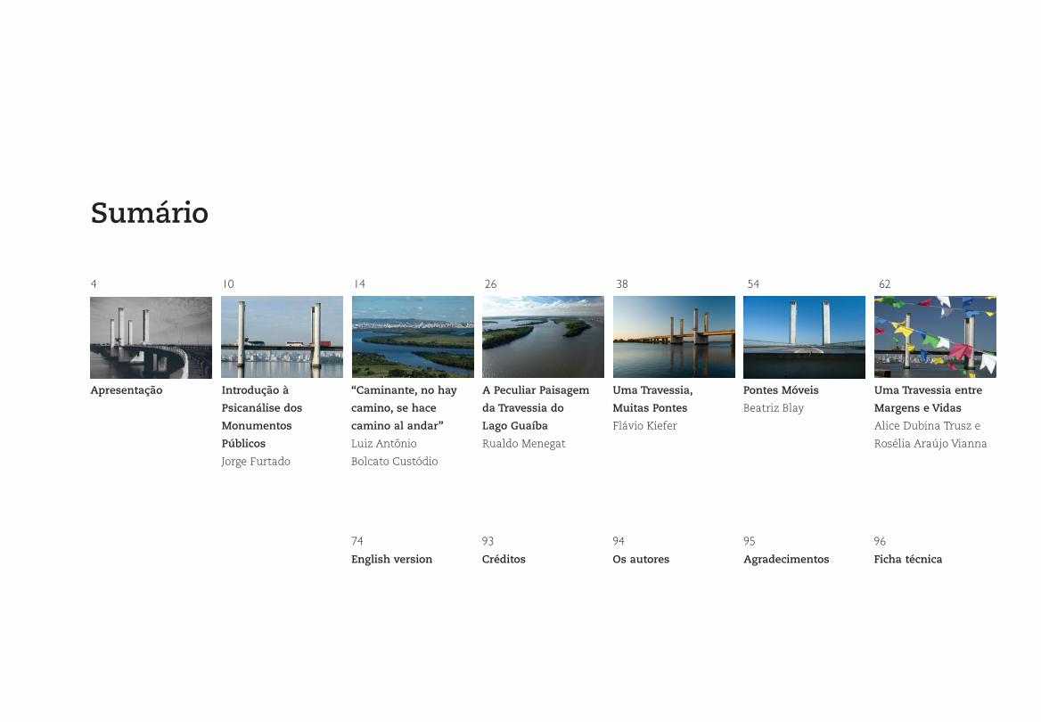
Sumário
4 10 14 26 38 54 62

4
Apresentação
Apresentação
6Apresentação
7 A Ponte do Guaíba
Com esta edição comemorativa dos dez anos da Concepa –
Concessionária da Rodovia Osório-Porto Alegre, o Instituto Sócio-
cultural TPI, vinculado ao Grupo Triunfo, quer homenagear o Rio
Grande do Sul e o Brasil. Ao escolher o tema, preparamo-nos tam-
bém para o início das comemorações dos 50 anos desta que foi,
desde o primeiro momento, um símbolo da identidade gaúcha: a
ponte do Guaíba.
Monumentalidade, estética, criatividade, funcionalidade e
adequação ao ambiente foram os critérios que pautaram a esco-
lha do projeto vencedor para a travessia do Guaíba 50 anos atrás.
E a harmonia do conjunto torna-se clara seja quando a percor-
remos, seja na leitura dos memoriais de projeto ou, ainda, quan-
do observamos atentamente as imagens deste livro. Ela é, sem
dúvida, a materialização do ideário moderno nas suas refinadas
linhas e sofisticada tecnologia.
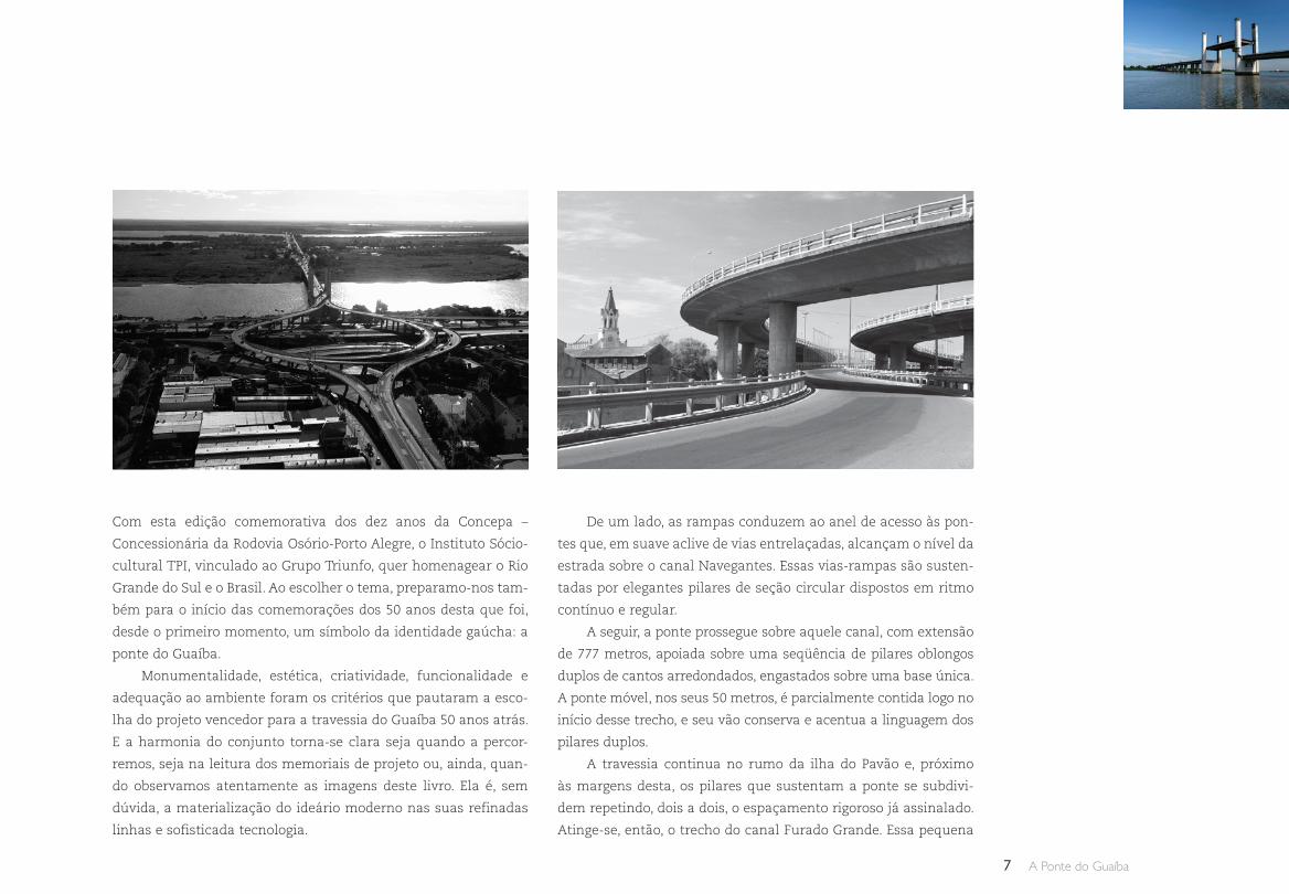
De um lado, as rampas conduzem ao anel de acesso às pon-
tes que, em suave aclive de vias entrelaçadas, alcançam o nível da
estrada sobre o canal Navegantes. Essas vias-rampas são susten-
tadas por elegantes pilares de seção circular dispostos em ritmo
contínuo e regular.
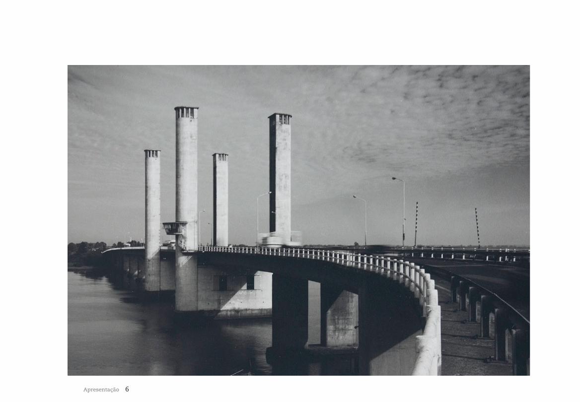
A seguir, a ponte prossegue sobre aquele canal, com extensão
de 777 metros, apoiada sobre uma seqüência de pilares oblongos
duplos de cantos arredondados, engastados sobre uma base única.
A ponte móvel, nos seus 50 metros, é parcialmente contida logo no
início desse trecho, e seu vão conserva e acentua a linguagem dos
pilares duplos.
A travessia continua no rumo da ilha do Pavão e, próximo
às margens desta, os pilares que sustentam a ponte se subdivi-
dem repetindo, dois a dois, o espaçamento rigoroso já assinalado.
Atinge-se, então, o trecho do canal Furado Grande. Essa pequena
8Apresentação
travessia, assim como as que se seguem, foi duplicada com uma
ponte que não levou em consideração a elegância de sua prece-
dente. A observação atenta deixa claro o contraste com o projeto
original cuja seqüência prossegue repetindo a mesma forma do
trecho anterior: ponte sustentada por pilares oblongos de cantos
arredondados, aqui colocados em seqüência, um a um.
E alcançamos a ilha Grande dos Marinheiros que, uma vez
transposta, conduz ao canal Três Rios. Esse segmento, bem mais
longo do que o anterior, foi vencido com a via sustentada pelas
colunas de seção circular que retornam em duplas, ecoando,
assim, a passagem pelo canal Navegantes. Aqui o ritmo contínuo
da seqüência de pilares só é interrompido na proximidade das
margens. A altura da ponte é contínua e, como se trata de trecho
não navegável, muito baixa. Sua marcante horizontalidade dese-
nha um risco na paisagem do grande espelho d’água.
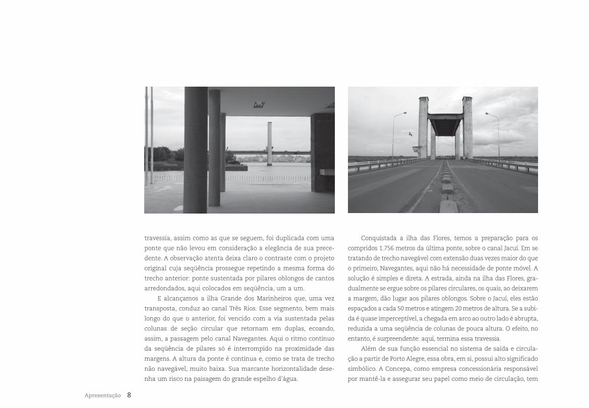
Conquistada a ilha das Flores, temos a preparação para os
compridos 1.756 metros da última ponte, sobre o canal Jacuí. Em se
tratando de trecho navegável com extensão duas vezes maior do que
o primeiro, Navegantes, aqui não há necessidade de ponte móvel. A
solução é simples e direta. A estrada, ainda na ilha das Flores, gra-
dualmente se ergue sobre os pilares circulares, os quais, ao deixarem
a margem, dão lugar aos pilares oblongos. Sobre o Jacuí, eles estão
espaçados a cada 50 metros e atingem 20 metros de altura. Se a subi-
da é quase imperceptível, a chegada em arco ao outro lado é abrupta,
reduzida a uma seqüência de colunas de pouca altura. O efeito, no
entanto, é surpreendente: aqui, termina essa travessia.
Além de sua função essencial no sistema de saída e circula-
ção a partir de Porto Alegre, essa obra, em si, possui alto significado
simbólico. A Concepa, como empresa concessionária responsável
por mantê-la e assegurar seu papel como meio de circulação, tem
9 A Ponte do Guaíba
consciência, também, de sua responsabilidade na manutenção
e conservação de um monumento de inestimável valor cultural.
Nessa dupla dimensão está o seu compromisso, um compromis-
so do qual não se afasta. E é também com essa perspectiva que
lembramos a apropriada reflexão do professor Rualdo Menegat, ao
observar as belas tomadas aéreas de Eduardo Aigner:
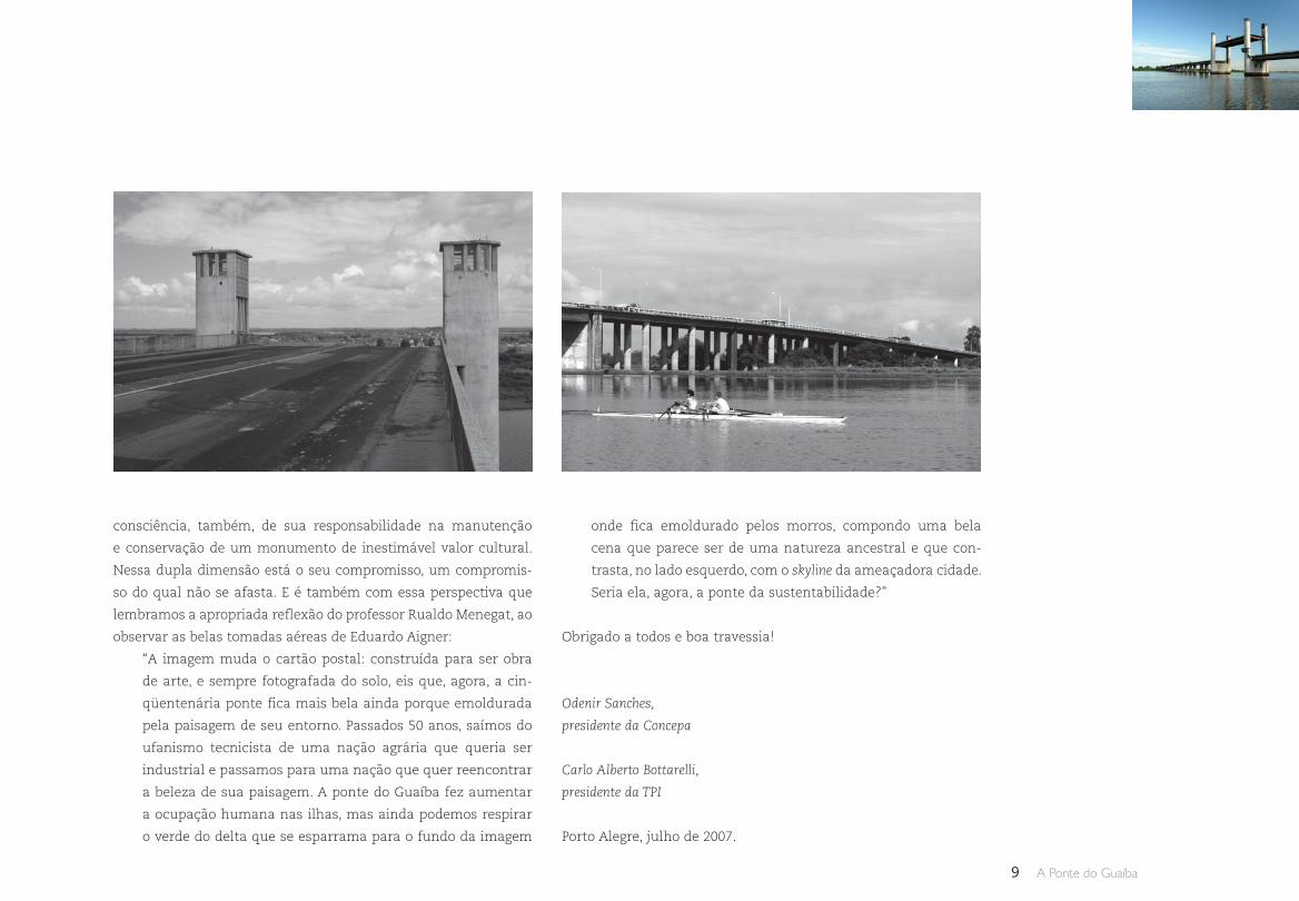
“A imagem muda o cartão postal: construída para ser obra
de arte, e sempre fotografada do solo, eis que, agora, a cin-
qüentenária ponte fica mais bela ainda porque emoldurada
pela paisagem de seu entorno. Passados 50 anos, saímos do
ufanismo tecnicista de uma nação agrária que queria ser
industrial e passamos para uma nação que quer reencontrar
a beleza de sua paisagem. A ponte do Guaíba fez aumentar
a ocupação humana nas ilhas, mas ainda podemos respirar
o verde do delta que se esparrama para o fundo da imagem
onde fica emoldurado pelos morros, compondo uma bela
cena que parece ser de uma natureza ancestral e que con-
trasta, no lado esquerdo, com o skyline da ameaçadora cidade.
Seria ela, agora, a ponte da sustentabilidade?”
Obrigado a todos e boa travessia!
Odenir Sanches,
presidente da Concepa
Carlo Alberto Bottarelli,
presidente da TPI
Porto Alegre, julho de 2007.
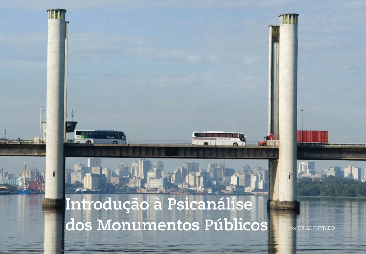
10Pontes Móveis
Introdução à Psicanálise dos Monumentos Públicos por JORGE FURTADO
11 A Ponte do Guaíba
Os moradores do Rio de Janeiro que, no dia 8 de julho de 1896,
pagaram mil réis para entrar numa sala da Rua do Ouvidor e ver
pela primeira vez as ruas de Paris, com seus personagens e carros
em movimento, mudaram sua maneira de pensar o mundo. No
início do século XX, a “magnífica impressão de vida real” provoca-
da pelo cinema passou a ser a nova plataforma de lançamento de
nossa imaginação.
O cenário vivo talvez seja o personagem principal do cinema.
Foi a capacidade técnica de saltar de Paris para Nova York e daí
para o interior das selvas africanas, em segundos, o maior atrativo
para quem pretendia fazer do cinema uma arte dramática, e não
uma simples atração de circo. Quem já tentou mudar uma cena
do Egito para Roma sobre um palco, como fez Shakespeare em
“Antônio e Cleópatra”, sabe o tamanho da encrenca. Entrou para o
folclore local a história da equipe de uma agência de publicidade
– cerca de 15 pessoas – que, no início dos anos 80, foi a Barcelona
filmar uma campanha de televisão e voltou de lá com algumas
horas de material, tudo em close. Foram demitidos, com justa
causa. “Ao filmar em Paris, enquadre a Torre Eiffel.” O sábio con-
selho é de Alfred Hitchcock.
Cada cidade tem um espírito próprio, uma alma feita de
arquitetura, sons, história, sotaques, genética, culinária e lumi-
nosidade. O calor labiríntico de Nova York é totalmente diferente
do calor boca de forno de Cuiabá, embora a temperatura seja a
mesma, e as pimentas do México e de Salvador causam diferen-
tes sensações e problemas, mas temperatura e sabor são infil-
máveis. Resta aos cineastas os atributos das imagens e dos sons.
Tipos humanos são móveis, sons e luzes podem ser simulados e
mesmo a arquitetura urbana tende a se repetir. É possível filmar
em Havana uma história que se passa em Salvador, Tóquio dá
para enganar filmando em São Paulo, Lisboa e o Rio têm algumas
esquinas quase idênticas, mas a Torre Eiffel ao fundo não deixa
dúvidas: estamos em Paris.
Para que alguns monumentos ou grandes construções públi-
cas tornem-se imagens referenciais de uma cidade, eles precisam
preencher dois requisitos básicos. O primeiro é serem únicos:
12Introdução à Psicanálise dos Monumentos Públicos
pouca coisa consegue ser mais ridícula que a Estátua da Liberdade
que enfeita um shopping na Barra da Tijuca. O segundo é, de algu-
ma maneira, corresponderem ao espírito da cidade. Haverá quem
diga, não sem razão, que o símbolo de Nova York deveria ser um
táxi amarelo dirigido por um paquistanês irado, mas também é
fato que a Estátua da Liberdade responde à vocação democrática
e à pretensão cosmopolita da cidade, assim como a rigidez e a lim-
peza da Alexanderplatz são a cara de Berlim, a Igreja da Sagrada
Família é uma maluquice brilhante só possível em Barcelona, o
Big Ben nos lembra a austera sofisticação londrina e nada mais
carioca que um Cristo sem sua cruz, pronto a abraçar quem chega
e a convidar para tomar um chopp com batatinhas.
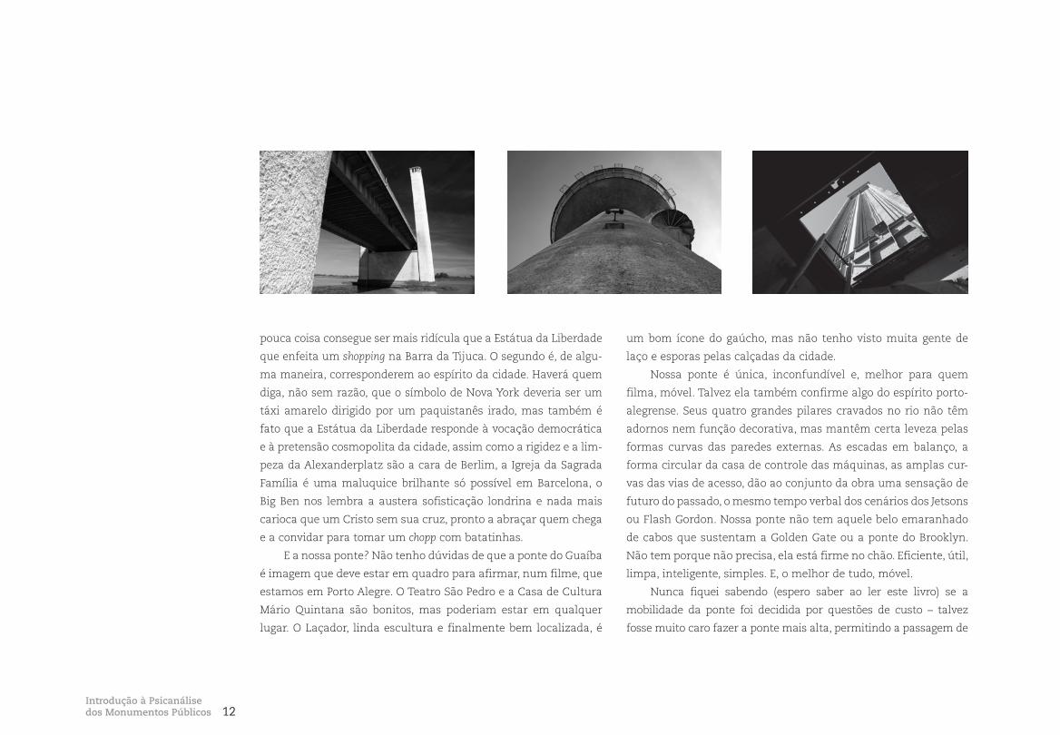
E a nossa ponte? Não tenho dúvidas de que a ponte do Guaíba
é imagem que deve estar em quadro para afirmar, num filme, que
estamos em Porto Alegre. O Teatro São Pedro e a Casa de Cultura
Mário Quintana são bonitos, mas poderiam estar em qualquer
lugar. O Laçador, linda escultura e finalmente bem localizada, é
um bom ícone do gaúcho, mas não tenho visto muita gente de
laço e esporas pelas calçadas da cidade.
Nossa ponte é única, inconfundível e, melhor para quem
filma, móvel. Talvez ela também confirme algo do espírito porto-
alegrense. Seus quatro grandes pilares cravados no rio não têm
adornos nem função decorativa, mas mantêm certa leveza pelas
formas curvas das paredes externas. As escadas em balanço, a
forma circular da casa de controle das máquinas, as amplas cur-
vas das vias de acesso, dão ao conjunto da obra uma sensação de
futuro do passado, o mesmo tempo verbal dos cenários dos Jetsons
ou Flash Gordon. Nossa ponte não tem aquele belo emaranhado
de cabos que sustentam a Golden Gate ou a ponte do Brooklyn.
Não tem porque não precisa, ela está firme no chão. Eficiente, útil,
limpa, inteligente, simples. E, o melhor de tudo, móvel.
Nunca fiquei sabendo (espero saber ao ler este livro) se a
mobilidade da ponte foi decidida por questões de custo – talvez
fosse muito caro fazer a ponte mais alta, permitindo a passagem de
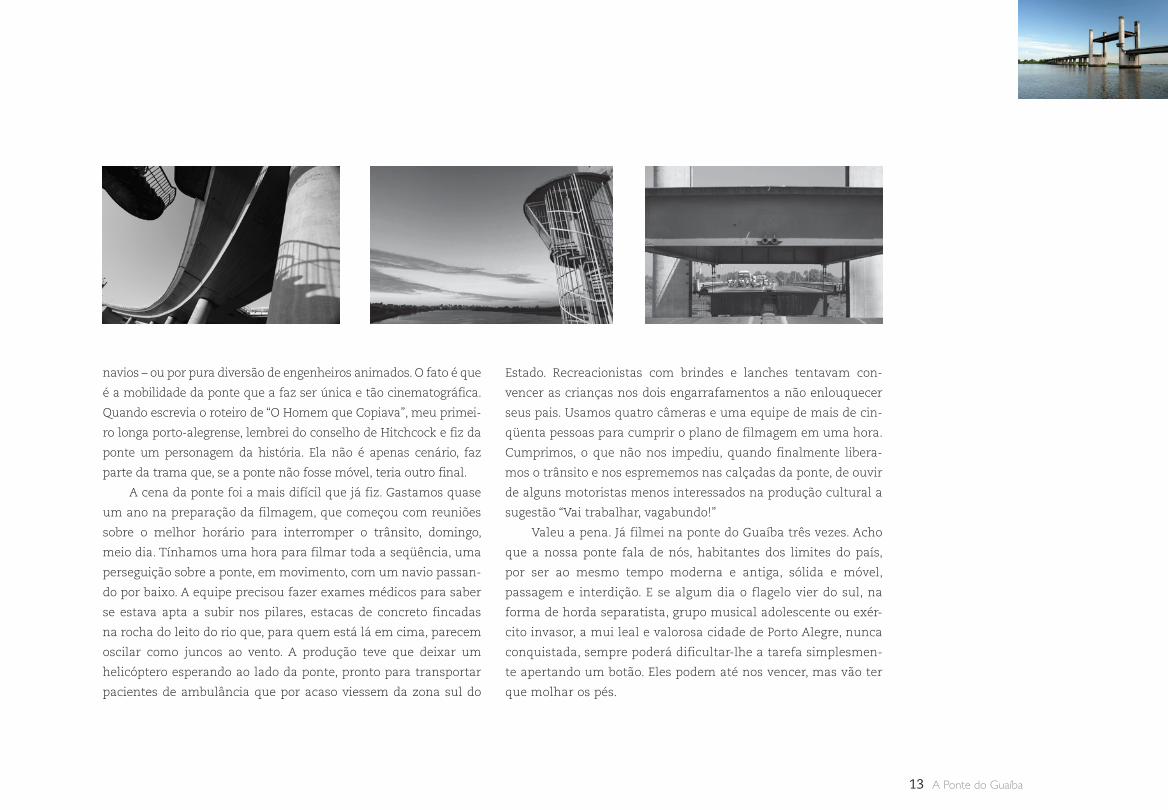
13 A Ponte do Guaíba
navios – ou por pura diversão de engenheiros animados. O fato é que
é a mobilidade da ponte que a faz ser única e tão cinematográfica.
Quando escrevia o roteiro de “O Homem que Copiava”, meu primei-
ro longa porto-alegrense, lembrei do conselho de Hitchcock e fiz da
ponte um personagem da história. Ela não é apenas cenário, faz
parte da trama que, se a ponte não fosse móvel, teria outro final.
A cena da ponte foi a mais difícil que já fiz. Gastamos quase
um ano na preparação da filmagem, que começou com reuniões
sobre o melhor horário para interromper o trânsito, domingo,
meio dia. Tínhamos uma hora para filmar toda a seqüência, uma
perseguição sobre a ponte, em movimento, com um navio passan-
do por baixo. A equipe precisou fazer exames médicos para saber
se estava apta a subir nos pilares, estacas de concreto fincadas
na rocha do leito do rio que, para quem está lá em cima, parecem
oscilar como juncos ao vento. A produção teve que deixar um
helicóptero esperando ao lado da ponte, pronto para transportar
pacientes de ambulância que por acaso viessem da zona sul do
Estado. Recreacionistas com brindes e lanches tentavam con-
vencer as crianças nos dois engarrafamentos a não enlouquecer
seus pais. Usamos quatro câmeras e uma equipe de mais de cin-
qüenta pessoas para cumprir o plano de filmagem em uma hora.
Cumprimos, o que não nos impediu, quando finalmente libera-
mos o trânsito e nos esprememos nas calçadas da ponte, de ouvir
de alguns motoristas menos interessados na produção cultural a
sugestão “Vai trabalhar, vagabundo!”
Valeu a pena. Já filmei na ponte do Guaíba três vezes. Acho
que a nossa ponte fala de nós, habitantes dos limites do país,
por ser ao mesmo tempo moderna e antiga, sólida e móvel,
passagem e interdição. E se algum dia o flagelo vier do sul, na
forma de horda separatista, grupo musical adolescente ou exér-
cito invasor, a mui leal e valorosa cidade de Porto Alegre, nunca
conquistada, sempre poderá dificultar-lhe a tarefa simplesmen-
te apertando um botão. Eles podem até nos vencer, mas vão ter
que molhar os pés.
14Pontes Móveis
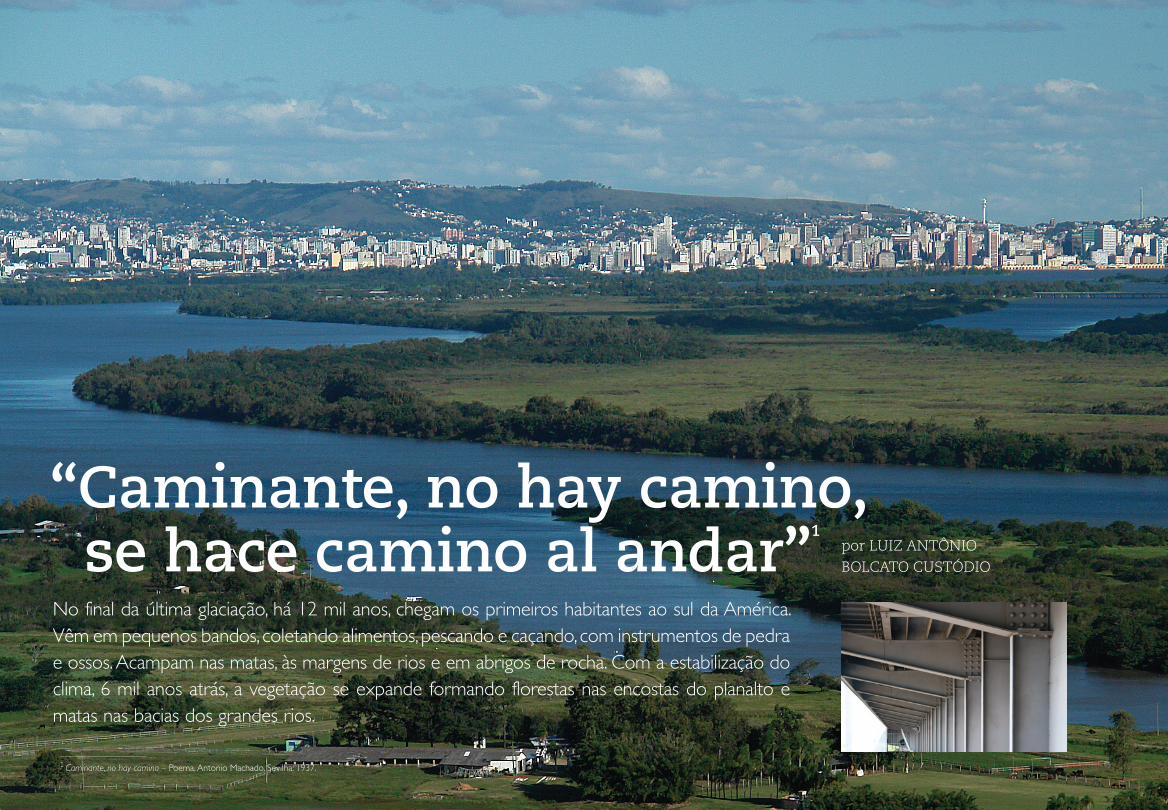
“Caminante, no hay camino, se hace camino al andar”
1
por LUIZ ANTÔNIO BOLCATO CUSTÓDIO
No final da última glaciação, há 12 mil anos, chegam os primeiros habitantes ao sul da América. Vêm em pequenos bandos, coletando alimentos, pescando e caçando, com instrumentos de pedra e ossos. Acampam nas matas, às margens de rios e em abrigos de rocha. Com a estabilização do clima, 6 mil anos atrás, a vegetação se expande formando florestas nas encostas do planalto e matas nas bacias dos grandes rios.
1 Caminante, no hay camino – Poema. Antonio Machado. Sevilha: 1937.
15 A Ponte do Guaíba
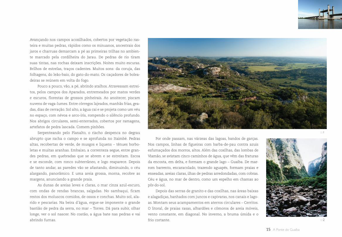
Avançando nos campos acoxilhados, cobertos por vegetação ras-
teira e muitas pedras, rápidos como os minuanos, ancestrais dos
jaros e charruas demarcam a pé as primeiras trilhas no ambien-
te marcado pela cordilheira do Jarau. De pedras de rio tiram
suas tintas, nas rochas deixam inscrições. Noites muito escuras.
Brilhos de estrelas, traços cadentes. Muitos sons: da coruja, das
folhagens, do leão-baio, do gato-do-mato. Os caçadores de bolea-
deiras se reúnem em volta do fogo.
Pouco a pouco, vão, a pé, abrindo atalhos. Atravessam estrei-
tos, pelos campos dos Aparados, entremeados por matos verdes
e escuros, florestas de grossos pinheirais. Ao anoitecer, piscam
nuvens de vaga-lumes. Entre córregos lajeados, manhãs frias, gea-
das, dias de cerração. Sol alto, a água cai e se projeta como um véu
no espaço, com névoa e arco-íris, rompendo o silêncio profundo.
Nos abrigos circulares, semi-enterrados, cobertos por ramagens,
artefatos de pedra lascada. Comem pinhões.
Serpenteando pelo Planalto, o riacho despenca no degrau
abrupto que racha o campo e se aprofunda no Itaimbé. Pedras
altas, recobertas de verde, de musgos e liquens – tênues borbo-
letas e muitas aranhas. Embaixo, a correnteza segue, entre gran-
des pedras, em quebradas que se abrem e se estreitam. Escoa
e se esconde, com ronco subterrâneo, e logo reaparece. Depois
de tanto andar, as paredes vão se afastando, diminuindo, o céu
alargando, panorâmico. E uma areia grossa, morna, recobre as
margens, anunciando a grande praia.
As dunas de areias leves e claras, o mar cinza azul-escuro,
com ondas de rendas brancas, salgadas. No sambaqui, ficam
restos dos moluscos comidos, de ossos e conchas. Muito sol, ala-
rido e pescarias. Na beira d’água, ergue-se imponente o grande
bastião de pedra da serra, no mar – Torres. Dá para subir, olhar
longe, ver o sol nascer. No costão, a água bate nas pedras e vai
abrindo furnas.
Por onde passam, nas várzeas das lagoas, bandos de garças.
Nos campos, linhas de figueiras com barba-de-pau contra azuis
esfumaçados dos morros, altos. Além das coxilhas, das lombas de
Viamão, se avistam cinco caminhos de água, que vêm das fraturas
da encosta, em delta, e formam o grande lago – Guaíba. De mar-
rom barrento, encaracolado, trazendo aguapés, formam praias e
enseadas, areias claras, ilhas de pedras arredondadas, com cobras.
Céu e água, no mar de dentro, como um espelho em chamas ao
pôr-do-sol.
Depois das serras de granito e das coxilhas, nas áreas baixas
e alagadiças, banhados com juncos e capivaras, nos canais e lago-
as. Montam seus acampamentos em aterros circulares – Cerritos.
O litoral, de praias rasas, albardões e cômoros de areia móveis,
vento constante, em diagonal. No inverno, a bruma úmida e o
frio cortante.
: : 1
: : 2
16
2 Érico Veríssimo, O continente, 1949.
Então, adentram, amazônicos, os guaranis. Com casas de
palha, famílias extensas, redes de dormir. Respeitam tuvichás e
pajés. Agricultores de coivara plantam em clareiras nas florestas.
Queimam cerâmicas, fumam cachimbos e tomam mate, curtem
sonhos em lua cheia. Circulam na paisagem, livres, vão pelo
Cruzeiro, na eterna busca da “terra sem males”, rumo ao sul.
Vestindo negras sotainas e sandálias, trazem o breviário na
mão, determinados. Os missionários vão a pé, percorrendo as cristas
dos morros, atravessando matas e rios. Roque Gonzáles, de Santa
Cruz, da Companhia de Jesus, em 1626, atravessa o rio Uruguai e
entra no Tape – território espanhol, no porto seguro de Santo Isidro,
lavrador, padroeiro dos agricultores. Na colina, se elevam a cruz, a
capela, o assentamento provisório. São Nicolau, primeira querência,
redução da Banda Oriental, do rio Uruguai. A terra, vermelho mis-
sioneiro – barro e pó –, contrasta com o verde intenso.
No Caaró, reação dos pajés – e caem os três primeiros san-
tos mártires. Entram tropas de gado franqueiro e de cavalos, do
Paraguai. Criam estâncias em terras sem limites, mangueiras de
pedra. Formam-se as vacarias: “dos Pinhais”, nos Campos de Cima
da Serra, e “del Mar”, no litoral. Dos ervais nativos extraem erva-
mate – caá – e usam a cuia – caîguá – para sorver. Do ritual profano,
nativo, ao produto industrial missioneiro, exportando a tradição.
A redução se implanta como um castrum romano. Duas vias
principais cruzam o centro da praça, formam o grande “foro”. De
um lado, a igreja e seu campanário. Dos outros, as casas dos índios,
alpendradas. O cabildo – do conselho; o tambo – hospedagem; e o
cotiguaçu – onde recolhem viúvas e mulheres com maridos ausen-
tes. Fontes e, por todo lado, símbolos e cruzes missioneiras.
Na igreja, centro do barroco, requintados rituais. Missas fes-
tivas, orquestras, corais e muito incenso entre dourados retábulos
repletos de santos, anjos, querubins e serafins. A grande praça, o
palco das funções religiosas, cívicas e esportivas. Teatro sacro, pro-
cissões, jogos, entradas de visitantes, desfiles com roupagens espe-
ciais, decorações efêmeras, pássaros vivos e as punições. Muitos
mitos – do tesouro, dos túneis – e lendas, como a da cobra grande...
Pelo caminho, vão reunindo, convertendo, reduzindo índios,
na “conquista espiritual”. Unindo veredas, portos de rios, ponti-
lhões, formando a rede: a cultura européia, recém-chegada, e a
nativa, que sempre esteve.
Pelo Atlântico, os portugueses avançam para o sul e criam a
Colônia do Santíssimo Sacramento, cidadela portuguesa no Rio
da Prata, em terras espanholas – 1680. Inacessível por terra, foi
apoiada por Laguna, o último assentamento luso. Depois, só havia
o extenso, reto e raso litoral, a praia com cômoros que encobriam
a barra de Rio Grande – única entrada para o “Continente”2.
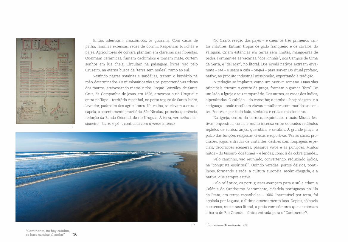
“Caminante, no hay camino,se hace camino al andar”
: : 3
: : 4
17 A Ponte do Guaíba
: : 6
Era preciso abrir estrada, explorar, ligar Colônia com o Brasil.
Nos campos povoados por gado e índios, as incursões bandeiran-
tes – paulistas – buscavam braços missioneiros. Não se fixavam
no território.
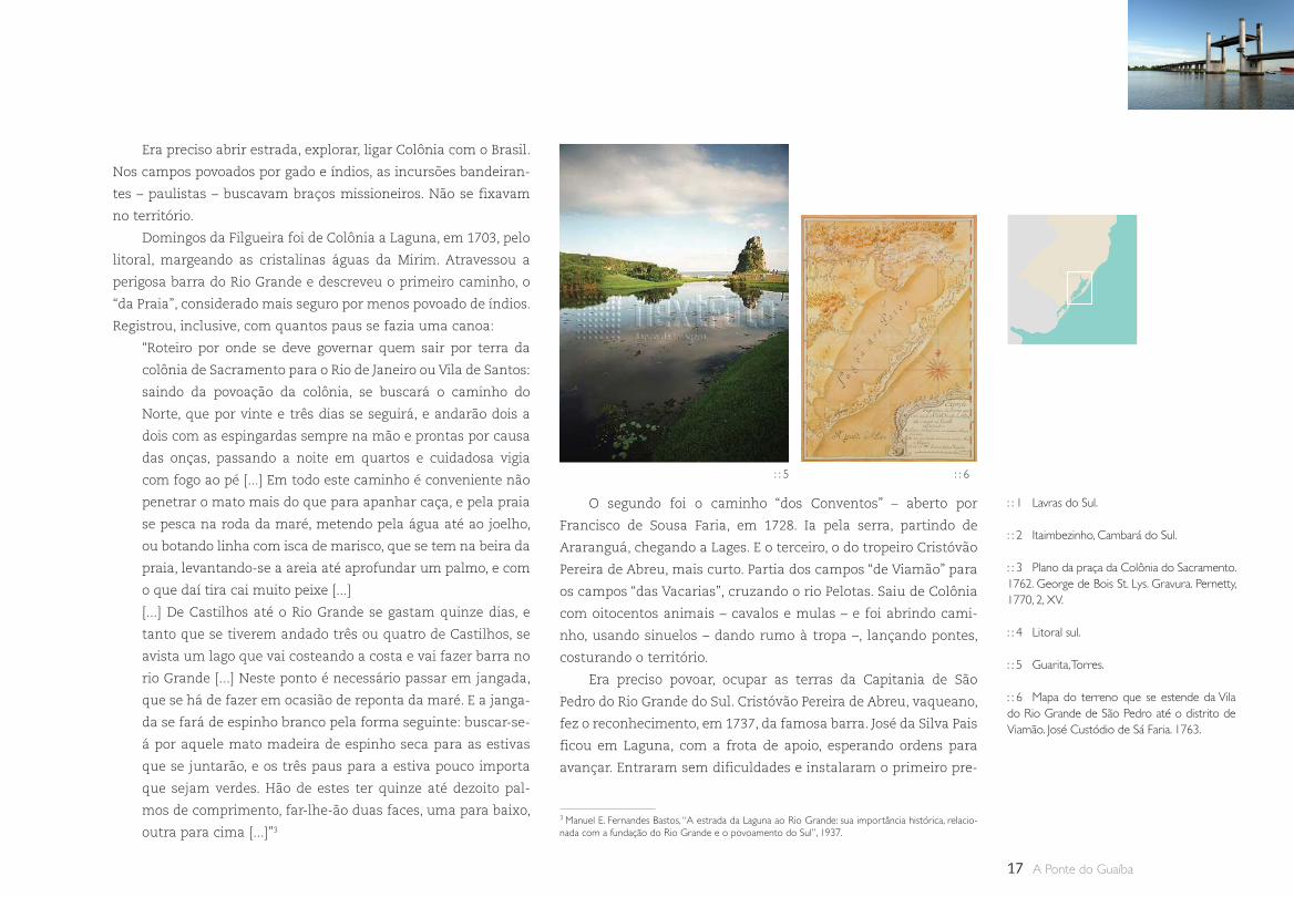
Domingos da Filgueira foi de Colônia a Laguna, em 1703, pelo
litoral, margeando as cristalinas águas da Mirim. Atravessou a
perigosa barra do Rio Grande e descreveu o primeiro caminho, o
“da Praia”, considerado mais seguro por menos povoado de índios.
Registrou, inclusive, com quantos paus se fazia uma canoa:
“Roteiro por onde se deve governar quem sair por terra da
colônia de Sacramento para o Rio de Janeiro ou Vila de Santos:
saindo da povoação da colônia, se buscará o caminho do
Norte, que por vinte e três dias se seguirá, e andarão dois a
dois com as espingardas sempre na mão e prontas por causa
das onças, passando a noite em quartos e cuidadosa vigia
com fogo ao pé [...] Em todo este caminho é conveniente não
penetrar o mato mais do que para apanhar caça, e pela praia
se pesca na roda da maré, metendo pela água até ao joelho,
ou botando linha com isca de marisco, que se tem na beira da
praia, levantando-se a areia até aprofundar um palmo, e com
o que daí tira cai muito peixe [...]
[...] De Castilhos até o Rio Grande se gastam quinze dias, e
tanto que se tiverem andado três ou quatro de Castilhos, se
avista um lago que vai costeando a costa e vai fazer barra no
rio Grande [...] Neste ponto é necessário passar em jangada,
que se há de fazer em ocasião de reponta da maré. E a janga-
da se fará de espinho branco pela forma seguinte: buscar-se-
á por aquele mato madeira de espinho seca para as estivas
que se juntarão, e os três paus para a estiva pouco importa
que sejam verdes. Hão de estes ter quinze até dezoito pal-
mos de comprimento, far-lhe-ão duas faces, uma para baixo,
outra para cima [...]”3
O segundo foi o caminho “dos Conventos” – aberto por
Francisco de Sousa Faria, em 1728. Ia pela serra, partindo de
Araranguá, chegando a Lages. E o terceiro, o do tropeiro Cristóvão
Pereira de Abreu, mais curto. Partia dos campos “de Viamão” para
os campos “das Vacarias”, cruzando o rio Pelotas. Saiu de Colônia
com oitocentos animais – cavalos e mulas – e foi abrindo cami-
nho, usando sinuelos – dando rumo à tropa –, lançando pontes,
costurando o território.
Era preciso povoar, ocupar as terras da Capitania de São
Pedro do Rio Grande do Sul. Cristóvão Pereira de Abreu, vaqueano,
fez o reconhecimento, em 1737, da famosa barra. José da Silva Pais
ficou em Laguna, com a frota de apoio, esperando ordens para
avançar. Entraram sem dificuldades e instalaram o primeiro pre-
3 Manuel E. Fernandes Bastos, “A estrada da Laguna ao Rio Grande: sua importância histórica, relacio-nada com a fundação do Rio Grande e o povoamento do Sul”, 1937.
: : 1 Lavras do Sul.
: : 2 Itaimbezinho, Cambará do Sul.
: : 3 Plano da praça da Colônia do Sacramento. 1762. George de Bois St. Lys. Gravura. Pernetty, 1770, 2, XV.
: : 4 Litoral sul.
: : 5 Guarita, Torres.
: : 6 Mapa do terreno que se estende da Vila do Rio Grande de São Pedro até o distrito de Viamão. José Custódio de Sá Faria. 1763.
: : 5
18
sídio, o Forte Jesus, Maria e José e o Regimento de Dragões. Depois,
construíram outros fortins e baterias para defesa nos dois lados
do canal. Logo foi criada, no Norte, a estância Real de Bojuru.
Eles vinham pelo gado alçado, deixado pelos espanhóis, em
campos e invernadas. Percorriam trilhas indígenas, formando
caminhos pioneiros em busca de couro e sebo para indústria, de
cavalos e mulas para transporte.
Aos poucos os seus antigos pousos e os registros – postos
de cobrança de impostos – foram se transformando em vilas e
cidades. Os Caminhos das Tropas integravam o Sul ao mercado
brasileiro. Mulas carregadas com bruacas, feijão-tropeiro, farinha
– ruas das Tropas. Os rios eram atravessados nos vaus ou passos,
às vezes em pelotas, embarcações de couro para carregar manti-
mentos ou um indivíduo, puxadas pelo guia, que ia a nado.
O Rio Grande era um grande vazio e as ilhas dos Açores,
superpovoadas. O governo português recomendou a vinda de
ilhéus para ocupar as Missões, que foram trocadas por Colônia, no
Tratado de Madri, de 1750. Os casais chegaram dois anos depois
e se instalaram perto da sede da Capitania, porque as Missões
continuavam sob domínio espanhol. Com a distribuição de terras,
em sesmarias e léguas em quadros, começaram a plantar trigo,
a produzir vinho e a abastecer a região. Com gado abundante,
alguns se tornaram fazendeiros.
Quando Rio Grande foi invadida, em 1763, a população foge
em busca de proteção, entra pela costa doce da Lagoa, se refugia
em Viamão. Ali se instala a capital da Província, depois transferida
para o porto, na Freguesia de São Francisco do Porto dos Casais.
Sobem o Jacuí e instalam suas primeiras vilas. Garantem o acesso
a Rio Pardo, a “tranqueira invicta”, ponto avançado do domínio
português na época.
Igrejas caiadas com torres sineiras, casas de porta e janelas,
com guilhotinas, telhados com beirais, curtos. Nas ruas, festas
religiosas, semana santa, Corpus Christi, império, procissões lumi-
nosas, tapetes floridos e cheiro de alecrim queimado, sinos repi-
cando. Os ternos de reis, cantigas de roda e doces, muito doces, de
ovos. Nos navegantes, das embarcações se ouvia o cantar ao doce
coração de Maria.
Limites e fronteirasDepois do Tratado de Madri, as comissões demarcadoras das
cortes de Espanha e Portugal começam a implantar marcos de
pedra, a partir do Chuí, em requintados rituais barrocos. De longe,
são observados pelos missioneiros, que reagem em escaramuças.
“Esta terra tem dono”, bradou Sepé, e eclode o enfrentamento. A
Guerra Guaranítica, um verdadeiro genocídio por poderes desi-
guais: dois exércitos aparelhados versus lanceiros nativos. Os
vencedores ocupam as reduções e, com o estranhamento, logo se
expulsam os jesuítas de Portugal e Espanha. E o papa extingue a
ordem religiosa. É o fim do sonho, da “utopia” americana.
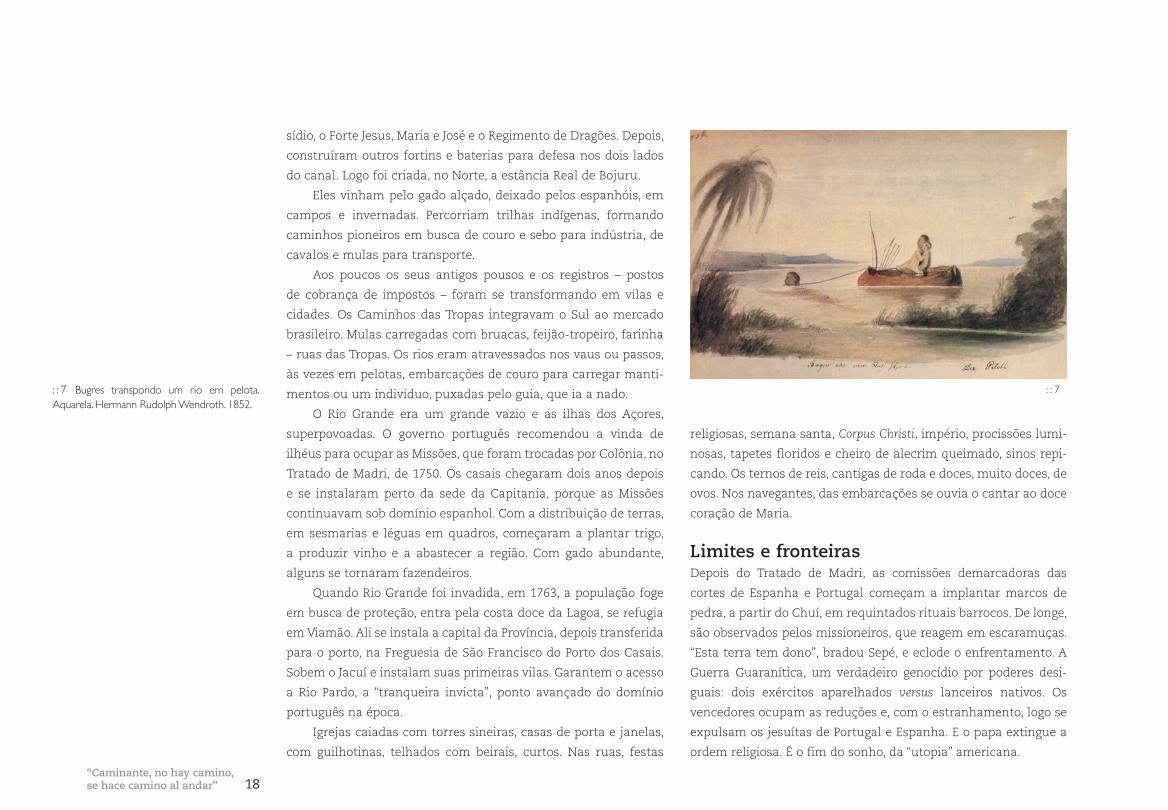
: : 7 Bugres transpondo um rio em pelota. Aquarela. Hermann Rudolph Wendroth. 1852.
: : 7
“Caminante, no hay camino,se hace camino al andar”
19 A Ponte do Guaíba
Em 1761, os limites estabelecidos foram revogados e a situ-
ação volta atrás. Os portugueses reforçam o controle militar na
área e distribuem mais terras e cargos. Novos latifúndios.
Os conflitos se sucedem por questões internas ou externas,
por fronteiras, por interesses econômicos e envolvem, geralmente,
soldados arregimentados na região. No jogo político, o governador
de Buenos Aires toma Colônia do Sacramento e, em 1763, os fortes
de Santa Teresa e São Miguel, no Chuí. Ocupa a vila de Rio Grande
até 1776. Em 1777, invade Colônia e a ilha de Santa Catarina, e,
neste mesmo ano, um novo tratado, o de Santo Ildefonso, redefine
os limites. Os portugueses ficam com a ilha e os espanhóis, com
Missões e Sacramento. A fronteira fica assim até 1801, quando
um grupo de estancieiros e soldados brasileiros reconquista os
Sete Povos. Em 1820, Portugal incorpora o território da Província
Cisplatina, retomado pelos Trinta e Três Orientais, em 1825, e cria
a República Oriental do Uruguai. Em 1828, Frutuoso Rivera ocupa
as Missões brasileiras e leva como troféu de guerra 60 carretas
de bens. O mapa do Rio Grande do Sul só se configura a partir
do tratado de 1851, revisto pelo barão de Rio Branco, em 1909.
Os acampamentos militares criados para defesa geraram novas
povoações – cidades marcos. Fronteiras móveis, terras conquista-
das “nas patas dos cavalos”.
Mistura de português, espanhol e índio, se forma o gaúcho,
homem de estância, produto de fronteira. “Pêlo duro”, usa botas
e bombachas folgadas. Galopa livre pelas coxilhas na imensidão
do pampa, espantando perdizes, assustando lebres, provocando o
revoar de quero-queros. Acompanhado pelo cão, o cusco, trata o
gado nos rodeios.
Nas estradas empedradas, transitam os carreteiros. Nas
paradas, assam a fina carne do matambre em fogo de chão
sobre a trempe ou fazem arroz com charque. Trazem salmoura
na guampa e esquentam água do chimarrão na cambona, preta
do fogo. Nas taperas, sobre escombros de antigas construções,
crescem figueiras e cactos, entre as pedras. Abrigo para aranhas.
E quando venta norte, aparecem nos campos cobras cruzeiras.
Nas estâncias, porteiras, mangueiras de pedra, taquareiras de
pára-vento e, sempre, umbus. Nos moirões das cercas pousam coru-
jas e secam couros estaqueados de reses, atraindo moscas. A água
é tirada da cacimba. O patrão mora “nas casas”, a peonada no gal-
pão. O alvorecer é sempre com assado. E depois, a camperear, para
tratar do gado. De noite, um jogo de cartas, o truco, e contar causos
de assombrações, a falar das chinas e das façanhas de gaudérios.
Nos bailes ao som de gaiteiros, arrastam pés, dançam com prendas
vestidas de chita, de rosto pintado com ruge e perfumes fortes.
A carne se conservava salgada, como charque. Era o alimento
básico dos escravos em todo o Brasil. A oportunidade de vender
charque para o Nordeste – o principal consumidor – favoreceu a
indústria. As charqueadas da zona sul localizavam-se nos arre-
dores das cidades, principalmente na região de Pelotas, perto de
arroios para facilitar a ligação com o porto.
O charque trouxe riqueza para a região, antes simples, rude e
campeira. A sofisticação das novas famílias ricas, ostentando cos-
tumes importados, se verificou nas cidades. Entrou com estilo o
neoclássico, a pompa no pampa, da nova elite de charqueadores.
: : 8 Carreteiro. : : 9 Churrasco. Desenho. Série “O gaúcho”. José Lutzemberger.
: : 10 Vencendo obstáculos. Desenho. Série “Cai-xeiro viajante”. José Lutzemberger.
: : 8 : : 9 : : 10
20
Brocados, veludos, rendas, louças e pratarias e muito luxo, de
um lado. Rios de sangue, moscas, fedentina e escravidão, do outro.
Na cidade, desfiles nos teatros, óperas e musica clássica. Saraus
nos palacetes. A culinária – de sal e açúcar – com sabores antes não
apreciados. Nas senzalas, os negros – motores das charqueadas.
Enormes grupos – maiores que os de homens livres – submetidos à
força a trabalhos exaustivos. Rebeliões e fugas. Quilombos.
Na fronteira oeste, os saladeiros – do espanhol – no final
do século XIX. Utilizavam assalariados e envolviam tropeiros
para puxar o gado da fronteira. Como não havia estradas para
Rio Grande, os produtos eram transportados por ferrovias até
Montevidéu, de onde iam para o mercado brasileiro. Um momen-
to de riqueza na estagnada economia da região da Campanha. A
sobretaxa para o transporte de charque, por via externa, quebrou
o sistema. Restaram imponentes ruínas.
A partir de 1824, chegam os alemães. Pequenos proprietários,
artesãos livres, num contexto de senhores e escravos, formam uma
nova classe social. Trazidos de regiões pobres, vinham com promes-
sas de terras, insumos e subsídios. Desembarcavam na capital de
onde iam para a Real Feitoria do Linho-Cânhamo, em São Leopoldo,
onde esperavam até receber terras. Ocuparam as matas das encos-
tas da serra e os vales dos rios Sinos, Caí, Jacuí e Taquari.
As novas cidades se organizaram com traçados alinhados por
engenheiros militares. Casas com frontões recortados, varandas e
jardins floridos. Igrejas protestantes, geralmente com torre cen-
tral, marcaram a paisagem na região. No campo, surgem linhas
e picadas e pontes em madeira ou pedra grês. E por todo o lado,
casas em enxaimel, com cozinhas separadas, cercas e galpões. Nos
entroncamentos surgem as vendas, que, junto às igrejas, salões e
sociedades, animam a colônia. Nos kerbs, adornos com guirlandas
e muita cerveja. Faces rosadas, risonhas. Os mascates – vendedores
ambulantes – promovem o intercâmbio, as trocas, os empréstimos.
Levam notícias, produtos e novidades, da e para a capital.
O descontentamento com impostos estabelecidos pelo impé-
rio a produtos pecuários – a base da economia gaúcha – provocou
reações e desencadeou a Guerra dos Farrapos a partir de 1835.
Guerra que criou a República Rio-grandense, com território inde-
pendente, constituição, brasão, bandeira e hino. Um conflito que
envolveu grande parte da população sob o comando de lideranças
locais, como Bento Gonçalves da Silva e, inclusive, do “herói de
dois mundos”, Giuseppe Garibaldi.
A reação imperial, com apoio de Porto Alegre e Rio Grande,
provocou o deslocamento sucessivo da capital Farroupilha:
Piratini, Caçapava e depois Alegrete. Os combates se sucederam
e, no de Porongos, foram exterminados os bravos lanceiros negros.
Após dez anos de luta e com o surgimento de conflitos internacio-
nais, o governo imperial buscou uma “paz honrosa”, firmada em
Ponche Verde, em 1845.
: : 11 O motorizado na volta. Desenho. Série “Caixeiro viajante”. José Lutzemberger.
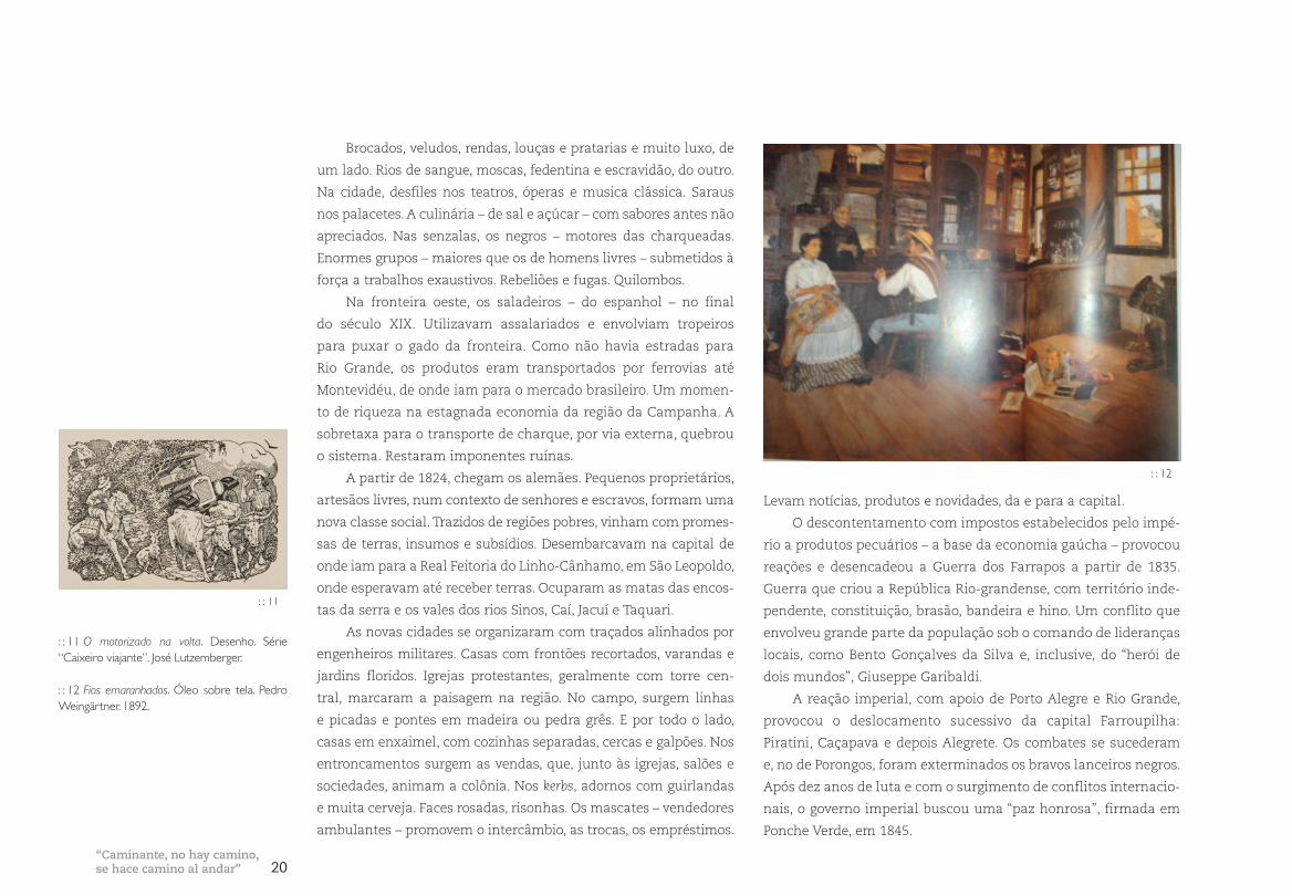
: : 12 Fios emaranhados. Óleo sobre tela. Pedro Weingärtner. 1892.
: : 11
: : 12
“Caminante, no hay camino,se hace camino al andar”
21 A Ponte do Guaíba
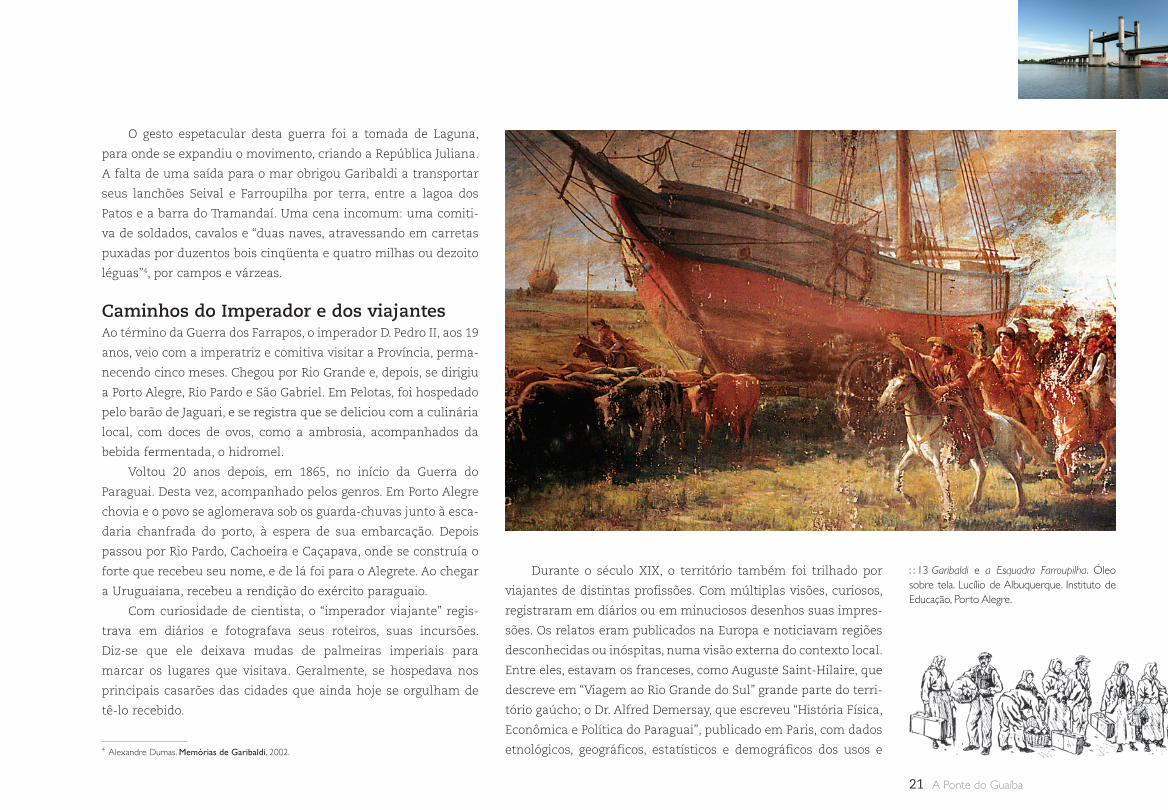
O gesto espetacular desta guerra foi a tomada de Laguna,
para onde se expandiu o movimento, criando a República Juliana.
A falta de uma saída para o mar obrigou Garibaldi a transportar
seus lanchões Seival e Farroupilha por terra, entre a lagoa dos
Patos e a barra do Tramandaí. Uma cena incomum: uma comiti-
va de soldados, cavalos e “duas naves, atravessando em carretas
puxadas por duzentos bois cinqüenta e quatro milhas ou dezoito
léguas”4, por campos e várzeas.
Caminhos do Imperador e dos viajantesAo término da Guerra dos Farrapos, o imperador D. Pedro II, aos 19
anos, veio com a imperatriz e comitiva visitar a Província, perma-
necendo cinco meses. Chegou por Rio Grande e, depois, se dirigiu
a Porto Alegre, Rio Pardo e São Gabriel. Em Pelotas, foi hospedado
pelo barão de Jaguari, e se registra que se deliciou com a culinária
local, com doces de ovos, como a ambrosia, acompanhados da
bebida fermentada, o hidromel.
Voltou 20 anos depois, em 1865, no início da Guerra do
Paraguai. Desta vez, acompanhado pelos genros. Em Porto Alegre
chovia e o povo se aglomerava sob os guarda-chuvas junto à esca-
daria chanfrada do porto, à espera de sua embarcação. Depois
passou por Rio Pardo, Cachoeira e Caçapava, onde se construía o
forte que recebeu seu nome, e de lá foi para o Alegrete. Ao chegar
a Uruguaiana, recebeu a rendição do exército paraguaio.
Com curiosidade de cientista, o “imperador viajante” regis-
trava em diários e fotografava seus roteiros, suas incursões.
Diz-se que ele deixava mudas de palmeiras imperiais para
marcar os lugares que visitava. Geralmente, se hospedava nos
principais casarões das cidades que ainda hoje se orgulham de
tê-lo recebido.
Durante o século XIX, o território também foi trilhado por
viajantes de distintas profissões. Com múltiplas visões, curiosos,
registraram em diários ou em minuciosos desenhos suas impres-
sões. Os relatos eram publicados na Europa e noticiavam regiões
desconhecidas ou inóspitas, numa visão externa do contexto local.
Entre eles, estavam os franceses, como Auguste Saint-Hilaire, que
descreve em “Viagem ao Rio Grande do Sul” grande parte do terri-
tório gaúcho; o Dr. Alfred Demersay, que escreveu “História Física,
Econômica e Política do Paraguai”, publicado em Paris, com dados
etnológicos, geográficos, estatísticos e demográficos dos usos e 4 Alexandre Dumas. Memórias de Garibaldi, 2002.
: : 13 Garibaldi e a Esquadra Farroupilha. Óleo sobre tela. Lucílio de Albuquerque. Instituto de Educação, Porto Alegre.
22
costumes do Paraguai, incluindo as Missões jesuíticas entre 1844 e
1847; e Robert Avé-Lallemant, autor de “Viagem pela Província do
Rio Grande do Sul”, 1858, que define a barra de Rio Grande como
“das mais desagradáveis e perigosas que existem”, referindo-se
à quantidade de naufrágios. Também estava Hermann Rudolf
Wendroth, um Brummer – rezingão, um dos soldados mercenários
alemães contratados em 1851 para a Guerra contra Oribe e Rosas.
Ele desertou e embrenhou-se pelo interior da província.
Depois de 1875, também começam a vir colonos italianos.
Com situação semelhante aos seus antecessores, buscam a opor-
tunidade de far l’Amèrica. Cosa sarà questa Mèrica?5
As terras próximas à capital já estavam ocupadas pelos ale-
mães. A possibilidade era ocupar a serra no nordeste do Estado,
nas áreas dos antigos pinheirais. Logo são traçadas “a cordel e
régua” as primeiras colônias, sendo três no nordeste e uma no
centro do Estado. Após o extermínio dos bugres – como se deno-
minavam os nativos –, se estruturam cidades e colônias abrindo
picadas e travessões, derrubando araucárias. Uma arquitetura de
grandes casarões, construídos em madeira ou pedra basalto, com
telhados cobertos inicialmente de scàndole – em tabuinhas – e
posteriormente substituídos por zinco e, em alguns casos, orna-
mentados por lambrequins.
O traçado das cidades, ortogonais, regulares, militares, sem
relação com a topografia acidentada formada por encostas e
peraus. Depois de abrir terreno, começaram as suas plantações
nas encostas, introduzindo parreirais. Paisagens douradas no
outono, invernos com cerração. Águas geladas nos rios de corre-
deiras, com balseiros nos passos.
A religiosidade marcada por cruzes, oratórios de campo – os
capitéis –, capelas e igrejas, singelamente coloridas, geralmente
de nave única e campanário, independente. As festas sacras, de
padroeiros, procissões, quermesses comemoradas nos salões
paroquiais aos domingos, depois das missas. Com risotos, galetos,
polentas e saladas de radíci, com vinho, muito tinto. As mammas
com aventais bordados, lenços na cabeça e adereços dourados, às
vezes exagerados, de gosto vêneto.
Palco de lutasOs conflitos continuam, inicialmente por conquistas de terras
e, depois, por sua manutenção. Quase todos envolvendo os gaú-
chos como soldados para a defesa da fronteira ou como base de
apoio estratégico.
As lutas contra Oribe, do Uruguai, entre 1848 e 1851, as con-
tra Rosas, da Argentina, entre 1852 e 1853, e a maior, a Guerra do
Paraguai, de 1865 a 1870, na qual a Província é atacada em São
Borja e Uruguaiana.
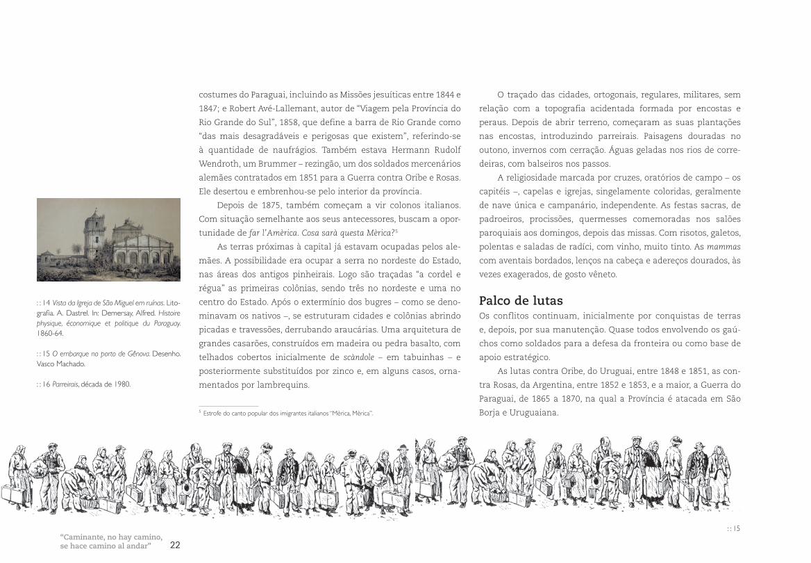
: : 14 Vista da Igreja de São Miguel em ruínas. Lito-grafia. A. Dastrel. In: Demersay, Alfred. Histoire physique, économique et politique du Paraguay. 1860-64.
: : 15 O embarque no porto de Gênova. Desenho. Vasco Machado.
: : 16 Parreirais, década de 1980.
: : 15
5 Estrofe do canto popular dos imigrantes italianos “Mèrica, Mèrica”.
“Caminante, no hay camino,se hace camino al andar”
23 A Ponte do Guaíba
A Revolução Federalista, de 1893, foi uma disputa entre as
principais correntes políticas gaúchas, identificadas pelos lenços
vermelhos dos maragatos, que lutavam contra o excessivo contro-
le do governo central, buscando um sistema federativo com mais
autonomia, e pelos lenços brancos dos pica-paus ou chimangos,
que apoiavam o governo central.
E, no início do século XX, o tenentismo, que pretendia derrubar
as oligarquias dominantes e desenvolver reformas institucionais no
país. O movimento conhecido como Coluna Prestes culminou com
a Grande Marcha, entre 1925 e 1927, quando gaúchos comandados
por Luís Carlos Prestes partiram de Santo Ângelo, se encontraram
com tropas de São Paulo e percorreram a maior parte dos Estados
do país, atravessando o Paraguai, chegando a Teresina.
Durante o século XX, outras etnias, de diferentes proveniên-
cias, mas em contingentes menores, também vieram para o Rio
Grande. Por diferentes motivos, oportunidades ou necessidades,
chegaram poloneses, judeus, árabes, sírios, libaneses e, recente-
mente, japoneses, entre outros. Em grupos ou isoladamente, se
assentaram em distintas regiões, definindo novas paisagens cul-
turais. A maior parte, no entanto, ficou na capital. Este mosaico
cultural6 gerado pela intensa miscigenação, interna e externa, se
verifica na contribuição das diferentes culturas que moldaram
os setores urbanos e rurais de cada região. Com as guerras mun-
diais, chegam novos grupos, outros destinos, que se encontram no
mesmo território.
As redes, o intercâmbioDurante esse período conturbado, a Província buscou se recons-
truir e instalar infra-estrutura para circulação e produção bus-
cando melhorar as conexões entre as várias regiões e a capital.
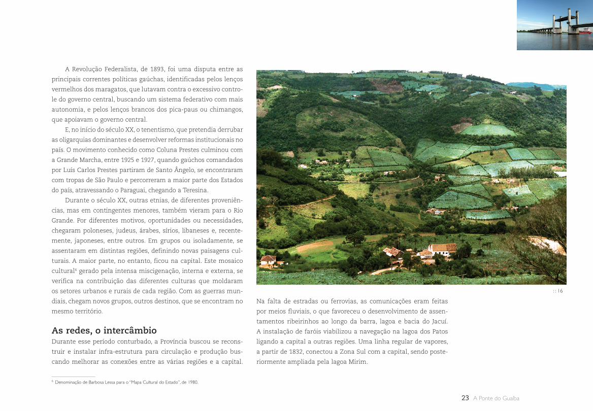
Na falta de estradas ou ferrovias, as comunicações eram feitas
por meios fluviais, o que favoreceu o desenvolvimento de assen-
tamentos ribeirinhos ao longo da barra, lagoa e bacia do Jacuí.
A instalação de faróis viabilizou a navegação na lagoa dos Patos
ligando a capital a outras regiões. Uma linha regular de vapores,
a partir de 1832, conectou a Zona Sul com a capital, sendo poste-
riormente ampliada pela lagoa Mirim.
: : 16
6 Denominação de Barbosa Lessa para o “Mapa Cultural do Estado”, de 1980.
24
A existência de carvão favoreceu a implantação de ferrovias
e de um parque industrial. Em 1869, iniciou-se a construção da
linha ligando São Leopoldo, que foi expandida para Hamburgo-
Velho, Taquara e Canela. Em 1873, o império determinou a cons-
trução da linha para Uruguaiana, que se ligou com a Rio Grande-
Bagé, chegando a Uruguaiana, em 1907. E pouco a pouco, foram
criados outros ramais, ligando as colônias à Zona Sul e fronteira
oeste, atingindo o Uruguai. O principal pólo ferroviário do interior
se consolidou em Santa Maria, uma cidade universitária estrate-
gicamente localizada no centro do Estado.
As primeiras locomotivas eram movidas a carvão, do tipo
maria-fumaça, e cortavam lentamente a paisagem, deixando
atrás de si um rastro de fuligem negra, com chiados e apitos
característicos. Mais tarde, chegam os trens de luxo, com ar
condicionado, tracionados a diesel, como o Minuano e, depois,
o Húngaro.
As ligações rodoviárias eram bastante precárias até cerca de
1950. O trajeto Rio Grande–Porto Alegre, por exemplo, levava dois
dias, com trechos de terra e três balsas, até chegar ao trapiche da
Vila Assunção, na capital. Lentamente, foram implantadas novas
estradas, federais, estaduais, municipais, condicionando o destino
das localidades por onde passavam ou por onde deixavam de
passar. O novo modelo rodoviário nacional se reflete no Estado.
As ferrovias começam a ser desativadas e as estruturas portuárias
modificam sua forma de operar. A rede rodoviária se estrutura e
as estradas de chão vão sendo substituidas por asfalto. E novas
estradas, como a Free-Way, com duas faixas, constituem um
marco na história rodoviária do Estado.
Ligando as novas vias foram construídas pontes. Nas frontei-
ras, as internacionais, algumas mais estilosas, como a de Jaguarão,
com o Uruguai, e a de Uruguaiana, com a Argentina, ou as mais
modernas, como a de Quaraí ou São Borja.
O transporte aéreo entra em ação, em 1927, quando é implan-
tada a linha regular até Rio Grande, feita por hidroavião, pela recém-
criada Viação Aérea Rio Grandense, empresa que logo ganhou
reconhecimento internacional. Para suporte deste sistema, surgem
novas estruturas, os campos de aviação, e, logo, os aeroportos.
Durante o século XX, o Rio Grande consolida sua posição como
região celeiro e sofre grandes modificações em sua estrutura fun-
diária estabelecida. O cultivo de trigo e soja, com a introdução da
agricultura mecanizada, transforma regiões de minifúndio e gera
o êxodo rural. Populações se deslocam para áreas periféricas das
cidades maiores e da própria capital, onde começa a se estruturar
uma região metropolitana.
No nordeste do Estado, se implantam pólos industriais meta-
lúrgicos, moveleiros e vinícolas. A Zona Sul e a fronteira mantêm,
principalmente, uma economia vinculada ao latifúndio e seus
pólos regionais recebem o excedente dos contingentes populacio-
nais em busca de empregos.
No entorno de Porto Alegre – centro administrativo e de ser-
viços –, surgem novas cidades e zonas industriais. Também se for-
mam cinturões de pobreza, que passam a demandar infra-estru-
tura e transportes. A cidade cresce e se transforma, incorporando
grandes edifícios e novas práticas sociais. Sucedem-se planos e
projetos urbanos, grandes obras viárias com a abertura de radiais
e perimetrais, expansões e aterros. Novos sistemas de transporte
substituem os antigos bondes da Carris.
A capital é palco de ações, reações e manifestações – memo-
ráveis – ao sabor da conjuntura política local e nacional. É neste
contexto que o velho anseio – a ponte do Guaíba – finalmente se
concretiza. Como o grande conector da metrópole com o mosaico
cultural do Estado, um monumento que articula, simbolicamente,
o Continente – as paisagens culturais, realidades e sonhos gaúchos
– a todo o Brasil.
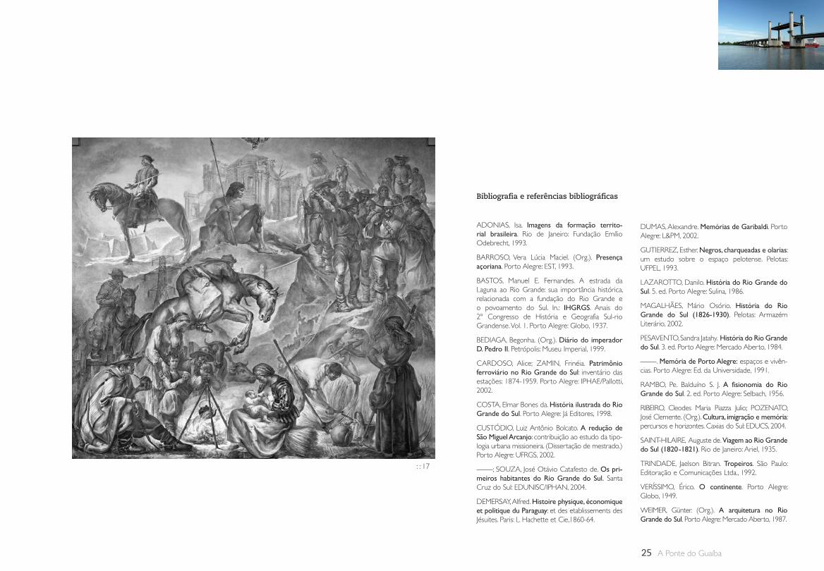
: : 17 A formação histórico etnográfica do povo Rio-grandense. Pintura mural. Aldo Locatelli. 1951. Palácio Piratini.
“Caminante, no hay camino,se hace camino al andar”
25 A Ponte do Guaíba
Bibliografia e referências bibliográficas
ADONIAS, Isa. Imagens da formação territo-rial brasileira. Rio de Janeiro: Fundação Emílio Odebrecht, 1993.
BARROSO, Vera Lúcia Maciel. (Org.). Presença açoriana. Porto Alegre: EST, 1993.
BASTOS, Manuel E. Fernandes. A estrada da Laguna ao Rio Grande: sua importância histórica, relacionada com a fundação do Rio Grande e o povoamento do Sul. In.: IHGRGS. Anais do 2º Congresso de História e Geografia Sul-rio Grandense. Vol. 1. Porto Alegre: Globo, 1937.
BEDIAGA, Begonha. (Org.). Diário do imperador D. Pedro II. Petrópolis: Museu Imperial, 1999.
CARDOSO, Alice; ZAMIN, Frinéia. Patrimônio ferroviário no Rio Grande do Sul: inventário das estações: 1874-1959. Porto Alegre: IPHAE/Pallotti, 2002.
COSTA, Elmar Bones da. História ilustrada do Rio Grande do Sul. Porto Alegre: Já Editores, 1998.
CUSTÓDIO, Luiz Antônio Bolcato. A redução de São Miguel Arcanjo: contribuição ao estudo da tipo-logia urbana missioneira. (Dissertação de mestrado.) Porto Alegre: UFRGS, 2002.
; SOUZA, José Otávio Catafesto de. Os pri-meiros habitantes do Rio Grande do Sul. Santa Cruz do Sul: EDUNISC/IPHAN, 2004.
DEMERSAY, Alfred. Histoire physique, économique et politique du Paraguay: et des etablissements des Jésuites. Paris: L. Hachette et Cie,1860-64.
DUMAS, Alexandre. Memórias de Garibaldi. Porto Alegre: L&PM, 2002.
GUTIERREZ, Esther. Negros, charqueadas e olarias: um estudo sobre o espaço pelotense. Pelotas: UFPEL, 1993.
LAZAROTTO, Danilo. História do Rio Grande do Sul. 5. ed. Porto Alegre: Sulina, 1986.
MAGALHÃES, Mário Osório. História do Rio Grande do Sul (1826-1930). Pelotas: Armazém Literário, 2002.
PESAVENTO, Sandra Jatahy. História do Rio Grande do Sul. 3. ed. Porto Alegre: Mercado Aberto, 1984.
. Memória de Porto Alegre: espaços e vivên-cias. Porto Alegre: Ed. da Universidade, 1991.
RAMBO, Pe. Balduíno S. J. A fisionomia do Rio Grande do Sul. 2. ed. Porto Alegre: Selbach, 1956.
RIBEIRO, Cleodes Maria Piazza Julio; POZENATO, José Clemente. (Org.). Cultura, imigração e memória: percursos e horizontes. Caxias do Sul: EDUCS, 2004.
SAINT-HILAIRE, Auguste de. Viagem ao Rio Grande do Sul (1820 -1821). Rio de Janeiro: Ariel, 1935.
TRINDADE, Jaelson Bitran. Tropeiros. São Paulo: Editoração e Comunicações Ltda., 1992.
VERÍSSIMO, Érico. O continente. Porto Alegre: Globo, 1949.
WEIMER, Günter. (Org.). A arquitetura no Rio Grande do Sul. Porto Alegre: Mercado Aberto, 1987.
: : 17
26Pontes Móveis
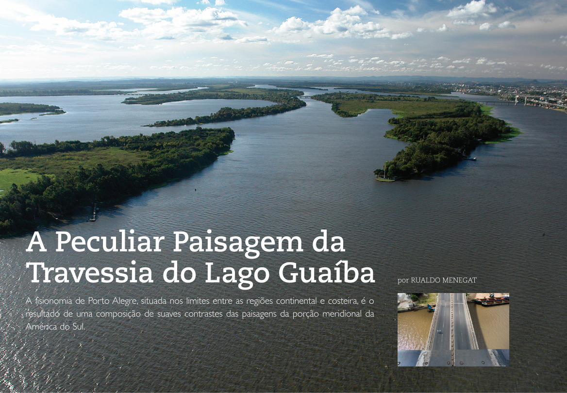
A Peculiar Paisagem da Travessia do Lago Guaíba por RUALDO MENEGAT
A fisionomia de Porto Alegre, situada nos limites entre as regiões continental e costeira, é o resultado de uma composição de suaves contrastes das paisagens da porção meridional da América do Sul.
27 A Ponte do Guaíba
Nessas paragens, não são descortinados os imponentes abismos
andinos, nem a imensidão do grande ecossistema amazônico,
mas sim a quietude de morros, planícies e terraços cobertos por
uma peculiar vegetação e banhados por um lago de margens
invulgares recortadas por pontas e enseadas: o Guaíba.
Esse cenário, cujos fulgor e grandiosidade revelam-se quan-
do é envolto por uma sucessão de cortinas com cores alaranja-
das e púrpuras que estampam o céu no pôr-do-sol – e que ganha
outras cores ainda ao refletir-se no espelho do lago –, resulta da
interface de sete grandes ecorregiões do Cone Sul da nossa
América. Do norte, chegam até a região de Porto Alegre as influ-
ências da Floresta Atlântica, da Mata Mista de Araucárias e,
mesmo, da borda da Amazônia. Vindas do oeste, alcançam a
região várias espécies vegetais do Chaco. Do sul, chegam
até aqui as influências do Pampa argentino e dos Campos
Sulinos do Uruguai e do Escudo Sul-Rio-Grandense. Do leste,
sopra a brisa litorânea e chega a influência das espécies da
Província Costeira do Rio Grande do Sul, da qual faz parte o
lago Guaíba.
Exatamente na margem norte do lago, onde se situa um
arquipélago conhecido como delta do Jacuí, encontra-se a ponte
que realiza a travessia do Guaíba. Descrever esse cenário é mer-
gulhar na longa história natural que modelou o relevo e vestiu de
verde os terrenos onde hoje se situa a cidade de Porto Alegre. É o
que faremos no presente capítulo.
O encontro de paisagensAs grandes cidades brasileiras costumam ser áreas de convergên-
cia de rodovias. Para Porto Alegre, por exemplo, convergem a BR
116, que liga o norte do Brasil com o extremo sul do Estado por
meio da travessia da ponte do Guaíba; a BR 290, que une a fron-
teira oeste com o litoral no leste, também passando pela ponte do
Guaíba; a BR 386, que liga a capital com o noroeste do Estado e,
além, com as vias da vasta região do oeste do Brasil.
Mas, para Porto Alegre também convergem quatro caudalo-
sos rios – Jacuí, Caí, Sinos e Gravataí – que drenam grande parte
da região central e norte-nordeste do Estado e desembocam no
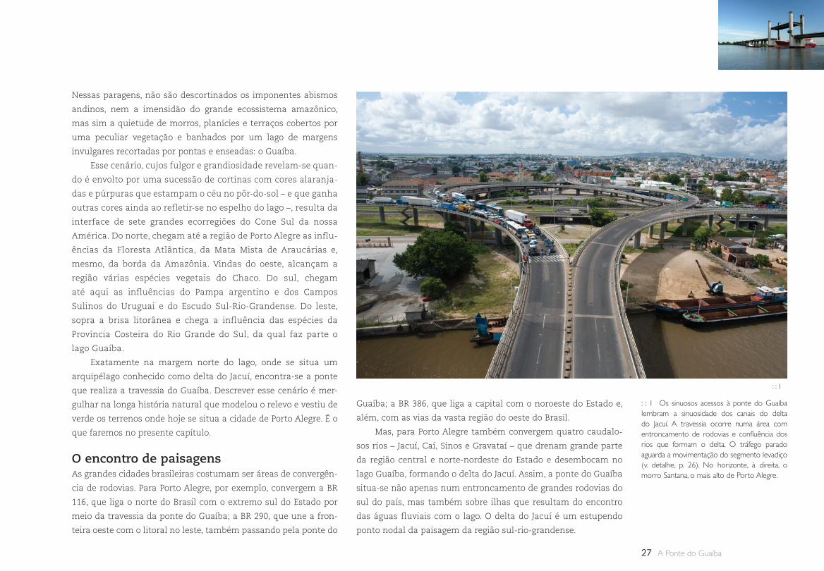
lago Guaíba, formando o delta do Jacuí. Assim, a ponte do Guaíba
situa-se não apenas num entroncamento de grandes rodovias do
sul do país, mas também sobre ilhas que resultam do encontro
das águas fluviais com o lago. O delta do Jacuí é um estupendo
ponto nodal da paisagem da região sul-rio-grandense.
: : 1 Os sinuosos acessos à ponte do Guaíba lembram a sinuosidade dos canais do delta do Jacuí. A travessia ocorre numa área com entroncamento de rodovias e confluência dos rios que formam o delta. O tráfego parado aguarda a movimentação do segmento levadiço (v. detalhe, p. 26). No horizonte, à direita, o morro Santana, o mais alto de Porto Alegre.
: : 1
28
SÃO PAULO RIO DE JANEIRO
SANTOSPERUÍBE
PARANAGUÁ
CURITIBA
CASCAVEL
RIO GRANDE DO SUL
FLORIANÓPOLIS
PORTO ALEGRE
MONTEVIDÉU
BUENOS AIRES
ASSUNÇÃO
PA R A G U A I
U R U G U A I
Oc
ea
no
At l â
n t i co
BR 290
BR 3
86
BR 116
BR 10
1
A R G E N T I N A
Entenderemos melhor esse fenômeno se considerarmos que
a região de Porto Alegre é uma síntese das quatro grandes uni-
dades morfológicas do sul do Brasil, as quais podem ser todas
vistas ao atravessarmos a ponte do Guaíba. Quando olhamos para
o norte, é possível divisar a extensa escarpa, chamada de Serra
Geral, que marca a borda do imenso Planalto Meridional, que se
prolonga desde o sul de Mato Grosso do Sul e da região oeste de
São Paulo, Paraná e Santa Catarina. Também se avistam os diver-
sos morros testemunhos, como o morro do Chapéu, para quem
vem do norte pela BR 116, ou o Itacolomi, para quem vem do leste
pela BR 290 (Free-Way). Esses morros marcam antigas linhas da
escarpa do Planalto Meridional, que está recuando cada vez mais
para o norte devido à sua contínua erosão, deixando para trás
seus testemunhos de antigas posições.
Quando olhamos para o sul-sudeste, avistamos morros arre-
dondados e mamiformes que pertencem ao Planalto do Escudo
Sul-Rio-Grandense. Tais morros são constituídos por rochas gra-
níticas que se formaram há 550 milhões de anos. Nesse tempo
imemorial, essas rochas faziam parte das raízes de uma antiga
cadeia de montanhas, a qual foi totalmente erodida. O que vemos
hoje são apenas as rochas das raízes dessa ancestral cordilheira
que não existe mais.
Entre os dois planaltos, vislumbra-se para oeste uma planície
fluvial bem estreita, chamada de Depressão Periférica, que segue
até a região de Rosário do Sul, onde começa a se alargar um pouco
mais. Quem segue pela rodovia BR 290 em direção à Uruguaiana,
divisará ao norte morros testemunhos tabuliformes, resquícios da
escarpa do Planalto Meridional; e, para o sul, morros do Escudo
Sul-Rio-Gandense, tanto mamiformes quanto tabuliformes, a
exemplo do cerro Partido, próximo a Pântano do Sul.
Finalmente, no leste, para quem chega pela BR 290 (Free-
Way), situa-se a Província Costeira, formada por uma longa faixa
arenosa, onde se localizam as pequenas lagoas do litoral norte
– como as lagoas dos Quadros, Barros e Tramandaí – e as gran-
des lagoas do litoral sul – laguna dos Patos e lagoas Mangueira e
Mirim. O lago Guaíba e o delta do Jacuí fazem parte dessa provín-
cia morfológica.
Assim, quem atravessa a ponte do Guaíba pode reconhe-
cer, num curto trajeto, as principais províncias morfológicas do
Estado, ao mesmo tempo em que aprecia uma paisagem invulgar
graças à confluência de caudalosos rios que desembocam no lago
e formam um delta. Pelo fato dos vãos da ponte serem elevados
em relação às terras planas e baixas das ilhas, a travessia passa a
ser um admirável mirante da paisagem.
: : P. 26 Vista do delta em direção ao norte. Essas ilhas são as mais novas do arquipélago. Possuem a forma de bumerangue, cujas pontas externas apontam em direção à corrente dos canais que a bordejam. No primeiro plano, bem à esquerda, vê-se a ilha do Chico Inglês. Nela, são nítidas várias manchas de cor verde, indicando sucessi-vas fases de colonização dos vegetais. Ao fundo, na primeira linha de morros, avista-se o morro do Chapéu, bem à direita. Esse alinhamento marca a posição da antiga escarpa do Planalto Meridional. No horizonte, vê-se a silhueta da atual escarpa.
: : 2 Mapa do Rio Grande do Sul com as qua-tro províncias morfológicas do sul do Brasil e as principais rodovias e rios que confluem para a região de Porto Alegre no delta do Jacuí.
: : 3 Corticeira-do-banhado (Erythrina crista-galli), que ocorre nas ilhas do delta, florida na primavera.
: : 4 Bando de biguás, muito comuns nas ilhas do delta.
: : 5 Juncal na margem de uma ilha.
: : 6 Bando de garças-brancas.
A Peculiar Paisagem da Travessia do Lago Guaíba
: : 2
B R A S I L
Rodovia
Planalto Meridional
Planalto do Escudo
Depressão Periférica
Província Costeira
Rodovia
Planalto Meridional
Planalto do Escudo
Depressão Periférica
Província Costeira
Rodovia
Planalto Meridional
Planalto do Escudo
Depressão Periférica
Província Costeira
Rodovia
Planalto Meridional
Planalto do Escudo
Depressão Periférica
Província Costeira
Rodovia
Planalto Meridional
Planalto do Escudo
Depressão Periférica
Província Costeira
29 A Ponte do Guaíba
: : 3 : : 4 : : 5 : : 6
30
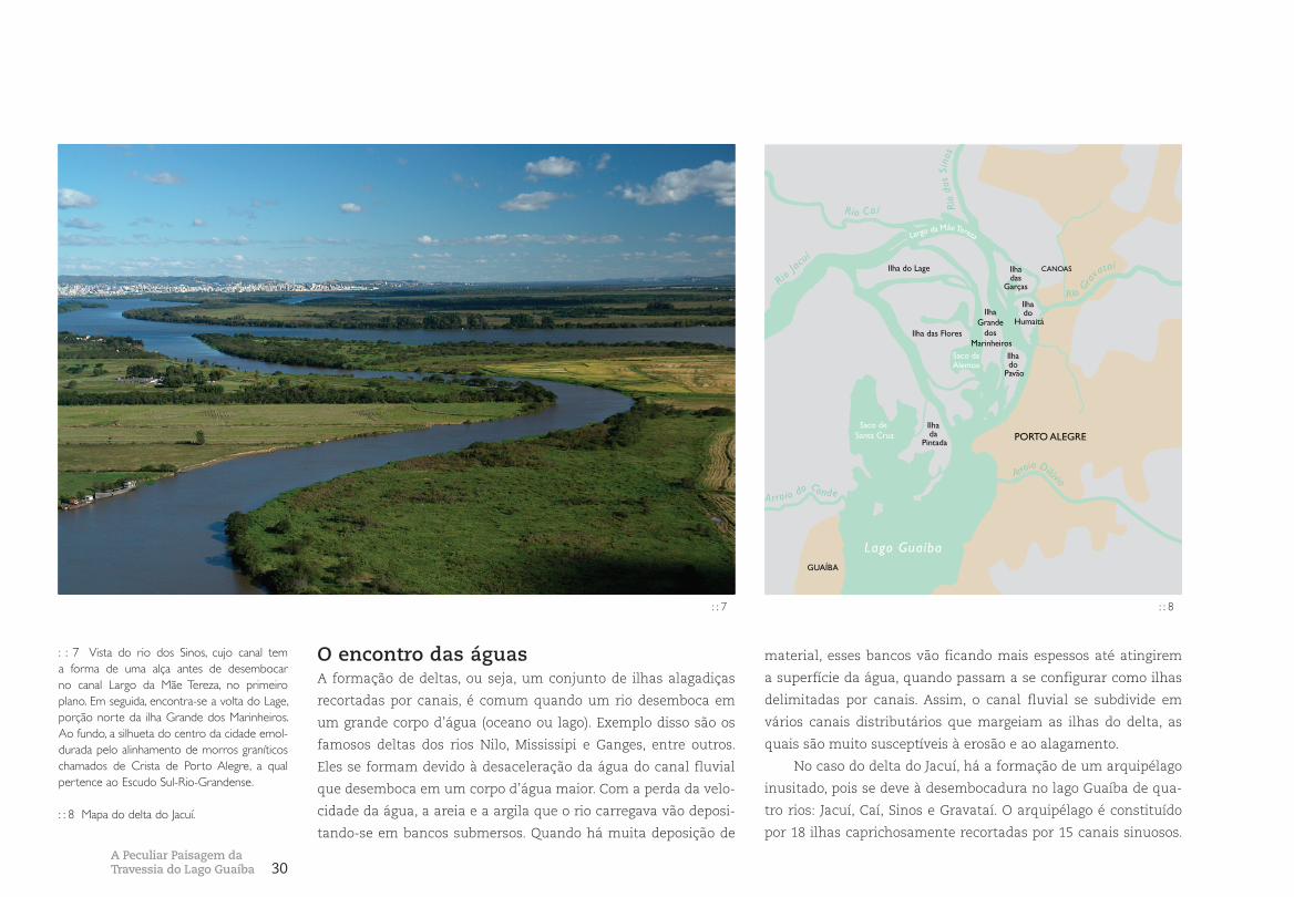
O encontro das águasA formação de deltas, ou seja, um conjunto de ilhas alagadiças
recortadas por canais, é comum quando um rio desemboca em
um grande corpo d’água (oceano ou lago). Exemplo disso são os
famosos deltas dos rios Nilo, Mississipi e Ganges, entre outros.
Eles se formam devido à desaceleração da água do canal fluvial
que desemboca em um corpo d’água maior. Com a perda da velo-
cidade da água, a areia e a argila que o rio carregava vão deposi-
tando-se em bancos submersos. Quando há muita deposição de
material, esses bancos vão ficando mais espessos até atingirem
a superfície da água, quando passam a se configurar como ilhas
delimitadas por canais. Assim, o canal fluvial se subdivide em
vários canais distributários que margeiam as ilhas do delta, as
quais são muito susceptíveis à erosão e ao alagamento.
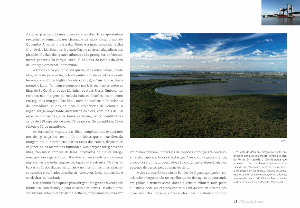
No caso do delta do Jacuí, há a formação de um arquipélago
inusitado, pois se deve à desembocadura no lago Guaíba de qua-
tro rios: Jacuí, Caí, Sinos e Gravataí. O arquipélago é constituído
por 18 ilhas caprichosamente recortadas por 15 canais sinuosos.
: : 7 Vista do rio dos Sinos, cujo canal tem a forma de uma alça antes de desembocar no canal Largo da Mãe Tereza, no primeiro plano. Em seguida, encontra-se a volta do Lage, porção norte da ilha Grande dos Marinheiros. Ao fundo, a silhueta do centro da cidade emol-durada pelo alinhamento de morros graníticos chamados de Crista de Porto Alegre, a qual pertence ao Escudo Sul-Rio-Grandense.
: : 8 Mapa do delta do Jacuí.
: : 7 : : 8
Saco de Santa Cruz
Ilha do Lage
Ilha Grande
dos Marinheiros
Ilha do
Pavão
Ilha do
Humaitá
Ilha das
Garças
Ilha das Flores
Saco da Alemoa
Ilha da
Pintada
Saco de Santa Cruz
Lago GuaíbaGUAÍBA
PORTO ALEGRE
Rio Gra
vataí
Rio Jac
uí
Rio Caí Rio
dos
Sino
s
Arroio Dilúvio
Largo da Mãe Tereza
CANOAS
Arroio do Conde
A Peculiar Paisagem da Travessia do Lago Guaíba
31 A Ponte do Guaíba
As ilhas possuem formas diversas, e muitas delas apresentam
reentrâncias semicirculares chamadas de sacos, como o saco do
Quilombo. A maior ilha é a das Flores e a mais comprida, a ilha
Grande dos Marinheiros. O arquipélago e as áreas alagadiças das
planícies fluviais dos quatro afluentes são protegidos ambiental-
mente por meio do Parque Estadual do Delta do Jacuí e da Área
de Proteção Ambiental homônima.
A travessia da ponte possui quatro vãos sobre canais, sendo
eles, de leste para oeste, o Navegantes – onde se situa a ponte
levadiça –, o Chico Inglês (Furado Grande), o Três Rios e, final-
mente, o Jacuí. Também é composta por três segmentos sobre as
ilhas do Pavão, Grande dos Marinheiros e das Flores. Embora nos
terrenos nas margens da rodovia haja edificações, assim como
em algumas margens das ilhas, onde há núcleos habitacionais
de pescadores, clubes náuticos e residências de veraneio, a
região abriga importante diversidade da flora, com mais de 320
espécies conhecidas, e da fauna selvagem, sendo identificadas
cerca de 210 espécies de aves, 78 de peixes, 24 de anfíbios, 18 de
répteis e 32 de mamíferos.
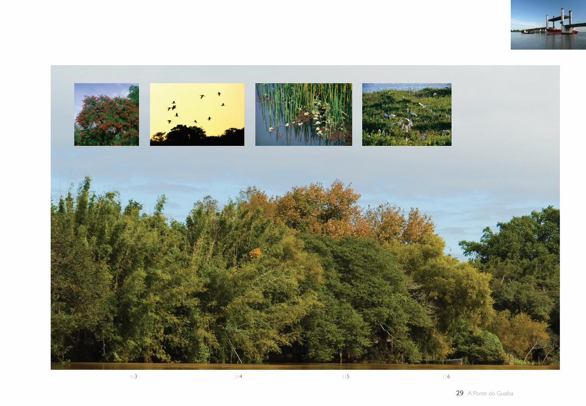
As formações vegetais das ilhas compõem um exuberante
mosaico paisagístico constituído por faixas que se sucedem da
margem até o interior. Nas partes rasas dos canais, dispõem-se
os juncais e os macrófitos flutuantes. Nas porções marginais das
ilhas, elevam-se cordões de lama, chamados de diques margi-
nais, que são vegetados por florestas aluviais onde predominam
imponentes sarandis, ingazeiros, figueiras e salseiros. Nas terras
baixas atrás dos diques marginais e no interior das ilhas, situam-
se campos e banhados inundáveis, com ocorrência de maricás e
corticeiras-do-banhado.
Esse cenário é adequado para abrigar uma grande diversidade
faunística, com destaque para as aves e os peixes. Devido à pres-
são urbana sobre o ecossistema deltaico, encontram-se, cada vez
em menor número, indivíduos de espécies como jacaré-de-papo-
amarelo, capivara, lontra e tartaruga. Aves como a garça-branca,
o socó-boi e o martim-pescador são comumente observáveis nos
passeios de barcos pelos canais do delta.
Muito característicos são os bandos de biguás, que podem ser
avistados mergulhando no espelho quieto das águas ou pousando
em galhos e troncos secos, donde a esbelta silhueta toda preta
e lustrosa pode ser captada contra o azul do céu ou o verde dos
ingazeiros. Nas margens arenosas das ilhas, habitualmente pro-
: : 9 Vista do delta em direção ao norte. No primeiro plano, vê-se a ilha da Pólvora e o saco do Ferraz. Em seguida, o vão da ponte que atravessa o Saco da Alemoa, ligando as ilhas Grande dos Marinheiros, à direita, e das Flores, à esquerda. Bem ao fundo, a silhueta do alinha-mento de morros testemunhos, sendo evidente, à esquerda, o morro do Chapéu. No horizonte, a silhueta da escarpa do Planalto Meridional.
: : 9

32
curam mariscos e de lá acenam abrindo as enormes asas quando
barcos passam pelos canais do delta. Ao entardecer, o céu é tingido
por cortinas de cores laranja e vermelha, rosa e lilás, e os bandos
retornam para seus ninhais em vôos determinados, desenhando
peculiares formações em V. Os cidadãos que vivem próximos às
margens do lago podem acompanhar o vôo dessas aves de longe.
Eventualmente, alguns biguás se desalinham, mas rapidamente se
reorganizam como se soubessem que há gente assistindo ao espe-
táculo. Sinais de que a noite está caindo mansamente na cidade e
de que, no dia seguinte, estarão de volta para júbilo de todos.
A fauna que se abriga nas ilhas também pode ser encontra-
da nas matas e nos banhados de toda a extensão das margens
do lago. As áreas ambientalmente protegidas do delta são, dessa
maneira, um importante abrigo natural para toda a fauna da
região do lago Guaíba.
Travessia sobre um rio ou um lago?Durante um longo período de tempo, desde meados do século XIX
até o final do XX, o Guaíba foi denominado erroneamente de rio e,
às vezes, também de estuário. Porém, diversos estudos científicos,
entre os quais aqueles coordenados por Hans Thofern, célebre
cartógrafo e professor da Universidade Federal do Rio Grande do
Sul, e o “Atlas Ambiental de Porto Alegre” (2006) concluíram que a
designação correta é a de lago. Quais seriam as razões disso?
A primeira delas diz respeito às causas que propiciam a
existência do delta do Jacuí. Ninguém nunca discordou que esse
arquipélago de ilhas fosse um delta. Como vimos, essa morfologia
sedimentar origina-se quando ocorre a desembocadura de um rio
em um corpo d’água maior. Assim, caso o Guaíba fosse um rio,
como poderiam suas nascentes situar-se na desembocadura de
outros rios? Como poderia um delta formar-se dentro do canal de
um rio? Tais paradoxos são falsos, pois somente existem a partir
da definição errônea do Guaíba como rio.
Além disso, as margens de um rio tendem a ser paralelas, con-
formando um canal por onde escoa a água. As margens do Guaíba
estão longe de ser paralelas. Elas são definidas por pontas e enseadas
que desenham caprichosamente vários átrios ao longo dos 50 quilô-
metros que separam a margem norte, onde se situa o delta, da mar-
gem sul, onde as águas do lago confluem para a laguna dos Patos.
Na margem leste, nos municípios de Porto Alegre e Viamão,
as pontas são constituídas por pequenos espigões e morros rocho-
sos residuais que se projetam na lâmina d’água, resultando em
: : 10 Vista em direção ao sul do terceiro vão da ponte, sobre o canal Três Rios, ligando a ilha Grande dos Marinheiros, à esquerda, e a ilha das Flores, cuja ponta meridional aparece à direita na imagem. Ao fundo, a silhueta da cidade de Porto Alegre, que se desenvolve sobre a Crista da Matriz, emoldurada pelos morros da Crista de Porto Alegre.
: : 10
A Peculiar Paisagem da Travessia do Lago Guaíba
33 A Ponte do Guaíba
Rio dos Sino
s
Rio Gravataí
Rio
Caí
BR 290
BR 290
BR 386
LagoGuaíba
BR
116
BR
116
PORTO ALEGRE
GUAÍBA
CANOAS
NOVO HAMBURGO
ALVORADA
CHARQUEADAS
Rio Jacuí
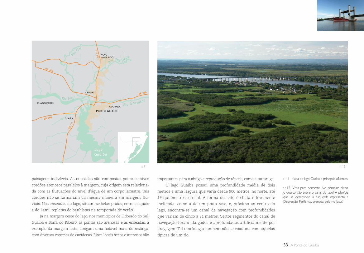
paisagens indizíveis. As enseadas são compostas por sucessivos
cordões arenosos paralelos à margem, cuja origem está relaciona-
da com as flutuações do nível d’água de um corpo lacustre. Tais
cordões não se formariam da mesma maneira em margens flu-
viais. Nas enseadas do lago, situam-se belas praias, entre as quais
a do Lami, repletas de banhistas na temporada de verão.
Já na margem oeste do lago, nos municípios de Eldorado do Sul,
Guaíba e Barra do Ribeiro, as pontas são arenosas e as enseadas, a
exemplo da margem leste, abrigam uma notável mata de restinga,
com diversas espécies de cactáceas. Esses locais secos e arenosos são
importantes para o abrigo e reprodução de répteis, como a tartaruga.
O lago Guaíba possui uma profundidade média de dois
metros e uma largura que varia desde 900 metros, no norte, até
19 quilômetros, no sul. A forma do leito é chata e levemente
inclinada, como a de um prato raso, e, próximo ao centro do
lago, encontra-se um canal de navegação com profundidades
que variam de cinco a 31 metros. Certos segmentos do canal de
navegação foram alargados e aprofundados artificialmente por
dragagem. Tal morfologia também não se coaduna com aquelas
típicas de um rio.
: : 11 Mapa do lago Guaíba e principais afluentes.
: : 12 Vista para noroeste. No primeiro plano, o quarto vão sobre o canal do Jacuí. A planície que se desenvolve à esquerda representa a Depressão Periférica, drenada pelo rio Jacuí.
: : 11 : : 12

34
: : 13 Evolução geológica da região de Porto Alegre nos últimos 400 mil anos (imagens gentilmente cedidas pelo Atlas Ambiental de Porto Alegre).
1. Antes de 400 mil anos, com nível do mar baixo. 2. 400 mil anos: primeira transgressão marinha. 3. 325 mil anos: segunda transgressão marinha.
4. 120 mil anos: terceira transgressão marinha. 5. 5 mil anos: quarta e última transgressão.
A Peculiar Paisagem da Travessia do Lago Guaíba
35 A Ponte do Guaíba
O escoamento das águas num rio comumente ocorre no
sentido longitudinal do canal, das terras mais elevadas para as
mais baixas. Em certas circunstâncias, em regiões mais planas,
a água pode também fluir no sentido inverso. No caso do lago
Guaíba, a dinâmica da água é bidimensional, ou seja, também
acontece no sentido transversal, formando áreas com veloci-
dades diferenciadas. Além disso, cerca de 85% da água ficam
residentes por um longo período de tempo e, em situações de
seca prolongada, a superfície do lago fica esverdeada devido à
proliferação de algas e à diminuição da carga argilosa provenien-
te de seus afluentes.
Segundo relato do insigne naturalista francês Auguste
Saint-Hilaire, que visitou Porto Alegre em 1820, esse corpo
d’água era denominado de lagoa de Viamão ou de Porto Alegre.
Foi em torno dessa época que houve a mudança da designação
para rio. Mas, para esse sábio, não havia dúvida de que se tra-
tava de um lago, pois “quem navega desde o Jacuí até o Guaíba
logo percebe que a embarcação adentra num corpo d’água
muito maior, portanto lacustre”.
Assim, considerar o Guaíba como lago não apenas melhora
nossa geografia, mas também o modelo ambiental que constru-
ímos em relação a esse corpo d’água. Tem sido comum pensar
que aquilo que se joga em um rio a água leva para longe. Porém,
aquilo que se joga em um lago ali permanece. Sendo o Guaíba
um lago, ele guarda na memória de seu leito argiloso os rejeitos
nele lançados ao longo da história de Porto Alegre e das cidades
metropolitanas. Portanto, denominá-lo de forma correta é ajudar
a construir uma nova responsabilidade ambiental diante de tão
importante reservatório d’água para a saúde dos cidadãos e dos
ecossistemas da região.
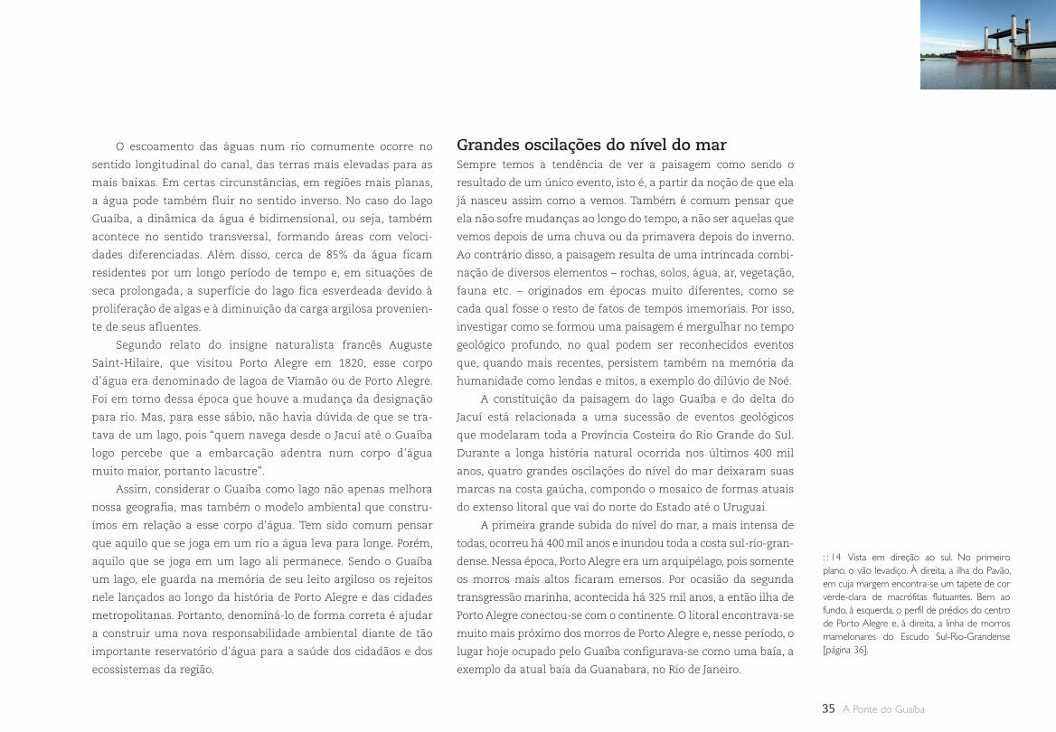
: : 14 Vista em direção ao sul. No primeiro plano, o vão levadiço. À direita, a ilha do Pavão, em cuja margem encontra-se um tapete de cor verde-clara de macrófitas flutuantes. Bem ao fundo, à esquerda, o perfil de prédios do centro de Porto Alegre e, à direita, a linha de morros mamelonares do Escudo Sul-Rio-Grandense [página 36].
Grandes oscilações do nível do marSempre temos a tendência de ver a paisagem como sendo o
resultado de um único evento, isto é, a partir da noção de que ela
já nasceu assim como a vemos. Também é comum pensar que
ela não sofre mudanças ao longo do tempo, a não ser aquelas que
vemos depois de uma chuva ou da primavera depois do inverno.
Ao contrário disso, a paisagem resulta de uma intrincada combi-
nação de diversos elementos – rochas, solos, água, ar, vegetação,
fauna etc. – originados em épocas muito diferentes, como se
cada qual fosse o resto de fatos de tempos imemoriais. Por isso,
investigar como se formou uma paisagem é mergulhar no tempo
geológico profundo, no qual podem ser reconhecidos eventos
que, quando mais recentes, persistem também na memória da
humanidade como lendas e mitos, a exemplo do dilúvio de Noé.
A constituição da paisagem do lago Guaíba e do delta do
Jacuí está relacionada a uma sucessão de eventos geológicos
que modelaram toda a Província Costeira do Rio Grande do Sul.
Durante a longa história natural ocorrida nos últimos 400 mil
anos, quatro grandes oscilações do nível do mar deixaram suas
marcas na costa gaúcha, compondo o mosaico de formas atuais
do extenso litoral que vai do norte do Estado até o Uruguai.
A primeira grande subida do nível do mar, a mais intensa de
todas, ocorreu há 400 mil anos e inundou toda a costa sul-rio-gran-
dense. Nessa época, Porto Alegre era um arquipélago, pois somente
os morros mais altos ficaram emersos. Por ocasião da segunda
transgressão marinha, acontecida há 325 mil anos, a então ilha de
Porto Alegre conectou-se com o continente. O litoral encontrava-se
muito mais próximo dos morros de Porto Alegre e, nesse período, o
lugar hoje ocupado pelo Guaíba configurava-se como uma baía, a
exemplo da atual baía da Guanabara, no Rio de Janeiro.
36
: : 14
A Peculiar Paisagem da Travessia do Lago Guaíba
37 A Ponte do Guaíba
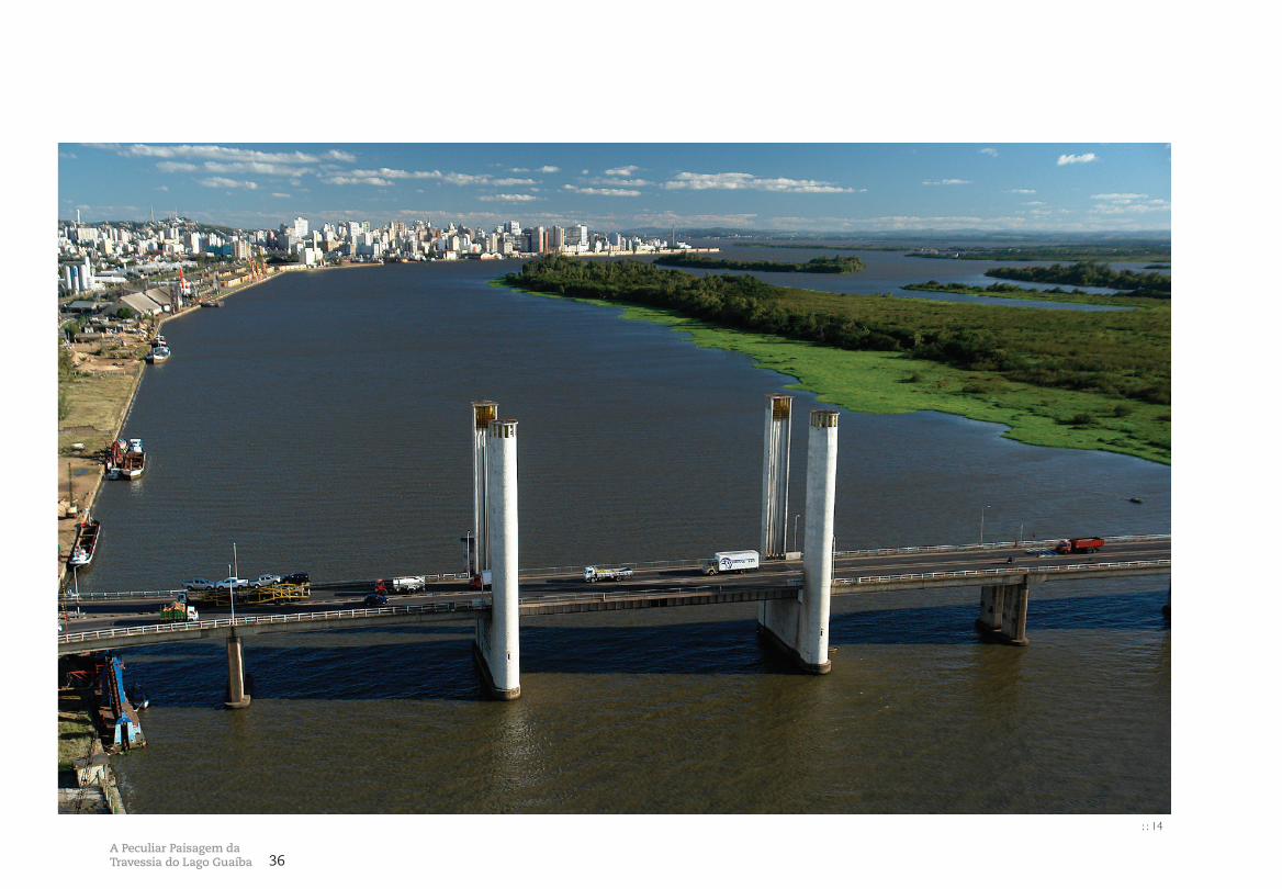
Foi apenas na terceira subida do nível do mar, verificada há
120 mil anos, que se formou a laguna dos Patos e o lago Guaíba.
Dessa época resultam, também, os grandes traços da atual morfo-
logia do delta do Jacuí e da região de banhados e planícies aluviais
dos seus afluentes. Porém, o delineamento do modelado atual
está relacionado à última grande transgressão do nível do mar,
ocorrida há 5 mil anos. Nesse episódio, formaram-se no litoral sul
as lagoas Mangueira e Mirim e, no norte, o rosário de pequenas
lagoas isoladas.
Esses eventos de variação do nível do mar são globais e se
devem à sucessão de ciclos glaciais e interglaciais. Durante uma
glaciação, a precipitação no continente acontece como neve, for-
mando extensas geleiras. Na medida em que a água não retorna
aos oceanos e a evaporação destes continua, o nível marinho
vai baixando. De modo inverso, com o aumento da temperatura
num período interglacial, as geleiras derretem, fazendo subir o
nível do mar. A última elevação do nível do mar ficou registrada
na memória de inúmeros povos em todo o planeta, sendo nar-
rada pelos relatos bíblicos. Também no Novo Mundo, em quase
todas as culturas ameríndias há lendas que remetem a fenôme-
nos diluvianos.
O advento do último período interglacial levou a mudanças
profundas da paisagem, sendo a principal delas a expansão das
florestas e a extinção dos mamíferos gigantes, como o gliptodon-
te e o mamute. Devido ao aumento da temperatura, as florestas
que se concentravam próximas da região equatorial do Brasil se
expandiram para o sul. Assim, espécies da Mata Atlântica e tam-
bém da Amazônia passaram a povoar as terras de Porto Alegre
acompanhadas pela fauna tropical e, também, pelos povos indíge-
nas situados mais ao norte, como os guaranis e os kaingang, que,
ao migrarem para o sul, depararam-se com os povos indígenas
pampianos, como os charruas e os minuanos.
O lago Guaíba, o delta do Jacuí e a sustentabilidade O lago Guaíba, cujo nome deriva da língua guarani e significa
“encontro das águas” e também “de enseadas”, tem uma
importância ambiental muito grande para as populações das
cidades que vivem no seu entorno. Em primeiro lugar, porque
é um impressionante reservatório de água doce, com cerca de
1 km3, sendo praticamente a única fonte de abastecimento de Porto
Alegre. O lago também é fundamental para dispersar os rejeitos
líquidos da cidade. Sem ter onde colocar os efluentes produzidos
diariamente por parques industriais altamente contaminantes, a
vida urbana seria inviável, pois a população morreria intoxicada.
Porém, fruto do descaso com a paisagem natural, o descarte
dos efluentes é, em geral, feito nos corpos d’água, sem tratamento,
o que leva à deterioração do ambiente. Nos últimos anos, devido
ao impacto de contaminantes domésticos e industriais, a pesca no
lago diminuiu muito, bem como o usufruto de suas belas praias.
A preservação ambiental do lago Guaíba e do delta do Jacuí é
estratégica para os cerca de quatro milhões de cidadãos da região
metropolitana de Porto Alegre. Além de impedir a degradação da
imponente paisagem que o lago oferece, evitaria a sucumbência
dos ecossistemas onde as cidades estão encravadas, tornando
mais sustentável a vida de toda a população.
Bibliografia
GOMES, A. M. B. Geomorfologia do delta do Jacuí: relatório final. Porto Alegre: Plandel, Metroplan, 1979.
LICHT, H. F. B. Parque Estadual Delta do Jacuí: aci-dentes geográficos, denominações e topônimos. Porto Alegre: Plandel, Metroplan, 1978.
LONGHI, H. F. B.; RAMOS, R. F. Botânica do delta do Jacuí: relatório final. Porto Alegre: Plandel, Metroplan, 1977.
MENEGAT, R. (Coord. geral); PORTO, M. L.; CARRARO, C. C.; FERNANDES, L. A. D. (Coords.) Atlas ambiental de Porto Alegre. 3. ed. Porto Alegre: Editora da UFRGS, 2006.
MOHR, U. S. Paisagem do delta do Jacuí. Porto Alegre: Plandel, Metroplan, 1979.
PORTO ALEGRE, Prefeitura Municipal de. Parque Estadual do delta do Jacuí: plano básico. Porto Alegre: Secretaria do Planejamento Municipal, 88 pp.
SAINT-HILAIRE, A. Viagem ao Rio Grande do Sul: 1820-1821. Rio de Janeiro: Ariel, 1934.
38Pontes Móveis
Uma Travessia, Muitas Pontes por FLÁVIO KIEFER
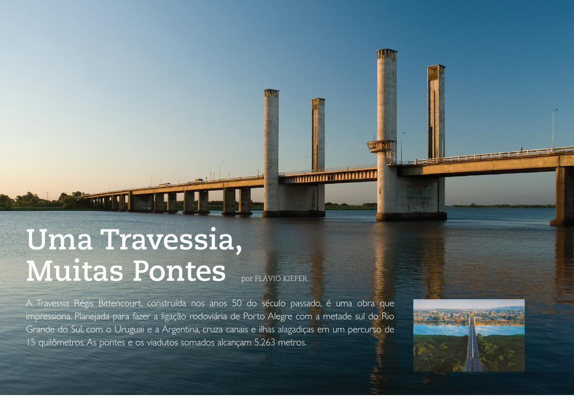
A Travessia Régis Bittencourt, construída nos anos 50 do século passado, é uma obra que impressiona. Planejada para fazer a ligação rodoviária de Porto Alegre com a metade sul do Rio Grande do Sul, com o Uruguai e a Argentina, cruza canais e ilhas alagadiças em um percurso de 15 quilômetros. As pontes e os viadutos somados alcançam 5.263 metros.
39 A Ponte do Guaíba
O
sório
Pelo
tas
BR 1
16
BR 290
BR 2
90
RS 287
NOVO HAMBURGO
SÃO LEOPOLDO
Niterói
Esteio
CANOAS
Sapucaia
PORTO ALEGRE
Garibaldi
CaíCaxias
SÃO JERÔNIMO
Arroio dos Ratos
TRIUNFO
MONTENEGRO
GENERAL CÂMARA
Santo Amaro
General Neto
Passo Raso
Charqueadas Conde
Barca
GUAÍBA
Rio
dos
Sin
os
Rio Caí
Rio Gravataí
R i o Jacuí
Lago
Gua
íba
Rio Taquar i
Uruguaiana
Vale do Taquari
RS 244
RS 122
BR 1
16
Os desafios técnico-construtivos e a definição da localização da tra-
vessia demandaram mais de cinco anos de estudos. A construção do
vão levadiço não era inédita, mas apresentava complexidade inco-
mum. Já a utilização de concreto protendido tinha sido pouco testada
em terras brasileiras. Soluções vindas da Alemanha foram adaptadas
às condições dos fabricantes nacionais. Tudo isso em tempo muito
curto, 1165 dias1, utilizando recursos públicos e com coordenação
dos governos federal e estadual por intermédio do Departamento
Nacional de Estradas de Rodagem – DNER e Departamento Autônomo
de Estradas de Rodagem – DAER respectivamente.
Os estudos e projetos da travessia coincidiram com um perí-
odo conturbado da política brasileira que culminou com o suicí-
dio do presidente Vargas, em 1954. Já a obra, a partir de 1955, foi
fruto dos anos JK, de Juscelino Kubitschek, o presidente que queria
avançar 50 anos em 5. E, de fato, foi um período de muitas obras.
A mais famosa foi a construção de Brasília, mas os investimentos
na construção de rodovias também foram significativos. A meta
era integrar e consolidar o mercado consumidor nacional para
uma industrialização que tinha como um de seus pilares a indús-
tria automobilística. Para o setor de cargas, o governo construiu a
Fábrica Nacional de Motores, produtora dos caminhões FNM, que
dominaram durante décadas a paisagem das estradas brasileiras.
O Plano Rodoviário Nacional, criado por Getúlio Vargas,
em 1944, previa uma rede de estradas ligando as fronteiras do
extremo sul aos Estados do Norte e Nordeste, passando pelos
principais centros urbanos do país. Nesse plano, Porto Alegre era
cortada pela BR-2 – hoje 116 – e BR-37 – hoje 290 – que tinham
no Guaíba um obstáculo para sua continuidade. A Travessia Régis
Bittencourt não só ligava duas metades de um Estado, mas tam-
bém aproximava vizinhos comercialmente importantes.
A história de Porto Alegre está intimamente ligada ao lago
Guaíba. Iniciou-se em 1752 como um acampamento de açorianos
que nunca receberiam as prometidas terras para colonizar o oeste
do Estado. Depois, a facilidade de comunicação com o interior,
através dos diversos rios que deságuam no lago, e com o mar, a
partir da lagoa dos Patos e barra de Rio Grande, propiciou as con-
dições para o desenvolvimento comercial do pequeno povoado. A
chegada ao Rio Grande do Sul dos imigrantes alemães, em 1824,
e italianos, em 1875, acelerou seu desenvolvimento comercial e
promoveu sua industrialização. A implantação das estradas de
ferro, em 1874, deu início a uma intensa acumulação de capitais
: : 1 Na direção norte-sul a BR-2 – hoje 116 – liga a cidade de Jaguarão a Belém do Pará e na direção leste-oeste a BR-37 – hoje 290 –, Osório a Uruguaiana.
1 Conforme placa de inauguração da obra, afixada em uma das torres do vão móvel da ponte sobre o Guaíba, do dia 20 de outubro de 1955 a 28 de dezembro de 1958.
Rodovia
Ferrovia
: : 1
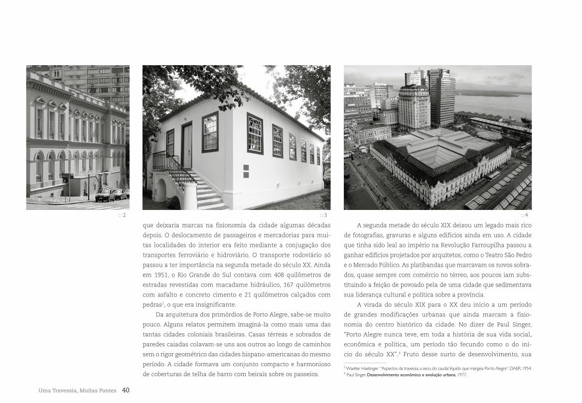
40
que deixaria marcas na fisionomia da cidade algumas décadas
depois. O deslocamento de passageiros e mercadorias para mui-
tas localidades do interior era feito mediante a conjugação dos
transportes ferroviário e hidroviário. O transporte rodoviário só
passou a ter importância na segunda metade do século XX. Ainda
em 1951, o Rio Grande do Sul contava com 408 quilômetros de
estradas revestidas com macadame hidráulico, 167 quilômetros
com asfalto e concreto cimento e 21 quilômetros calçados com
pedras2, o que era insignificante.
Da arquitetura dos primórdios de Porto Alegre, sabe-se muito
pouco. Alguns relatos permitem imaginá-la como mais uma das
tantas cidades coloniais brasileiras. Casas térreas e sobrados de
paredes caiadas colavam-se uns aos outros ao longo de caminhos
sem o rigor geométrico das cidades hispano-americanas do mesmo
período. A cidade formava um conjunto compacto e harmonioso
de coberturas de telha de barro com beirais sobre os passeios.
A segunda metade do século XIX deixou um legado mais rico
de fotografias, gravuras e alguns edifícios ainda em uso. A cidade
que tinha sido leal ao império na Revolução Farroupilha passou a
ganhar edifícios projetados por arquitetos, como o Teatro São Pedro
e o Mercado Público. As platibandas que marcavam os novos sobra-
dos, quase sempre com comércio no térreo, aos poucos iam subs-
tituindo a feição de povoado pela de uma cidade que sedimentava
sua liderança cultural e política sobre a província.
A virada do século XIX para o XX deu início a um período
de grandes modificações urbanas que ainda marcam a fisio-
nomia do centro histórico da cidade. No dizer de Paul Singer,
“Porto Alegre nunca teve, em toda a história de sua vida social,
econômica e política, um período tão fecundo como o do iní-
cio do século XX”.3 Fruto desse surto de desenvolvimento, sua
Uma Travessia, Muitas Pontes
2 Waelter Haetinger. “Aspectos da travessia, a seco, do caudal líquido que margeia Porto Alegre”. DAER, 1954. 3 Paul Singer. Desenvolvimento econômico e evolução urbana, 1977.
: : 2 : : 3 : : 4
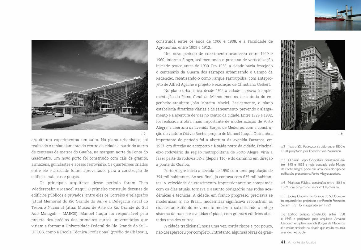
41 A Ponte do Guaíba
arquitetura experimentou um salto. No plano urbanístico, foi
realizado o replanejamento do centro da cidade a partir do aterro
de centenas de metros do Guaíba, na margem norte da Ponta do
Gasômetro. Um novo porto foi construído com cais de granito,
armazéns, guindastes e acesso ferroviário. Os quarteirões criados
entre ele e a cidade foram aproveitados para a construção de
edifícios públicos e praças.
Os principais arquitetos desse período foram Theo
Wiederspahn e Manoel Itaqui. O primeiro construiu dezenas de
edifícios públicos e privados, entre eles os Correios e Telégrafos
(atual Memorial do Rio Grande do Sul) e a Delegacia Fiscal do
Tesouro Nacional (atual Museu de Arte do Rio Grande do Sul
Ado Malagoli – MARGS). Manoel Itaqui foi responsável pelo
projeto dos prédios dos primeiros cursos universitários que
viriam a formar a Universidade Federal do Rio Grande do Sul –
UFRGS, como a Escola Técnica Profissional (prédio do Château),
construída entre os anos de 1906 e 1908, e a Faculdade de
Agronomia, entre 1909 e 1912.
Um novo período de crescimento aconteceu entre 1940 e
1960, informa Singer, sedimentando o processo de verticalização
iniciado pouco antes de 1930. Em 1935, a cidade havia festejado
o centenário da Guerra dos Farrapos urbanizando o Campo da
Redenção, rebatizando-o como Parque Farroupilha, com antepro-
jeto de Alfred Agache e projeto e execução de Christiano Gelbert.
No plano urbanístico, desde 1914 a cidade aspirava à imple-
mentação do Plano Geral de Melhoramentos, de autoria do en-
genheiro-arquiteto João Moreira Maciel. Basicamente, o plano
estabelecia diretrizes viárias e de saneamento, prevendo o alarga-
mento e a abertura de vias no centro da cidade. Entre 1928 e 1932,
foi realizada a obra mais importante de modernização de Porto
Alegre, a abertura da avenida Borges de Medeiros, com a constru-
ção do viaduto Otávio Rocha, projeto de Manoel Itaqui. Outra obra
importante do período foi a abertura da avenida Farrapos, em
1937, em direção ao aeroporto e à saída norte da cidade. Principal
eixo rodoviário da região metropolitana de Porto Alegre, viria a
fazer parte da rodovia BR-2 (depois 116) e do caminho em direção
à ponte do Guaíba.
Porto Alegre inicia a década de 1950 com uma população de
394 mil habitantes. Ao seu final, já contava com 635 mil habitan-
tes. A velocidade de crescimento, impressionante se comparada
com os dias atuais, tornava o assunto obrigatório nas rodas aca-
dêmicas e técnicas. A cidade, em franco progresso, precisava se
modernizar. E, no Brasil, modernizar significava reconstruir as
cidades ao estilo do movimento moderno, substituindo o antigo
sistema de ruas por avenidas rápidas, com grandes edifícios afas-
tados uns dos outros.
A cidade tradicional, mais uma vez, corria riscos e, por pouco,
não desapareceu por completo. Entretanto, algumas obras de gran-
: : 2 Teatro São Pedro, construído entre 1850 e 1858, projetado por Theodor von Normann.
: : 3 O Solar Lopo Gonçalves, construído en-tre 1845 e 1855 e hoje ocupado pelo Museu de Porto Alegre, pode dar uma idéia do tipo de edificação presente na Porto Alegre açoriana.
: : 4 Mercado Público, construído entre 1861 e 1869, com projeto de Friedrich Heydtmann,
: : 5 Jockey Club do Rio Grande do Sul. Conjun-to arquitetônico projetado por Román Fresnedo Siri em 1951, foi inaugurado em 1959.
: : 6 Edifício Sulacap, construído entre 1938 e 1943 e projetado pelo arquiteto Arnaldo Gladosch em plena avenida Borges de Medeiros, é o maior símbolo da cidade que então assumia ares de metrópole.
: : 5 : : 6
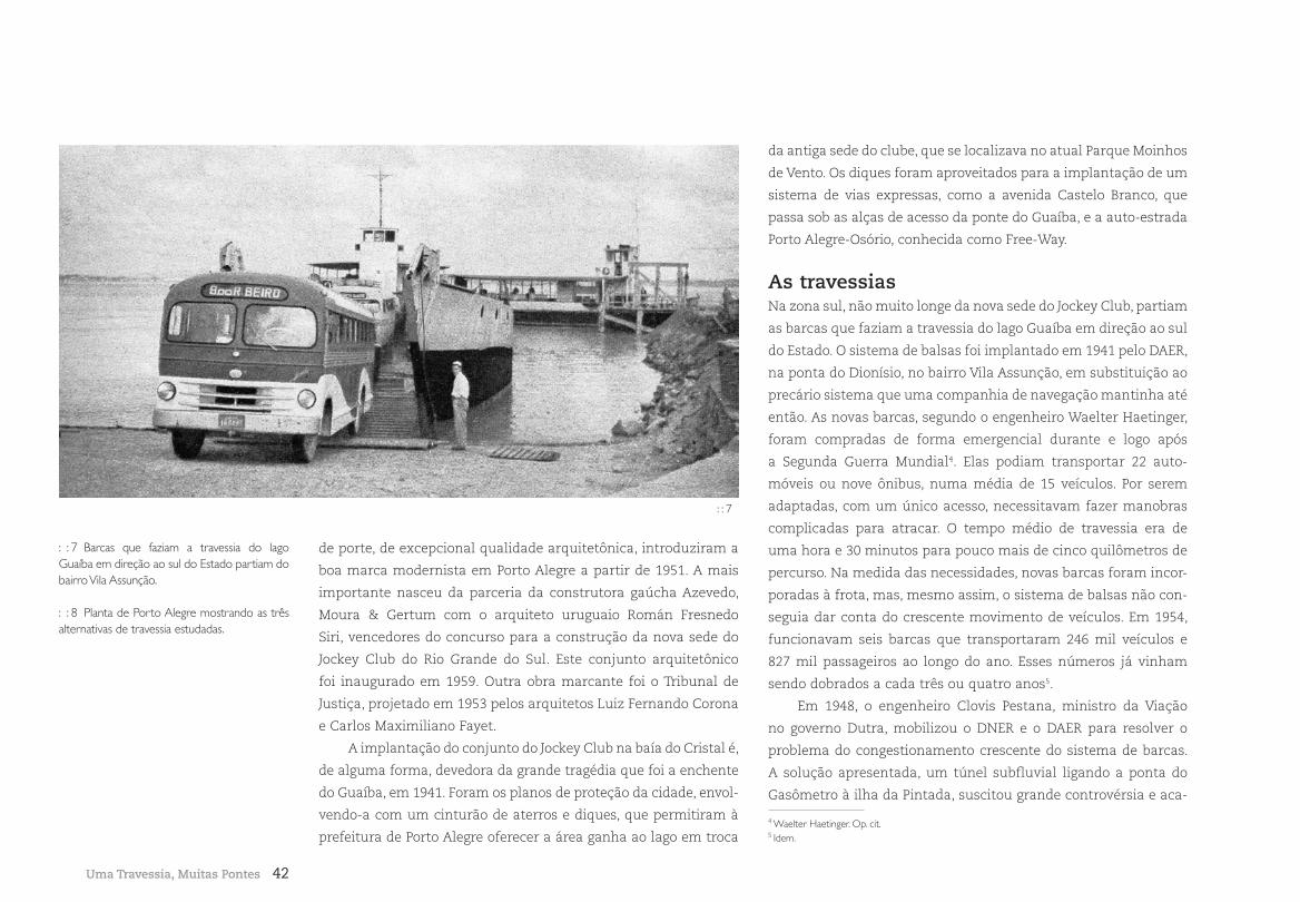
42Uma Travessia, Muitas Pontes
de porte, de excepcional qualidade arquitetônica, introduziram a
boa marca modernista em Porto Alegre a partir de 1951. A mais
importante nasceu da parceria da construtora gaúcha Azevedo,
Moura & Gertum com o arquiteto uruguaio Román Fresnedo
Siri, vencedores do concurso para a construção da nova sede do
Jockey Club do Rio Grande do Sul. Este conjunto arquitetônico
foi inaugurado em 1959. Outra obra marcante foi o Tribunal de
Justiça, projetado em 1953 pelos arquitetos Luiz Fernando Corona
e Carlos Maximiliano Fayet.
A implantação do conjunto do Jockey Club na baía do Cristal é,
de alguma forma, devedora da grande tragédia que foi a enchente
do Guaíba, em 1941. Foram os planos de proteção da cidade, envol-
vendo-a com um cinturão de aterros e diques, que permitiram à
prefeitura de Porto Alegre oferecer a área ganha ao lago em troca
da antiga sede do clube, que se localizava no atual Parque Moinhos
de Vento. Os diques foram aproveitados para a implantação de um
sistema de vias expressas, como a avenida Castelo Branco, que
passa sob as alças de acesso da ponte do Guaíba, e a auto-estrada
Porto Alegre-Osório, conhecida como Free-Way.
As travessiasNa zona sul, não muito longe da nova sede do Jockey Club, partiam
as barcas que faziam a travessia do lago Guaíba em direção ao sul
do Estado. O sistema de balsas foi implantado em 1941 pelo DAER,
na ponta do Dionísio, no bairro Vila Assunção, em substituição ao
precário sistema que uma companhia de navegação mantinha até
então. As novas barcas, segundo o engenheiro Waelter Haetinger,
foram compradas de forma emergencial durante e logo após
a Segunda Guerra Mundial4. Elas podiam transportar 22 auto-
móveis ou nove ônibus, numa média de 15 veículos. Por serem
adaptadas, com um único acesso, necessitavam fazer manobras
complicadas para atracar. O tempo médio de travessia era de
uma hora e 30 minutos para pouco mais de cinco quilômetros de
percurso. Na medida das necessidades, novas barcas foram incor-
poradas à frota, mas, mesmo assim, o sistema de balsas não con-
seguia dar conta do crescente movimento de veículos. Em 1954,
funcionavam seis barcas que transportaram 246 mil veículos e
827 mil passageiros ao longo do ano. Esses números já vinham
sendo dobrados a cada três ou quatro anos5.
Em 1948, o engenheiro Clovis Pestana, ministro da Viação
no governo Dutra, mobilizou o DNER e o DAER para resolver o
problema do congestionamento crescente do sistema de barcas.
A solução apresentada, um túnel subfluvial ligando a ponta do
Gasômetro à ilha da Pintada, suscitou grande controvérsia e aca-
: : 7 Barcas que faziam a travessia do lago Guaíba em direção ao sul do Estado partiam do bairro Vila Assunção.
: : 8 Planta de Porto Alegre mostrando as três alternativas de travessia estudadas.
: : 7
4 Waelter Haetinger. Op. cit.5 Idem.
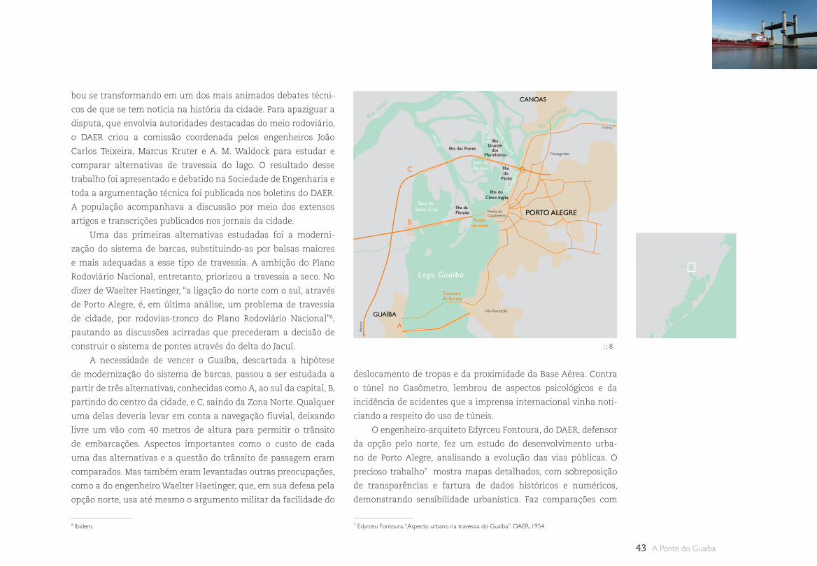
43 A Ponte do Guaíba
Rio G
ravataí
Rio Jac
uí
Ilha do Chico Inglês
A
B
C
Ilha Grande
dos Marinheiros
Fura
do G
rand
e
Ilha do
Pavão
Ilha das Flores
Saco da Alemoa
Ilha da Pintada
Ponte ou túnel
Travessia de barcas
Ponta do Gasômetro
Vila Assunção
Navegantes
Osório
Pelo
tas
Saco de Santa Cruz
Lago Guaíba
PORTO ALEGRE
GUAÍBA
CANOAS
J
acuí
Três
Rio
s
Nav
egan
tes
bou se transformando em um dos mais animados debates técni-
cos de que se tem notícia na história da cidade. Para apaziguar a
disputa, que envolvia autoridades destacadas do meio rodoviário,
o DAER criou a comissão coordenada pelos engenheiros João
Carlos Teixeira, Marcus Kruter e A. M. Waldock para estudar e
comparar alternativas de travessia do lago. O resultado desse
trabalho foi apresentado e debatido na Sociedade de Engenharia e
toda a argumentação técnica foi publicada nos boletins do DAER.
A população acompanhava a discussão por meio dos extensos
artigos e transcrições publicados nos jornais da cidade.
Uma das primeiras alternativas estudadas foi a moderni-
zação do sistema de barcas, substituindo-as por balsas maiores
e mais adequadas a esse tipo de travessia. A ambição do Plano
Rodoviário Nacional, entretanto, priorizou a travessia a seco. No
dizer de Waelter Haetinger, “a ligação do norte com o sul, através
de Porto Alegre, é, em última análise, um problema de travessia
de cidade, por rodovias-tronco do Plano Rodoviário Nacional”6,
pautando as discussões acirradas que precederam a decisão de
construir o sistema de pontes através do delta do Jacuí.
A necessidade de vencer o Guaíba, descartada a hipótese
de modernização do sistema de barcas, passou a ser estudada a
partir de três alternativas, conhecidas como A, ao sul da capital, B,
partindo do centro da cidade, e C, saindo da Zona Norte. Qualquer
uma delas deveria levar em conta a navegação fluvial, deixando
livre um vão com 40 metros de altura para permitir o trânsito
de embarcações. Aspectos importantes como o custo de cada
uma das alternativas e a questão do trânsito de passagem eram
comparados. Mas também eram levantadas outras preocupações,
como a do engenheiro Waelter Haetinger, que, em sua defesa pela
opção norte, usa até mesmo o argumento militar da facilidade do
deslocamento de tropas e da proximidade da Base Aérea. Contra
o túnel no Gasômetro, lembrou de aspectos psicológicos e da
incidência de acidentes que a imprensa internacional vinha noti-
ciando a respeito do uso de túneis.
O engenheiro-arquiteto Edyrceu Fontoura, do DAER, defensor
da opção pelo norte, fez um estudo do desenvolvimento urba-
no de Porto Alegre, analisando a evolução das vias públicas. O
precioso trabalho7 mostra mapas detalhados, com sobreposição
de transparências e fartura de dados históricos e numéricos,
demonstrando sensibilidade urbanística. Faz comparações com
7 Edyrceu Fontoura. “Aspecto urbano na travessia do Guaíba”. DAER, 1954.
: : 8
6 Ibidem.
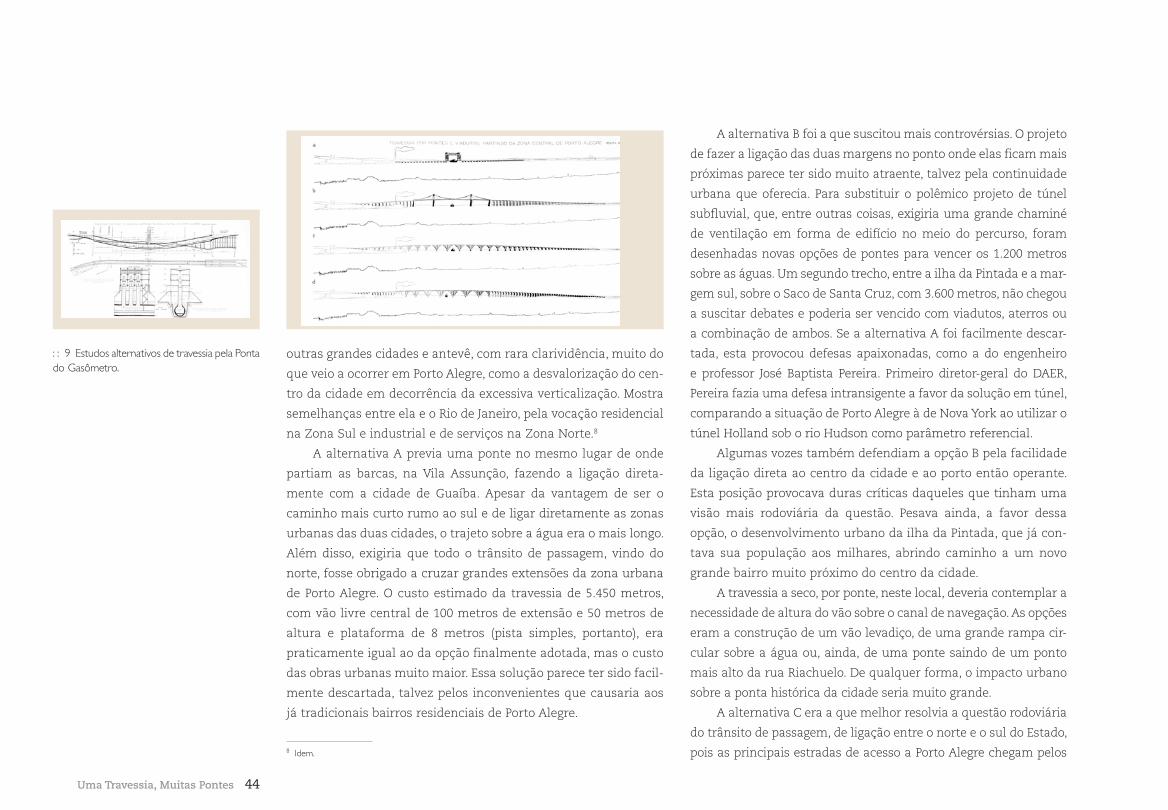
44
outras grandes cidades e antevê, com rara clarividência, muito do
que veio a ocorrer em Porto Alegre, como a desvalorização do cen-
tro da cidade em decorrência da excessiva verticalização. Mostra
semelhanças entre ela e o Rio de Janeiro, pela vocação residencial
na Zona Sul e industrial e de serviços na Zona Norte.8
A alternativa A previa uma ponte no mesmo lugar de onde
partiam as barcas, na Vila Assunção, fazendo a ligação direta-
mente com a cidade de Guaíba. Apesar da vantagem de ser o
caminho mais curto rumo ao sul e de ligar diretamente as zonas
urbanas das duas cidades, o trajeto sobre a água era o mais longo.
Além disso, exigiria que todo o trânsito de passagem, vindo do
norte, fosse obrigado a cruzar grandes extensões da zona urbana
de Porto Alegre. O custo estimado da travessia de 5.450 metros,
com vão livre central de 100 metros de extensão e 50 metros de
altura e plataforma de 8 metros (pista simples, portanto), era
praticamente igual ao da opção finalmente adotada, mas o custo
das obras urbanas muito maior. Essa solução parece ter sido facil-
mente descartada, talvez pelos inconvenientes que causaria aos
já tradicionais bairros residenciais de Porto Alegre.
A alternativa B foi a que suscitou mais controvérsias. O projeto
de fazer a ligação das duas margens no ponto onde elas ficam mais
próximas parece ter sido muito atraente, talvez pela continuidade
urbana que oferecia. Para substituir o polêmico projeto de túnel
subfluvial, que, entre outras coisas, exigiria uma grande chaminé
de ventilação em forma de edifício no meio do percurso, foram
desenhadas novas opções de pontes para vencer os 1.200 metros
sobre as águas. Um segundo trecho, entre a ilha da Pintada e a mar-
gem sul, sobre o Saco de Santa Cruz, com 3.600 metros, não chegou
a suscitar debates e poderia ser vencido com viadutos, aterros ou
a combinação de ambos. Se a alternativa A foi facilmente descar-
tada, esta provocou defesas apaixonadas, como a do engenheiro
e professor José Baptista Pereira. Primeiro diretor-geral do DAER,
Pereira fazia uma defesa intransigente a favor da solução em túnel,
comparando a situação de Porto Alegre à de Nova York ao utilizar o
túnel Holland sob o rio Hudson como parâmetro referencial.
Algumas vozes também defendiam a opção B pela facilidade
da ligação direta ao centro da cidade e ao porto então operante.
Esta posição provocava duras críticas daqueles que tinham uma
visão mais rodoviária da questão. Pesava ainda, a favor dessa
opção, o desenvolvimento urbano da ilha da Pintada, que já con-
tava sua população aos milhares, abrindo caminho a um novo
grande bairro muito próximo do centro da cidade.
A travessia a seco, por ponte, neste local, deveria contemplar a
necessidade de altura do vão sobre o canal de navegação. As opções
eram a construção de um vão levadiço, de uma grande rampa cir-
cular sobre a água ou, ainda, de uma ponte saindo de um ponto
mais alto da rua Riachuelo. De qualquer forma, o impacto urbano
sobre a ponta histórica da cidade seria muito grande.
A alternativa C era a que melhor resolvia a questão rodoviária
do trânsito de passagem, de ligação entre o norte e o sul do Estado,
pois as principais estradas de acesso a Porto Alegre chegam pelos
Uma Travessia, Muitas Pontes
: : 9 Estudos alternativos de travessia pela Ponta do Gasômetro.
8 Idem.
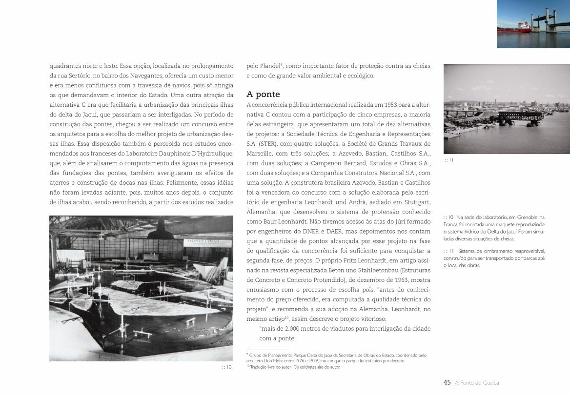
45 A Ponte do Guaíba
quadrantes norte e leste. Essa opção, localizada no prolongamento
da rua Sertório, no bairro dos Navegantes, oferecia um custo menor
e era menos conflituosa com a travessia de navios, pois só atingia
os que demandavam o interior do Estado. Uma outra atração da
alternativa C era que facilitaria a urbanização das principais ilhas
do delta do Jacuí, que passariam a ser interligadas. No período de
construção das pontes, chegou a ser realizado um concurso entre
os arquitetos para a escolha do melhor projeto de urbanização des-
sas ilhas. Essa disposição também é percebida nos estudos enco-
mendados aos franceses do Laboratoire Dauphinois D’Hydraulique,
que, além de analisarem o comportamento das águas na presença
das fundações das pontes, também averiguaram os efeitos de
aterros e construção de docas nas ilhas. Felizmente, essas idéias
não foram levadas adiante, pois, muitos anos depois, o conjunto
de ilhas acabou sendo reconhecido, a partir dos estudos realizados
pelo Plandel9, como importante fator de proteção contra as cheias
e como de grande valor ambiental e ecológico.
A ponteA concorrência pública internacional realizada em 1953 para a alter-
nativa C contou com a participação de cinco empresas, a maioria
delas estrangeira, que apresentaram um total de dez alternativas
de projetos: a Sociedade Técnica de Engenharia e Representações
S.A. (STER), com quatro soluções; a Société de Grands Travaux de
Marseille, com três soluções; a Azevedo, Bastian, Castilhos S.A.,
com duas soluções; a Campenon Bernard, Estudos e Obras S.A.,
com duas soluções; e a Companhia Construtora Nacional S.A., com
uma solução. A construtora brasileira Azevedo, Bastian e Castilhos
foi a vencedora do concurso com a solução elaborada pelo escri-
tório de engenharia Leonhardt und Andrä, sediado em Stuttgart,
Alemanha, que desenvolveu o sistema de protensão conhecido
como Baur-Leonhardt. Não tivemos acesso às atas do júri formado
por engenheiros do DNER e DAER, mas depoimentos nos contam
que a quantidade de pontos alcançada por esse projeto na fase
de qualificação da concorrência foi suficiente para conquistar a
segunda fase, de preços. O próprio Fritz Leonhardt, em artigo assi-
nado na revista especializada Beton und Stahlbetonbau (Estruturas
de Concreto e Concreto Protendido), de dezembro de 1963, mostra
entusiasmo com o processo de escolha pois, “antes do conheci-
mento do preço oferecido, era computada a qualidade técnica do
projeto”, e recomenda a sua adoção na Alemanha. Leonhardt, no
mesmo artigo10, assim descreve o projeto vitorioso:
“mais de 2.000 metros de viadutos para interligação da cidade
com a ponte;
: : 10 Na sede do laboratório, em Grenoble, na França, foi montada uma maquete reproduzindo o sistema hídrico do Delta do Jacuí. Foram simu-ladas diversas situações de cheias.
: : 11 Sistema de cimbramento reaproveitável, construído para ser transportado por barcas até o local das obras.
9 Grupo de Planejamento Parque Delta do Jacuí da Secretaria de Obras do Estado, coordenado pelo arquiteto Udo Mohr, entre 1976 e 1979, ano em que o parque foi instituído por decreto. 10 Tradução livre do autor. Os colchetes são do autor. : : 10
: : 11
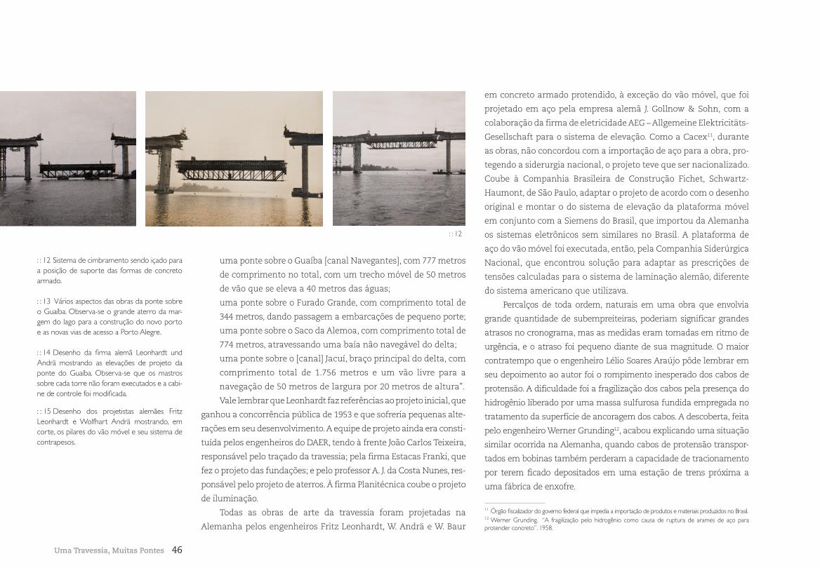
46
uma ponte sobre o Guaíba [canal Navegantes], com 777 metros
de comprimento no total, com um trecho móvel de 50 metros
de vão que se eleva a 40 metros das águas;
uma ponte sobre o Furado Grande, com comprimento total de
344 metros, dando passagem a embarcações de pequeno porte;
uma ponte sobre o Saco da Alemoa, com comprimento total de
774 metros, atravessando uma baía não navegável do delta;
uma ponte sobre o [canal] Jacuí, braço principal do delta, com
comprimento total de 1.756 metros e um vão livre para a
navegação de 50 metros de largura por 20 metros de altura”.
Vale lembrar que Leonhardt faz referências ao projeto inicial, que
ganhou a concorrência pública de 1953 e que sofreria pequenas alte-
rações em seu desenvolvimento. A equipe de projeto ainda era consti-
tuída pelos engenheiros do DAER, tendo à frente João Carlos Teixeira,
responsável pelo traçado da travessia; pela firma Estacas Franki, que
fez o projeto das fundações; e pelo professor A. J. da Costa Nunes, res-
ponsável pelo projeto de aterros. À firma Planitécnica coube o projeto
de iluminação.
Todas as obras de arte da travessia foram projetadas na
Alemanha pelos engenheiros Fritz Leonhardt, W. Andrä e W. Baur
em concreto armado protendido, à exceção do vão móvel, que foi
projetado em aço pela empresa alemã J. Gollnow & Sohn, com a
colaboração da firma de eletricidade AEG – Allgemeine Elektricitäts-
Gesellschaft para o sistema de elevação. Como a Cacex11, durante
as obras, não concordou com a importação de aço para a obra, pro-
tegendo a siderurgia nacional, o projeto teve que ser nacionalizado.
Coube à Companhia Brasileira de Construção Fichet, Schwartz-
Haumont, de São Paulo, adaptar o projeto de acordo com o desenho
original e montar o do sistema de elevação da plataforma móvel
em conjunto com a Siemens do Brasil, que importou da Alemanha
os sistemas eletrônicos sem similares no Brasil. A plataforma de
aço do vão móvel foi executada, então, pela Companhia Siderúrgica
Nacional, que encontrou solução para adaptar as prescrições de
tensões calculadas para o sistema de laminação alemão, diferente
do sistema americano que utilizava.
Percalços de toda ordem, naturais em uma obra que envolvia
grande quantidade de subempreiteiras, poderiam significar grandes
atrasos no cronograma, mas as medidas eram tomadas em ritmo de
urgência, e o atraso foi pequeno diante de sua magnitude. O maior
contratempo que o engenheiro Lélio Soares Araújo pôde lembrar em
seu depoimento ao autor foi o rompimento inesperado dos cabos de
protensão. A dificuldade foi a fragilização dos cabos pela presença do
hidrogênio liberado por uma massa sulfurosa fundida empregada no
tratamento da superfície de ancoragem dos cabos. A descoberta, feita
pelo engenheiro Werner Grunding12, acabou explicando uma situação
similar ocorrida na Alemanha, quando cabos de protensão transpor-
tados em bobinas também perderam a capacidade de tracionamento
por terem ficado depositados em uma estação de trens próxima a
uma fábrica de enxofre.
Uma Travessia, Muitas Pontes
11 Órgão fiscalizador do governo federal que impedia a importação de produtos e materiais produzidos no Brasil. 12 Werner Grunding. “A fragilização pelo hidrogênio como causa de ruptura de arames de aço para protender concreto”. 1958.
: : 12 Sistema de cimbramento sendo içado para a posição de suporte das formas de concreto armado.
: : 13 Vários aspectos das obras da ponte sobre o Guaíba. Observa-se o grande aterro da mar-gem do lago para a construção do novo porto e as novas vias de acesso a Porto Alegre.
: : 14 Desenho da firma alemã Leonhardt und Andrä mostrando as elevações de projeto da ponte do Guaíba. Observa-se que os mastros sobre cada torre não foram executados e a cabi-ne de controle foi modificada.
: : 15 Desenho dos projetistas alemães Fritz Leonhardt e Wolfhart Andrä mostrando, em corte, os pilares do vão móvel e seu sistema de contrapesos.
: : 12
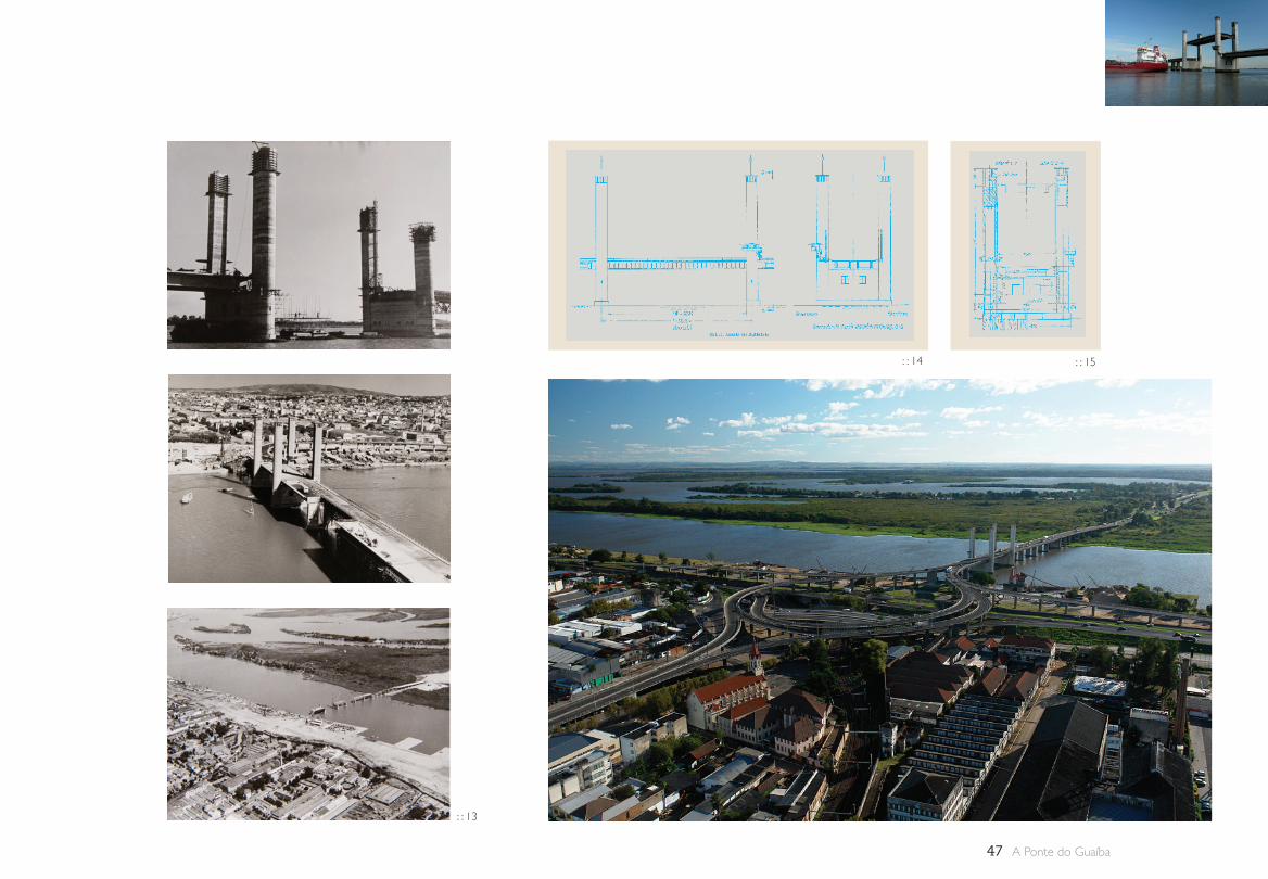
47 A Ponte do Guaíba
: : 13
: : 14 : : 15
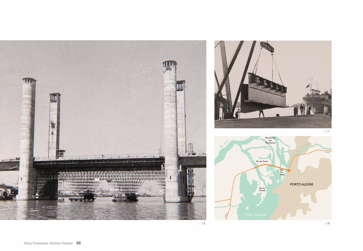
48Uma Travessia, Muitas Pontes
: : 16
: : 17
Rio Gra
vataíRio
Jacuí
Ilha Grande dos
Marinheiros
Ilha do
Pavão
Ilha das Flores
Saco da Alemoa
Ilha da Pintada
Lago Guaíba
PORTO ALEGRE
J
acuí
Nav
egan
tes
Osório
Pelo
tas
: : 18
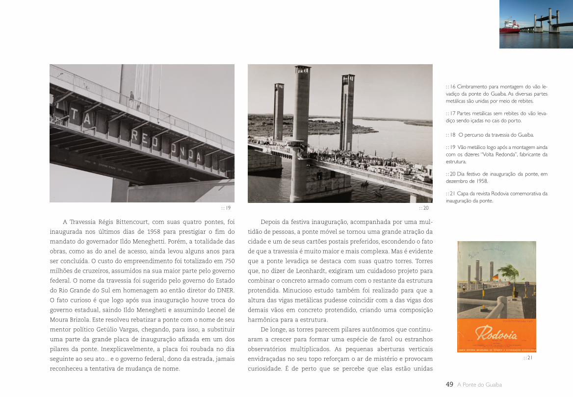
49 A Ponte do Guaíba
: : 16 Cimbramento para montagem do vão le-vadiço da ponte do Guaíba. As diversas partes metálicas são unidas por meio de rebites.
: : 17 Partes metálicas sem rebites do vão leva-diço sendo içadas no cais do porto.
: : 18 O percurso da travessia do Guaíba.
: : 19 Vão metálico logo após a montagem ainda com os dizeres “Volta Redonda”, fabricante da estrutura.
: : 20 Dia festivo de inauguração da ponte, em dezembro de 1958.
: : 21 Capa da revista Rodovia comemorativa da inauguração da ponte.
: : 19 : : 20
: : 21
A Travessia Régis Bittencourt, com suas quatro pontes, foi
inaugurada nos últimos dias de 1958 para prestigiar o fim do
mandato do governador Ildo Meneghetti. Porém, a totalidade das
obras, como as do anel de acesso, ainda levou alguns anos para
ser concluída. O custo do empreendimento foi totalizado em 750
milhões de cruzeiros, assumidos na sua maior parte pelo governo
federal. O nome da travessia foi sugerido pelo governo do Estado
do Rio Grande do Sul em homenagem ao então diretor do DNER.
O fato curioso é que logo após sua inauguração houve troca do
governo estadual, saindo Ildo Menegheti e assumindo Leonel de
Moura Brizola. Este resolveu rebatizar a ponte com o nome de seu
mentor político Getúlio Vargas, chegando, para isso, a substituir
uma parte da grande placa de inauguração afixada em um dos
pilares da ponte. Inexplicavelmente, a placa foi roubada no dia
seguinte ao seu ato... e o governo federal, dono da estrada, jamais
reconheceu a tentativa de mudança de nome.
Depois da festiva inauguração, acompanhada por uma mul-
tidão de pessoas, a ponte móvel se tornou uma grande atração da
cidade e um de seus cartões postais preferidos, escondendo o fato
de que a travessia é muito maior e mais complexa. Mas é evidente
que a ponte levadiça se destaca com suas quatro torres. Torres
que, no dizer de Leonhardt, exigiram um cuidadoso projeto para
combinar o concreto armado comum com o restante da estrutura
protendida. Minucioso estudo também foi realizado para que a
altura das vigas metálicas pudesse coincidir com a das vigas dos
demais vãos em concreto protendido, criando uma composição
harmônica para a estrutura.
De longe, as torres parecem pilares autônomos que continu-
aram a crescer para formar uma espécie de farol ou estranhos
observatórios multiplicados. As pequenas aberturas verticais
envidraçadas no seu topo reforçam o ar de mistério e provocam
curiosidade. É de perto que se percebe que elas estão unidas
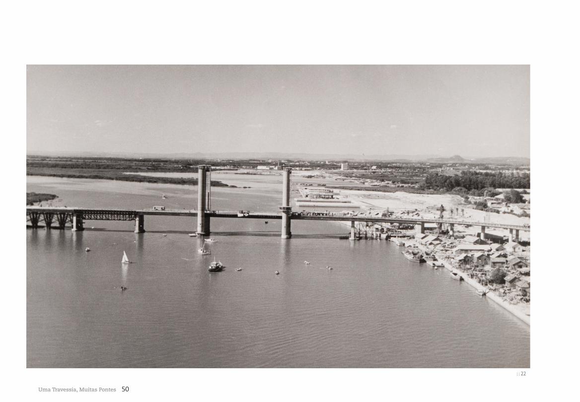
50Uma Travessia, Muitas Pontes
: : 22
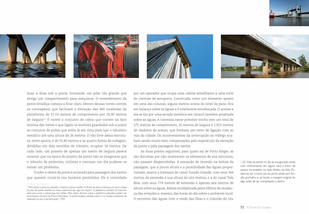
51 A Ponte do Guaíba
duas a duas sob a ponte, formando um pilar tão grande que
abriga um compartimento para máquinas. O entendimento da
ponte levadiça começa a ficar claro. Dentro dessas torres correm
os contrapesos que facilitam a elevação das 460 toneladas da
plataforma de 57,54 metros de comprimento por 18,30 metros
de largura13. É visível o conjunto de cabos que correm na face
interna das torres e que ligam os motores guardados sob a ponte
ao conjunto de polias que estão lá em cima para içar o tabuleiro
metálico até uma altura de 26 metros. O vão livre dessa estrutu-
ra, entre apoios, é de 55,80 metros e as quatro faixas de rodagem,
divididas em dois sentidos de trânsito, ocupam 16 metros. De
cada lado, um passeio de apenas um metro de largura parece
mostrar que na época do projeto da ponte não se imaginava que
o trânsito de pedestres, ciclistas e carroças um dia pudesse se
tornar um problema.
O sobe-e-desce da ponte é acionado para passagem dos navios
que querem cruzá-la nos horários permitidos. Ele é controlado
por um operador que ocupa uma cabine semelhante a uma torre
de controle de aeroporto. Construída como um elemento aposto
em uma das colunas, alguns metros acima do nível da pista, fica
em balanço sobre as águas e é totalmente envidraçada. O acesso a
ela se faz por uma escada metálica em caracol também projetada
sobre as águas. A travessia nesse primeiro trecho tem um total de
575 metros de comprimento, 16 metros de largura e 1.815 metros
de viadutos de acesso, que formam um trevo de ligação com as
vias da cidade. Os inconvenientes da interrupção do tráfego aca-
bam sendo muito bem compensados pelo espetáculo da elevação
da ponte e pela passagem dos navios.
As duas pontes seguintes, para quem sai de Porto Alegre, se
são discretas por não mostrarem os elementos de sua estrutura,
não passam despercebidas. A sensação de imersão na beleza da
paisagem, que a pouca altura e a proximidade das águas propor-
cionam, marca a travessia do canal Furado Grande, com seus 344
metros de extensão e sua altura de oito metros, e a do canal Três
Rios, com seus 774 metros de extensão e apenas seis metros de
altura sobre as águas. Beleza multiplicada pelos efeitos da mudan-
ça das estações e, mesmo, das horas do dia sobre o ambiente local.
O encontro das águas com o verde das ilhas e o colorido do céu
: : 22 Vista da ponte no dia da inauguração ainda com cimbramento em alguns vãos e trevo de acesso incompleto no lado direito da foto. Po-dem-se ver o novo cais do porto ainda sem fun-ção portuária e, ao fundo, a margem original do lago antes de ser completado o aterro.
13 Para aliviar o peso, foi utilizado o sistema, à época inédito no Brasil, de placa ortótropa, em que a chapa do piso da ponte substitui as mesas superiores das vigas em duplo T. A plataforma também foi toda sol-dada para evitar a sobrecarga dos rebites. Mais dados técnicos sobre a plataforma elevadiça podem ser encontrados em: José de Moura Villas Boas. “A ponte levadiça, soldada, sobre o rio Guaíba: problemas de obtenção do aço e de fabricação”, 1959.
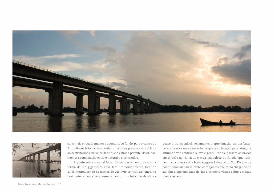
52
servem de enquadramento e apontam, ao fundo, para o centro de
Porto Alegre. Não há como evitar uma fugaz presença do sublime
ao desfrutarmos, na velocidade que a estrada permite, dessa har-
moniosa combinação entre o natural e o construído.
A ponte sobre o canal Jacuí, última desse percurso, com a
forma de um gigantesco arco, tem um comprimento total de
1.755 metros, sendo 53 metros do vão livre central. De longe, no
horizonte, a ponte se apresenta como um obstáculo de altura
quase intransponível. Felizmente, a aproximação vai desfazen-
do aos poucos essa sensação, já que a inclinação para atingir a
altura do vão central é suave e gentil. Por ele passam os navios
em direção ao rio Jacuí, o mais caudaloso do Estado, que tam-
bém faz a divisa entre Porto Alegre e Eldorado do Sul. Do alto da
ponte, como de um mirante, os viajantes que estão chegando do
sul têm a oportunidade de dar a primeira visada sobre a cidade
que os espera.
Uma Travessia, Muitas Pontes
53 A Ponte do Guaíba
Quanto mais se estuda esse projeto, mais os aspectos cons-
trutivos, de cálculo, de execução das fundações, formas, proten-
são, estrutura metálica e parte mecânica do vão móvel, além dos
aspectos arquitetônicos e formais, mostram sua relevância para a
cultura técnica e científica. Esperamos que novas pesquisas conti-
nuem a se debruçar sobre os dados apresentados neste trabalho e
que se encontram dispersos em publicações e arquivos do Brasil,
Alemanha e França, ampliando o conhecimento sobre essa obra.
A articulação da ponte com a cidade, vista de cima, mostra a
beleza de um desenho que não se consegue perceber facilmente
do solo. Um conjunto de vias entrelaçadas na forma de um círculo
faz a distribuição do trânsito em diversas direções. Abaixo deste
círculo, temos a presença das avenidas Castelo Branco e sua con-
tinuação como Free-Way, do trem suburbano, do trânsito local e do
prolongamento da avenida Voluntários da Pátria, que utiliza um
viaduto que achou seu lugar entre os elevados e a linha do metrô.
Abaixo de tudo isso, foi necessário construir uma passagem para
ligar o bairro ao porto. A complexidade de fluxos é tão grande que,
do ponto de vista do pedestre, toda essa concentração de pistas e
viadutos acabou gerando um verdadeiro não lugar inseguro e de
difícil orientação. As extensas áreas residuais só são utilizadas
uma vez por ano na tradicional Festa dos Navegantes. A cidade,
que encontrou no lago as melhores possibilidades de desenvolvi-
mento econômico, é tímida em explorá-lo em sua potencialidade
turística, cultural e de lazer.
Referências bibliográficas
BOAS, José de Moura Villas. A ponte levadiça, sol-dada, sobre o rio Guaíba: problemas de obtenção do aço e de fabricação. Separata do Boletim da Associação Brasileira de Metais, São Paulo, ABM, n. 55, 1959.
Boletim do DAER–RS, n. 36, ano IX, set. 1947. Folheto impresso pelo DAER na época da inau-guração da travessia.
GRUNDING, Werner. A fragilização pelo hidro-gênio como causa de ruptura de arames de aço para protender concreto. Separata do Boletim da Associação Brasileira de Metais, São Paulo, ABM, n. 53, 1958.
KIEFER, Flávio; LUZ, Maturino. La arquitectura de Porto Alegre. Revista Elarqa, Montevideo, n. 33, fev. 2000.
LEONHARDT, F.; Andrä, W. Die Guaiba Brücke bei Porto Alegre, Brasilien (The Guaiba Bridge at Porto Alegre, Brazil). Beton und Stahlbetonbau, n. 58, 1963, pp. 273-279.
Revista Rodovia, Rio de Janeiro, n. 226, dez. 1958.
Separata do Boletim do DAER–RS, n. 62-63, ano XVII, 1954.
SINGER, Paul. Desenvolvimento econômico e evolução urbana. São Paulo: Nacional, 1977.
SOUZA, Célia Ferraz de; MULLER, Dóris Maria. Porto Alegre e sua evolução urbana. Porto Alegre: UFRGS, 1997.
A construção da Free-Way Porto Alegre-Osório nos anos 70
complementou um sistema de distribuição de tráfego que, das
pontes, permite grande facilidade de conexão com todas as demais
estradas que cruzam a região metropolitana de Porto Alegre. Não
é preciso muito esforço para perceber a correção da localização da
travessia e sua importância no cotidiano dos porto-alegrenses. O
volume de tráfego cresceu tanto que, em 1979, tornou-se impres-
cindível sua duplicação, mostrando o acerto e a previdência de já
ter sido construída a ponte com o vão móvel com pista dupla. A
concessão da rodovia à Concepa, integrando-a à Free-Way Porto
Alegre-Osório, permitiu os investimentos necessários para a dupli-
cação do trecho restante e sua transformação em via expressa
com a construção de um viaduto de acesso a Eldorado do Sul,
cidade que cresceu às margens e como decorrência da rodovia. A
evolução do trânsito de passagem indica, contudo, que breve será
necessário construir uma nova alternativa de travessia do Guaíba.
A ponte levadiça, como também é referida, cartão postal da cida-
de, entrará, então, em um novo ciclo, absorvendo apenas o trân-
sito local. Quem sabe, mais integrada à vida do bairro e melhor
aproveitada paisagisticamente. O certo é que por muito tempo
continuará sendo uma sentinela guardiã da entrada sul da cidade.
Monumento símbolo, mostra, desde logo, o que espera o visitante.
Elementos quase medievais misturados com formas dinâmicas
que apontam para o futuro, não deixam dúvidas: aqui o conflito
entre passado e futuro, tradição e vanguarda é sempre presente.
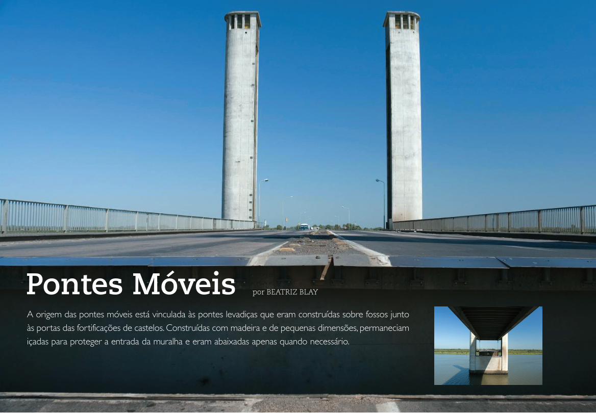
54Pontes Móveis
Pontes Móveis por BEATRIZ BLAY
A origem das pontes móveis está vinculada às pontes levadiças que eram construídas sobre fossos junto às portas das fortificações de castelos. Construídas com madeira e de pequenas dimensões, permaneciam içadas para proteger a entrada da muralha e eram abaixadas apenas quando necessário.
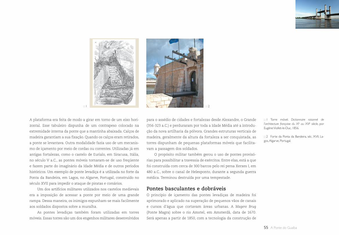
55 A Ponte do Guaíba
A plataforma era feita de modo a girar em torno de um eixo hori-
zontal. Esse tabuleiro dispunha de um contrapeso colocado na
extremidade interna da ponte que a mantinha abaixada. Calços de
madeira garantiam a sua fixação. Quando os calços eram retirados,
a ponte se levantava. Outra modalidade fazia uso de um mecanis-
mo de içamento por meio de cordas ou correntes. Utilizadas já em
antigas fortalezas, como o castelo de Eurialo, em Siracusa, Itália,
no século V a.C., as pontes móveis tornaram-se de uso freqüente
e fazem parte do imaginário da Idade Média e de outros períodos
históricos. Um exemplo de ponte levadiça é a utilizada no forte da
Ponta da Bandeira, em Lagos, no Algarve, Portugal, construído no
século XVII para impedir o ataque de piratas e corsários.
Um dos artifícios militares utilizados nos castelos medievais
era a imposição de acessar a ponte por meio de uma grande
rampa. Dessa maneira, os inimigos expunham-se mais facilmente
aos soldados dispostos sobre a muralha.
As pontes levadiças também foram utilizadas em torres
móveis. Essas torres são um dos engenhos militares desenvolvidos
: : 1 Torre móvel. Dictionnaire raisonné de l’architecture française du XIe au XVIe siècle, por Eugène Viollet-le-Duc, 1856.
: : 2 Forte da Ponta da Bandeira, séc. XVII. La-gos, Algarve, Portugal.
: : 1 : : 2
para o assédio de cidades e fortalezas desde Alexandre, o Grande
(356-323 a.C.) e perduraram por toda a Idade Média até a introdu-
ção da nova artilharia da pólvora. Grandes estruturas verticais de
madeira, geralmente da altura da fortaleza a ser conquistada, as
torres dispunham de pequenas plataformas móveis que facilita-
vam a passagem dos soldados.
O propósito militar também gerou o uso de pontes provisó-
rias para possibilitar a travessia de exércitos. Entre elas, está a que
foi construída com cerca de 300 barcos pelo rei persa Xerxes I, em
480 a.C., sobre o canal de Helesponto, durante a segunda guerra
médica. Terminou destruída por uma tempestade.
Pontes basculantes e dobráveisO princípio de içamento das pontes levadiças de madeira foi
aprimorado e aplicado na superação de pequenos vãos de canais
e cursos d’água que cortavam áreas urbanas. A Magere Brug
(Ponte Magra) sobre o rio Amstel, em Amsterdã, data de 1670.
Será apenas a partir de 1850, com a tecnologia da construção de
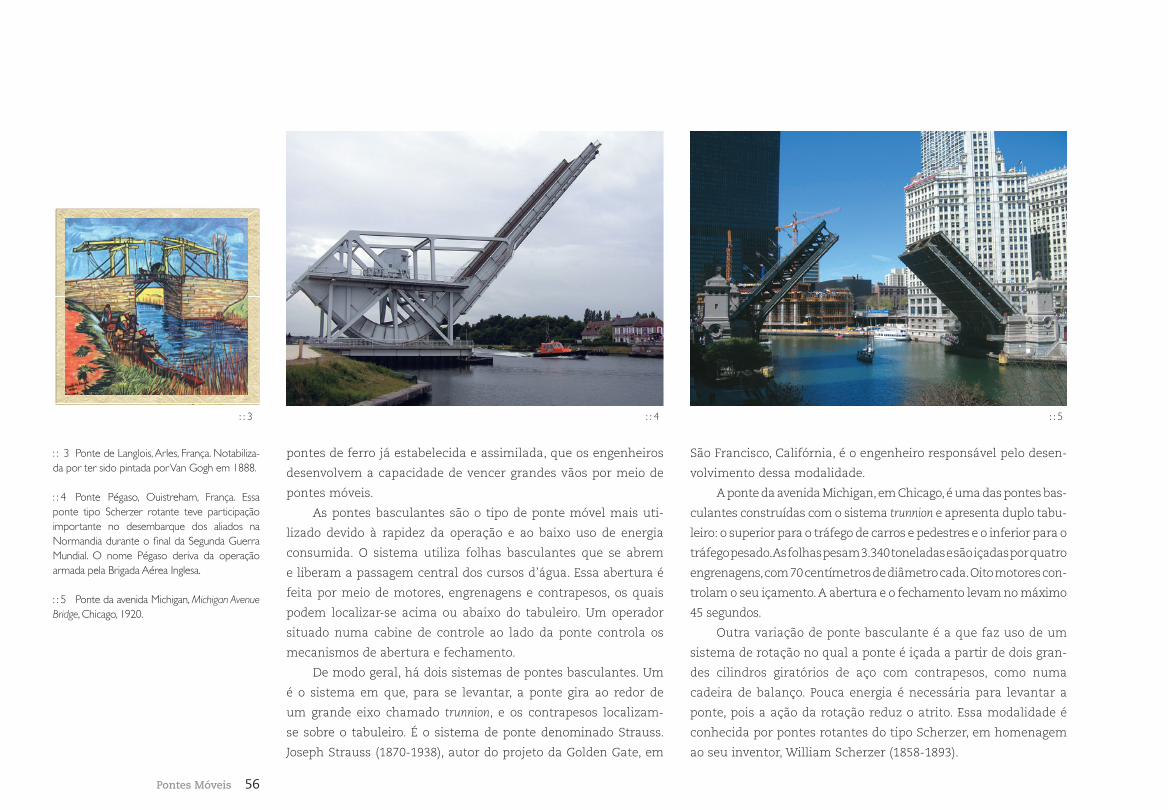
56Pontes Móveis
: : 5: : 4
pontes de ferro já estabelecida e assimilada, que os engenheiros
desenvolvem a capacidade de vencer grandes vãos por meio de
pontes móveis.
As pontes basculantes são o tipo de ponte móvel mais uti-
lizado devido à rapidez da operação e ao baixo uso de energia
consumida. O sistema utiliza folhas basculantes que se abrem
e liberam a passagem central dos cursos d’água. Essa abertura é
feita por meio de motores, engrenagens e contrapesos, os quais
podem localizar-se acima ou abaixo do tabuleiro. Um operador
situado numa cabine de controle ao lado da ponte controla os
mecanismos de abertura e fechamento.
De modo geral, há dois sistemas de pontes basculantes. Um
é o sistema em que, para se levantar, a ponte gira ao redor de
um grande eixo chamado trunnion, e os contrapesos localizam-
se sobre o tabuleiro. É o sistema de ponte denominado Strauss.
Joseph Strauss (1870-1938), autor do projeto da Golden Gate, em
São Francisco, Califórnia, é o engenheiro responsável pelo desen-
volvimento dessa modalidade.
A ponte da avenida Michigan, em Chicago, é uma das pontes bas-
culantes construídas com o sistema trunnion e apresenta duplo tabu-
leiro: o superior para o tráfego de carros e pedestres e o inferior para o
tráfego pesado. As folhas pesam 3.340 toneladas e são içadas por quatro
engrenagens, com 70 centímetros de diâmetro cada. Oito motores con-
trolam o seu içamento. A abertura e o fechamento levam no máximo
45 segundos.
Outra variação de ponte basculante é a que faz uso de um
sistema de rotação no qual a ponte é içada a partir de dois gran-
des cilindros giratórios de aço com contrapesos, como numa
cadeira de balanço. Pouca energia é necessária para levantar a
ponte, pois a ação da rotação reduz o atrito. Essa modalidade é
conhecida por pontes rotantes do tipo Scherzer, em homenagem
ao seu inventor, William Scherzer (1858-1893).
: : 3 Ponte de Langlois, Arles, França. Notabiliza-da por ter sido pintada por Van Gogh em 1888.
: : 4 Ponte Pégaso, Ouistreham, França. Essa ponte tipo Scherzer rotante teve participação importante no desembarque dos aliados na Normandia durante o final da Segunda Guerra Mundial. O nome Pégaso deriva da operação armada pela Brigada Aérea Inglesa.
: : 5 Ponte da avenida Michigan, Michigan Avenue Bridge, Chicago, 1920.
: : 3
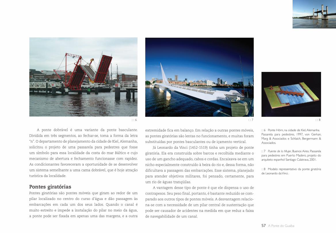
57 A Ponte do Guaíba
A ponte dobrável é uma variante da ponte basculante.
Dividida em três segmentos, ao fechar-se, toma a forma da letra
“n”. O departamento de planejamento da cidade de Kiel, Alemanha,
solicitou o projeto de uma passarela para pedestres que fosse
um símbolo para essa localidade da costa do mar Báltico e cujo
mecanismo de abertura e fechamento funcionasse com rapidez.
As condicionantes favoreceram a oportunidade de se desenvolver
um sistema semelhante a uma cama dobrável, que é hoje atração
turística da localidade.
Pontes giratóriasPontes giratórias são pontes móveis que giram ao redor de um
pilar localizado no centro do curso d’água e dão passagem às
embarcações em cada um dos seus lados. Quando o canal é
muito estreito e impede a instalação do pilar no meio da água,
a ponte pode ser fixada em apenas uma das margens, e a outra
extremidade fica em balanço. Em relação a outras pontes móveis,
as pontes giratórias são lentas no funcionamento, e muitas foram
substituídas por pontes basculantes ou de içamento vertical.
Já Leonardo da Vinci (1452-1519) tinha um projeto de ponte
giratória. Ela era construída sobre barcos e recolhida mediante o
uso de um gancho adequado, cabos e cordas. Encaixava-se em um
nicho especialmente construído à beira do rio e, dessa forma, não
dificultava a passagem das embarcações. Esse sistema, planejado
para atender objetivos militares, foi pensado, certamente, para
um rio de águas tranqüilas.
A vantagem desse tipo de ponte é que ele dispensa o uso de
contrapesos. Seu peso final, portanto, é bastante reduzido se com-
parado aos outros tipos de pontes móveis. A desvantagem relacio-
na-se com a necessidade de um pilar central de sustentação que
pode ser causador de acidentes na medida em que reduz a faixa
de navegabilidade de um canal.
: : 6 : : 7
: : 6 Ponte Hörn, na cidade de Kiel, Alemanha. Passarela para pedestres, 1997, von Gerkan, Marg & Associados e Schlaich, Bergermann & Associados.
: : 7 Puente de la Mujer, Buenos Aires. Passarela para pedestres em Puerto Madero, projeto do arquiteto espanhol Santiago Calatrava, 2001.
: : 8 Modelo representativo da ponte giratória de Leonardo da Vinci.
: : 8
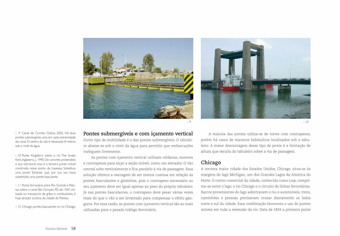
58Pontes Móveis
A maioria das pontes utiliza-se de torres com contrapesos,
porém há casos de macacos hidráulicos localizados sob o tabu-
leiro. A maior desvantagem desse tipo de ponte é a limitação de
altura que resulta do tabuleiro sobre a via de passagem.
ChicagoA terceira maior cidade dos Estados Unidos, Chicago, situa-se às
margens do lago Michigan, um dos Grandes Lagos da América do
Norte. O centro comercial da cidade, conhecido como Loop, compri-
me-se entre o lago, o rio Chicago e o circuito de linhas ferroviárias.
Barcos provenientes do lago adentravam o rio, e automóveis, trens,
caminhões e pessoas precisavam cruzar diariamente os lados
norte e sul da cidade. Essa combinação favoreceu o uso de pontes
móveis em toda a extensão do rio. Data de 1834 a primeira ponte
: : 9
Pontes submergíveis e com içamento verticalOutro tipo de mobilidade é o das pontes submergíveis. O tabulei-
ro abaixa-se sob o nível da água para permitir que embarcações
trafeguem livremente.
As pontes com içamento vertical utilizam roldanas, motores
e contrapesos para alçar a seção móvel, como um elevador. O vão
central sobe verticalmente e fica paralelo à via de passagem. Essa
solução oferece a vantagem de ser menos custosa em relação às
pontes basculantes e giratórias, pois o contrapeso necessário ao
seu içamento deve ser igual apenas ao peso do próprio tabuleiro.
Já nas pontes basculantes, o contrapeso deve pesar várias vezes
mais do que o vão a ser levantado para compensar o efeito gan-
gorra. Por essa razão, as pontes com içamento vertical são as mais
utilizadas para o pesado tráfego ferroviário.
: : 9 Canal de Corinto, Grécia, 2002. Há duas pontes submergíveis, uma em cada extremidade do canal. O centro do vão é rebaixado 8 metros sob o nível da água.
: : 10 Ponte Kingsferry sobre o rio The Swale, Kent, Inglaterra, c. 1990. De concreto protendido e aço estrutural, essa é a terceira ponte móvel construída nesse ponto da travessia. Substituiu uma ponte Scherzer que, por sua vez, havia substituído uma ponte basculante.
: : 11 Ponte ferroviária entre Rio Grande e Pelo-tas, sobre o canal São Gonçalo, RS, séc. XIX. Uti-lizada no transporte de grãos e combustíveis, é hoje atração turística da cidade de Pelotas.
: : 12 Chicago, pontes basculantes no rio Chicago.
: : 10
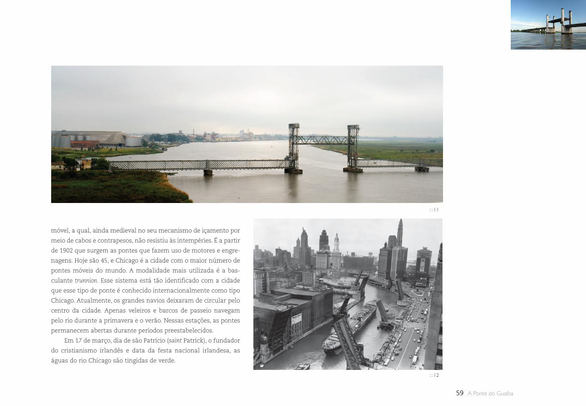
59 A Ponte do Guaíba
: : 13
móvel, a qual, ainda medieval no seu mecanismo de içamento por
meio de cabos e contrapesos, não resistiu às intempéries. É a partir
de 1902 que surgem as pontes que fazem uso de motores e engre-
nagens. Hoje são 45, e Chicago é a cidade com o maior número de
pontes móveis do mundo. A modalidade mais utilizada é a bas-
culante trunnion. Esse sistema está tão identificado com a cidade
que esse tipo de ponte é conhecido internacionalmente como tipo
Chicago. Atualmente, os grandes navios deixaram de circular pelo
centro da cidade. Apenas veleiros e barcos de passeio navegam
pelo rio durante a primavera e o verão. Nessas estações, as pontes
permanecem abertas durante períodos preestabelecidos.
Em 17 de março, dia de são Patrício (saint Patrick), o fundador
do cristianismo irlandês e data da festa nacional irlandesa, as
águas do rio Chicago são tingidas de verde.
: : 11
: : 12
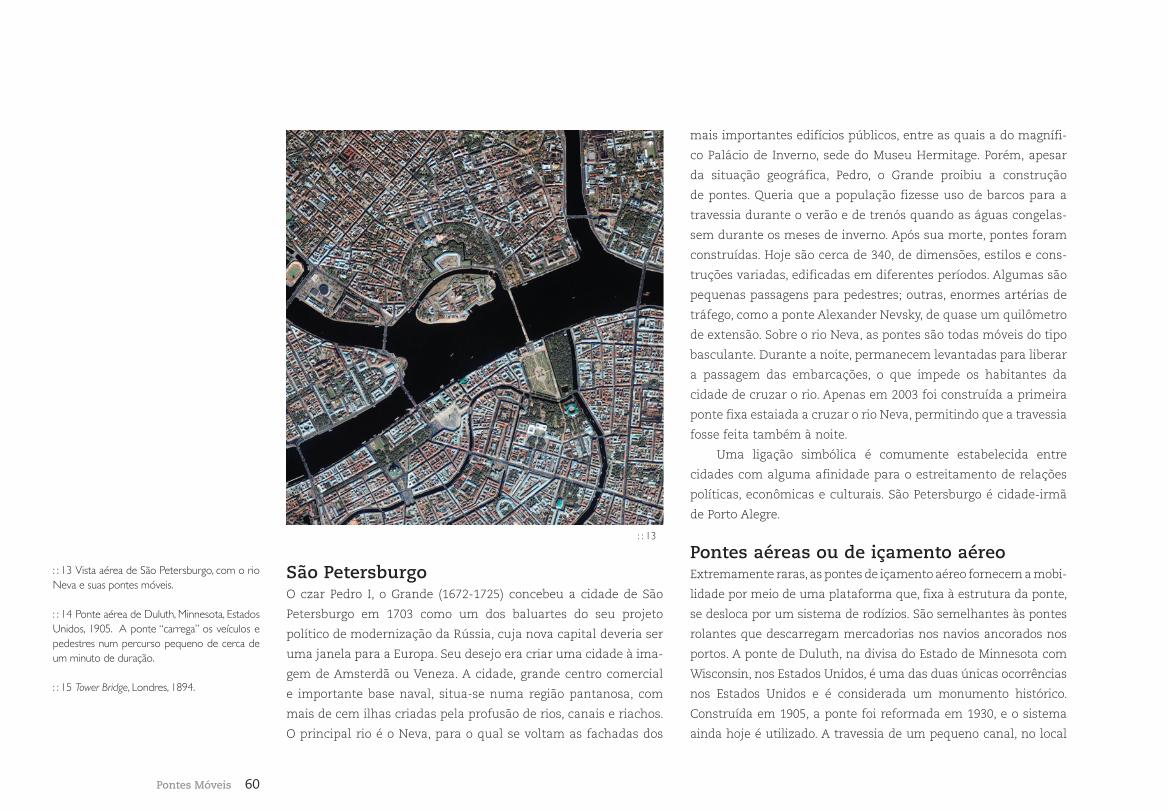
60Pontes Móveis
: : 13 Vista aérea de São Petersburgo, com o rio Neva e suas pontes móveis.
: : 14 Ponte aérea de Duluth, Minnesota, Estados Unidos, 1905. A ponte “carrega” os veículos e pedestres num percurso pequeno de cerca de um minuto de duração.
: : 15 Tower Bridge, Londres, 1894.
São PetersburgoO czar Pedro I, o Grande (1672-1725) concebeu a cidade de São
Petersburgo em 1703 como um dos baluartes do seu projeto
político de modernização da Rússia, cuja nova capital deveria ser
uma janela para a Europa. Seu desejo era criar uma cidade à ima-
gem de Amsterdã ou Veneza. A cidade, grande centro comercial
e importante base naval, situa-se numa região pantanosa, com
mais de cem ilhas criadas pela profusão de rios, canais e riachos.
O principal rio é o Neva, para o qual se voltam as fachadas dos
mais importantes edifícios públicos, entre as quais a do magnífi-
co Palácio de Inverno, sede do Museu Hermitage. Porém, apesar
da situação geográfica, Pedro, o Grande proibiu a construção
de pontes. Queria que a população fizesse uso de barcos para a
travessia durante o verão e de trenós quando as águas congelas-
sem durante os meses de inverno. Após sua morte, pontes foram
construídas. Hoje são cerca de 340, de dimensões, estilos e cons-
truções variadas, edificadas em diferentes períodos. Algumas são
pequenas passagens para pedestres; outras, enormes artérias de
tráfego, como a ponte Alexander Nevsky, de quase um quilômetro
de extensão. Sobre o rio Neva, as pontes são todas móveis do tipo
basculante. Durante a noite, permanecem levantadas para liberar
a passagem das embarcações, o que impede os habitantes da
cidade de cruzar o rio. Apenas em 2003 foi construída a primeira
ponte fixa estaiada a cruzar o rio Neva, permitindo que a travessia
fosse feita também à noite.
Uma ligação simbólica é comumente estabelecida entre
cidades com alguma afinidade para o estreitamento de relações
políticas, econômicas e culturais. São Petersburgo é cidade-irmã
de Porto Alegre.
Pontes aéreas ou de içamento aéreoExtremamente raras, as pontes de içamento aéreo fornecem a mobi-
lidade por meio de uma plataforma que, fixa à estrutura da ponte,
se desloca por um sistema de rodízios. São semelhantes às pontes
rolantes que descarregam mercadorias nos navios ancorados nos
portos. A ponte de Duluth, na divisa do Estado de Minnesota com
Wisconsin, nos Estados Unidos, é uma das duas únicas ocorrências
nos Estados Unidos e é considerada um monumento histórico.
Construída em 1905, a ponte foi reformada em 1930, e o sistema
ainda hoje é utilizado. A travessia de um pequeno canal, no local
: : 13
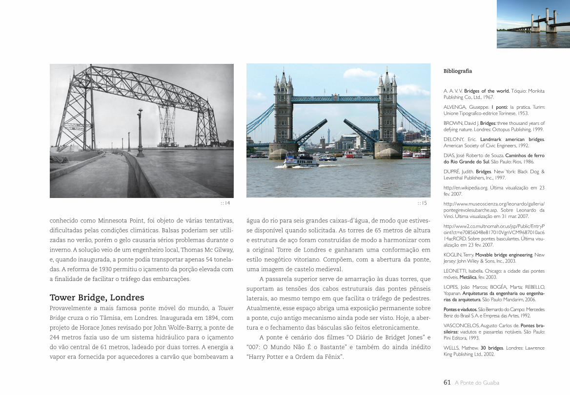
61 A Ponte do Guaíba
Bibliografia
A. A. V. V. Bridges of the world. Tóquio: Morikita Publishing Co., Ltd., 1967.
ALVENGA, Giuseppe. I ponti: la pratica. Turim: Unione Tipografico-editrice Torinese, 1953.
BROWN, David J. Bridges: three thousand years of defying nature. Londres: Octopus Publishing, 1999.
DELONY, Eric. Landmark american bridges. American Society of Civic Engineers, 1992.
DIAS, José Roberto de Souza. Caminhos de ferro do Rio Grande do Sul. São Paulo: Rios, 1986.
DUPRÉ, Judith. Bridges. New York: Black Dog & Leventhal Publishers, Inc., 1997.
http://en.wikipedia.org. Última visualização em 23 fev. 2007.
http://www.museoscienza.org/leonardo/galleria/pontegirevolesubarche.asp. Sobre Leonardo da Vinci. Última visualização em 31 mar. 2007.
http://www2.co.multnomah.or.us/jsp/Public/EntryPoint?ct=e70856048e817010VgnVCM9687010ac614acRCRD. Sobre pontes basculantes. Última visu-alização em 23 fev. 2007.
KOGLIN, Terry. Movable bridge engineering. New Jersey: John Wiley & Sons, Inc., 2003.
LEONETTI, Isabella. Chicago: a cidade das pontes móveis. Metálica, fev. 2003.
LOPES, João Marcos; BOGÉA, Marta; REBELLO, Yopanan. Arquiteturas da engenharia ou engenha-rias da arquitetura. São Paulo: Mandarim, 2006.
Pontes e viadutos. São Bernardo do Campo: Mercedes Benz do Brasil S. A. e Empresa das Artes, 1992.
VASCONCELOS, Augusto Carlos de. Pontes bra-sileiras: viadutos e passarelas notáveis. São Paulo: Pini Editora, 1993.
WELLS, Mathew. 30 bridges. Londres: Lawrence King Publishing Ltd., 2002.
conhecido como Minnesota Point, foi objeto de várias tentativas,
dificultadas pelas condições climáticas. Balsas poderiam ser utili-
zadas no verão, porém o gelo causaria sérios problemas durante o
inverno. A solução veio de um engenheiro local, Thomas Mc Gilway,
e, quando inaugurada, a ponte podia transportar apenas 54 tonela-
das. A reforma de 1930 permitiu o içamento da porção elevada com
a finalidade de facilitar o tráfego das embarcações.
Tower Bridge, LondresProvavelmente a mais famosa ponte móvel do mundo, a Tower
Bridge cruza o rio Tâmisa, em Londres. Inaugurada em 1894, com
projeto de Horace Jones revisado por John Wolfe-Barry, a ponte de
244 metros fazia uso de um sistema hidráulico para o içamento
do vão central de 61 metros, ladeado por duas torres. A energia a
vapor era fornecida por aquecedores a carvão que bombeavam a
água do rio para seis grandes caixas-d’água, de modo que estives-
se disponível quando solicitada. As torres de 65 metros de altura
e estrutura de aço foram construídas de modo a harmonizar com
a original Torre de Londres e ganharam uma conformação em
estilo neogótico vitoriano. Compõem, com a abertura da ponte,
uma imagem de castelo medieval.
A passarela superior serve de amarração às duas torres, que
suportam as tensões dos cabos estruturais das pontes pênseis
laterais, ao mesmo tempo em que facilita o tráfego de pedestres.
Atualmente, esse espaço abriga uma exposição permanente sobre
a ponte, cujo antigo mecanismo ainda pode ser visto. Hoje, a aber-
tura e o fechamento das básculas são feitos eletronicamente.
A ponte é cenário dos filmes “O Diário de Bridget Jones” e
“007: O Mundo Não É o Bastante” e também do ainda inédito
“Harry Potter e a Ordem da Fênix”.
: : 14 : : 15
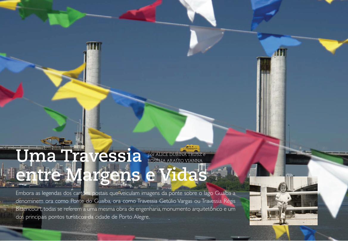
62Pontes Móveis
Uma Travessia entre Margens e Vidas
por ALICE DUBINA TRUSZ e ROSÉLIA ARAÚJO VIANNA
Embora as legendas dos cartões postais que veiculam imagens da ponte sobre o lago Guaíba a denominem ora como Ponte do Guaíba, ora como Travessia Getúlio Vargas ou Travessia Régis Bittencourt, todas se referem a uma mesma obra de engenharia, monumento arquitetônico e um dos principais pontos turísticos da cidade de Porto Alegre.
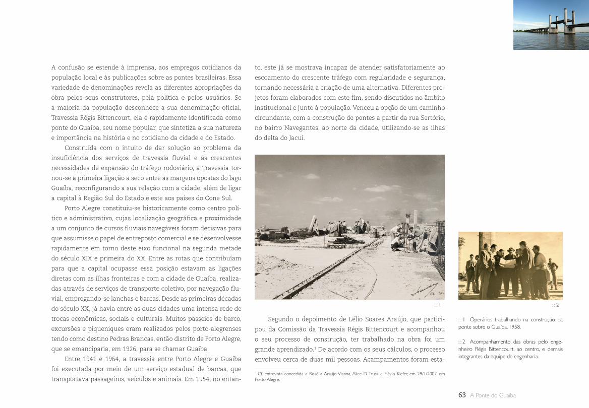
63 A Ponte do Guaíba
A confusão se estende à imprensa, aos empregos cotidianos da
população local e às publicações sobre as pontes brasileiras. Essa
variedade de denominações revela as diferentes apropriações da
obra pelos seus construtores, pela política e pelos usuários. Se
a maioria da população desconhece a sua denominação oficial,
Travessia Régis Bittencourt, ela é rapidamente identificada como
ponte do Guaíba, seu nome popular, que sintetiza a sua natureza
e importância na história e no cotidiano da cidade e do Estado.
Construída com o intuito de dar solução ao problema da
insuficiência dos serviços de travessia fluvial e às crescentes
necessidades de expansão do tráfego rodoviário, a Travessia tor-
nou-se a primeira ligação a seco entre as margens opostas do lago
Guaíba, reconfigurando a sua relação com a cidade, além de ligar
a capital à Região Sul do Estado e este aos países do Cone Sul.
Porto Alegre constituiu-se historicamente como centro polí-
tico e administrativo, cujas localização geográfica e proximidade
a um conjunto de cursos fluviais navegáveis foram decisivas para
que assumisse o papel de entreposto comercial e se desenvolvesse
rapidamente em torno deste eixo funcional na segunda metade
do século XIX e primeira do XX. Entre as rotas que contribuíam
para que a capital ocupasse essa posição estavam as ligações
diretas com as ilhas fronteiras e com a cidade de Guaíba, realiza-
das através de serviços de transporte coletivo, por navegação flu-
vial, empregando-se lanchas e barcas. Desde as primeiras décadas
do século XX, já havia entre as duas cidades uma intensa rede de
trocas econômicas, sociais e culturais. Muitos passeios de barco,
excursões e piqueniques eram realizados pelos porto-alegrenses
tendo como destino Pedras Brancas, então distrito de Porto Alegre,
que se emanciparia, em 1926, para se chamar Guaíba.
Entre 1941 e 1964, a travessia entre Porto Alegre e Guaíba
foi executada por meio de um serviço estadual de barcas, que
transportava passageiros, veículos e animais. Em 1954, no entan-
to, este já se mostrava incapaz de atender satisfatoriamente ao
escoamento do crescente tráfego com regularidade e segurança,
tornando necessária a criação de uma alternativa. Diferentes pro-
jetos foram elaborados com este fim, sendo discutidos no âmbito
institucional e junto à população. Venceu a opção de um caminho
circundante, com a construção de pontes a partir da rua Sertório,
no bairro Navegantes, ao norte da cidade, utilizando-se as ilhas
do delta do Jacuí.
: : 1 Operários trabalhando na construção da ponte sobre o Guaíba, 1958.
: : 2 Acompanhamento das obras pelo enge-nheiro Régis Bittencourt, ao centro, e demais integrantes da equipe de engenharia.
1 Cf. entrevista concedida a Rosélia Araújo Vianna, Alice D. Trusz e Flávio Kiefer, em 29/1/2007, em Porto Alegre.
: : 1 : : 2
Segundo o depoimento de Lélio Soares Araújo, que partici-
pou da Comissão da Travessia Régis Bittencourt e acompanhou
o seu processo de construção, ter trabalhado na obra foi um
grande aprendizado.1 De acordo com os seus cálculos, o processo
envolveu cerca de duas mil pessoas. Acampamentos foram esta-

64Uma Travessia entre Margens e Vidas
belecidos nas redondezas para dar suporte aos trabalhadores.
Operários locais e técnicos franceses e alemães tiveram os seus
trabalhos acompanhados por engenheiros como Edmundo Régis
Bittencourt, o diretor do DNER, Ildo Meneguetti e Leonel Brizola,
respectivamente governador do Estado e prefeito de Porto Alegre,
além do padre Arthur Wickert, da paróquia de Nossa Senhora dos
Navegantes, que visitaram habitualmente o canteiro de obras.
A localização do trecho inicial da travessia no bairro
Navegantes e o seu prosseguimento nas ilhas provocaram altera-
ções não só sobre o aspecto físico da região, mas sobre o cotidiano
de seus respectivos moradores. Ao longo de sua história, a região
do Navegantes sofreu grandes transformações físicas e sociais.
Inicialmente uma zona rural, fora dos limites urbanos da cidade,
local de fixação de residências de verão e chácaras de abastados
portugueses e seus descendentes, cedeu lugar ao uso residencial
de classes menos privilegiadas, constituídas, sobretudo, por imi-
grantes, no século XIX.
A capital gaúcha iniciou o seu povoamento na região entre
as atuais Ponta do Gasômetro e praça da Alfândega, e se esten-
deu em direção à Zona Sul e, logo após, à Zona Norte, então
zonas semi-rurais. Desde 1806, quando foi aberto o Caminho
Novo (atual avenida Voluntários da Pátria), a área urbana e cen-
tral que delimitava Porto Alegre passou a se comunicar com os
municípios da Região Norte (Gravataí, Santo Antônio, Osório e
Vacaria), desfrutando de um novo e belo passeio que margeava
o lago, sendo, ao mesmo tempo, abastecida por meio dele. O
Caminho Novo se tornou, após 1850, rota de um intenso tráfego
de carretas dirigidas ao mercado público central. Foi neste eixo
que o Navegantes se desenvolveu, ganhando impulso a partir da
construção da estrada de ferro entre Porto Alegre, São Leopoldo
(1874) e Novo Hamburgo (1876) e da abertura das primeiras ruas,
a partir de 1870.
Fatores como o loteamento de algumas chácaras e a melho-
ria dos transportes impulsionaram a densificação populacional
da região. Aproveitando a abundante mão-de-obra, a existência de
vias férreas e a proximidade de pontos de atracação, ali se instala-
ram as primeiras indústrias, contribuindo para que o Navegantes
se afirmasse como o arrabalde operário da cidade na virada do
século. Essas primeiras fábricas eram pequenos e médios estabe-
lecimentos que produziam para consumo interno, abastecendo
com bens não duráveis a região colonial. Destacaram-se as indús-
trias de fiação e tecidos, crescendo e ganhando renome nacional
fábricas como A. J. Renner & Cia. e Companhia Industrial Rio
Guahyba, entre outras.
A partir de 1926, quando foram estendidas redes de água até
as residências do arrabalde, ocorreu um expressivo aumento da
construção de moradias, sobretudo de madeira. Novos moradores
chegaram à região, entre os quais imigrantes europeus, fugindo
das guerras na Europa. Entre estes estava o polonês Wasyl Trusz,
: : 3 Panorama da rua Voluntários da Pátria na década de 1910: vista do centro em direção ao arrabalde dos Navegantes.
: : 3
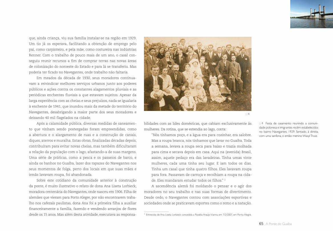
65 A Ponte do Guaíba
que, ainda criança, viu sua família instalar-se na região em 1929.
Um tio já os esperava, facilitando a obtenção de emprego pelo
pai, como carpinteiro, e pela mãe, como costureira nas indústrias
Renner. Com o trabalho de pouco mais de um ano, o casal con-
seguiu reunir recursos a fim de comprar terras nas novas áreas
de colonização do noroeste do Estado e para lá se transferiu. Mas
poderia ter ficado no Navegantes, onde trabalho não faltaria.
Em meados da década de 1930, seus moradores continua-
vam a reivindicar melhores serviços urbanos junto aos poderes
públicos e ações contra os constantes alagamentos pluviais e as
periódicas enchentes fluviais a que estavam sujeitos. Apesar da
larga experiência com as cheias e seus prejuízos, nada se igualaria
à enchente de 1941, que inundou mais da metade do território do
Navegantes, desabrigando a maior parte dos seus moradores e
deixando 40 mil flagelados na cidade.
Após a calamidade pública, diversas medidas de saneamen-
to que vinham sendo postergadas foram empreendidas, como
a abertura e o alargamento de ruas e a construção de canais,
diques, aterros e muralha. Estas obras, finalizadas décadas depois,
contribuíram para evitar novas cheias, mas também dificultaram
a relação da população com o lago, afastando-a de suas margens.
Uma série de práticas, como a pesca e os passeios de barco, e
ainda os banhos no Guaíba, lazer dos rapazes do Navegantes nos
seus momentos de folga, perto dos locais em que suas mães e
irmãs lavavam roupa, foi abandonada.
Sobre este cotidiano da comunidade anterior à construção
da ponte, é muito ilustrativo o relato de dona Ana Liseta Lorbieck,
moradora centenária do Navegantes, onde nasceu em 1906. Filha de
alemães que vieram para Porto Alegre, por não encontrarem traba-
lho nos cafezais paulistas, dona Ana foi a primeira filha a auxiliar
financeiramente a família, fazendo e vendendo arranjos de flores
desde os 15 anos. Mas além desta atividade, executava as responsa-
bilidades com as lides domésticas, que cabiam exclusivamente às
mulheres. Da rotina, que se estendia ao lago, conta:
“Nós tínhamos poço, e a água era para cozinhar, era salobre.
Mas a roupa branca, nós tínhamos que lavar no Guaíba. Toda
a semana, levava a roupa seca para baixo e trazia molhada
para cima e secava depois em casa. Aqui na (avenida) Brasil,
assim, aquele pedaço era das lavadeiras. Tinha umas vinte
mulheres, cada uma tinha seu lugar. E iam todos os dias.
Tinha um casal que tinha quatro filhos. Eles lavavam roupa
para fora. Passavam de carroça e recolhiam a roupa na cida-
de. Eles mandaram estudar todos os filhos.” 2
A ascendência alemã foi moldando o pensar e o agir dos
moradores no seu trabalho e nas suas formas de divertimento.
Desde cedo, o Navegantes contou com associações esportivas e
sociedades onde se praticavam esportes como o remo e a natação.
: : 4 Festa de casamento reunindo a comuni-dade polonesa e imigrantes recém-estabelecidos no bairro Navegantes, 1929. Sentado, à direita, com uma sanfona, o então menino Wasyl Trusz.
2 Entrevista de Ana Liseta Lorbieck concedida a Rosélia Araújo Vianna, em 7/2/2007, em Porto Alegre.
: : 4
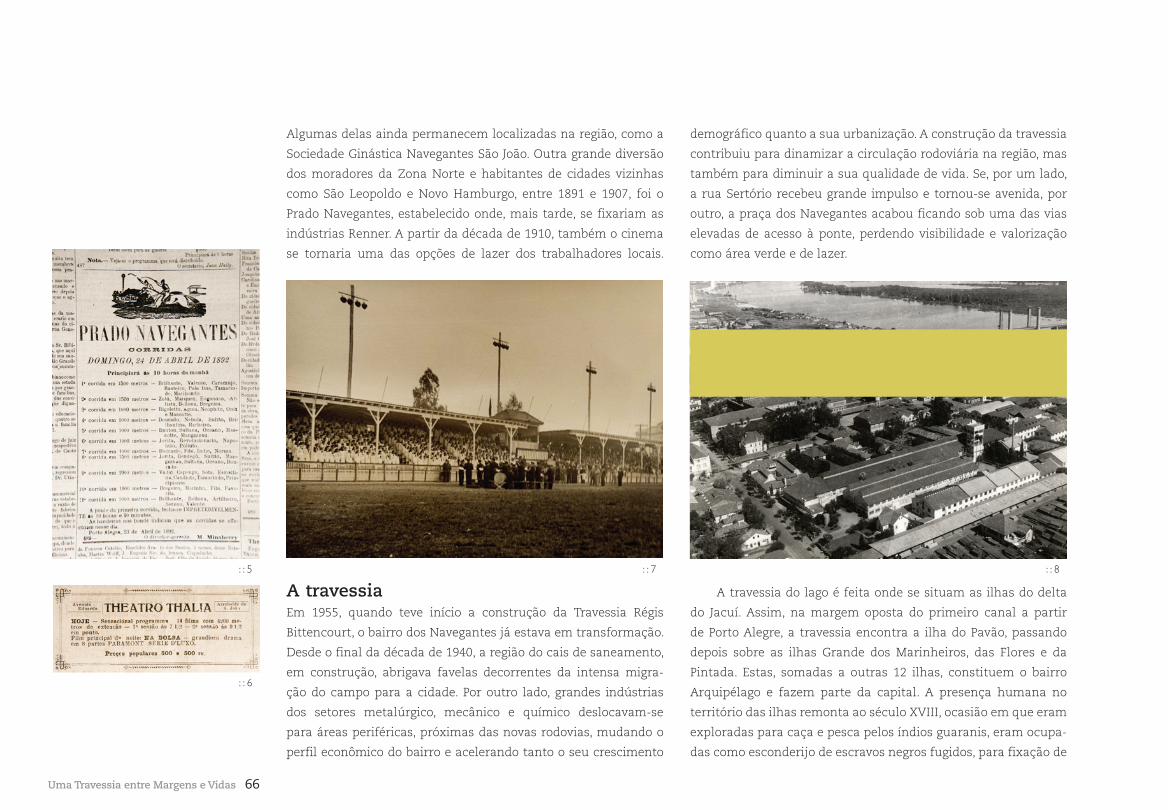
66
demográfico quanto a sua urbanização. A construção da travessia
contribuiu para dinamizar a circulação rodoviária na região, mas
também para diminuir a sua qualidade de vida. Se, por um lado,
a rua Sertório recebeu grande impulso e tornou-se avenida, por
outro, a praça dos Navegantes acabou ficando sob uma das vias
elevadas de acesso à ponte, perdendo visibilidade e valorização
como área verde e de lazer.
Algumas delas ainda permanecem localizadas na região, como a
Sociedade Ginástica Navegantes São João. Outra grande diversão
dos moradores da Zona Norte e habitantes de cidades vizinhas
como São Leopoldo e Novo Hamburgo, entre 1891 e 1907, foi o
Prado Navegantes, estabelecido onde, mais tarde, se fixariam as
indústrias Renner. A partir da década de 1910, também o cinema
se tornaria uma das opções de lazer dos trabalhadores locais.
Uma Travessia entre Margens e Vidas
: : 5
: : 6
: : 7 : : 8
A travessiaEm 1955, quando teve início a construção da Travessia Régis
Bittencourt, o bairro dos Navegantes já estava em transformação.
Desde o final da década de 1940, a região do cais de saneamento,
em construção, abrigava favelas decorrentes da intensa migra-
ção do campo para a cidade. Por outro lado, grandes indústrias
dos setores metalúrgico, mecânico e químico deslocavam-se
para áreas periféricas, próximas das novas rodovias, mudando o
perfil econômico do bairro e acelerando tanto o seu crescimento
A travessia do lago é feita onde se situam as ilhas do delta
do Jacuí. Assim, na margem oposta do primeiro canal a partir
de Porto Alegre, a travessia encontra a ilha do Pavão, passando
depois sobre as ilhas Grande dos Marinheiros, das Flores e da
Pintada. Estas, somadas a outras 12 ilhas, constituem o bairro
Arquipélago e fazem parte da capital. A presença humana no
território das ilhas remonta ao século XVIII, ocasião em que eram
exploradas para caça e pesca pelos índios guaranis, eram ocupa-
das como esconderijo de escravos negros fugidos, para fixação de
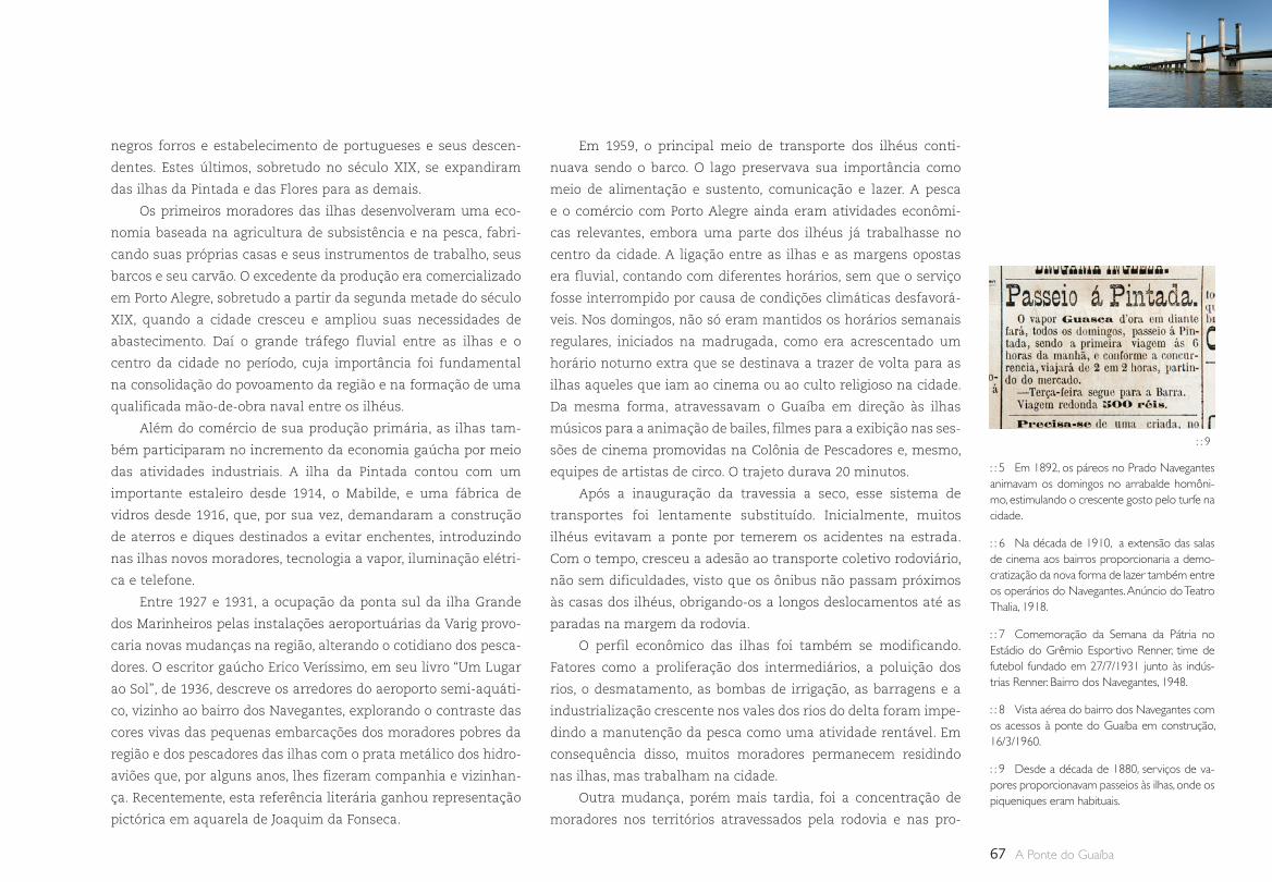
67 A Ponte do Guaíba
negros forros e estabelecimento de portugueses e seus descen-
dentes. Estes últimos, sobretudo no século XIX, se expandiram
das ilhas da Pintada e das Flores para as demais.
Os primeiros moradores das ilhas desenvolveram uma eco-
nomia baseada na agricultura de subsistência e na pesca, fabri-
cando suas próprias casas e seus instrumentos de trabalho, seus
barcos e seu carvão. O excedente da produção era comercializado
em Porto Alegre, sobretudo a partir da segunda metade do século
XIX, quando a cidade cresceu e ampliou suas necessidades de
abastecimento. Daí o grande tráfego fluvial entre as ilhas e o
centro da cidade no período, cuja importância foi fundamental
na consolidação do povoamento da região e na formação de uma
qualificada mão-de-obra naval entre os ilhéus.
Além do comércio de sua produção primária, as ilhas tam-
bém participaram no incremento da economia gaúcha por meio
das atividades industriais. A ilha da Pintada contou com um
importante estaleiro desde 1914, o Mabilde, e uma fábrica de
vidros desde 1916, que, por sua vez, demandaram a construção
de aterros e diques destinados a evitar enchentes, introduzindo
nas ilhas novos moradores, tecnologia a vapor, iluminação elétri-
ca e telefone.
Entre 1927 e 1931, a ocupação da ponta sul da ilha Grande
dos Marinheiros pelas instalações aeroportuárias da Varig provo-
caria novas mudanças na região, alterando o cotidiano dos pesca-
dores. O escritor gaúcho Erico Veríssimo, em seu livro “Um Lugar
ao Sol”, de 1936, descreve os arredores do aeroporto semi-aquáti-
co, vizinho ao bairro dos Navegantes, explorando o contraste das
cores vivas das pequenas embarcações dos moradores pobres da
região e dos pescadores das ilhas com o prata metálico dos hidro-
aviões que, por alguns anos, lhes fizeram companhia e vizinhan-
ça. Recentemente, esta referência literária ganhou representação
pictórica em aquarela de Joaquim da Fonseca.
Em 1959, o principal meio de transporte dos ilhéus conti-
nuava sendo o barco. O lago preservava sua importância como
meio de alimentação e sustento, comunicação e lazer. A pesca
e o comércio com Porto Alegre ainda eram atividades econômi-
cas relevantes, embora uma parte dos ilhéus já trabalhasse no
centro da cidade. A ligação entre as ilhas e as margens opostas
era fluvial, contando com diferentes horários, sem que o serviço
fosse interrompido por causa de condições climáticas desfavorá-
veis. Nos domingos, não só eram mantidos os horários semanais
regulares, iniciados na madrugada, como era acrescentado um
horário noturno extra que se destinava a trazer de volta para as
ilhas aqueles que iam ao cinema ou ao culto religioso na cidade.
Da mesma forma, atravessavam o Guaíba em direção às ilhas
músicos para a animação de bailes, filmes para a exibição nas ses-
sões de cinema promovidas na Colônia de Pescadores e, mesmo,
equipes de artistas de circo. O trajeto durava 20 minutos.
Após a inauguração da travessia a seco, esse sistema de
transportes foi lentamente substituído. Inicialmente, muitos
ilhéus evitavam a ponte por temerem os acidentes na estrada.
Com o tempo, cresceu a adesão ao transporte coletivo rodoviário,
não sem dificuldades, visto que os ônibus não passam próximos
às casas dos ilhéus, obrigando-os a longos deslocamentos até as
paradas na margem da rodovia.
O perfil econômico das ilhas foi também se modificando.
Fatores como a proliferação dos intermediários, a poluição dos
rios, o desmatamento, as bombas de irrigação, as barragens e a
industrialização crescente nos vales dos rios do delta foram impe-
dindo a manutenção da pesca como uma atividade rentável. Em
consequência disso, muitos moradores permanecem residindo
nas ilhas, mas trabalham na cidade.
Outra mudança, porém mais tardia, foi a concentração de
moradores nos territórios atravessados pela rodovia e nas pro-
: : 5 Em 1892, os páreos no Prado Navegantes animavam os domingos no arrabalde homôni-mo, estimulando o crescente gosto pelo turfe na cidade.
: : 6 Na década de 1910, a extensão das salas de cinema aos bairros proporcionaria a demo-cratização da nova forma de lazer também entre os operários do Navegantes. Anúncio do Teatro Thalia, 1918.
: : 7 Comemoração da Semana da Pátria no Estádio do Grêmio Esportivo Renner, time de futebol fundado em 27/7/1931 junto às indús-trias Renner. Bairro dos Navegantes, 1948.
: : 8 Vista aérea do bairro dos Navegantes com os acessos à ponte do Guaíba em construção, 16/3/1960.
: : 9 Desde a década de 1880, serviços de va-pores proporcionavam passeios às ilhas, onde os piqueniques eram habituais.
: : 9
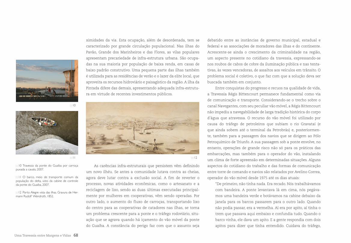
68Uma Travessia entre Margens e Vidas
ximidades da via. Esta ocupação, além de desordenada, tem se
caracterizado por grande circulação populacional. Nas ilhas do
Pavão, Grande dos Marinheiros e das Flores, as vilas populares
apresentam precariedade de infra-estrutura urbana. São ocupa-
das na sua maioria por população de baixa renda, em casas de
baixo padrão construtivo. Uma pequena parte das ilhas também
é utilizada para as residências de verão e o lazer da elite local, que
aproveita os recursos hidroviário e paisagístico da região. A ilha da
Pintada difere das demais, apresentando adequada infra-estrutu-
ra em virtude de recentes investimentos públicos.
debatido entre as instâncias de governo municipal, estadual e
federal e as associações de moradores das ilhas e do continente.
Acrescente-se ainda o crescimento da criminalidade na região,
um aspecto presente no cotidiano da travessia, expressando-se
nos roubos de cabos de cobre da iluminação pública e nas tenta-
tivas, às vezes vencedoras, de assaltos aos veículos em trânsito. O
problema social é coletivo, o que faz com que a solução deva ser
buscada também em conjunto.
Entre conquistas do progresso e recuos na qualidade de vida,
a Travessia Régis Bittencourt permanece fundamental como via
de comunicação e transporte. Considerando-se o trecho sobre o
canal Navegantes, com seu peculiar vão móvel, a Régis Bittencourt
não impediu a navegabilidade de larga tradição histórica do corpo
d’água que atravessa. O recurso do vão móvel foi utilizado por
causa do tráfego de petroleiros que subiam o rio Gravataí (e
que ainda sobem até o terminal da Petrobrás) e, posteriormen-
te, também para a passagem dos navios que se dirigem ao Pólo
Petroquímico de Triunfo. A sua passagem sob a ponte envolve, no
entanto, operações de grande risco não só para os práticos das
embarcações, mas também para o operador do vão, instalando
um clima de forte apreensão em determinadas situações. Alguns
aspectos do cotidiano do trabalho e das formas de comunicação
entre torre de comando e navios são relatados por Avelino Correa,
operador do vão móvel desde 1975 até os dias atuais:
“De primeiro, não tinha nada. Era recado. Nós trabalhávamos
com bandeira. A ponte levantava lá em cima, nós pegáva-
mos uma bandeira verde e botávamos na cabine debaixo da
janela para os barcos passarem para o outro lado. Quando
não podia passar, era a vermelha. Aí era por apito, aí tinha o
trem que passava aqui embaixo e confundia tudo. Quando o
barco vinha, ele dava um apito. E a gente respondia com dois
apitos para dizer que tinha entendido. Cuidava do tráfego,
: : 10 Travessia da ponte do Guaíba por carroça puxada a cavalo, 2007.
: : 11 O barco, meio de transporte comum da população do delta, visto da cabine de controle da ponte do Guaíba, 2007.
: : 12 Porto Alegre vista das ilhas. Gravura de Her-mann Rudolf Wendroth, 1852.
: : 12
As carências infra-estruturais que persistem vêm definindo
um novo ilhéu. Se antes a comunidade lutava contra as cheias,
agora deve lutar contra a exclusão social. A fim de reverter o
processo, novas atividades econômicas, como o artesanato e a
reciclagem de lixo, sendo as duas últimas executadas principal-
mente por mulheres em cooperativas, vêm sendo operadas. Por
outro lado, o aumento do fluxo de carroças, transportando lixo
do centro para as cooperativas de catadores nas ilhas, se torna
um problema crescente para a ponte e o tráfego rodoviário, situ-
ação que se agrava quando há içamento do vão móvel da ponte
do Guaíba. A constância do perigo faz com que o assunto seja
: : 10
: : 11
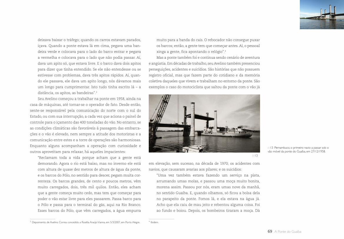
69 A Ponte do Guaíba
deixava baixar o tráfego; quando os carros estavam parados,
içava. Quando a ponte estava lá em cima, pegava uma ban-
deira verde e colocava para o lado do barco entrar e pegava
a vermelha e colocava para o lado que não podia passar. Aí,
dava um apito só, que estava livre. E o barco dava dois apitos
para dizer que tinha entendido. Se ele não entendesse ou se
estivesse com problemas, dava três apitos rápidos. Aí, quan-
do ele passava, ele dava um apito longo, nós dávamos mais
um longo para cumprimentar. Isto tudo tinha escrito lá – a
distância, os apitos, as bandeiras”.3
Seu Avelino começou a trabalhar na ponte em 1958, ainda na
casa de máquinas, até tornar-se o operador de fato. Desde então,
sente-se responsável pela comunicação do norte com o sul do
Estado, ou com sua interrupção, a cada vez que aciona o painel de
controle para o içamento das 400 toneladas do vão. No entanto, se
as condições climáticas são favoráveis à passagem das embarca-
ções e o vão é elevado, nem sempre a atitude dos motoristas e a
comunicação entre estes e a torre de operações são harmoniosas.
Enquanto alguns acompanham a operação com curiosidade e
outros aproveitam para relaxar, há aqueles impacientes:
“Reclamam toda a vida porque acham que a gente está
demorando. Agora o rio está baixo, mas no inverno ele está
com altura de quase dez metros de altura de água da ponte,
e os barcos do Pólo, no sentido para descer, pegam muita cor-
renteza. Os barcos grandes, de cento e poucos metros, vêm
muito carregados, dois, três mil quilos. Então, eles acham
que a gente começa muito cedo, mas tem que começar para
poder o vão estar livre para eles passarem. Passa barco para
o Pólo e passa para o terminal do gás, aqui na Rio Branco.
Esses barcos do Pólo, que vêm carregados, a água empurra
muito para a banda do cais. O rebocador não consegue puxar
os barcos; então, a gente tem que começar antes. Aí, o pessoal
xinga a gente, fica apontando o relógio”.4
Mas a ponte também foi e continua sendo cenário de aventura
e angústia. Em décadas de trabalho, seu Avelino também presenciou
perseguições, acidentes e suicídios. São histórias que não possuem
registro oficial, mas que fazem parte do cotidiano e da memória
coletiva daqueles que vivem e trabalham no entorno da ponte. São
exemplos o caso do motociclista que saltou da ponte com o vão já
: : 13 Pernambuco, o primeiro navio a passar sob o vão móvel da ponte do Guaíba, em 27/12/1958.
3 Depoimento de Avelino Correa concedido a Rosélia Araújo Vianna, em 5/3/2007, em Porto Alegre. 4 Ibidem.
em elevação, sem sucesso, na década de 1970; os acidentes com
navios, que causaram avarias aos pilares; e os suicídios:
“Uma vez também estava fazendo um serviço na pista,
arrumando umas molas, e passou uma moça muito bonita,
morena assim. Passou por nós, eram umas nove da manhã,
no sentido Guaíba. E, quando olhamos, só ficou a bolsa dela
no parapeito da ponte. Fomos lá, e ela estava na água já.
Acho que ela caiu de mau jeito e rebentou alguma coisa. Foi
ao fundo e boiou. Depois, os bombeiros tiraram a moça. Dá
: : 13
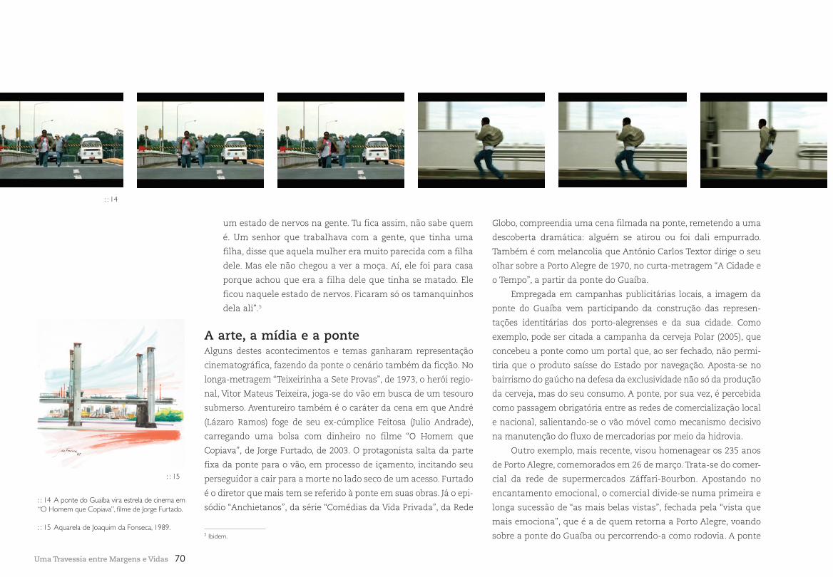
70Uma Travessia entre Margens e Vidas
um estado de nervos na gente. Tu fica assim, não sabe quem
é. Um senhor que trabalhava com a gente, que tinha uma
filha, disse que aquela mulher era muito parecida com a filha
dele. Mas ele não chegou a ver a moça. Aí, ele foi para casa
porque achou que era a filha dele que tinha se matado. Ele
ficou naquele estado de nervos. Ficaram só os tamanquinhos
dela ali”.5
A arte, a mídia e a ponte Alguns destes acontecimentos e temas ganharam representação
cinematográfica, fazendo da ponte o cenário também da ficção. No
longa-metragem “Teixeirinha a Sete Provas”, de 1973, o herói regio-
nal, Vitor Mateus Teixeira, joga-se do vão em busca de um tesouro
submerso. Aventureiro também é o caráter da cena em que André
(Lázaro Ramos) foge de seu ex-cúmplice Feitosa (Julio Andrade),
carregando uma bolsa com dinheiro no filme “O Homem que
Copiava”, de Jorge Furtado, de 2003. O protagonista salta da parte
fixa da ponte para o vão, em processo de içamento, incitando seu
perseguidor a cair para a morte no lado seco de um acesso. Furtado
é o diretor que mais tem se referido à ponte em suas obras. Já o epi-
sódio “Anchietanos”, da série “Comédias da Vida Privada”, da Rede
Globo, compreendia uma cena filmada na ponte, remetendo a uma
descoberta dramática: alguém se atirou ou foi dali empurrado.
Também é com melancolia que Antônio Carlos Textor dirige o seu
olhar sobre a Porto Alegre de 1970, no curta-metragem “A Cidade e
o Tempo”, a partir da ponte do Guaíba.
Empregada em campanhas publicitárias locais, a imagem da
ponte do Guaíba vem participando da construção das represen-
tações identitárias dos porto-alegrenses e da sua cidade. Como
exemplo, pode ser citada a campanha da cerveja Polar (2005), que
concebeu a ponte como um portal que, ao ser fechado, não permi-
tiria que o produto saísse do Estado por navegação. Aposta-se no
bairrismo do gaúcho na defesa da exclusividade não só da produção
da cerveja, mas do seu consumo. A ponte, por sua vez, é percebida
como passagem obrigatória entre as redes de comercialização local
e nacional, salientando-se o vão móvel como mecanismo decisivo
na manutenção do fluxo de mercadorias por meio da hidrovia.
Outro exemplo, mais recente, visou homenagear os 235 anos
de Porto Alegre, comemorados em 26 de março. Trata-se do comer-
cial da rede de supermercados Záffari-Bourbon. Apostando no
encantamento emocional, o comercial divide-se numa primeira e
longa sucessão de “as mais belas vistas”, fechada pela “vista que
mais emociona”, que é a de quem retorna a Porto Alegre, voando
sobre a ponte do Guaíba ou percorrendo-a como rodovia. A ponte
: : 14 A ponte do Guaíba vira estrela de cinema em “O Homem que Copiava”, filme de Jorge Furtado.
: : 15 Aquarela de Joaquim da Fonseca, 1989.
: : 15
: : 14
5 Ibidem.
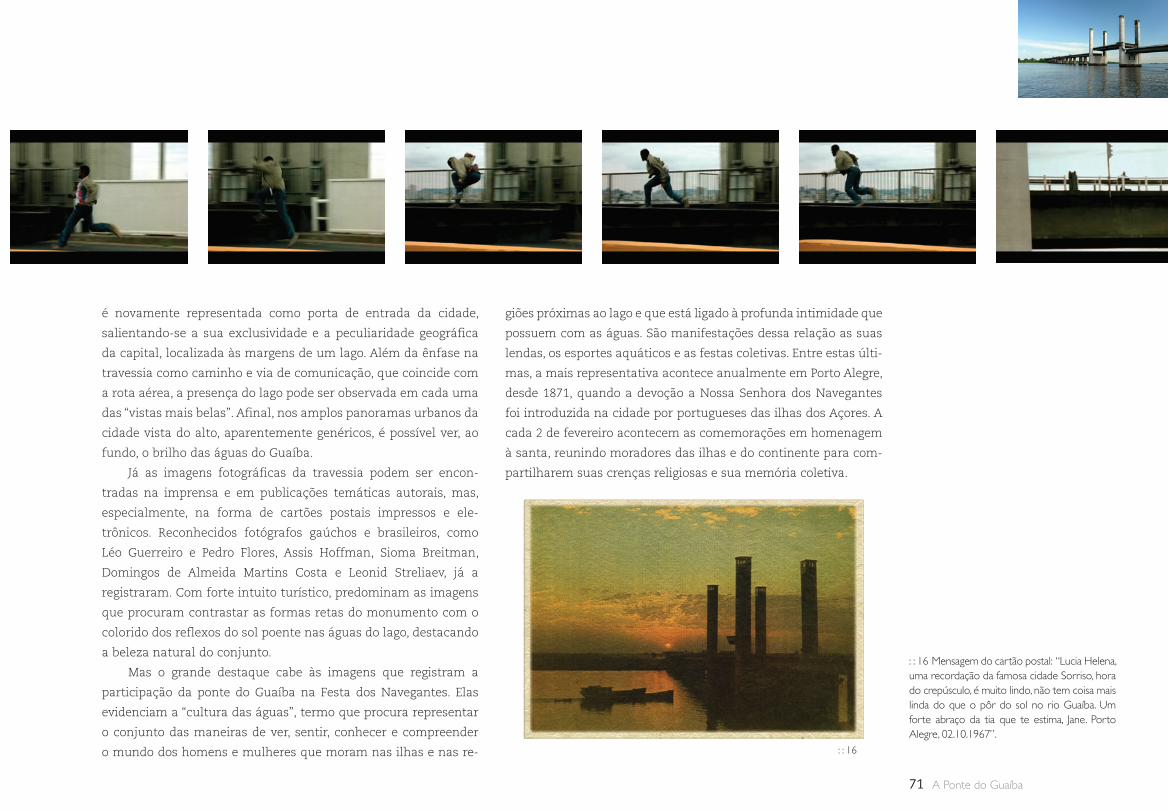
71 A Ponte do Guaíba
é novamente representada como porta de entrada da cidade,
salientando-se a sua exclusividade e a peculiaridade geográfica
da capital, localizada às margens de um lago. Além da ênfase na
travessia como caminho e via de comunicação, que coincide com
a rota aérea, a presença do lago pode ser observada em cada uma
das “vistas mais belas”. Afinal, nos amplos panoramas urbanos da
cidade vista do alto, aparentemente genéricos, é possível ver, ao
fundo, o brilho das águas do Guaíba.
Já as imagens fotográficas da travessia podem ser encon-
tradas na imprensa e em publicações temáticas autorais, mas,
especialmente, na forma de cartões postais impressos e ele-
trônicos. Reconhecidos fotógrafos gaúchos e brasileiros, como
Léo Guerreiro e Pedro Flores, Assis Hoffman, Sioma Breitman,
Domingos de Almeida Martins Costa e Leonid Streliaev, já a
registraram. Com forte intuito turístico, predominam as imagens
que procuram contrastar as formas retas do monumento com o
colorido dos reflexos do sol poente nas águas do lago, destacando
a beleza natural do conjunto.
Mas o grande destaque cabe às imagens que registram a
participação da ponte do Guaíba na Festa dos Navegantes. Elas
evidenciam a “cultura das águas”, termo que procura representar
o conjunto das maneiras de ver, sentir, conhecer e compreender
o mundo dos homens e mulheres que moram nas ilhas e nas re-
giões próximas ao lago e que está ligado à profunda intimidade que
possuem com as águas. São manifestações dessa relação as suas
lendas, os esportes aquáticos e as festas coletivas. Entre estas últi-
mas, a mais representativa acontece anualmente em Porto Alegre,
desde 1871, quando a devoção a Nossa Senhora dos Navegantes
foi introduzida na cidade por portugueses das ilhas dos Açores. A
cada 2 de fevereiro acontecem as comemorações em homenagem
à santa, reunindo moradores das ilhas e do continente para com-
partilharem suas crenças religiosas e sua memória coletiva.
: : 16 Mensagem do cartão postal: “Lucia Helena, uma recordação da famosa cidade Sorriso, hora do crepúsculo, é muito lindo, não tem coisa mais linda do que o pôr do sol no rio Guaíba. Um forte abraço da tia que te estima, Jane. Porto Alegre, 02.10.1967”.
: : 16
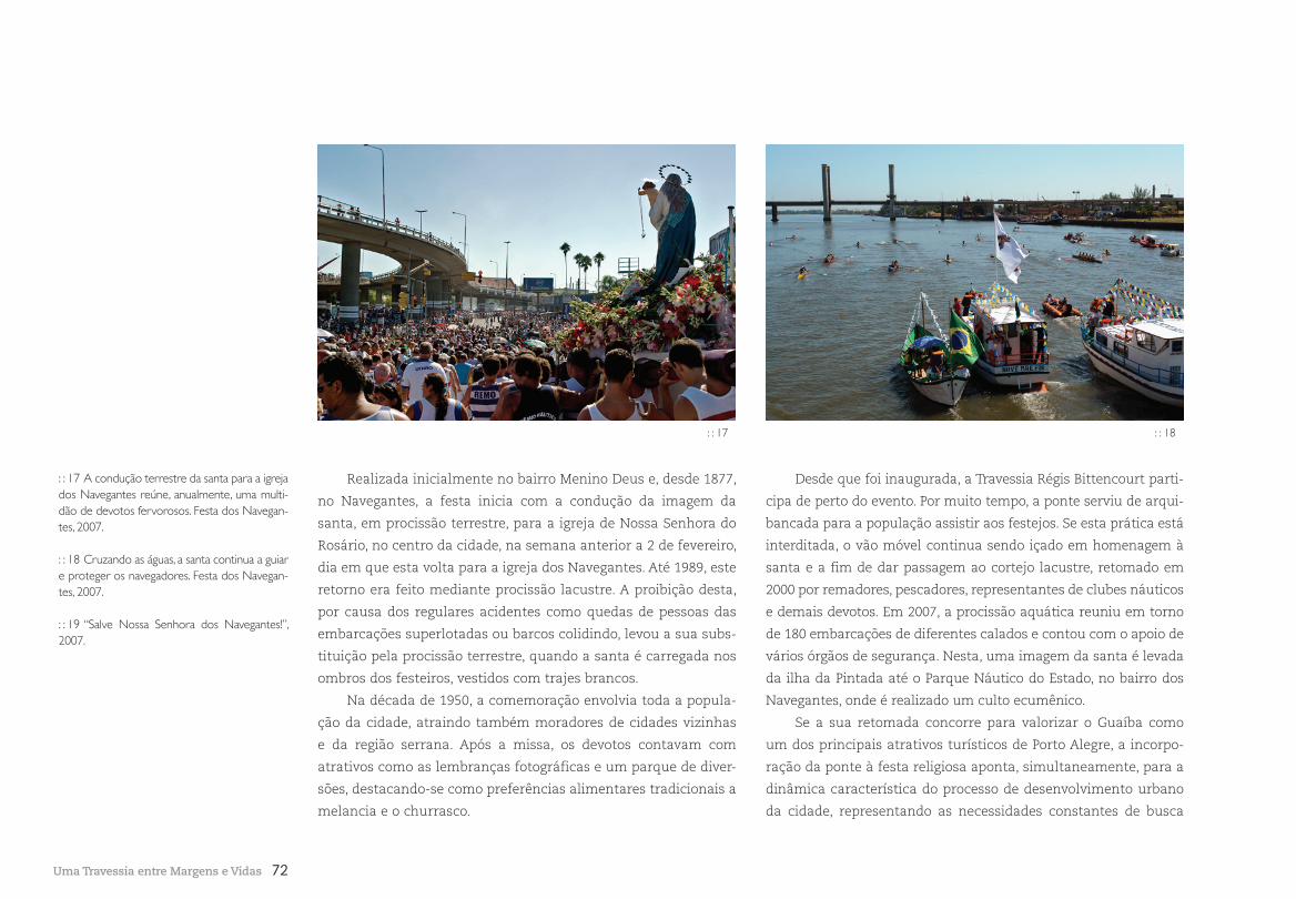
72
Realizada inicialmente no bairro Menino Deus e, desde 1877,
no Navegantes, a festa inicia com a condução da imagem da
santa, em procissão terrestre, para a igreja de Nossa Senhora do
Rosário, no centro da cidade, na semana anterior a 2 de fevereiro,
dia em que esta volta para a igreja dos Navegantes. Até 1989, este
retorno era feito mediante procissão lacustre. A proibição desta,
por causa dos regulares acidentes como quedas de pessoas das
embarcações superlotadas ou barcos colidindo, levou a sua subs-
tituição pela procissão terrestre, quando a santa é carregada nos
ombros dos festeiros, vestidos com trajes brancos.
Na década de 1950, a comemoração envolvia toda a popula-
ção da cidade, atraindo também moradores de cidades vizinhas
e da região serrana. Após a missa, os devotos contavam com
atrativos como as lembranças fotográficas e um parque de diver-
sões, destacando-se como preferências alimentares tradicionais a
melancia e o churrasco.
Uma Travessia entre Margens e Vidas
Desde que foi inaugurada, a Travessia Régis Bittencourt parti-
cipa de perto do evento. Por muito tempo, a ponte serviu de arqui-
bancada para a população assistir aos festejos. Se esta prática está
interditada, o vão móvel continua sendo içado em homenagem à
santa e a fim de dar passagem ao cortejo lacustre, retomado em
2000 por remadores, pescadores, representantes de clubes náuticos
e demais devotos. Em 2007, a procissão aquática reuniu em torno
de 180 embarcações de diferentes calados e contou com o apoio de
vários órgãos de segurança. Nesta, uma imagem da santa é levada
da ilha da Pintada até o Parque Náutico do Estado, no bairro dos
Navegantes, onde é realizado um culto ecumênico.
Se a sua retomada concorre para valorizar o Guaíba como
um dos principais atrativos turísticos de Porto Alegre, a incorpo-
ração da ponte à festa religiosa aponta, simultaneamente, para a
dinâmica característica do processo de desenvolvimento urbano
da cidade, representando as necessidades constantes de busca
: : 17 A condução terrestre da santa para a igreja dos Navegantes reúne, anualmente, uma multi-dão de devotos fervorosos. Festa dos Navegan-tes, 2007.
: : 18 Cruzando as águas, a santa continua a guiar e proteger os navegadores. Festa dos Navegan-tes, 2007.
: : 19 “Salve Nossa Senhora dos Navegantes!”, 2007.
: : 17 : : 18
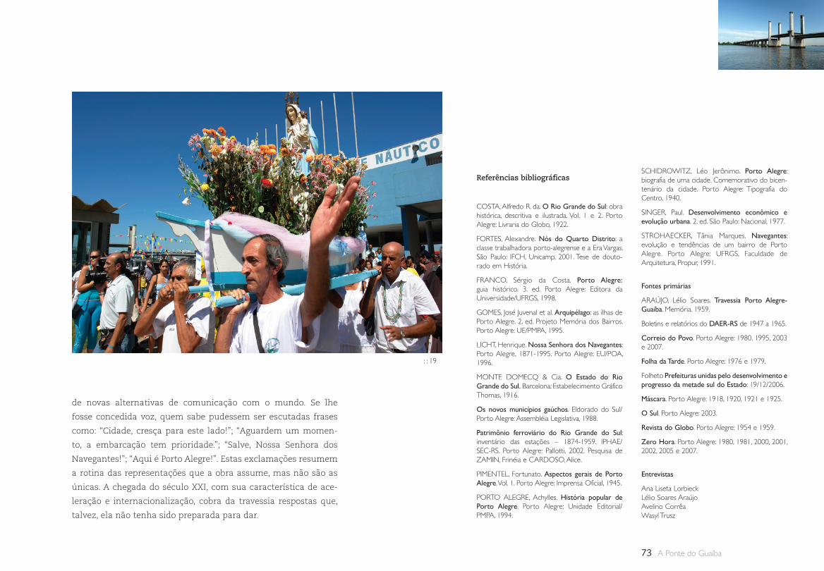
73 A Ponte do Guaíba
SCHIDROWITZ, Léo Jerônimo. Porto Alegre: biografia de uma cidade. Comemorativo do bicen-tenário da cidade. Porto Alegre: Tipografia do Centro, 1940.
SINGER, Paul. Desenvolvimento econômico e evolução urbana. 2. ed. São Paulo: Nacional, 1977.
STROHAECKER, Tânia Marques. Navegantes: evolução e tendências de um bairro de Porto Alegre. Porto Alegre: UFRGS, Faculdade de Arquitetura, Propur, 1991.
Fontes primárias
ARAÚJO, Lélio Soares. Travessia Porto Alegre-Guaíba. Memória. 1959.
Boletins e relatórios do DAER-RS de 1947 a 1965.
Correio do Povo. Porto Alegre: 1980, 1995, 2003 e 2007.
Folha da Tarde. Porto Alegre: 1976 e 1979.
Folheto Prefeituras unidas pelo desenvolvimento e progresso da metade sul do Estado: 19/12/2006.
Máscara. Porto Alegre: 1918, 1920, 1921 e 1925.
O Sul. Porto Alegre: 2003.
Revista do Globo. Porto Alegre: 1954 e 1959.
Zero Hora. Porto Alegre: 1980, 1981, 2000, 2001, 2002, 2005 e 2007.
Entrevistas
Ana Liseta LorbieckLélio Soares AraújoAvelino CorrêaWasyl Trusz
Referências bibliográficas
COSTA, Alfredo R. da. O Rio Grande do Sul: obra histórica, descritiva e ilustrada. Vol. 1 e 2. Porto Alegre: Livraria do Globo, 1922.
FORTES, Alexandre. Nós do Quarto Distrito: a classe trabalhadora porto-alegrense e a Era Vargas. São Paulo: IFCH, Unicamp, 2001. Tese de douto-rado em História.
FRANCO, Sérgio da Costa. Porto Alegre: guia histórico. 3. ed. Porto Alegre: Editora da Universidade/UFRGS, 1998.
GOMES, José Juvenal et al. Arquipélago: as ilhas de Porto Alegre. 2. ed. Projeto Memória dos Bairros. Porto Alegre: UE/PMPA, 1995.
LICHT, Henrique. Nossa Senhora dos Navegantes: Porto Alegre, 1871-1995. Porto Alegre: EU/POA, 1996.
MONTE DOMECQ & Cia. O Estado do Rio Grande do Sul. Barcelona: Estabelecimento Gráfico Thomas, 1916.
Os novos municípios gaúchos. Eldorado do Sul/Porto Alegre: Assembléia Legislativa, 1988.
Patrimônio ferroviário do Rio Grande do Sul: inventário das estações – 1874-1959. IPHAE/ SEC-RS. Porto Alegre: Pallotti, 2002. Pesquisa de ZAMIN, Frinéia e CARDOSO, Alice.
PIMENTEL, Fortunato. Aspectos gerais de Porto Alegre. Vol. 1. Porto Alegre: Imprensa Oficial, 1945.
PORTO ALEGRE, Achylles. História popular de Porto Alegre. Porto Alegre: Unidade Editorial/PMPA, 1994.
: : 19
de novas alternativas de comunicação com o mundo. Se lhe
fosse concedida voz, quem sabe pudessem ser escutadas frases
como: “Cidade, cresça para este lado!”; “Aguardem um momen-
to, a embarcação tem prioridade.”; “Salve, Nossa Senhora dos
Navegantes!”; “Aqui é Porto Alegre!”. Estas exclamações resumem
a rotina das representações que a obra assume, mas não são as
únicas. A chegada do século XXI, com sua característica de ace-
leração e internacionalização, cobra da travessia respostas que,
talvez, ela não tenha sido preparada para dar.
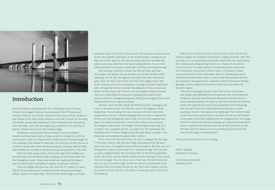
74
Introduction
With this edition celebrating the 10th anniversary of the Concepa
(Osório-Porto Alegre Freeway Concessionaire), The TPI Social and
Cultural Institute, an institute created by the Grupo Triunfo, wishes to
pay tribute to the State of Rio Grande do Sul and to Brazil. By choosing
this theme, we are also preparing to start celebrating the 50 years of
what has been, since the very beginning, a symbol of the identity of
the Rio Grande do Sul State: the Guaíba bridge.
Impressive, monumental characteristics from an aesthetic,
creative and functional point of view, as well as integration with the
environment, were the criteria used in selecting the winning design for
the crossing of the Guaíba 50 years ago. The harmony of the venture as
a whole is made clear when we drive along the crossing, read through
the specification records or attentively study the pictures in this book.
From one side, ramps lead to the access ring to the bridges, in a
smooth slope of intertwined roads, reaching the motorway level over
the Navegantes canal. These ramp-roads are supported by elegant
round shaped pillars unfolding at regular, continuous intervals.
Then the bridge stretches over the canal for 777 meters to reach
Ilha do Pavão, leaning over a series of double oblong round edged
pillars, rooted on a single base. The 50 meter draw bridge is partially
contained right at the start of this stretch, and the span maintains and
boosts the aesthetic expression of the double pillars. Looking across
they are further apart so that the motorway can fit in between the
pillars and, rising, they form the deck hoisting towers. It is as if the
pillars had been cut across, moved over to let the motorway through.
The crossing continues towards the Ilha do Pavão and near
the margins, the pillars are sub-divided into circular section pillars
repeating, two by two, the rigorous spacing of the other side of the
span. Then, we reach the stretch over the Chico Inglês canal. This
small crossing, just as the subsequent crossings, has been duplicated
with a bridge that did not consider the elegance of the previous one.
When we look closer, the contrast with the original design becomes
clear, as it maintained the sequence repeating the shape of the
previous stretch: a bridge leaning over oblong round edged pillars, here
placed one by one at regular intervals.
We then reach the Ilha Grande dos Marinheiros and, crossing it, we
come to the next section: the Três Rios canal. This segment, fairly
longer than the preceding one, was overcome with the motorway
supported by circular columns bringing back the duos to repeat the
section over the Navegantes canal. Here, the structure repeats once
again the continual intervals of the double pillars only to stop as
the margins come nearer. The height of the bridge is even and, as it
is above a non navigable section, it is quite low. The horizontal line
formed by the 774 meter bridge across the lake draws a streak in the
landscape surrounding this grand water surface.
Once across the Ilha das Flores, we start to prepare for the long
1 756 meter stretch with the last bridge spanning across the Jacuí
canal. As this is a navigable section twice as large as the first one, the
Navegantes, there no need exists for a movable bridge. The solution
is quite straightforward; the motorway still on the island, gradually
moves up on the circular pillars, which become oblong as they recede
from the margin. Over the Jacuí canal, they have 50 meter intervals
and are up to 20 meters high. Unlike the almost unnoticeable slope
upwards, the arch shaped arrival on the other side is steep, reduced
to a series of short columns. The effect is amazing: this is the end of
the crossing.
Other than its vital function in the exit and traffic system out
of Porto Alegre, the landmark itself plays a highly symbolic role. The
Concepa, as a concessionary enterprise, responsible for maintaining
the crossing and safeguarding its role as a means of circulation,
is also aware of its responsibility in maintaining and preserving
this monument of precious cultural value. It is based on these
two premises that it has undertaken this ever challenging, never
abandoned,commitment. And it is also under this perspective that
we remember the appropriate comments made by Professor Rualdo
Menegat, when studying the beautiful aerial pictures taken by
Eduardo Aigner:
“The picture changes the post card: built to be a monument,
and always photographed from the ground, now the 50 year-old
bridge has become more beautiful because it is framed by the
surrounding landscape. 50 years on, we now abandon the patriotic
pride of an agricultural nation just acquainted with technology
that wanted to become industrialized and became a nation
aspiring to recover the beauty of its landscape. The Guaíba bridge
caused the island populations to increase, but we can still breath
in the green of the delta spilling over the background of the image
where it is framed by the hills, making up a beautiful scene which
seems to spawn from an ancestral nature that contrasts, on the
left side, with the skyline of the overwhelming city. Would this
now be the bridge of sustainability?”
Thank you all and have a nice crossing!
Odenir Sanches,
President of Concepa
Carlo Alberto Bottarelli,
President of TPI
Introduction
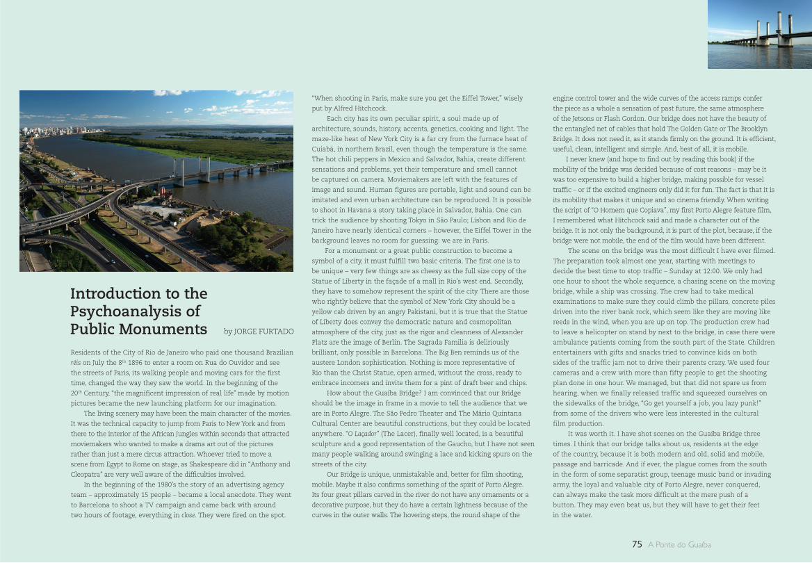
75 A Ponte do Guaíba
Introduction to the Psychoanalysis of Public MonumentsResidents of the City of Rio de Janeiro who paid one thousand Brazilian
réis on July the 8th 1896 to enter a room on Rua do Ouvidor and see
the streets of Paris, its walking people and moving cars for the first
time, changed the way they saw the world. In the beginning of the
20th Century, “the magnificent impression of real life” made by motion
pictures became the new launching platform for our imagination.
The living scenery may have been the main character of the movies.
It was the technical capacity to jump from Paris to New York and from
there to the interior of the African Jungles within seconds that attracted
moviemakers who wanted to make a drama art out of the pictures
rather than just a mere circus attraction. Whoever tried to move a
scene from Egypt to Rome on stage, as Shakespeare did in “Anthony and
Cleopatra” are very well aware of the difficulties involved.
In the beginning of the 1980’s the story of an advertising agency
team – approximately 15 people – became a local anecdote. They went
to Barcelona to shoot a TV campaign and came back with around
two hours of footage, everything in close. They were fired on the spot.
“When shooting in Paris, make sure you get the Eiffel Tower,” wisely
put by Alfred Hitchcock.
Each city has its own peculiar spirit, a soul made up of
architecture, sounds, history, accents, genetics, cooking and light. The
maze-like heat of New York City is a far cry from the furnace heat of
Cuiabá, in northern Brazil, even though the temperature is the same.
The hot chili peppers in Mexico and Salvador, Bahia, create different
sensations and problems, yet their temperature and smell cannot
be captured on camera. Moviemakers are left with the features of
image and sound. Human figures are portable, light and sound can be
imitated and even urban architecture can be reproduced. It is possible
to shoot in Havana a story taking place in Salvador, Bahia. One can
trick the audience by shooting Tokyo in São Paulo; Lisbon and Rio de
Janeiro have nearly identical corners – however, the Eiffel Tower in the
background leaves no room for guessing: we are in Paris.
For a monument or a great public construction to become a
symbol of a city, it must fulfill two basic criteria. The first one is to
be unique – very few things are as cheesy as the full size copy of the
Statue of Liberty in the façade of a mall in Rio’s west end. Secondly,
they have to somehow represent the spirit of the city. There are those
who rightly believe that the symbol of New York City should be a
yellow cab driven by an angry Pakistani, but it is true that the Statue
of Liberty does convey the democratic nature and cosmopolitan
atmosphere of the city, just as the rigor and cleanness of Alexander
Platz are the image of Berlin. The Sagrada Familia is deliriously
brilliant, only possible in Barcelona. The Big Ben reminds us of the
austere London sophistication. Nothing is more representative of
Rio than the Christ Statue, open armed, without the cross, ready to
embrace incomers and invite them for a pint of draft beer and chips.
How about the Guaíba Bridge? I am convinced that our Bridge
should be the image in frame in a movie to tell the audience that we
are in Porto Alegre. The São Pedro Theater and The Mário Quintana
Cultural Center are beautiful constructions, but they could be located
anywhere. “O Laçador” (The Lacer), finally well located, is a beautiful
sculpture and a good representation of the Gaucho, but I have not seen
many people walking around swinging a lace and kicking spurs on the
streets of the city.
Our Bridge is unique, unmistakable and, better for film shooting,
mobile. Maybe it also confirms something of the spirit of Porto Alegre.
Its four great pillars carved in the river do not have any ornaments or a
decorative purpose, but they do have a certain lightness because of the
curves in the outer walls. The hovering steps, the round shape of the
engine control tower and the wide curves of the access ramps confer
the piece as a whole a sensation of past future, the same atmosphere
of the Jetsons or Flash Gordon. Our bridge does not have the beauty of
the entangled net of cables that hold The Golden Gate or The Brooklyn
Bridge. It does not need it, as it stands firmly on the ground. It is efficient,
useful, clean, intelligent and simple. And, best of all, it is mobile.
I never knew (and hope to find out by reading this book) if the
mobility of the bridge was decided because of cost reasons – may be it
was too expensive to build a higher bridge, making possible for vessel
traffic – or if the excited engineers only did it for fun. The fact is that it is
its mobility that makes it unique and so cinema friendly. When writing
the script of “O Homem que Copiava”, my first Porto Alegre feature film,
I remembered what Hitchcock said and made a character out of the
bridge. It is not only the background, it is part of the plot, because, if the
bridge were not mobile, the end of the film would have been different.
The scene on the bridge was the most difficult I have ever filmed.
The preparation took almost one year, starting with meetings to
decide the best time to stop traffic – Sunday at 12:00. We only had
one hour to shoot the whole sequence, a chasing scene on the moving
bridge, while a ship was crossing. The crew had to take medical
examinations to make sure they could climb the pillars, concrete piles
driven into the river bank rock, which seem like they are moving like
reeds in the wind, when you are up on top. The production crew had
to leave a helicopter on stand by next to the bridge, in case there were
ambulance patients coming from the south part of the State. Children
entertainers with gifts and snacks tried to convince kids on both
sides of the traffic jam not to drive their parents crazy. We used four
cameras and a crew with more than fifty people to get the shooting
plan done in one hour. We managed, but that did not spare us from
hearing, when we finally released traffic and squeezed ourselves on
the sidewalks of the bridge, “Go get yourself a job, you lazy punk!”
from some of the drivers who were less interested in the cultural
film production.
It was worth it. I have shot scenes on the Guaíba Bridge three
times. I think that our bridge talks about us, residents at the edge
of the country, because it is both modern and old, solid and mobile,
passage and barricade. And if ever, the plague comes from the south
in the form of some separatist group, teenage music band or invading
army, the loyal and valuable city of Porto Alegre, never conquered,
can always make the task more difficult at the mere push of a
button. They may even beat us, but they will have to get their feet
in the water.
by JORGE FURTADO
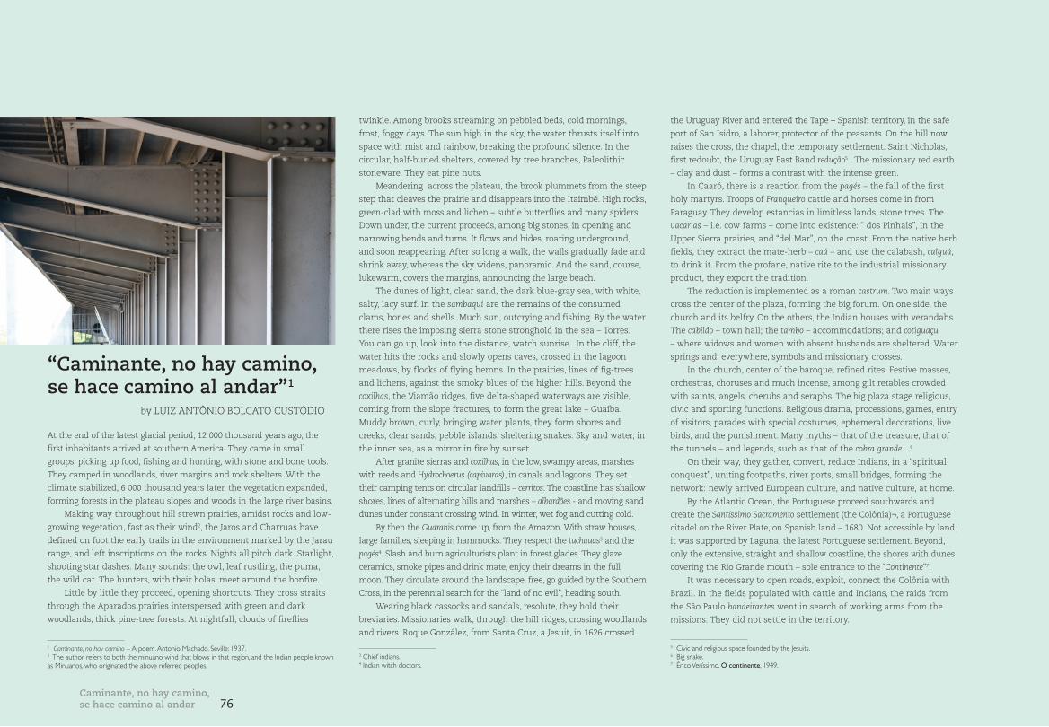
76Caminante, no hay camino, se hace camino al andar
by LUIZ ANTÔNIO BOLCATO CUSTÓDIO
At the end of the latest glacial period, 12 000 thousand years ago, the
first inhabitants arrived at southern America. They came in small
groups, picking up food, fishing and hunting, with stone and bone tools.
They camped in woodlands, river margins and rock shelters. With the
climate stabilized, 6 000 thousand years later, the vegetation expanded,
forming forests in the plateau slopes and woods in the large river basins.
Making way throughout hill strewn prairies, amidst rocks and low-
growing vegetation, fast as their wind2, the Jaros and Charruas have
defined on foot the early trails in the environment marked by the Jarau
range, and left inscriptions on the rocks. Nights all pitch dark. Starlight,
shooting star dashes. Many sounds: the owl, leaf rustling, the puma,
the wild cat. The hunters, with their bolas, meet around the bonfire.
Little by little they proceed, opening shortcuts. They cross straits
through the Aparados prairies interspersed with green and dark
woodlands, thick pine-tree forests. At nightfall, clouds of fireflies
twinkle. Among brooks streaming on pebbled beds, cold mornings,
frost, foggy days. The sun high in the sky, the water thrusts itself into
space with mist and rainbow, breaking the profound silence. In the
circular, half-buried shelters, covered by tree branches, Paleolithic
stoneware. They eat pine nuts.
Meandering across the plateau, the brook plummets from the steep
step that cleaves the prairie and disappears into the Itaimbé. High rocks,
green-clad with moss and lichen – subtle butterflies and many spiders.
Down under, the current proceeds, among big stones, in opening and
narrowing bends and turns. It flows and hides, roaring underground,
and soon reappearing. After so long a walk, the walls gradually fade and
shrink away, whereas the sky widens, panoramic. And the sand, course,
lukewarm, covers the margins, announcing the large beach.
The dunes of light, clear sand, the dark blue-gray sea, with white,
salty, lacy surf. In the sambaqui are the remains of the consumed
clams, bones and shells. Much sun, outcrying and fishing. By the water
there rises the imposing sierra stone stronghold in the sea – Torres.
You can go up, look into the distance, watch sunrise. In the cliff, the
water hits the rocks and slowly opens caves, crossed in the lagoon
meadows, by flocks of flying herons. In the prairies, lines of fig-trees
and lichens, against the smoky blues of the higher hills. Beyond the
coxilhas, the Viamão ridges, five delta-shaped waterways are visible,
coming from the slope fractures, to form the great lake – Guaíba.
Muddy brown, curly, bringing water plants, they form shores and
creeks, clear sands, pebble islands, sheltering snakes. Sky and water, in
the inner sea, as a mirror in fire by sunset.
After granite sierras and coxilhas, in the low, swampy areas, marshes
with reeds and Hydrochoerus (capivaras), in canals and lagoons. They set
their camping tents on circular landfills – cerritos. The coastline has shallow
shores, lines of alternating hills and marshes – albardões - and moving sand
dunes under constant crossing wind. In winter, wet fog and cutting cold.
By then the Guaranis come up, from the Amazon. With straw houses,
large families, sleeping in hammocks. They respect the tuchauas3 and the
pagés4. Slash and burn agriculturists plant in forest glades. They glaze
ceramics, smoke pipes and drink mate, enjoy their dreams in the full
moon. They circulate around the landscape, free, go guided by the Southern
Cross, in the perennial search for the “land of no evil”, heading south.
Wearing black cassocks and sandals, resolute, they hold their
breviaries. Missionaries walk, through the hill ridges, crossing woodlands
and rivers. Roque González, from Santa Cruz, a Jesuit, in 1626 crossed
the Uruguay River and entered the Tape – Spanish territory, in the safe
port of San Isidro, a laborer, protector of the peasants. On the hill now
raises the cross, the chapel, the temporary settlement. Saint Nicholas,
first redoubt, the Uruguay East Band redução5 . The missionary red earth
– clay and dust – forms a contrast with the intense green.
In Caaró, there is a reaction from the pagés – the fall of the first
holy martyrs. Troops of Franqueiro cattle and horses come in from
Paraguay. They develop estancias in limitless lands, stone trees. The
vacarias – i.e. cow farms – come into existence: “ dos Pinhais”, in the
Upper Sierra prairies, and “del Mar”, on the coast. From the native herb
fields, they extract the mate-herb – caá – and use the calabash, caîguá,
to drink it. From the profane, native rite to the industrial missionary
product, they export the tradition.
The reduction is implemented as a roman castrum. Two main ways
cross the center of the plaza, forming the big forum. On one side, the
church and its belfry. On the others, the Indian houses with verandahs.
The cabildo – town hall; the tambo – accommodations; and cotiguaçu
– where widows and women with absent husbands are sheltered. Water
springs and, everywhere, symbols and missionary crosses.
In the church, center of the baroque, refined rites. Festive masses,
orchestras, choruses and much incense, among gilt retables crowded
with saints, angels, cherubs and seraphs. The big plaza stage religious,
civic and sporting functions. Religious drama, processions, games, entry
of visitors, parades with special costumes, ephemeral decorations, live
birds, and the punishment. Many myths – that of the treasure, that of
the tunnels – and legends, such as that of the cobra grande…6
On their way, they gather, convert, reduce Indians, in a “spiritual
conquest”, uniting footpaths, river ports, small bridges, forming the
network: newly arrived European culture, and native culture, at home.
By the Atlantic Ocean, the Portuguese proceed southwards and
create the Santíssimo Sacramento settlement (the Colônia)¬, a Portuguese
citadel on the River Plate, on Spanish land – 1680. Not accessible by land,
it was supported by Laguna, the latest Portuguese settlement. Beyond,
only the extensive, straight and shallow coastline, the shores with dunes
covering the Rio Grande mouth – sole entrance to the “Continente”7.
It was necessary to open roads, exploit, connect the Colônia with
Brazil. In the fields populated with cattle and Indians, the raids from
the São Paulo bandeirantes went in search of working arms from the
missions. They did not settle in the territory.
“Caminante, no hay camino, se hace camino al andar”1
1 Caminante, no hay camino – A poem. Antonio Machado. Seville: 1937.2 The author refers to both the minuano wind that blows in that region, and the Indian people known as Minuanos, who originated the above referred peoples.
3 Chief indians.4 Indian witch doctors.
5 Civic and religious space founded by the Jesuits.6 Big snake.7 Érico Veríssimo. O continente, 1949.
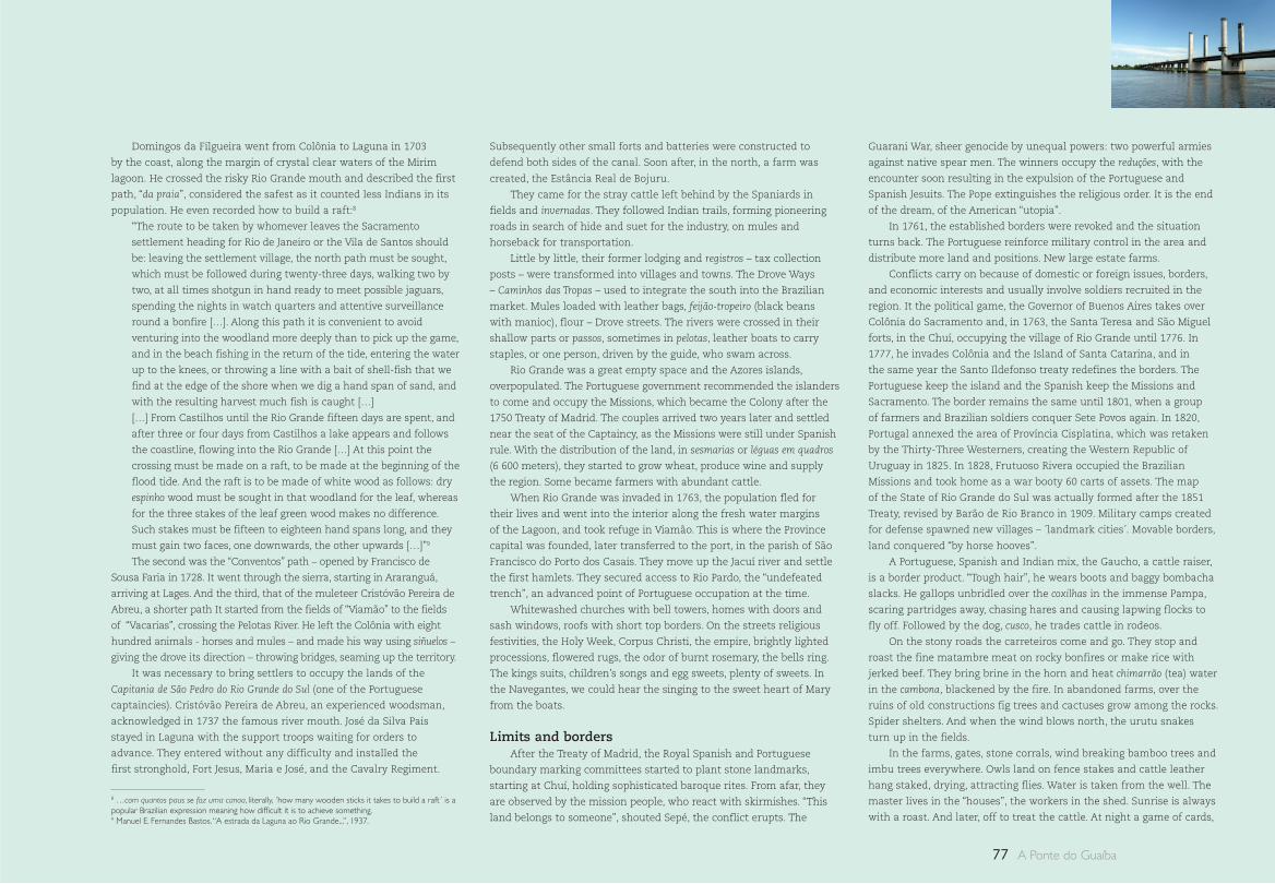
77 A Ponte do Guaíba
Domingos da Filgueira went from Colônia to Laguna in 1703
by the coast, along the margin of crystal clear waters of the Mirim
lagoon. He crossed the risky Rio Grande mouth and described the first
path, “da praia”, considered the safest as it counted less Indians in its
population. He even recorded how to build a raft:8
“The route to be taken by whomever leaves the Sacramento
settlement heading for Rio de Janeiro or the Vila de Santos should
be: leaving the settlement village, the north path must be sought,
which must be followed during twenty-three days, walking two by
two, at all times shotgun in hand ready to meet possible jaguars,
spending the nights in watch quarters and attentive surveillance
round a bonfire […]. Along this path it is convenient to avoid
venturing into the woodland more deeply than to pick up the game,
and in the beach fishing in the return of the tide, entering the water
up to the knees, or throwing a line with a bait of shell-fish that we
find at the edge of the shore when we dig a hand span of sand, and
with the resulting harvest much fish is caught […]
[…] From Castilhos until the Rio Grande fifteen days are spent, and
after three or four days from Castilhos a lake appears and follows
the coastline, flowing into the Rio Grande […] At this point the
crossing must be made on a raft, to be made at the beginning of the
flood tide. And the raft is to be made of white wood as follows: dry
espinho wood must be sought in that woodland for the leaf, whereas
for the three stakes of the leaf green wood makes no difference.
Such stakes must be fifteen to eighteen hand spans long, and they
must gain two faces, one downwards, the other upwards […]”9
The second was the “Conventos” path – opened by Francisco de
Sousa Faria in 1728. It went through the sierra, starting in Araranguá,
arriving at Lages. And the third, that of the muleteer Cristóvão Pereira de
Abreu, a shorter path It started from the fields of “Viamão” to the fields
of “Vacarias”, crossing the Pelotas River. He left the Colônia with eight
hundred animals - horses and mules – and made his way using siñuelos –
giving the drove its direction – throwing bridges, seaming up the territory.
It was necessary to bring settlers to occupy the lands of the
Capitania de São Pedro do Rio Grande do Sul (one of the Portuguese
captaincies). Cristóvão Pereira de Abreu, an experienced woodsman,
acknowledged in 1737 the famous river mouth. José da Silva Pais
stayed in Laguna with the support troops waiting for orders to
advance. They entered without any difficulty and installed the
first stronghold, Fort Jesus, Maria e José, and the Cavalry Regiment.
Subsequently other small forts and batteries were constructed to
defend both sides of the canal. Soon after, in the north, a farm was
created, the Estância Real de Bojuru.
They came for the stray cattle left behind by the Spaniards in
fields and invernadas. They followed Indian trails, forming pioneering
roads in search of hide and suet for the industry, on mules and
horseback for transportation.
Little by little, their former lodging and registros – tax collection
posts – were transformed into villages and towns. The Drove Ways
– Caminhos das Tropas – used to integrate the south into the Brazilian
market. Mules loaded with leather bags, feijão-tropeiro (black beans
with manioc), flour – Drove streets. The rivers were crossed in their
shallow parts or passos, sometimes in pelotas, leather boats to carry
staples, or one person, driven by the guide, who swam across.
Rio Grande was a great empty space and the Azores islands,
overpopulated. The Portuguese government recommended the islanders
to come and occupy the Missions, which became the Colony after the
1750 Treaty of Madrid. The couples arrived two years later and settled
near the seat of the Captaincy, as the Missions were still under Spanish
rule. With the distribution of the land, in sesmarias or léguas em quadros
(6 600 meters), they started to grow wheat, produce wine and supply
the region. Some became farmers with abundant cattle.
When Rio Grande was invaded in 1763, the population fled for
their lives and went into the interior along the fresh water margins
of the Lagoon, and took refuge in Viamão. This is where the Province
capital was founded, later transferred to the port, in the parish of São
Francisco do Porto dos Casais. They move up the Jacuí river and settle
the first hamlets. They secured access to Rio Pardo, the “undefeated
trench”, an advanced point of Portuguese occupation at the time.
Whitewashed churches with bell towers, homes with doors and
sash windows, roofs with short top borders. On the streets religious
festivities, the Holy Week, Corpus Christi, the empire, brightly lighted
processions, flowered rugs, the odor of burnt rosemary, the bells ring.
The kings suits, children’s songs and egg sweets, plenty of sweets. In
the Navegantes, we could hear the singing to the sweet heart of Mary
from the boats.
Limits and bordersAfter the Treaty of Madrid, the Royal Spanish and Portuguese
boundary marking committees started to plant stone landmarks,
starting at Chuí, holding sophisticated baroque rites. From afar, they
are observed by the mission people, who react with skirmishes. “This
land belongs to someone”, shouted Sepé, the conflict erupts. The
Guarani War, sheer genocide by unequal powers: two powerful armies
against native spear men. The winners occupy the reduções, with the
encounter soon resulting in the expulsion of the Portuguese and
Spanish Jesuits. The Pope extinguishes the religious order. It is the end
of the dream, of the American “utopia”.
In 1761, the established borders were revoked and the situation
turns back. The Portuguese reinforce military control in the area and
distribute more land and positions. New large estate farms.
Conflicts carry on because of domestic or foreign issues, borders,
and economic interests and usually involve soldiers recruited in the
region. It the political game, the Governor of Buenos Aires takes over
Colônia do Sacramento and, in 1763, the Santa Teresa and São Miguel
forts, in the Chuí, occupying the village of Rio Grande until 1776. In
1777, he invades Colônia and the Island of Santa Catarina, and in
the same year the Santo Ildefonso treaty redefines the borders. The
Portuguese keep the island and the Spanish keep the Missions and
Sacramento. The border remains the same until 1801, when a group
of farmers and Brazilian soldiers conquer Sete Povos again. In 1820,
Portugal annexed the area of Província Cisplatina, which was retaken
by the Thirty-Three Westerners, creating the Western Republic of
Uruguay in 1825. In 1828, Frutuoso Rivera occupied the Brazilian
Missions and took home as a war booty 60 carts of assets. The map
of the State of Rio Grande do Sul was actually formed after the 1851
Treaty, revised by Barão de Rio Branco in 1909. Military camps created
for defense spawned new villages – ´landmark cities´. Movable borders,
land conquered “by horse hooves”.
A Portuguese, Spanish and Indian mix, the Gaucho, a cattle raiser,
is a border product. “Tough hair”, he wears boots and baggy bombacha
slacks. He gallops unbridled over the coxilhas in the immense Pampa,
scaring partridges away, chasing hares and causing lapwing flocks to
fly off. Followed by the dog, cusco, he trades cattle in rodeos.
On the stony roads the carreteiros come and go. They stop and
roast the fine matambre meat on rocky bonfires or make rice with
jerked beef. They bring brine in the horn and heat chimarrão (tea) water
in the cambona, blackened by the fire. In abandoned farms, over the
ruins of old constructions fig trees and cactuses grow among the rocks.
Spider shelters. And when the wind blows north, the urutu snakes
turn up in the fields.
In the farms, gates, stone corrals, wind breaking bamboo trees and
imbu trees everywhere. Owls land on fence stakes and cattle leather
hang staked, drying, attracting flies. Water is taken from the well. The
master lives in the “houses”, the workers in the shed. Sunrise is always
with a roast. And later, off to treat the cattle. At night a game of cards,
8 …com quantos paus se faz uma canoa, literally, ´how many wooden sticks it takes to build a raft´ is a popular Brazilian expression meaning how difficult it is to achieve something.9 Manuel E. Fernandes Bastos. “A estrada da Laguna ao Rio Grande...”, 1937.
78
gin rummy, ghost story telling, talk about whores and exploits by the
crooks. In the balls the sound of harmonica players, moving their
feet, dancing with chintz–clad maidens, with blush on the cheeks and
pungent perfume.
The meat was kept in salt: “charque” (jerked beef). This was the
staple food of the slaves all around Brazil. The opportunity to sell
charque to the northeast – main consumer market – developed the
industry. The charqueadas of the southern region were located in the
outskirts of the cities, especially in the region of Pelotas, near brooks to
facilitate connection to the port.
The charque trade brought prosperity to the region, formerly
simple, rough and rural. The new wealthy sophisticated families
boasted imported costumes in the cities. The neo-classic style made
the scene, a pompous pampa of the new charque producing elite.
Brocade, velvet, lace, china, silverware and plenty of luxury on the one
side. Blood baths, flies, stench, and slavery on the other. In the city,
fashion shows in the theaters, opera and classical music. Soirées in the
palaces. Cooking – with salt and sugar - with flavors not appreciated
before. In the slave quarters the Africans – fuel to the charque factories.
Huge groups – larger than the free men – forced into exhausting labor.
Rebellions and fugitives. Quilombos (refuge colonies of fleeing slaves).
On the west border, the saladeiros (also charque producers) – from
the Spanish, saladeros - at the end of the 19th century. They used paid
employees and took the muleteers to bring the cattle from the border.
As there were no roads to Rio Grande, the products were transported
by rail to Montevideo and from there came into the Brazilian market.
A moment of prosperity in the slow economy of the Campanha region.
The surcharge on the transportation of jerked beef from abroad
bankrupted the system. Impressive ruins remained.
As early as 1824 the Germans arrived. Small landowners,
independent craftsmen, in a context of masters and slaves: a new social
class emerged. Coming from poor areas, they were attracted by promises
of land, inputs and subsidies. They arrived in the capital and then went
to the Real Feitoria do Linho-Cânhamo, in São Leopoldo, where they
waited until they got their land. They occupied the bushes on the slopes
of the hills and the valleys of the Rivers Sinos, Caí, Jacuí and Taquari.
The new cities were organized along the lines drawn by military
engineers. Houses with jagged façades, flowered verandas and gardens.
Protestant churches, usually with a center tower, were, by then,
characteristic of the region. In the interior, manmade lines and trails,
wooden or sandstone bridges appear. And all over the place, timber framing
houses, with separate kitchens, fences and sheds. In the crossroads, little
shops, which, together with the churches, sitting rooms and societies make
the Colony a lively place. In the kerbs, garland decorations and plenty of
beer. Pink smiling faces. The mascates – peddling salesmen – foster exchange,
barter, loans. They bring news, products and novelty to the capital.
The dissatisfaction with taxes levied by the Empire on meat
products – staple of the regional economy – caused reaction and
triggered the Farrapos War in 1835. This war created the República
Rio-Grandense, with an independent territory, constitution, arms, flag
and anthem. The conflict involved a great number of people under
local command and leadership, such as Bento Gonçalves da Silva, and
included “the two world hero”, Giuseppe Garibaldi.
The response from the Empire, with the support of Porto Alegre
and Rio Grande, led to successive transfers of the Farroupilha
capital: Piratini, Caçapava and later, Alegrete. There were a number
of combats, and during the battle of Porongos, the brave black spear
men were exterminated. After ten years of battles and with the
emergence of international conflicts, the imperial government sought
an “honorable peace”, signed in Ponche Verde, in 1845.
The extraordinary event in this war was the Laguna siege, where
the movement expanded, creating the República Juliana. The absence
of an exit out to the sea, forced Garibaldi to transport the Seival and
Farroupilha barges over dry land, between the Lagoa dos Patos and
Barra do Tramandaí. An unusual scene: a group of soldiers, horses and
two ships going across pulled by two hundred oxen over 54 miles or 18
léguas (6 600 meters)”10 , through the fields and plains.
The jorneys taken by Emperor D. Pedro II and other travellersIn the aftermath of the Farrapos War, 19 year-old Emperor D. Pedro II,
came to visit the province with the Empress and entourage. They stayed
5 months. They arrived via Rio Grande and headed to Porto Alegre, Rio
Pardo and São Gabriel. In Pelotas, his host was the Baron of Jaguari.
It has been reported that the Emperor was extremely pleased with
the local cooking, egg sweets such as ambrosia accompanied with a
fermented drink, the hydromel.
He came back 20 years later, in 1865 in the beginning of the
Paraguay War bringing his sons-in-law. He visited Porto Alegre, Rio
Pardo, Cachoeira, and Caçapava, where a fort was constructed and
named after him, and from there headed to Alegrete. When he arrived
in Uruguaiana, the Paraguayan army surrendered to him.
With the curiosity of a scientist, the “traveling Emperor” recorded
the route in a journal and took pictures on the way. It is said that he
planted Imperial palm trees to leave his mark in the places he visited.
He usually stayed in palaces in the cities which are proud of the
imperial visit until this day.
During the 19th century, the territory was trailed by travelers of
different professions. With various views and curiosity, they recorded
their impressions in journals or detailed drawings. The records were
published in Europe, reporting on unfamiliar hostile regions in an
outside perspective of the local context. Among them were Frenchmen,
such as Auguste Saint-Hilaire, who described in the “Trip to Rio Grande
do Sul” a major part of the State territory; Dr. Alfred Demersay, who
wrote “The Physical, Economic and Political History of Paraguay”,
published in Paris, with ethnologic, geographic, statistical and
demographic data of the usages and costumes of Paraguay, including
the Jesuit Missions between 1844 and 1847; and Robert Avé-Lallemant,
author of “Journey through the Province of Rio Grande do Sul”, 1858
defining the Barra de Rio Grande as “one of the most unpleasant and
dangerous in existence”, due to the number of shipwrecks.
After 1875, Italian settlers also started to arrive. In a situation
similar to their antecessors, they came in search for the opportunities
to far l’América. Cosa sará questa Mèrica?11
The land around the capital was already occupied by the Germans.
There was a possibility of occupying the hills in the northeast of the State,
in the old pine tree areas. The first colonies were outlined with “string and
ruler”, three in the northeast and one in the center of the State. After the
extermination of the Bugres – local word for natives – cities and colonies
started to grow, opening trails, river passes, cutting down araucaria pine
trees. Typically, the architecture was mainly large manors, built in wood
or basalt stone, with roofs initially covered of scándole – short planks – and
later replaced by zinc and, in some cases, ornate with lambrequins.
The outline of the cities, orthogonal, regular, military, without any
relation to the rugged terrain formed by slopes and cliffs. After having
made their way, they started plantations on the slopes, introducing
vineyards. Golden landscapes in autumn, foggy winters. Cold waters in
the whitewater rivers, with barges in the shallow ends.
Religion was visible by crosses, field oratories – the capitéis
– chapels and churches, simply painted, usually with a single nave and
independent belfry. The sacred festivities, of patron saints, processions,
kermesses celebrated in church halls on Sundays after mass. Eating
risotto, galletti, polenta and radici, salads with plenty of red wine. The
mammas in their embroidered aprons, scarves around their heads and
golden frills, often exaggerated, Veneto style.
Caminante, no hay camino, se hace camino al andar
10 Alexandre Dumas. Memórias de Garibaldi, 2002. 11 Stanza of the Italian migrants popular song “Mèrica, Mèrica”.
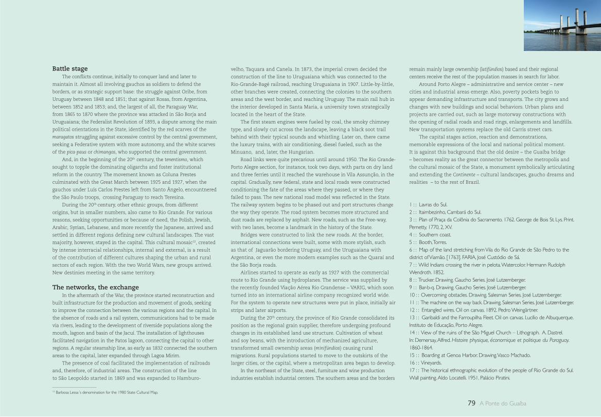
79 A Ponte do Guaíba
Battle stage The conflicts continue, initially to conquer land and later to
maintain it. Almost all involving gauchos as soldiers to defend the
borders, or as strategic support base: the struggle against Oribe, from
Uruguay between 1848 and 1851; that against Rosas, from Argentina,
between 1852 and 1853; and, the largest of all, the Paraguay War,
from 1865 to 1870 where the province was attacked in São Borja and
Uruguaiana; the Federalist Revolution of 1893, a dispute among the main
political orientations in the State, identified by the red scarves of the
maragatos struggling against excessive control by the central government,
seeking a Federative system with more autonomy, and the white scarves
of the pica-paus or chimangos, who supported the central government.
And, in the beginning of the 20th century, the tenentismo, which
sought to topple the dominating oligarchs and foster institutional
reform in the country. The movement known as Coluna Prestes
culminated with the Great March between 1925 and 1927, when the
gauchos under Luís Carlos Prestes left from Santo Ângelo, encountnered
the São Paulo troops, crossing Paraguay to reach Teresina.
During the 20th century, other ethnic groups, from different
origins, but in smaller numbers, also came to Rio Grande. For various
reasons, seeking opportunities or because of need, the Polish, Jewish,
Arabic, Syrian, Lebanese, and more recently the Japanese, arrived and
settled in different regions defining new cultural landscapes. The vast
majority, however, stayed in the capital. This cultural mosaic12, created
by intense interracial relationships, internal and external, is a result
of the contribution of different cultures shaping the urban and rural
sectors of each region. With the two World Wars, new groups arrived.
New destinies meeting in the same territory.
The networks, the exchangeIn the aftermath of the War, the province started reconstruction and
built infrastructure for the production and movement of goods, seeking
to improve the connection between the various regions and the capital. In
the absence of roads and a rail system, communications had to be made
via rivers, leading to the development of riverside populations along the
mouth, lagoon and basin of the Jacuí. The installation of lighthouses
facilitated navigation in the Patos lagoon, connecting the capital to other
regions. A regular steamship line, as early as 1832 connected the southern
areas to the capital, later expanded through Lagoa Mirim.
The presence of coal facilitated the implementation of railroads
and, therefore, of industrial areas. The construction of the line
to São Leopoldo started in 1869 and was expanded to Hamburo-
velho, Taquara and Canela. In 1873, the imperial crown decided the
construction of the line to Uruguaiana which was connected to the
Rio-Grande-Bagé railroad, reaching Uruguaiana in 1907. Little-by-little,
other branches were created, connecting the colonies to the southern
areas and the west border, and reaching Uruguay. The main rail hub in
the interior developed in Santa Maria, a university town strategically
located in the heart of the State.
The first steam engines were fueled by coal, the smoky chimney
type, and slowly cut across the landscape, leaving a black soot trail
behind with their typical sounds and whistling. Later on, there came
the luxury trains, with air conditioning, diesel fueled, such as the
Minuano, and, later, the Hungarian.
Road links were quite precarious until around 1950. The Rio Grande-
Porto Alegre section, for instance, took two days, with parts on dry land
and three ferries until it reached the warehouse in Vila Assunção, in the
capital. Gradually, new federal, state and local roads were constructed
conditioning the fate of the areas where they passed, or where they
failed to pass. The new national road model was reflected in the State.
The railway system begins to be phased out and port structures change
the way they operate. The road system becomes more structured and
dust roads are replaced by asphalt. New roads, such as the Free-way,
with two lanes, become a landmark in the history of the State.
Bridges were constructed to link the new roads. At the border,
international connections were built, some with more stylish, such
as that of Jaguarão bordering Uruguay, and the Uruguaiana with
Argentina, or even the more modern examples such as the Quaraí and
the São Borja roads.
Airlines started to operate as early as 1927 with the commercial
route to Rio Grande using hydroplanes. The service was supplied by
the recently founded Viação Aérea Rio Grandense – VARIG, which soon
turned into an international airline company recognized world wide.
For the system to operate new structures were put in place, initially air
strips and later airports.
During the 20th century, the province of Rio Grande consolidated its
position as the regional grain supplier, therefore undergoing profound
changes in its established land use structure. Cultivation of wheat
and soy beans, with the introduction of mechanized agriculture,
transformed small ownership areas (minifúndios) causing rural
migrations. Rural populations started to move to the outskirts of the
larger cities, or the capital, where a metropolitan area began to develop.
In the northeast of the State, steel, furniture and wine production
industries establish industrial centers. The southern areas and the borders
remain mainly large ownership (latifúndios) based and their regional
centers receive the rest of the population masses in search for labor.
Around Porto Alegre – administrative and service center – new
cities and industrial areas emerge. Also, poverty pockets begin to
appear demanding infrastructure and transports. The city grows and
changes with new buildings and social behaviors. Urban plans and
projects are carried out, such as large motorway constructions with
the opening of radial roads and road rings, enlargements and landfills.
New transportation systems replace the old Carris street cars.
The capital stages action, reaction and demonstrations,
memorable expressions of the local and national political moment.
It is against this background that the old desire – the Guaíba bridge
– becomes reality as the great connector between the metropolis and
the cultural mosaic of the State, a monument symbolically articulating
and extending the Continente – cultural landscapes, gaucho dreams and
realities – to the rest of Brazil.
1 : : Lavras do Sul.2 : : Itaimbezinho, Cambará do Sul.3 : : Plan of Praça da Colônia do Sacramento. 1762. George de Bois St. Lys. Print. Pernetty, 1770, 2, XV. 4 : : Southern coast.5 : : Booth, Torres.6 : : Map of the land stretching from Vila do Rio Grande de São Pedro to the district of Viamão. [1763]. FARIA, José Custódio de Sá.7 : : Wild Indians crossing the river in pelota. Watercolor. Hermann Rudolph Wendroth. 1852.8 : : Trucker. Drawing. Gaucho Series. José Lutzemberger.9 : : Bar-b-q. Drawing. Gaucho Series. José Lutzemberger.10 : : Overcoming obstacles. Drawing. Salesman Series. José Lutzemberger.11 : : The machine on the way back. Drawing. Salesman Series. José Lutzemberger.12 : : Entangled wires. Oil on canvas. 1892. Pedro Weingärtner.13 : : Garibaldi and the Farroupilha Fleet. Oil on canvas. Lucílio de Albuquerque. Instituto de Educação, Porto Alegre.14 : : View of the ruins of the São Miguel Church – Lithograph. A. Dastrel. In: Demersay, Alfred. Histoire physique, économique et politique du Paraguay. 1860-1864.15 : : Boarding at Genoa Harbor. Drawing. Vasco Machado.16 : : Vineyards.17 : : The historical ethnographic evolution of the people of Rio Grande do Sul.Wall painting. Aldo Locatelli. 1951. Palácio Piratini.
12 Barbosa Lessa´s denomination for the 1980 State Cultural Map.
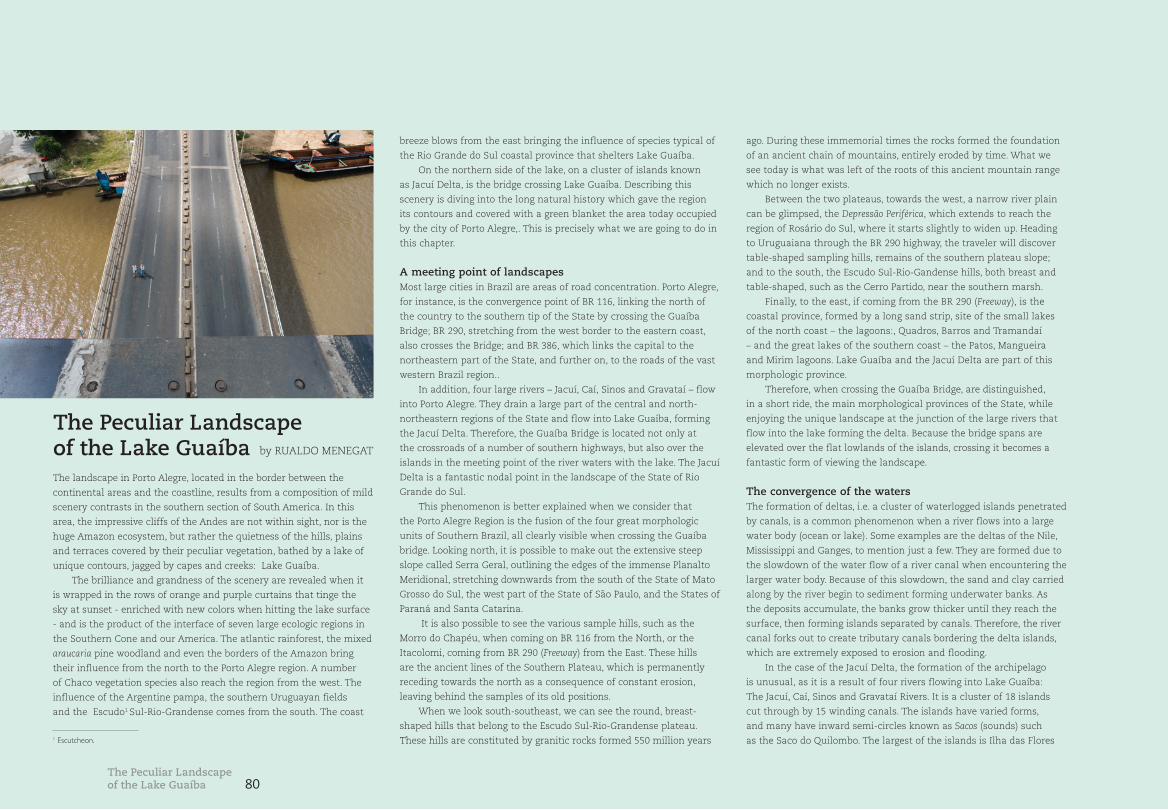
80
The landscape in Porto Alegre, located in the border between the
continental areas and the coastline, results from a composition of mild
scenery contrasts in the southern section of South America. In this
area, the impressive cliffs of the Andes are not within sight, nor is the
huge Amazon ecosystem, but rather the quietness of the hills, plains
and terraces covered by their peculiar vegetation, bathed by a lake of
unique contours, jagged by capes and creeks: Lake Guaíba.
The brilliance and grandness of the scenery are revealed when it
is wrapped in the rows of orange and purple curtains that tinge the
sky at sunset - enriched with new colors when hitting the lake surface
- and is the product of the interface of seven large ecologic regions in
the Southern Cone and our America. The atlantic rainforest, the mixed
araucaria pine woodland and even the borders of the Amazon bring
their influence from the north to the Porto Alegre region. A number
of Chaco vegetation species also reach the region from the west. The
influence of the Argentine pampa, the southern Uruguayan fields
and the Escudo1 Sul-Rio-Grandense comes from the south. The coast
breeze blows from the east bringing the influence of species typical of
the Rio Grande do Sul coastal province that shelters Lake Guaíba.
On the northern side of the lake, on a cluster of islands known
as Jacuí Delta, is the bridge crossing Lake Guaíba. Describing this
scenery is diving into the long natural history which gave the region
its contours and covered with a green blanket the area today occupied
by the city of Porto Alegre,. This is precisely what we are going to do in
this chapter.
A meeting point of landscapesMost large cities in Brazil are areas of road concentration. Porto Alegre,
for instance, is the convergence point of BR 116, linking the north of
the country to the southern tip of the State by crossing the Guaíba
Bridge; BR 290, stretching from the west border to the eastern coast,
also crosses the Bridge; and BR 386, which links the capital to the
northeastern part of the State, and further on, to the roads of the vast
western Brazil region..
In addition, four large rivers – Jacuí, Caí, Sinos and Gravataí – flow
into Porto Alegre. They drain a large part of the central and north-
northeastern regions of the State and flow into Lake Guaíba, forming
the Jacuí Delta. Therefore, the Guaíba Bridge is located not only at
the crossroads of a number of southern highways, but also over the
islands in the meeting point of the river waters with the lake. The Jacuí
Delta is a fantastic nodal point in the landscape of the State of Rio
Grande do Sul.
This phenomenon is better explained when we consider that
the Porto Alegre Region is the fusion of the four great morphologic
units of Southern Brazil, all clearly visible when crossing the Guaíba
bridge. Looking north, it is possible to make out the extensive steep
slope called Serra Geral, outlining the edges of the immense Planalto
Meridional, stretching downwards from the south of the State of Mato
Grosso do Sul, the west part of the State of São Paulo, and the States of
Paraná and Santa Catarina.
It is also possible to see the various sample hills, such as the
Morro do Chapéu, when coming on BR 116 from the North, or the
Itacolomi, coming from BR 290 (Freeway) from the East. These hills
are the ancient lines of the Southern Plateau, which is permanently
receding towards the north as a consequence of constant erosion,
leaving behind the samples of its old positions.
When we look south-southeast, we can see the round, breast-
shaped hills that belong to the Escudo Sul-Rio-Grandense plateau.
These hills are constituted by granitic rocks formed 550 million years
ago. During these immemorial times the rocks formed the foundation
of an ancient chain of mountains, entirely eroded by time. What we
see today is what was left of the roots of this ancient mountain range
which no longer exists.
Between the two plateaus, towards the west, a narrow river plain
can be glimpsed, the Depressão Periférica, which extends to reach the
region of Rosário do Sul, where it starts slightly to widen up. Heading
to Uruguaiana through the BR 290 highway, the traveler will discover
table-shaped sampling hills, remains of the southern plateau slope;
and to the south, the Escudo Sul-Rio-Gandense hills, both breast and
table-shaped, such as the Cerro Partido, near the southern marsh.
Finally, to the east, if coming from the BR 290 (Freeway), is the
coastal province, formed by a long sand strip, site of the small lakes
of the north coast – the lagoons:, Quadros, Barros and Tramandaí
– and the great lakes of the southern coast – the Patos, Mangueira
and Mirim lagoons. Lake Guaíba and the Jacuí Delta are part of this
morphologic province.
Therefore, when crossing the Guaíba Bridge, are distinguished,
in a short ride, the main morphological provinces of the State, while
enjoying the unique landscape at the junction of the large rivers that
flow into the lake forming the delta. Because the bridge spans are
elevated over the flat lowlands of the islands, crossing it becomes a
fantastic form of viewing the landscape.
The convergence of the watersThe formation of deltas, i.e. a cluster of waterlogged islands penetrated
by canals, is a common phenomenon when a river flows into a large
water body (ocean or lake). Some examples are the deltas of the Nile,
Mississippi and Ganges, to mention just a few. They are formed due to
the slowdown of the water flow of a river canal when encountering the
larger water body. Because of this slowdown, the sand and clay carried
along by the river begin to sediment forming underwater banks. As
the deposits accumulate, the banks grow thicker until they reach the
surface, then forming islands separated by canals. Therefore, the river
canal forks out to create tributary canals bordering the delta islands,
which are extremely exposed to erosion and flooding.
In the case of the Jacuí Delta, the formation of the archipelago
is unusual, as it is a result of four rivers flowing into Lake Guaíba:
The Jacuí, Caí, Sinos and Gravataí Rivers. It is a cluster of 18 islands
cut through by 15 winding canals. The islands have varied forms,
and many have inward semi-circles known as Sacos (sounds) such
as the Saco do Quilombo. The largest of the islands is Ilha das Flores
The Peculiar Landscape of the Lake Guaíba by RUALDO MENEGAT
The Peculiar Landscape of the Lake Guaíba
1 Escutcheon.
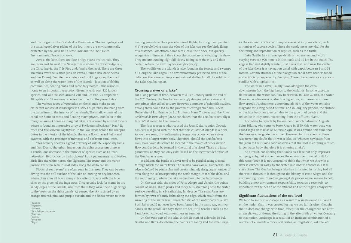
81 A Ponte do Guaíba
and the longest is Ilha Grande dos Marinheiros. The archipelago and
the waterlogged river plains of the four rivers are environmentally
protected by the Jacuí Delta State Park and the Jacuí Delta
Environmental Protection Area.
Across the lake, there are four bridge spans over canals. They
are, from east to west: the Navegantes – where the draw bridge is –,
the Chico Inglês, the Três Rios and, finally, the Jacuí. There are three
stretches over the islands (Ilha do Pavão, Grande dos Marinheiros
and das Flores). Despite the existence of buildings along the road,
as well as along the water lines of the islands - location of fishing
communities, boating clubs and secondary homes - this region is
home to an important vegetation diversity, with over 320 known
species, and wildlife with around 210 bird, 78 fish, 24 amphibian,
18 reptile and 32 mammal species identified to the present day.
The various types of vegetation on the islands make up an
exuberant mosaic of landscapes in a series of patches stretching from
the waterlines to the interior of the islands. The shallow parts of the
canal are home to reeds and floating macrophytes. Mud belts in the
marginal areas, known as marginal dikes, are covered by alluvial forests
where is found an impressive array of Phyllantus sellowianus2, Inga,3 fig
trees and Mühlenbeckia sagittifolia4. In the low lands behind the marginal
dykes in the interior of the islands, there are flood hazard fields and
swamps, with the presence of mimosas and cockspur coral-trees.
This scenery shelters a great diversity of wildlife, especially birds
and fish. Due to the urban impact on the delta ecosystem there is
a continuous decrease in the number of species such as Caiman
latirostris5, Hydrochoerus hydrochoeris6 Lutra paranaensis7 and turtles.
Birds like the white-heron, the Tigrisoma lineatum8 and the martin-
pêcheur are often seen in boat rides along the delta canals.
Flocks of sea ravens9 are often seen in this area. They can be seen
diving into the still surface of the lake or landing on dry branches,
where their slim all black shiny silhouette contrasts with the blue
skies or the green of the Inga trees. They usually look for clams in the
sandy edges of the islands, and from there they wave their huge wings
to the boats on the delta canals. At sunset, the sky is tinted by an
orange and red, pink and purple curtain and the flocks return to their
nesting grounds in their predetermined flights, forming their peculiar
V. The people living near the edge of the lake can see the birds flying
at a distance. Sometimes, some birds leave their flock, but quickly
reorganize in lines as if they knew that someone is watching the show.
They are announcing nightfall slowly taking over the city and their
certain return the next day for everybody’s joy.
The wildlife on the islands is also found in the forests and swamps
all along the lake edges. The environmentally protected areas of the
delta are, therefore, an important natural shelter for all the wildlife of
the Lake Guaíba region.
Crossing a river or a lake?For a long period of time, between mid 19th Century until the end of
the 20th Century, the Guaíba was wrongly designated as a river and
sometimes also called estuary. However, a number of scientific studies,
among them some led by the prominent cartographer and Federal
University of Rio Grande do Sul Professor Hans Thofern, and the Atlas
Ambiental de Porto Alegre (2006) concluded that the Guaíba is actually a
lake. What would be the reasons?
The first reason is what caused the Jacuí Delta to exist. Nobody
has ever disagreed with the fact that this cluster of islands is a delta.
As we have seen, this sedimentary formation occurs when a river
flows into a larger water body. Therefore, should the Guaíba be a
river, how could its source be located in the mouth of other rivers?
How could a delta be formed in the canal of a river? These are false
paradoxes, as they can only exist based on the incorrect definition of
the Guaíba as a river.
In addition, the banks of a river tend to be parallel, along a canal
through which the water flows. The Guaíba banks are all but parallel. The
edge is defined by peninsulas and creeks minutely designing a number of
atria along the 50 km separating the north margin, that of the delta, and
the south margin, where the lake waters flow into the Patos lagoon.
On the east side, the cities of Porto Alegre and Viamão, the points
consist of small, sharp peaks and rocky hills stretching onto the water
surface, resulting in a breathtaking landscape. The small bays are
formed by rows of sandy belts along the edge, which result from the
wavering of the water level, characteristic of the water body of a lake.
Such belts could not ever have been formed in the same way on river
banks. In the small lake bays there are beautiful beaches such as the
Lami beach crowded with swimmers in summer.
On the west part of the lake, in the districts of Eldorado do Sul,
Guaíba and Barra do Ribeiro, the points are sandy and the small bays,
as the east end, are home to impressive sand strip woodland, with
a number of cactus species. These dry sandy areas are vital for the
sheltering and reproduction of reptiles, such as the turtle.
Lake Guaíba has an average depth of two meters and width
varying between 900 meters in the north and 19 km in the south. The
edge is flat and slightly slanted, just like a dish, and near the center
of the lake there is a navigation canal with depth between 5 and 31
meters. Certain stretches of the navigation canal have been widened
and artificially deepened by dredging. These characteristics are also in
conflict with a typical river.
The water in a river, usually flows alongside the canal,
downstream from the highlands to the lowlands. In some cases, in
flatter areas, the water can flow backwards. In Lake Guaíba, the water
flows in two dimensions, also flowing across, with areas in different
flow speeds. Furthermore, approximately 85% of the water remains
stagnant for a long period of time, and in long, dry periods, the surface
of the lake becomes greenish due to the growth of weeds and the
reduction in clay amounts coming from the affluent rivers.
According to reports by the eminent French naturalist Auguste
Saint-Hilaire, who came to Porto Alegre in 1820, this water body was
called lagoa de Viamão or de Porto Alegre. It was around this time that
the lake was designated as a river. However, for this scientist there
was never any doubt that it was a lake, as “whoever navigates from
the Jacuí to the Guaíba soon observes that the boat is entering a much
larger water body, therefore it is entering a lake”.
As a result, considering the Guaíba as a lake not only improves
our geography, but also enhances the environment model built for
this water body. It is not unusual to think that what we throw in a
river is carried far away by the water. But what is thrown in a lake
stays there. The Guaíba, being a lake has imprinted in its clay bed all
the waste thrown in it throughout the history of Porto Alegre and the
surrounding cities. Therefore, giving it its proper name, means to help
building a new environment responsibility towards a reservoir so
important for the health of the citizens and of the region ecosystems.
Significant fluctuations of the sea levelWe tend to see our landscape as a result of a single event, i.e. based
on the notion that it was created just as we see it. It is often thought
that it does not change with time, except for the changes we see after
a rain shower, or during the spring in the aftermath of winter. Contrary
to this notion, landscape is a result of an intricate combination of a
number of elements – rocks, soil, water, air, vegetation, wildlife, etc.
2 Sarandis.3 Ingazeiros.4 Salseiros.5 Jacaré-de-papo-amarelo.6 Capivara.7 Lontra.8 Socó-boi.9 Biguá.
82
– originating in very distinct eras, as if each of them were a vestige of
facts of immemorial times. Therefore, investigating how a landscape
was formed means diving into a deep geological time, where events
can be recognized which, when more recent, are present in human
memory as legends and myths, such as Noa’s Universal Deluge.
The formation of the landscape of Lake Guaíba and the Jacuí Delta
is linked to a plurality of geological events shaping the whole of the
Rio Grande do Sul coastal province. During the long natural history
that developed over the last 400 000 years, four major fluctuations of
the level of the sea left their footprint on the coast of the State of Rio
Grande do Sul, making up a mosaic of the current forms of the long
coast stretching from the north of the State to reach Uruguay.
The first major sea level rise, the most intense of them all,
occurred 400 000 years ago and flooded the whole of the coast in Rio
Grande do Sul. At this time, Porto Alegre was a cluster of islands, as
only the higher hills remained above water. In the second movement
in sea level, 325 000 years ago, the island in the location of today’s
Porto Alegre became connected to the continent. The coast was much
closer to the hills. At that time the place occupied by the Guaíba
nowadays was a bay, similar to the Guanabara bay in Rio de Janeiro.
It was only in the third sea level movement, 120 000 years ago,
that the Patos lagoon and Lake Guaíba were formed. Major features
of the current configuration of the Jacuí Delta and of the region of
swamps and alluvial plains of their affluents also date from that time.
However, the contours of the current profile date from the last great
sea level movement 5.000 years ago. In this episode, the Mangueira
and Mirim lagoons were formed in the south coast, and the rosary of
small standalone lagoons appeared in the north.
These fluctuations of the sea level are a global phenomenon, caused
by successive glacial and interglacial cycles. During a glacial period, the
rainfall in the continent turns into snow, creating extensive glaciers.
As the water does not return to the sea and evaporation continues, the
water depth is gradually reduced. Conversely, with temperature increases
in an interglacial period, the glaciers will melt leading to an increase in
the water depth. The last increase in the sea level is imprinted in the
memory of a number of peoples around the planet, and was recorded in
the Bible. In the New World, in almost all American/Indian cultures there
are also narratives of deluge phenomena.
The last interglacial period led to a profound landscape
transformation, one major change was the expansion of forests and
the extinction of giant mammals, such as the glyptodont and the
mammoth. Due to the increase in temperature, the forests around the
equatorial region of Brazil expanded towards the south. Thus, species
from the Atlantic Woodland and the Amazon reached the Porto Alegre
lands, followed by tropical wildlife and Indian populations located a
little further north, such as the Guaranis and the Kaingangs, who, in
migrating to the south, encountered the Indian Pampa populations,
such as the Charruas and the Minuanos.
Lake Guaíba, the Jacuí Delta and the sustainabilityLake Guaíba, whose name originates from the Guarani language
and means “where the waters meet” and also “where the creeks
meet”, plays a vital environmental role for the populations living
in the surrounding cities. First and foremost, because it is a major
fresh water reservoir, with a 1 km3 capacity. It is practically the sole
source of water supply for the city of Porto Alegre. The lake is also
vital to receive liquid waste produced by the city. Urban life would be
impossible without a place where to disperse effluents daily produced
in a city with highly contaminating industrial areas, because the
population would be intoxicated to death.
However, because of carelessness with the natural landscape,
liquid waste is discharged in the waters without treatment leading
to the deterioration of the environment. In recent years, because of
the impact of domestic and industrial pollutants, fishing has been
drastically reduced, and so has the inflow of beach-goers to the
beautiful beaches. The environment preservation of Lake Guaíba and
the Jacuí Delta is strategic for the approximately 4 million inhabitants
of greater Porto Alegre. In addition to avoiding the destruction of
the impressive landscape offered by the lake, it would also prevent
the collapse of ecosystems where the cities are located, improving
sustainability for the population at large.
The Peculiar Landscape of the Lake Guaíba
P. 26 View of the delta looking north. These are the youngest islands of the archipelago. They are boomerang shaped. The outer ends going along the bordering canal currents. In the foreground to the very left, the Ilha do Chico Inglês. Greenish colored stains indicate the various vegetation colonization phases. In the background, on the first row of sample hills, we can see the morro do Chapéu, to the very right. This alignment borders the position of the old slope of the southern plateau. In the horizon we can make out the current slope.
1 : : The winding access ramps to the Guaíba Bridge remind us of the curves of the Jacuí delta canals. The crossing was built in an area where roads and the rivers forming the delta converge. The motionless cars wait for the movable section to come down (see detail, p.26). In the background to the right, the
Santana hill, the highest in Porto Alegre.
2 : : Map of the State of Rio Grande do Sul with the four morphological provinces of southern Brazil and the main motorways and rivers converging into the Porto Alegre region at the Jacuí delta.
3 : : Corticeira-do-banhado (Erythrina crista-galli), present in the delta islands, blossoming in spring.
4 : : A bigua flock, quite common in the delta islands.
5 : : Reed cluster on the margins of an island.
6 : : White heron flock at the margin of an island.
7 : : View of the River dos Sinos, the canal makes a loop before flowing into the Largo da Mãe Tereza Canal, in the foreground. Then, we find the volta do Lage, northern section of the Ilha Grande dos Marinheiros. In the background, the skyline of the city center framed within the alignment of the granitic hills called Crista de Porto Alegre, located in the Escudo Sul-Rio-Grandense.
8 : : The Jacuí delta.
9 : : View of the delta looking north. In the foreground, the Ilha da Pólvora and the saco do Ferraz. Then, the bridge span crossing the Saco da Alemoa, connecting the Ilha Grande dos Marinheiros, to the right, to the Ilha das Flores, to the left. In the background, the outline of the sample hills alignment, displaying, to the left, the morro do Chapéu. In the horizon, the outline of the slope of the southern plateau.
10 : : View looking south of the third bridge span, over the Três Rios Canal, connecting Ilha Grande dos Marinheiros, to the left, and the Ilha das Flores, whose southern tip shows at the right side of the picture. In the background, the skyline of the City of Porto Alegre evolving over the Crista da Matriz, framed by the hills of Crista de Porto Alegre.
11 : : Lake Guaíba and main affluents.
12 : : View to the northeast. In the foreground, the fourth span over the Jacuí Canal. The plain to the left is the Depressão Periférica, drained by the Jacuí River.
13 : : Geological evolution of today’s Porto Alegre region in the last 400 000 years.
14 : : View looking south. On the foreground, the draw span. To the right, the Ilha do Pavão. At the margins we find a light green carpet of floating macrophytes. In the background, to the left, the profile of the buildings downtown and, to the right, the outline of the breast shaped hills of the Escudo Sul-Rio-Grandense [page 36]
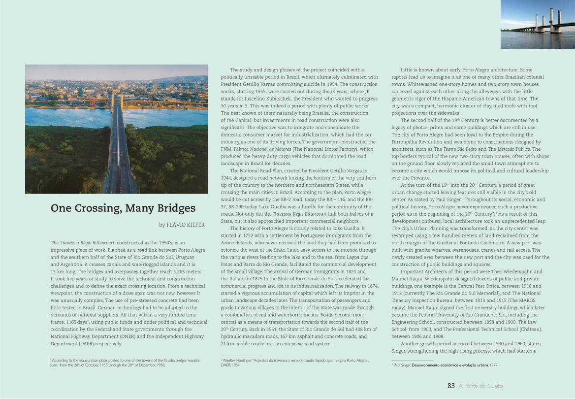
83 A Ponte do Guaíba
by FLÁVIO KIEFER
The Travessia Régis Bittencourt, constructed in the 1950’s, is an
impressive piece of work. Planned as a road link between Porto Alegre
and the southern half of the State of Rio Grande do Sul, Uruguay
and Argentina, it crosses canals and waterlogged islands and it is
15 km long. The bridges and overpasses together reach 5.263 meters.
It took five years of study to solve the technical and construction
challenges and to define the exact crossing location. From a technical
viewpoint, the construction of a draw span was not new, however it
was unusually complex. The use of pre-stressed concrete had been
little tested in Brazil. German technology had to be adapted to the
demands of national suppliers. All that within a very limited time
frame, 1165 days1, using public funds and under political and technical
coordination by the Federal and State governments through the
National Highway Department (DNER) and the Independent Highway
Department (DAER) respectively.
The study and design phases of the project coincided with a
politically unstable period in Brazil, which ultimately culminated with
President Getúlio Vargas committing suicide in 1954. The construction
works, starting 1955, were carried out during the JK years, where JK
stands for Juscelino Kubitschek, the President who wanted to progress
50 years in 5. This was indeed a period with plenty of public works.
The best known of them naturally being Brasilia, the construction
of the Capital, but investments in road construction were also
significant. The objective was to integrate and consolidate the
domestic consumer market for industrialization, which had the car
industry as one of its driving forces. The government constructed the
FNM, Fábrica Nacional de Motores (The National Motor Factory), which
produced the heavy-duty cargo vehicles that dominated the road
landscape in Brazil for decades.
The National Road Plan, created by President Getúlio Vargas in
1944, designed a road network linking the borders of the very southern
tip of the country to the northern and northeastern States, while
crossing the main cities in Brazil. According to the plan, Porto Alegre
would be cut across by the BR-2 road, today the BR – 116, and the BR-
37, BR-290 today. Lake Guaíba was a hurdle for the continuity of the
roads. Not only did the Travessia Régis Bittencourt link both halves of a
State, but it also approached important commercial neighbors.
The history of Porto Alegre is closely related to Lake Guaíba. It
started in 1752 with a settlement by Portuguese immigrants from the
Azores Islands, who never received the land they had been promised to
colonize the west of the State. Later, easy access to the interior, through
the various rivers leading to the lake and to the sea, from Lagoa dos
Patos and Barra do Rio Grande, facilitated the commercial development
of the small village. The arrival of German immigrants in 1824 and
the Italians in 1875 to the State of Rio Grande do Sul accelerated this
commercial progress and led to its industrialization. The railway in 1874,
started a vigorous accumulation of capital which left its imprint in the
urban landscape decades later. The transportation of passengers and
goods to various villages in the interior of the State was made through
a combination of rail and waterborne means. Roads become more
central as a means of transportation towards the second half of the
20th Century. Back in 1951, the State of Rio Grande do Sul had 408 km of
hydraulic macadam roads, 167 km asphalt and concrete roads, and
21 km cobble roads2, not an extensive road system.
Little is known about early Porto Alegre architecture. Some
reports lead us to imagine it as one of many other Brazilian colonial
towns. Whitewashed one-story homes and two-story town houses
squeezed against each other along the alleyways with the little
geometric rigor of the Hispanic-American towns of that time. The
city was a compact, harmonic cluster of clay tiled roofs with roof
projections over the sidewalks .
The second half of the 19th Century is better documented by a
legacy of photos, prints and some buildings which are still in use.
The city of Porto Alegre had been loyal to the Empire during the
Farroupilha Revolution and was home to constructions designed by
architects, such as The Teatro São Pedro and The Mercado Público. The
top borders typical of the new two-story town houses, often with shops
on the ground floor, slowly replaced the small town atmosphere to
become a city which would impose its political and cultural leadership
over the Province.
At the turn of the 19th into the 20th Century, a period of great
urban change started leaving features still visible in the city’s old
center. As stated by Paul Singer, “Throughout its social, economic and
political history, Porto Alegre never experienced such a productive
period as in the beginning of the 20th Century”.3 As a result of this
development outburst, local architecture took an unprecedented leap.
The city’s Urban Planning was transformed, as the city center was
revamped using a few hundred meters of land reclaimed from the
north margin of the Guaíba at Ponta do Gasômetro. A new port was
built with granite wharves, warehouses, cranes and rail access. The
newly created area between the new port and the city was used for the
construction of public buildings and squares.
Important Architects of this period were Theo Wiederspahn and
Manoel Itaqui. Wiederspahn designed dozens of public and private
buildings, one example is the Central Post Office, between 1910 and
1913 (currently The Rio Grande do Sul Memorial), and The National
Treasury Inspection Bureau, between 1913 and 1915 (The MARGS
today). Manoel Itaqui signed the first university buildings which later
became the Federal University of Rio Grande do Sul, including the
Engineering School, constructed between 1898 and 1900, The Law
School, from 1900, and The Professional Technical School (Château),
between 1906 and 1908.
Another growth period occurred between 1940 and 1960, states
Singer, strengthening the high rising process, which had started a
One Crossing, Many Bridges
1 According to the inauguration plate, posted to one of the towers of the Guaiba bridge movable span, from the 28th of October, 1955 through the 28th of December, 1958. 3 Paul Singer. Desenvolvimento econômico e evolução urbana. 1977.
2 Waelter Haetinger. “Aspectos da travessia, a seco, do caudal líquido que margeia Porto Alegre”. DAER, 1954.
84One Crossing, Many Bridges
little before 1930. In 1935, the city celebrated one hundred years of
Farroupilha War urbanizing Campo da Redenção, renaming it Parque
Farroupilha, whose preliminary drawings were signed by Alfred Agache
and design and construction by Christiano Gelbert.
In terms of urban planning, since 1914 the city had been expecting
the implementation of the General Improvements Plan, made by
engineer and architect João Moreira Maciel. The Plan basically
established road and sanitation guidelines, allowing for the widening
and opening of new streets in the city center. Between the years of 1928
and 1932, the most important enterprise for the modernization of Porto
Alegre, was the opening of Avenida Borges de Medeiros, including the
construction of the Otávio Rocha overpass, by Manoel Itaqui. Another
important project from the same period was the opening of Avenida
Farrapos, in 1937, towards the airport and the northern exit of the city.
This was the main road in metropolitan Porto Alegre, and became part
of the BR-2 (today 116) and of the path leading to the Guaíba bridge.
Porto Alegre started the 1950’s with a population of 394 000
inhabitants. At he end of the decade, it had reached 635 000.
This growth rate, quite impressive as compared with numbers
today, became a recurrent subject in the academic and technical
communities. The fast growing city needed to be modernized. In
Brazil at that time, modernizing meant rebuilding cities inspired in
the modern movement, replacing the old street network with fast
boulevards with huge buildings erected distant from each other.
The traditional city was yet again under pressure running the
risk of completely disappearing. However, a number of big size
construction works of exceptional architectural quality, introduced
a positive modernist footprint in Porto Alegre as of 1952. The most
important emerged from the partnership between the local Azevedo,
Moura & Gertum building company with Uruguayan Architect Román
Fresnedo Siri, who won the contest to construct the new building
of the Rio Grande do Sul Jockey Club. This architectural compound
was inaugurated in 1959. Another important building was the Court
of Appeals (Tribunal de Justiça), designed in 1953 by Architects Luiz
Fernando Corona and Carlos Maximiliano Fayet.
The implementation of the Jockey Club compound in Baía do
Cristal is, to a certain extent, a result of the enormous natural disaster
in 1941: the flooding of the Guaíba. It was the plan to protect the
city surrounding it by a belt of landfills and dikes, that allowed the
Porto Alegre local authorities to offer the land reclaimed form the
lake in exchange for the old club building, at the location of today’s
Parque Moinhos de Vento. The dikes were used for the construction of a
freeway system, including the Avenida Castelo Branco, crossing under
the access ramps of the Guaíba bridge, and the Porto Alegre – Osório
highway known as the Free-Way.
The crossingsFrom the southern end of the city, not far from the new Jockey
Club, the barges departed crossing Lake Guaíba towards the south of
the State. The barge system was implemented in 1941 by DAER, at the
Ponta do Dionísio, in the Vila Assunção neighborhood, to replace the
precarious system run by a boat transportation company until then.
The new barges, according to engineer Waelter Haetinger, were bought
as an emergency measure during and right after the Second World
War4. They could carry 22 cars or 9 buses, an average of 15 vehicles.
Because they were an adaptation with only one access, they were
forced to make complex maneuvers to dock. The average crossing time
was 1 hour and 30 minutes for a little over 5 km. New barges were
added to the fleet as needed, yet the system did not keep up with the
growth in traffic. In 1954, 6 barges were in operation, transporting 246
000 vehicles and 827 000 passengers, these numbers were increasing
twofold every three to four years5.
In 1948, engineer Clovis Pestana, Transport Minister during the
President Dutra administration, deployed the DNER and the DAER
to solve the growing deficiencies in the barge system. The proposed
solution was a tunnel underwater linking Ponta do Gasômetro to
Ilha da Pintada. It generated great controversy and turned into one
of the hottest technical debates the city has ever been through. To
settle the dispute involving important officials in road transportation,
the DAER created a committee under the coordination of engineers
João Carlos Teixeira, Marcus Kruter and A. M. Waldock to study and
compare solutions for crossing the lake. The result of this study
was presented and debated in the engineering community and the
technical arguments were made public in the DAER publications. The
local population followed the discussion through long articles and
transcripts published in the city newspapers.
One of the first options under study was to modernize the barge
system, replacing the old barges with larger ferries more adequate for
this type of crossing. The National Road Plan, however, preferred a dry
road crossing. As put by Walter Haetinger, “the link between north and
south, through Porto Alegre, is ultimately a problem of city crossing,
using the main roads of the National Road Plan”6. The controversy
dominated the discussions leading to the decision to construct a
bridge system on the Jacuí Delta.
The need to span across the Guaíba, once the idea of modernizing
the barge system had been ruled out, began to be looked at from
three perspectives: A - south of the capital, B - starting at the center
of town, and C - taking off from the north. Any of the above had to
take into account water crossing leaving a 40 meter span for vessel
traffic. Important aspects such as the cost of each alternative and the
issue of pass through traffic were compared. However, other issues
were raised, such as one put by engineer Waelter Haetinger, who,
advocating the choice of the north, even used the military argument
to facilitate the deployment of troops and the proximity of an air
base. Arguing against the tunnel in the Gasômetro, he pointed out
the psychological aspects and the number of tunnel accidents the
international media had been publishing.
Engineer and architect Edyrceu Fontoura, from DAER, in favor of
the north solution, conducted a study about the urban development
of Porto Alegre, focusing on the evolution of public means of
transportation. His valuable work7 included detailed maps, with slide
overlay and a wealth of historical data and numbers, and showed a
great deal of urban sensibility. It compares Porto Alegre with other big
cities and forecasts with rare clairvoyance, a lot of what became true
in Porto Alegre, such as the deterioration of the city center because
of the excessive proliferation of high rises. It shows similarities
with the city of Rio de Janeiro, with a residential use of the space in
the southern end and more industries and services located in the
northern areas8.
The A solution suggested a bridge exactly where the barges
departed from, in Vila Assunção, making a direct connection with the
city of Guaíba. Despite the advantage of being the shortest southbound
way and making a direct link between the urban areas of both cities,
the stretch over the water was longer. In addition, all the traffic from
the north would have to cross long urban parts of Porto Alegre. The
estimated cost of crossing 5 450 meters, with a 100 meter long
50 meter high central span and an 8 meter deck (single lane), was
almost the same as the final solution, but at much higher urban
construction costs. This solution seemed to have been easily ruled out,
4 Waelter Haetinger. Op. cit.5 Idem.
6 Ibidem. 7 Edyrceu Fontoura. “Aspecto urbano na travessia do Guaíba”. DAER, 1954.8 Idem
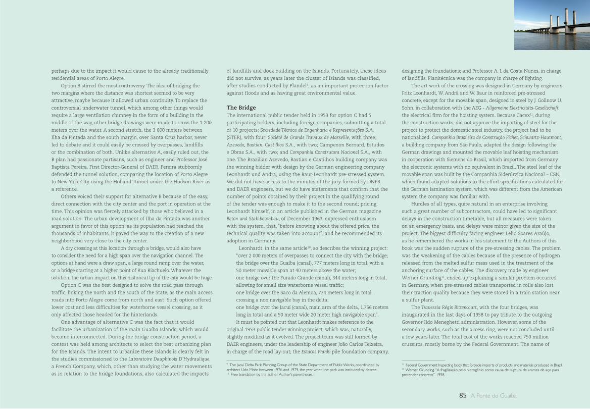
85 A Ponte do Guaíba
perhaps due to the impact it would cause to the already traditionally
residential areas of Porto Alegre.
Option B stirred the most controversy. The idea of bridging the
two margins where the distance was shortest seemed to be very
attractive, maybe because it allowed urban continuity. To replace the
controversial underwater tunnel, which among other things would
require a large ventilation chimney in the form of a building in the
middle of the way, other bridge drawings were made to cross the 1 200
meters over the water. A second stretch, the 3 600 meters between
Ilha da Pintada and the south margin, over Santa Cruz harbor, never
led to debate and it could easily be crossed by overpasses, landfills
or the combination of both. Unlike alternative A, easily ruled out, the
B plan had passionate partisans, such as engineer and Professor José
Baptista Pereira. First Director-General of DAER, Pereira stubbornly
defended the tunnel solution, comparing the location of Porto Alegre
to New York City using the Holland Tunnel under the Hudson River as
a reference.
Others voiced their support for alternative B because of the easy,
direct connection with the city center and the port in operation at the
time. This opinion was fiercely attacked by those who believed in a
road solution. The urban development of Ilha da Pintada was another
argument in favor of this option, as its population had reached the
thousands of inhabitants, it paved the way to the creation of a new
neighborhood very close to the city center.
A dry crossing at this location through a bridge, would also have
to consider the need for a high span over the navigation channel. The
options at hand were a draw span, a large round ramp over the water,
or a bridge starting at a higher point of Rua Riachuelo. Whatever the
solution, the urban impact on this historical tip of the city would be huge.
Option C was the best designed to solve the road pass through
traffic, linking the north and the south of the State, as the main access
roads into Porto Alegre come from north and east. Such option offered
lower cost and less difficulties for waterborne vessel crossing, as it
only affected those headed for the hinterlands.
One advantage of alternative C was the fact that it would
facilitate the urbanization of the main Guaíba Islands, which would
become interconnected. During the bridge construction period, a
contest was held among architects to select the best urbanizing plan
for the Islands. The intent to urbanize these Islands is clearly felt in
the studies commissioned to the Laboratoire Dauphinois D’Hydraulique,
a French Company, which, other than studying the water movements
as in relation to the bridge foundations, also calculated the impacts
of landfills and dock building on the Islands. Fortunately, these ideas
did not survive, as years later the cluster of Islands was classified,
after studies conducted by Plandel9, as an important protection factor
against floods and as having great environmental value.
The BridgeThe international public tender held in 1953 for option C had 5
participating bidders, including foreign companies, submitting a total
of 10 projects: Sociedade Técnica de Engenharia e Representações S.A.
(STER), with four; Société de Grands Travaux de Marseille, with three;
Azevedo, Bastian, Castilhos S.A., with two; Campenon Bernard, Estudos
e Obras S.A., with two; and Companhia Construtora Nacional S.A., with
one. The Brazilian Azevedo, Bastian e Castilhos building company was
the winning bidder with design by the German engineering company
Leonhardt und Andrä, using the Baur-Leonhardt pre-stressed system.
We did not have access to the minutes of the jury formed by DNER
and DAER engineers, but we do have statements that confirm that the
number of points obtained by their project in the qualifying round
of the tender was enough to make it to the second round; pricing.
Leonhardt himself, in an article published in the German magazine
Beton und Stahlbetonbau, of December 1963, expressed enthusiasm
with the system, that, “before knowing about the offered price, the
technical quality was taken into account”, and he recommended its
adoption in Germany.
Leonhardt, in the same article10, so describes the winning project:
“over 2 000 meters of overpasses to connect the city with the bridge;
the bridge over the Guaíba (canal), 777 meters long in total, with a
50 meter movable span at 40 meters above the water;
one bridge over the Furado Grande (canal), 344 meters long in total,
allowing for small size waterborne vessel traffic;
one bridge over the Saco da Alemoa, 774 meters long in total,
crossing a non navigable bay in the delta;
one bridge over the Jacuí (canal), main arm of the delta, 1.756 meters
long in total and a 50 meter wide 20 meter high navigable span”.
It must be pointed out that Leonhardt makes reference to the
original 1953 public tender winning project, which was, naturally,
slightly modified as it evolved. The project team was still formed by
DAER engineers, under the leadership of engineer João Carlos Teixeira,
in charge of the road lay-out; the Estacas Franki pile foundation company,
designing the foundations; and Professor A. J. da Costa Nunes, in charge
of landfills. Planitécnica was the company in charge of lighting.
The art work of the crossing was designed in Germany by engineers
Fritz Leonhardt, W. Andrä and W. Baur in reinforced pre-stressed
concrete, except for the movable span, designed in steel by J. Gollnow U.
Sohn, in collaboration with the AEG - Allgemeine Elektricitäts-Gesellschaft
the electrical firm for the hoisting system. Because Cacex11, during
the construction works, did not approve the importing of steel for the
project to protect the domestic steel industry, the project had to be
nationalized. Companhia Brasileira de Construção Fichet, Schwartz-Hautmont,
a building company from São Paulo, adapted the design following the
German drawings and mounted the movable leaf hoisting mechanism
in cooperation with Siemens do Brasil, which imported from Germany
the electronic systems with no equivalent in Brazil. The steel leaf of the
movable span was built by the Companhia Siderúrgica Nacional – CSN,
which found adapted solutions to the effort specifications calculated for
the German lamination system, which was different from the American
system the company was familiar with.
Hurdles of all types, quite natural in an enterprise involving
such a great number of subcontractors, could have led to significant
delays in the construction timetable, but all measures were taken
on an emergency basis, and delays were minor given the size of the
project. The biggest difficulty facing engineer Lélio Soares Araújo,
as he remembered the works in his statement to the Authors of this
book was the sudden rupture of the pre-stressing cables. The problem
was the weakening of the cables because of the presence of hydrogen
released from the melted sulfur mass used in the treatment of the
anchoring surface of the cables. The discovery made by engineer
Werner Grunding12, ended up explaining a similar problem occurred
in Germany, when pre-stressed cables transported in rolls also lost
their traction quality because they were stored in a train station near
a sulfur plant.
The Travessia Régis Bittencourt, with the four bridges, was
inaugurated in the last days of 1958 to pay tribute to the outgoing
Governor Ildo Meneghetti administration. However, some of the
secondary works, such as the access ring, were not concluded until
a few years later. The total cost of the works reached 750 million
cruzeiros, mostly borne by the Federal Government. The name of
9 The Jacuí Delta Park Planning Group of the State Department of Public Works, coordinated by architect Udo Mohr, between 1976 and 1979, the year when the park was instituted by decree.10 Free translation by the author. Author’s parentheses.
11 Federal Government Inspecting body that forbade imports of products and materials produced in Brazil.12 Werner Grunding. “A fragilização pelo hidrogênio como causa de ruptura de arames de aço para protender concreto”. 1958.
86
the crossing was a suggestion of the Government of the State of Rio
Grande do Sul as a tribute to the then Director of DNER. An interesting
fact was that the State administration changed soon after the
inauguration with Ildo Menegheti as the outgoing Governor replaced
by Governor Leonel de Moura Brizola. Governor Brizola decided to
rename the bridge as a tribute to his political mentor, Getúlio Vargas,
going to the extent of replacing part of the large inauguration panel
placed in one of the pillars. The plaque was mysteriously stolen the
day after... and the Federal Government, the actual owner of the road,
never recognized the attempt to change the name.
After the inauguration festivities, followed by a large crowd, the
movable bridge became a major attraction in the city, and one of
its most popular post cards, concealing the fact that the crossing is
much longer and complex. However, it is clear that the draw bridge
stands out with its four towers. These towers, according to Leonhardt,
demanded a detailed design to combine the regular reinforced
concrete with the rest of the pre-stressed structure. A detailed study
was also conducted to cause the height of the metal beams to coincide
with the other beams in the pre-stressed concrete spans, maintaining
a harmonic balance of the structure as a whole.
From afar they look like independent pillars which continued to
grow to form a sort of lighthouse or strange multiplied observatories.
The small vertical glass openings at the top reinforce the atmosphere
of mystery and inspire curiosity. It is only when we move closer that
it is possible to see that the towers are attached two by two under
the bridge, forming such a large pillar that it can shelter the control
equipment machinery. So, it becomes easier to understand the idea
behind the draw bridge. Inside these towers counterweights run to
hoist the 460 ton leaf (57,54 meters long X 18,30 meters wide13). It is
possible to see the set of cables running on the inside of the towers,
connecting the engines under the bridge to pulleys at the top to
hoist the metal deck 26 meters. The span of this structure between
supports is 55,80 meters high, and the four traffic lanes divided in two
directions are 16 meters wide. On each side, a one meter wide sidewalk
seems to confirm that at the time of the works it was unimaginable
that pedestrian, bicycle and horse-drawn cart traffic could one day
become a problem.
The lifting and lowering mechanism of the bridge is activated to
let waterborne traffic through at pre-booked hours and it is controlled
by an operator sitting in a booth similar to an airport control tower.
Constructed with an element attached to one of the columns, a few
meters above the traffic lanes, it juts out over the water and it is
entirely made of glass. Access to it is made by a spiral metal staircase
also hovering above the water . The crossing in this first stretch is
575 meters long, 16 meters wide, and has 1 815 meters of access
roads forming multiple connecting rings with the city streets. The
disadvantages of interrupting traffic are well offset by the exciting
experience of watching the lifting of the bridge and vessel crossing.
Although the next two bridges when leaving Porto Alegre are
discrete, as they do not show any structural elements, they cannot
be missed. The feeling of plunging into the beauty of the landscape,
triggered by the little height and proximity with the water is achieved
when crossing the Furado Grande canal, 344 meters long and 8 meters
high, and the Três Rios canal, 774 meters long and only six meters
above the water. This beauty is amplified by the effect of season change,
or even the different times of the day, on the local environment. The
meeting point of the waters against the green color of the islands
and the colorful sky make up the frame and point to downtown Porto
Alegre. It is impossible not to notice the ephemeral presence of the
sublime when we enjoy, as the speed of the road permits, such harmony
between the natural and the man-made landscape.
The bridge over the Jacuí canal, last in the crossing, has the shape
of a gigantic arch, is 1 755 meters long, with a 53 meter central span.
From afar, over the road horizon, the bridge appears as an obstacle of
almost insurmountable height. Fortunately, on approaching the bridge
this sensation is dissipated, revealing a smooth gentle slope built to
cross the high central span, 20 meters above the water. This span
allows for vessel crossing towards the Jacuí river, the largest in the
State, and the border between Porto Alegre and Eldorado do Sul. From
the top of the bridge, as in a belvedere, travelers arriving from the
south have the chance to see the city awaiting them for the first time.
The more we study this project, the more the construction,
calculation, foundation building, shapes, pre-stressing, metal
structures and mechanical systems of the movable span, as well as the
architectural and design aspects impress as a technical and scientific
contribution. We hope that further research work will continue to
analyze the data hereby presented , now dispersed in publications and
archives in Brazil, Germany and France, widening and deepening the
knowledge of this work.
The articulation of the crossing and the city, seen from above, shows
the beauty of a layout that we do not easily sense from the ground.
A cluster of intertwined roads forming a circle distributes the traffic
in many directions. Underneath this ring is Avenida Castelo Branco
and its extension as a freeway, the commuter trains, local traffic and
the extension of Avenida Voluntários da Pátria, using an overpass that
managed to squeeze itself between the bridges and the metro tracks.
Underneath all this, a passage between the neighborhood and the port
had to be built. Traffic flow is so complex that, for a pedestrian, this
concentration of vehicle lanes and overpasses ended up creating an
unsafe no-zone with difficult orientation. The vast residual areas are only
used once a year in the traditional Navegantes Festivities. The city saw
in the lake the best possibilities for economic development, but has been
timorous in exploiting its tourist, cultural and leisure potential.
The construction of the Porto Alegre–Osório Freeway in the 1970’s has
completed a traffic distribution system which is easily connected from
the bridge to the various roads crossing metropolitan Porto Alegre. It does
not take much effort to recognize the adequacy of the location of the
crossing and its impact on the everyday life of Porto Alegre residents.
The traffic has increased so much that its duplication became
inevitable in 1979, confirming how timely and wise was the construction
of the double lane movable span bridge. The concession of the road
to Concepa, integrating it to the Porto Alegre-Osório Freeway, enabled
further investments for the duplication of the remaining stretch and its
transformation into an expressway with the construction of an access
overpass to Eldorado do Sul - a city that grew along the road – and
because of the road. The current growth in pass through traffic, however,
indicates that it will soon be necessary to build an alternative for crossing
the Guaíba. The draw bridge, as it is also known, the city post card, will
be then entering a new cycle only serving local traffic. Possibly better
integrated into the life of the city and the landscape. It is certain that it
will continue for years to come the guardian of the southern entrance to
the city. A symbol and a landmark, revealing immediately what awaits
the visitor. Quasi medieval elements mixed with dynamic forms tuned
into the future leave no doubt: here, conflict between past and future,
tradition and avant-garde is always present.
13 In order to lighten the weight, the system utilized was one by that time unknown in Brazil: the orthothropic deck, where the deck plate of the bridge replaces the tables of the upper double T beams. The platform was also entirely welded in order to avoid overloading of the rivets. Further technical data on the draw bridge platform may be found in: José de Moura Villas Boas. “A ponte levadiça, soldada, sobre o rio Guaíba: problemas de obtenção do aço e de fabricação”, 1959.
One Crossing, Many Bridges
1 : : North to south, the BR-2 – today 116 –, connected the city of Jaguarão to Belém do Pará and east to west the BR-37 – today 290 – Osório to Uruguaiana.
2 : : São Pedro Theater built between 1850 and 1858, designed by Theodor Von Normann.
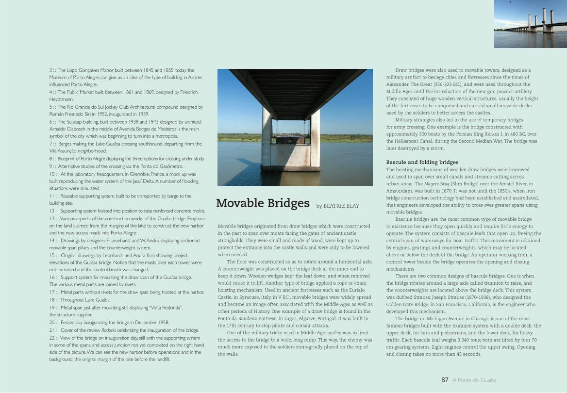
87 A Ponte do Guaíba
3 : : The Lopo Gonçalves Manor built between 1845 and 1855, today the Museum of Porto Alegre, can give us an idea of the type of building in Azores influenced Porto Alegre.
4 : : The Public Market built between 1861 and 1869, designed by Friedrich Heydtmann.
5 : : The Rio Grande do Sul Jockey Club. Architectural compound designed by Román Fresnedo Siri in 1952, inaugurated in 1959.
6 : : The Sulacap building, built between 1938 and 1943 designed by architect Arnaldo Gladosch in the middle of Avenida Borges de Medeiros is the main symbol of the city which was beginning to turn into a metropolis.
7 : : Barges making the Lake Guaíba crossing southbound, departing from the Vila Assunção neighborhood.
8 : : Blueprint of Porto Alegre displaying the three options for crossing under study.
9 : : Alternative studies of the crossing via the Ponta do Gasômetro.
10 : : At the laboratory headquarters, in Grenoble, France, a mock up was built reproducing the water system of the Jacuí Delta. A number of flooding situations were simulated.
11 : : Reusable supporting system, built to be transported by barge to the building site.
12 : : Supporting system hoisted into position to take reinforced concrete molds.
13 : : Various aspects of the construction works of the Guaíba bridge. Emphasis on the land claimed from the margins of the lake to construct the new harbor and the new access roads into Porto Alegre.
14 : : Drawings by designers F. Leonhardt and W. Andrä, displaying sectioned movable span pillars and the counterweight system.
15 : : Original drawings by Leonhardt und Andrä firm showing project elevations of the Guaíba bridge. Notice that the masts over each tower were not executed and the control booth was changed.
16 : : Support system for mounting the draw span of the Guaíba bridge. The various metal parts are joined by rivets.
17 : : Metal parts without rivets for the draw span being hoisted at the harbor.
18 : : Throughout Lake Guaíba.
19 : : Metal span just after mounting still displaying “Volta Redonda”, the structure supplier.
20 : : Festive day inaugurating the bridge in December 1958.
21 : : Cover of the review Rodovia celebrating the inauguration of the bridge.
22 : : View of the bridge on inauguration day, still with the supporting system in some of the spans, and access junction not yet completed on the right hand side of the picture. We can see the new harbor before operations, and in the background, the original margin of the lake before the landfill.
Movable bridges originated from draw bridges which were constructed
in the past to span over moats facing the gates of ancient castle
strongholds. They were small and made of wood, were kept up to
protect the entrance into the castle walls and were only to be lowered
when needed.
The floor was constructed so as to rotate around a horizontal axle.
A counterweight was placed on the bridge deck at the inner end to
keep it down. Wooden wedges kept the leaf down, and when removed
would cause it to lift. Another type of bridge applied a rope or chain
hoisting mechanism. Used in ancient fortresses such as the Eurialo
Castle, in Syracuse, Italy, in V BC., movable bridges were widely spread
and became an image often associated with the Middle Ages as well as
other periods of History. One example of a draw bridge is found in the
Ponta da Bandeira Fortress, in Lagos, Algarve, Portugal. It was built in
the 17th century to stop pirate and corsair attacks.
One of the military tricks used in Middle Age castles was to limit
the access to the bridge to a wide, long ramp. This way, the enemy was
much more exposed to the soldiers strategically placed on the top of
the walls.
Draw bridges were also used in movable towers, designed as a
military artifact to besiege cities and fortresses since the times of
Alexander, The Great (356-323 BC.), and were used throughout the
Middle Ages until the introduction of the new gun powder artillery.
They consisted of huge wooden vertical structures, usually the height
of the fortresses to be conquered and carried small movable decks
used by the soldiers to better access the castles.
Military strategies also led to the use of temporary bridges
for army crossing. One example is the bridge constructed with
approximately 300 boats by the Persian King Xerxes I, in 480 BC, over
the Hellespont Canal, during the Second Median War. The bridge was
later destroyed by a storm.
Bascule and folding bridgesThe hoisting mechanisms of wooden draw bridges were improved
and used to span over small canals and streams cutting across
urban areas. The Magere Brug (Slim Bridge) over the Amstel River, in
Amsterdam, was built in 1670. It was not until the 1850’s, when iron
bridge construction technology had been established and assimilated,
that engineers developed the ability to cross over greater spans using
movable bridges.
Bascule bridges are the most common type of movable bridge
in existence because they open quickly and require little energy to
operate. The system consists of bascule leafs that open up, freeing the
central span of waterways for boat traffic. This movement is obtained
by engines, gearings and counterweights, which may be located
above or below the deck of the bridge. An operator working from a
control tower beside the bridge operates the opening and closing
mechanisms.
There are two common designs of bascule bridges. One is when
the bridge rotates around a large axle called trunnion to raise, and
the counterweights are located above the bridge deck. This system
was dubbed Strauss. Joseph Strauss (1870-1938), who designed the
Golden Gate Bridge, in San Francisco, California, is the engineer who
developed this mechanism.
The bridge on Michigan Avenue in Chicago, is one of the most
famous bridges built with the trunnion system with a double deck: the
upper deck, for cars and pedestrians, and the lower deck, for heavy
traffic. Each bascule leaf weighs 3.340 tons; both are lifted by four 70
cm gearing systems. Eight engines control the upper swing. Opening
and closing takes no more than 45 seconds.
by BEATRIZ BLAYMovable Bridges
88
of the deck, whereas the bascule bridge counterweights have to weigh
several times more than the span to be lifted to offset the seesaw effect.
Therefore, vertical lift bridges are the most suitable for heavy rail traffic.
Most vertical lift bridges use towers with counterweights, some
use hydraulic jacks located below the deck. The main disadvantage
of this type of bridge is the height restriction resulting from the deck
being above the passageway.
ChicagoChicago is the third largest metropolitan area the United States. It is
located on the shores of Lake Michigan, one of North America’s Great
Lakes. The city center known as the Loop, is squeezed between the
lake, the Chicago River and the railway system. In early Chicago, boats
coming from the lake came into the river. Cars, trains and trucks as
well as pedestrians had to cross the city northbound and southbound
everyday. The combination of these factors led to the use of movable
bridges all along the river, the first one dated 1834. It did not survive
weather conditions due to its ancient cable and counterweight lifting
mechanism. It was not until 1902 that engine and gearing bridges
started to appear. Today, there are 45, and Chicago is the city with the
highest number of movable bridges in the world. The most common
is the bascule trunnion. This type of bridge has become so closely
associated with the city that it is internationally known as the Chicago
type. Today large water vessels no longer move around the center of
town. Only sail and leisure boats navigate the river during spring and
summer, when the bridges remain open at pre-booked hours.
On Saint Patrick’s Day, the 17th of March, National Irish Day and
celebration of the Founder of Irish Christianity, the Chicago River
waters are dyed green.
Saint PetersburgTsar Peter I, the Great (1672-1725) founded the city of Saint Petersburg
in 1703 as one of the pillars of his political project to modernize Russia.
The new capital was meant to be a window to Europe. His ambition
was to create a city inspired in the cities of Amsterdam or Venice. Saint
Petersburg is an important commercial center and naval base and it
is located in a swamp area among over one hundred islands amid the
scores of rivers, canals and streams. The main river is the Neva.
The main public buildings are all facing the Neva, including the Winter
Palace, home to the Hermitage Museum. However, despite its geographic
characteristics, Peter the Great banned the construction of bridges.
He wanted the local population to use boats in summer and
sledges when the water froze in winter. After his death a number of
bridges were constructed. Today, there are 342 bridges of different
sizes, styles and building techniques, constructed in different periods
in time. Some are small passageways for pedestrians; others are major
traffic roads, such as the Alexander Nevsky Bridge, almost one km
long. Over the Neva River, all bridges are bascule movable bridges.
During the night, they remain lifted to allow for boat traffic, keeping
pedestrians from crossing the river. It was not before 2003 that the
first braced fixed bridge was built to cross the Neva River, also allowing
night pedestrian crossing.
Town twining is a symbolic link created between two cities with
some affinity to foster political, economic and cultural bonds. Saint
Petersburg is sister town to Porto Alegre.
Transporter or aerial transfer bridgesAerial transfer or transporter bridges are quite rare. Mobility is achieved
by a gondola which hangs from a high bridge structure and moves
through a system of wheels. They are similar to rolling bridges which
unload cargo into vessels at harbor. The Duluth Bridge, in the border
between the States of Minnesota and Wisconsin, U.S.A., is one of the
two rare examples in America and it is considered to be a Historical
landmark. It was constructed in 1905 and redesigned in 1930, and is
still in use. Many attempts to cross the small canal spanning over a
place known as the Minnesota Point were hindered by difficult weather
conditions. Barges could be used in summer, but the ice made crossing
impossible in winter. A local Engineer, Thomas Mc Gilway, came up with
the solution and when inaugurated, the bridge could only carry 54 tons.
The 1930 redesign lifted the central span to facilitate waterborne traffic.
Tower Bridge, LondonProbably the most famous movable bridge in the world is the Tower
Bridge across the Thames in London. It was inaugurated in 1894,
designed by Horace Jones and later modified by John Wolfe-Barry. The
244 meter bridge was originally operated by a hydraulic system for
lifting the 61 meter wide central span, flanked by two towers. Steam
power from coal-burning boilers pumped river water into six large
hydraulic accumulators, so that power was readily available when
required. The 65 meter tall steel towers were built to be in harmony
with the original London Tower and were built in Victorian Gothic
style. When the bridge is open it looks like a Middle Age castle.
Another form of bascule bridge uses a rolling system, in which
the bridge is lifted from two huge rotating steel cylinders with
counterweights, similar to a rocking chair. Little energy is needed
to lift this type of bridge, as the rotation force reduces friction.
This system is known as Scherzer rolling lift bridge, a tribute to its
inventor, William Scherzer (1858-1893).
A folding bridge is a type of movable bridge. It is a three-segment
bascule bridge that folds in the shape of the letter “N”.
The Planning Department of the City of Kiel commissioned a
project for a pedestrian bridge to become a symbol of this Baltic
Sea town. The opening and closing mechanism were required to be
fast. The demands led to the development of a system resembling a
foldable bed, which became a tourist attraction in the city.
Swing bridgesSwing bridges are movable bridges which rotate around a pivot point
located in the center of a watercourse allowing for boat traffic on both
sides. When the canal is too narrow making it impossible to install
the pillar in the center, the bridge can be attached by one end while
the other remains jutting out over the water when the span is open.
Compared to other movable bridges, swing bridges are slow. Many of
them have been replaced by bascule or vertical lift bridges.
Leonardo da Vinci (1452-1519) designed a swing bridge. It was built
on boats and a special hook, cables and ropes caused it to withdraw
to fit into a niche especially built on the riverside, therefore not
obstructing water traffic. This system was likely developed for rivers
with still waters.
The advantage of this type of bridge is that it requires no
counterweights. Its complete weight is significantly reduced as
compared to other types of movable bridges. The disadvantage is
the need for a central foundation pier, which may be a hazard to
navigation as the shipping channel is reduced.
Submersible and vertical lift bridgesAnother type of movable bridge is the submersible bridges. The bridge
deck is lowered below the water level to permit waterborne traffic.
Vertical lift bridges use pulleys, engines and counterweights
to lift the movable section, as in an elevator. The central span rises
vertically while remaining parallel with the deck. This system offers
the benefit of lower cost as compared to bascule and swing bridges, as
the counterweights for lifting are required to be equal to the weight
Movable Bridges
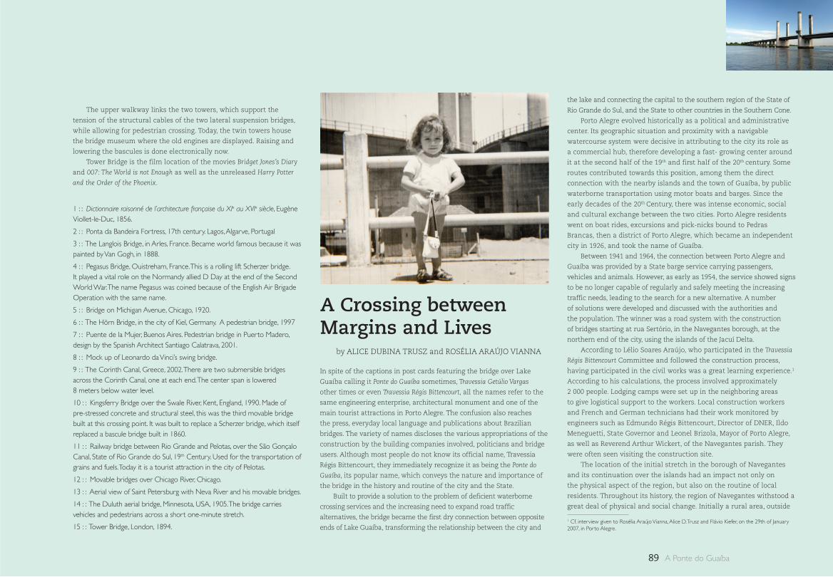
89 A Ponte do Guaíba
1 : : Dictionnaire raisonné de l’architecture française du XIe au XVIe siècle, Eugène Viollet-le-Duc, 1856.
2 : : Ponta da Bandeira Fortress, 17th century. Lagos, Algarve, Portugal
3 : : The Langlois Bridge, in Arles, France. Became world famous because it was painted by Van Gogh, in 1888.
4 : : Pegasus Bridge, Ouistreham, France. This is a rolling lift Scherzer bridge. It played a vital role on the Normandy allied D Day at the end of the Second World War. The name Pegasus was coined because of the English Air Brigade Operation with the same name.
5 : : Bridge on Michigan Avenue, Chicago, 1920.
6 : : The Hörn Bridge, in the city of Kiel, Germany. A pedestrian bridge, 1997
7 : : Puente de la Mujer, Buenos Aires. Pedestrian bridge in Puerto Madero, design by the Spanish Architect Santiago Calatrava, 2001.
8 : : Mock up of Leonardo da Vinci’s swing bridge.
9 : : The Corinth Canal, Greece, 2002. There are two submersible bridges across the Corinth Canal, one at each end. The center span is lowered 8 meters below water level.
10 : : Kingsferry Bridge over the Swale River, Kent, England, 1990. Made of pre-stressed concrete and structural steel, this was the third movable bridge built at this crossing point. It was built to replace a Scherzer bridge, which itself replaced a bascule bridge built in 1860.
11 : : Railway bridge between Rio Grande and Pelotas, over the São Gonçalo Canal, State of Rio Grande do Sul, 19th Century. Used for the transportation of grains and fuels. Today it is a tourist attraction in the city of Pelotas.
12 : : Movable bridges over Chicago River, Chicago.
13 : : Aerial view of Saint Petersburg with Neva River and his movable bridges.
14 : : The Duluth aerial bridge, Minnesota, USA, 1905. The bridge carries vehicles and pedestrians across a short one-minute stretch.
15 : : Tower Bridge, London, 1894.
The upper walkway links the two towers, which support the
tension of the structural cables of the two lateral suspension bridges,
while allowing for pedestrian crossing. Today, the twin towers house
the bridge museum where the old engines are displayed. Raising and
lowering the bascules is done electronically now.
Tower Bridge is the film location of the movies Bridget Jones’s Diary
and 007: The World is not Enough as well as the unreleased Harry Potter
and the Order of the Phoenix.
by ALICE DUBINA TRUSZ and ROSÉLIA ARAÚJO VIANNA
A Crossing between Margins and Lives
In spite of the captions in post cards featuring the bridge over Lake
Guaíba calling it Ponte do Guaíba sometimes, Travessia Getúlio Vargas
other times or even Travessia Régis Bittencourt, all the names refer to the
same engineering enterprise, architectural monument and one of the
main tourist attractions in Porto Alegre. The confusion also reaches
the press, everyday local language and publications about Brazilian
bridges. The variety of names discloses the various appropriations of the
construction by the building companies involved, politicians and bridge
users. Although most people do not know its official name, Travessia
Régis Bittencourt, they immediately recognize it as being the Ponte do
Guaíba, its popular name, which conveys the nature and importance of
the bridge in the history and routine of the city and the State.
Built to provide a solution to the problem of deficient waterborne
crossing services and the increasing need to expand road traffic
alternatives, the bridge became the first dry connection between opposite
ends of Lake Guaíba, transforming the relationship between the city and
the lake and connecting the capital to the southern region of the State of
Rio Grande do Sul, and the State to other countries in the Southern Cone.
Porto Alegre evolved historically as a political and administrative
center. Its geographic situation and proximity with a navigable
watercourse system were decisive in attributing to the city its role as
a commercial hub, therefore developing a fast- growing center around
it at the second half of the 19th and first half of the 20th century. Some
routes contributed towards this position, among them the direct
connection with the nearby islands and the town of Guaíba, by public
waterborne transportation using motor boats and barges. Since the
early decades of the 20th Century, there was intense economic, social
and cultural exchange between the two cities. Porto Alegre residents
went on boat rides, excursions and pick-nicks bound to Pedras
Brancas, then a district of Porto Alegre, which became an independent
city in 1926, and took the name of Guaíba.
Between 1941 and 1964, the connection between Porto Alegre and
Guaíba was provided by a State barge service carrying passengers,
vehicles and animals. However, as early as 1954, the service showed signs
to be no longer capable of regularly and safely meeting the increasing
traffic needs, leading to the search for a new alternative. A number
of solutions were developed and discussed with the authorities and
the population. The winner was a road system with the construction
of bridges starting at rua Sertório, in the Navegantes borough, at the
northern end of the city, using the islands of the Jacuí Delta.
According to Lélio Soares Araújo, who participated in the Travessia
Régis Bittencourt Committee and followed the construction process,
having participated in the civil works was a great learning experience.1
According to his calculations, the process involved approximately
2 000 people. Lodging camps were set up in the neighboring areas
to give logistical support to the workers. Local construction workers
and French and German technicians had their work monitored by
engineers such as Edmundo Régis Bittencourt, Director of DNER, Ildo
Meneguetti, State Governor and Leonel Brizola, Mayor of Porto Alegre,
as well as Reverend Arthur Wickert, of the Navegantes parish. They
were often seen visiting the construction site.
The location of the initial stretch in the borough of Navegantes
and its continuation over the islands had an impact not only on
the physical aspect of the region, but also on the routine of local
residents. Throughout its history, the region of Navegantes withstood a
great deal of physical and social change. Initially a rural area, outside
1 Cf. interview given to Rosélia Araújo Vianna, Alice D. Trusz and Flávio Kiefer, on the 29th of January 2007, in Porto Alegre.
90A Crossing between Margins and Lives
the urban borders of the city, it was a place where affluent Portuguese
and their descendents built their secondary homes and ranches. Later
on, it became a destination for the less privileged immigrant families
who built their homes in the 19th Century.
The capital of the State of Rio Grande do Sul started as a
settlement in the region between what is today Ponta do Gasômetro
and Praça da Alfândega, expanded to the south, and later, to the north,
both considered and occupied for a long time as semi-rural areas. As
of 1806, when the Caminho Novo (today Avenida Voluntários da Pátria)
was opened, the urban central area circumscribing Porto Alegre was
connected with the districts of the north (Gravataí, Santo Antônio,
Osório and Vacaria), and began to enjoy the pleasant road bordering
the lake which also became the supply route, with intense dray traffic
after 1850 to the central free market. Navegantes developed along this
axis and boomed after the construction of the railroad between Porto
Alegre, São Leopoldo (1874) and Novo Hamburgo (1876), with the first
streets appearing in the1870’s.
Population growth was driven by real state development of some
properties and improvements in the transportation system. With
abundant labor, a rail system and nearby berth facilities, the first
industries settled there making Navegantes a working class suburb of
the city in the turn of the century. The first factories were small and
medium size businesses producing for local consumption, supplying
non durable consumer goods to the colonial region. The main
industries were fiber spinning and textile industries, which developed
to become relevant factories nation-wide, such as A. J. Renner & Cia.
and Companhia Industrial Rio Guahyba, to mention just a few.
As of 1926, when water supply reached suburb residences, there
was a sharp increase in house construction, particularly wooden homes
. Newcomers arrived at the region, some were immigrants, fleeing the
wars in Europe. Among these immigrants was Wasyl Trusz, who came
to the region in 1929 as a child with his family. An uncle was waiting for
their arrival, and found his father a job as a carpenter and his mother a
position as a sewer in the Renner Industries. A little after one year, the
couple had enough resources to buy land in the new settlement areas
in the northeast of the State and moved there. They might as well have
stayed in Navegantes, where there was plenty of work.
Towards the mid 1930’s, residents continued to press public
authorities for better urban services and measures against constant rain
inundations and frequent river floods in the area. Despite the familiarity
with the floods and their consequent losses, nothing would compare to
the 1941 floods, which submerged half the Navegantes district, leaving
most of the residents homeless and affecting 40 000 people in the city.
After the public disaster, a number of sanitation measures, that
had long been postponed, were taken. Among them, opening and
widening streets and construction of canals, dikes, landfills and
walls. These projects, concluded decades later, contributed to prevent
new floods, but became a hurdle between local residents and the
lake, as they were driven away from the lake shores. A number of
local activities disappeared: fishing, boat rides, and swimming of the
Navegantes young men in their free time near the places where their
mothers and sisters washed clothes.
In connection with the local routine before the construction of the
bridge, it is interesting to hear dona Ana Liseta Lorbieck, a 100 year-
old resident of Navegantes. She was born there in 1906. The daughter
of German parents who came to Porto Alegre because they could not
find a job in the coffee farms in São Paulo, Mrs Lorbieck was the first
daughter in the family to provide financial help to the family, making
and selling flower bouquets at the age of 15. But, in addition to the
flowers, she also performed the house chores, activities by then carried
out by women only. About the routine around the lake she says:
“We had a well, and the water was for cooking. It was salty. But
white linen had to be washed in the lake. Every week I carried
dry laundry down and brought it up back wet, to dry at home.
Around here at (avenida) Brasil, was the place for the washing.
There were about twenty women, each had her own spot. And so
they did every day. There was a couple with four children. They
made an income by washing for other families. They went around
with a horse-cart and picked up laundry in town. They put all the
children through school this way.”2
Their German origin had an influence on the thinking and behavior
of the residents, in the way they worked and had fun. Since the early
beginning, Navegantes had sports associations and societies for rowing
and swimming. Some of them still exist today such as Sociedade
Ginástica Navegantes São João. Another great source of fun for local
residents of the north end and neighboring cities, such as São Leopoldo
and Novo Hamburgo, between 1891 and 1907, was the Prado Navegantes,
located where the Renner Industries were subsequently established. In
the 1910’s, the movies also became a leisure activity for local workers.
In 1955, when the construction of the Travessia Régis Bittencourt
started, the neighborhood was already going through changes.
Since the end of the 1940’s, the area of the sanitation wharf, under
construction, was home to a number of slums resulting from the
intense rural migration into the cities. At the same time, large steel
mechanic and chemical industries started to move to the outskirts
near the new roads changing the economic profile of the area and
driving population growth and urbanization. The construction of
the road contributed to boost road traffic in the region, but also
had an adverse impact on the quality of life. On the one hand, rua
Sertório boomed and became a boulevard, on the other, the Praça dos
Navegantes wound up underneath one of the access ramps to the
bridge, losing visibility along with its quality of green leisure area.
The crossing was constructed where the islands of the Jacuí
Delta were located. This way, at the opposite margin of the first canal
coming from Porto Alegre, it meets the Pavão island, crossing over
islands Grande dos Marinheiros, Flores and Pintada. These islands plus
the other 12, constitute the archipelago borough and are part of the
Greater Porto Alegre. Human presence on the islands dates back to
the 18th century, when it was used as hunting and fishing grounds by
the Guarani Indians and occupied as a hiding area for fleeing African
slaves, settlement of emancipated slaves and Portuguese immigrants
and their descendants, who settled in on the Pintada and Flores
islands and expanded to the others, mo ly in the 19th Century.
The first island dwellers developed the economy based on self-
sufficient farming and fishing, making their own homes and work
tools, boats and coal. Surplus was sold in Porto Alegre, especially after
the second half of the 19th Century, when the city grew larger and
supply needs were on the increase. Therefore, river traffic between
the islands and the center of town boomed in this period, this playing
a vital role in the consolidation of settlements in the region and in
spawning a naval skilled labor force among island residents.
In addition to selling their primary output, the islands also
participated in the economic development of the State through
industrial activities. As of 1914, Pintada was home to an important
shipyard, the Mabilde, and as of 1916 a glass factory. This led to the
construction of landfills and dikes to prevent floods, and brought new
residents, steam technology, electricity and telephone to the islands.
Between 1927 and 1931, the construction of airport facilities by
Varig in the southern end of Ilha Grande and Ilha dos Marinheiros
brought more changes to the region, impacting the routine of
fishermen. Author Erico Veríssimo, in his book “Um Lugar ao Sol”, 1936,
describes the surroundings of the semi-aquatic airport, next to the
Navegantes district, using the contrast between the bright colors of
small boats of poor local residents and island fishermen and the silver
metal of the hydroplanes which stood side-by-side and kept them
company for a number of years. Recently, the literary reference was
painted in watercolor by Joaquim da Fonseca.
In 1959, the main means of transportation for islands dwellers
was still boats. The lake maintained its importance as a source of
food and income, communication and leisure. Fishing and trade in 2 Interview with Ana Liseta Lorbieck given to Rosélia Araújo Vianna, on the 2nd of July 2007, in Porto Alegre.
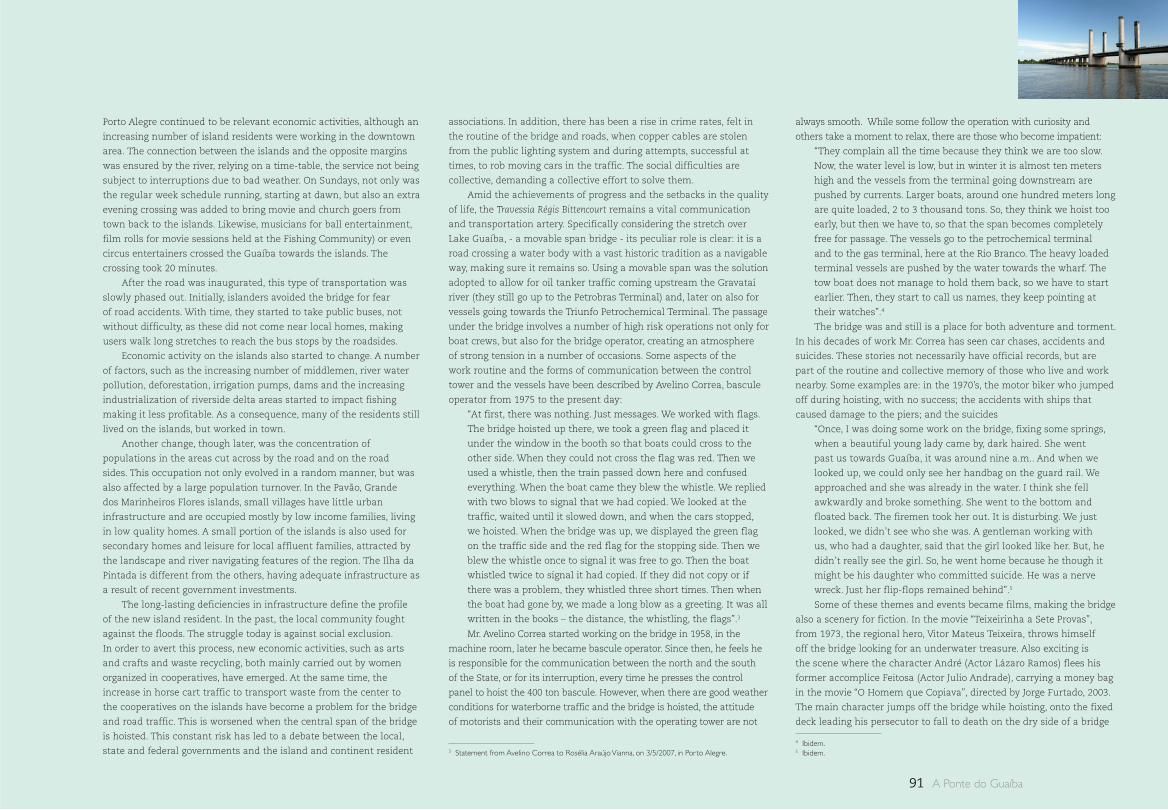
91 A Ponte do Guaíba
Porto Alegre continued to be relevant economic activities, although an
increasing number of island residents were working in the downtown
area. The connection between the islands and the opposite margins
was ensured by the river, relying on a time-table, the service not being
subject to interruptions due to bad weather. On Sundays, not only was
the regular week schedule running, starting at dawn, but also an extra
evening crossing was added to bring movie and church goers from
town back to the islands. Likewise, musicians for ball entertainment,
film rolls for movie sessions held at the Fishing Community) or even
circus entertainers crossed the Guaíba towards the islands. The
crossing took 20 minutes.
After the road was inaugurated, this type of transportation was
slowly phased out. Initially, islanders avoided the bridge for fear
of road accidents. With time, they started to take public buses, not
without difficulty, as these did not come near local homes, making
users walk long stretches to reach the bus stops by the roadsides.
Economic activity on the islands also started to change. A number
of factors, such as the increasing number of middlemen, river water
pollution, deforestation, irrigation pumps, dams and the increasing
industrialization of riverside delta areas started to impact fishing
making it less profitable. As a consequence, many of the residents still
lived on the islands, but worked in town.
Another change, though later, was the concentration of
populations in the areas cut across by the road and on the road
sides. This occupation not only evolved in a random manner, but was
also affected by a large population turnover. In the Pavão, Grande
dos Marinheiros Flores islands, small villages have little urban
infrastructure and are occupied mostly by low income families, living
in low quality homes. A small portion of the islands is also used for
secondary homes and leisure for local affluent families, attracted by
the landscape and river navigating features of the region. The Ilha da
Pintada is different from the others, having adequate infrastructure as
a result of recent government investments.
The long-lasting deficiencies in infrastructure define the profile
of the new island resident. In the past, the local community fought
against the floods. The struggle today is against social exclusion.
In order to avert this process, new economic activities, such as arts
and crafts and waste recycling, both mainly carried out by women
organized in cooperatives, have emerged. At the same time, the
increase in horse cart traffic to transport waste from the center to
the cooperatives on the islands have become a problem for the bridge
and road traffic. This is worsened when the central span of the bridge
is hoisted. This constant risk has led to a debate between the local,
state and federal governments and the island and continent resident
associations. In addition, there has been a rise in crime rates, felt in
the routine of the bridge and roads, when copper cables are stolen
from the public lighting system and during attempts, successful at
times, to rob moving cars in the traffic. The social difficulties are
collective, demanding a collective effort to solve them.
Amid the achievements of progress and the setbacks in the quality
of life, the Travessia Régis Bittencourt remains a vital communication
and transportation artery. Specifically considering the stretch over
Lake Guaíba, - a movable span bridge - its peculiar role is clear: it is a
road crossing a water body with a vast historic tradition as a navigable
way, making sure it remains so. Using a movable span was the solution
adopted to allow for oil tanker traffic coming upstream the Gravataí
river (they still go up to the Petrobras Terminal) and, later on also for
vessels going towards the Triunfo Petrochemical Terminal. The passage
under the bridge involves a number of high risk operations not only for
boat crews, but also for the bridge operator, creating an atmosphere
of strong tension in a number of occasions. Some aspects of the
work routine and the forms of communication between the control
tower and the vessels have been described by Avelino Correa, bascule
operator from 1975 to the present day:
“At first, there was nothing. Just messages. We worked with flags.
The bridge hoisted up there, we took a green flag and placed it
under the window in the booth so that boats could cross to the
other side. When they could not cross the flag was red. Then we
used a whistle, then the train passed down here and confused
everything. When the boat came they blew the whistle. We replied
with two blows to signal that we had copied. We looked at the
traffic, waited until it slowed down, and when the cars stopped,
we hoisted. When the bridge was up, we displayed the green flag
on the traffic side and the red flag for the stopping side. Then we
blew the whistle once to signal it was free to go. Then the boat
whistled twice to signal it had copied. If they did not copy or if
there was a problem, they whistled three short times. Then when
the boat had gone by, we made a long blow as a greeting. It was all
written in the books – the distance, the whistling, the flags”.3
Mr. Avelino Correa started working on the bridge in 1958, in the
machine room, later he became bascule operator. Since then, he feels he
is responsible for the communication between the north and the south
of the State, or for its interruption, every time he presses the control
panel to hoist the 400 ton bascule. However, when there are good weather
conditions for waterborne traffic and the bridge is hoisted, the attitude
of motorists and their communication with the operating tower are not
always smooth. While some follow the operation with curiosity and
others take a moment to relax, there are those who become impatient:
“They complain all the time because they think we are too slow.
Now, the water level is low, but in winter it is almost ten meters
high and the vessels from the terminal going downstream are
pushed by currents. Larger boats, around one hundred meters long
are quite loaded, 2 to 3 thousand tons. So, they think we hoist too
early, but then we have to, so that the span becomes completely
free for passage. The vessels go to the petrochemical terminal
and to the gas terminal, here at the Rio Branco. The heavy loaded
terminal vessels are pushed by the water towards the wharf. The
tow boat does not manage to hold them back, so we have to start
earlier. Then, they start to call us names, they keep pointing at
their watches”.4
The bridge was and still is a place for both adventure and torment.
In his decades of work Mr. Correa has seen car chases, accidents and
suicides. These stories not necessarily have official records, but are
part of the routine and collective memory of those who live and work
nearby. Some examples are: in the 1970’s, the motor biker who jumped
off during hoisting, with no success; the accidents with ships that
caused damage to the piers; and the suicides
“Once, I was doing some work on the bridge, fixing some springs,
when a beautiful young lady came by, dark haired. She went
past us towards Guaíba, it was around nine a.m.. And when we
looked up, we could only see her handbag on the guard rail. We
approached and she was already in the water. I think she fell
awkwardly and broke something. She went to the bottom and
floated back. The firemen took her out. It is disturbing. We just
looked, we didn’t see who she was. A gentleman working with
us, who had a daughter, said that the girl looked like her. But, he
didn’t really see the girl. So, he went home because he though it
might be his daughter who committed suicide. He was a nerve
wreck. Just her flip-flops remained behind”.5
Some of these themes and events became films, making the bridge
also a scenery for fiction. In the movie “Teixeirinha a Sete Provas”,
from 1973, the regional hero, Vitor Mateus Teixeira, throws himself
off the bridge looking for an underwater treasure. Also exciting is
the scene where the character André (Actor Lázaro Ramos) flees his
former accomplice Feitosa (Actor Julio Andrade), carrying a money bag
in the movie “O Homem que Copiava”, directed by Jorge Furtado, 2003.
The main character jumps off the bridge while hoisting, onto the fixed
deck leading his persecutor to fall to death on the dry side of a bridge
4 Ibidem.5 Ibidem.3 Statement from Avelino Correa to Rosélia Araújo Vianna, on 3/5/2007, in Porto Alegre.
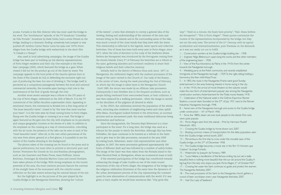
92A Crossing between Margins and Lives
access. Furtado is the film Director who has most used the bridge in
his work. The “Anchietanos” episode, of the TV broadcast “Comédias
da Vida Privada”, broadcast by Rede Globo, had a scene filmed on the
bridge, leading to a dramatic finding: somebody had jumped or was
pushed off. Antônio Carlos Textor turns his eyes over 1970’s Porto
Alegre from the Guaíba bridge with melancholy in the short film
“A Cidade e o Tempo”.
Also used in local advertising campaigns, the image of the Guaíba
bridge has been part in building up the identity representations
of Porto Alegre residents and their city. One example is the Polar
beer campaign (2005), which featured the bridge as a gate. When
closed it did not let the product go out of the State by water. The
campaign appeals to the local pride of the Gaucho (person born in
the State of Rio Grande do Sul) in defending the exclusive right not
just of producing the beer, but also of drinking it. The bridge itself is
perceived as a compulsory passageway between the local and national
commercial networks, the movable span having a vital role in the
maintenance of the flow of goods through the river.
Another more recent example was a tribute to the 235 years of
the city of Porto Alegre, celebrated on the 26th of March. It is the TV
commercial of the Záffari-Bourbon supermarket chain. Appealing to
emotional charm, the commercial is divided into a first long series of
“the most beautiful views”, closed in by “the view that most touches
your heart”, it is the view seen by those coming home to Porto Alegre,
flying over the Guaíba bridge or crossing it as a road. The bridge is
again featured as the gate into the city, with emphasis on its peculiarity
and unique geographic location at the shores of a lake. In addition to
the emphasis on the crossing as a way of communication, coinciding
with the air route, the presence of the lake can be seen in each of the
“most beautiful views”. After all, in the vast urban panoramas of the
city seen from above, general at a first glance, it is possible to see the
waters of the Guaíba shinning in the background.
The photos taken of the crossing can be found in the press and in
special publications, but most often in printed or electronic post card
format. Prominent Rio Grande do Sul and Brazilian photographers,
such as Léo Guerreiro and Pedro Flores, Assis Hoffman, Sioma
Breitman, Domingos de Almeida Martins Costa and Leonid Streliaev,
have taken photos of the bridge. With strong emphasis on the tourist
potential of the area, the most common pictures feature the contrast
of the straight lines of the monument with the colorful sunset
reflection on the lake waters enhancing the natural beauty of the site.
But the highlight is on the pictures of the part played by the
Guaíba Bridge in the Navegantes Festivities, showing the “culture
of the waters”, a term that attempts to convey a general idea of the
viewing, feeling and understanding of the universe of the men and
women living on the islands and in the surrounding areas of the lake,
very much a result of the close bonds that they have with the water.
This relationship is reflected in the legends, water sports and collective
festivities. One of these has been held every year in Porto Alegre, since
1871, when the rites of devotion to Our Lady of the Seafarers (Nossa
Senhora dos Navegantes) was introduced by the Portuguese coming from
the Azores Islands. Every 2nd of February the festivities are a tribute to
the saint, gathering islanders and continent residents to share their
religious beliefs and their collective memory.
Initially held in the district of Menino Deus and, since 1877, in
Navegantes, the celebration begins with the onshore procession of the
image of the saint carried to the Church of Our Lady of the Rosary ,
in the center of town, during the week preceding the 2nd of February,
on which day the image is taken back to the Navegantes Church
. Until 1989, the return was made by an offshore, lake procession.
Subsequently it was fobidden due to the frequent accidents, such as
people falling overboard from overcrowded boats, or boat collisions. It
was then replaced by a walking procession , when the image is carried
on the shoulders of the pilgrims all dressed in white.
In the 1950’s, the celebration involved the population of the whole
town, attracting also residents of neighboring towns and cities uphill.
After Mass, churchgoers looked forward to the attractions, as souvenir
pictures and an amusement park, the main traditional delicacies being
watermelon and barbecue.
Since the inauguration, the Travessia Régis Bittencourt is a close
participant in the event. For a long time, the bridge was used as a
tribune for the people to watch the festivities. Although this has been
forbidden, the span continues to be hoisted as a tribute to the Saint
and to give way to the lake procession, resumed in the year 2000
by rowing boats, fishermen, water club representatives and other
pilgrims. In 2007, the water procession gathered approximately 180
boats of different draft and was followed by a number of safety bodies.
The image of the Saint was then taken from the Pintada island to the
State Nautical Park, in Navegantes, where an ecumenical mass is held.
If the renewed participation of the bridge has contributed towards
enhancing the image of Lake Guaíba as one of the main tourist
attractions of the city of Porto Alegre, the integration of the bridge into
the religious celebration illustrates at the same time the dynamics of
the urban development process of the city, representing the constant
quest for new alternatives of communication with the world. If it was
given a voice, maybe we would hear sentences like: “City, grow this
way!”; “Hold on a minute, the boats have priority.”; “Hail, Nossa Senhora
dos Navegantes!”; “This is Porto Alegre!”. These quotes summarize the
routine of the representations incorporated by the bridge, but they
are not the only ones. The arrival of the 21st Century, with its typical
acceleration and internationalization, puts Travessia on the demands
as it was not really cut out to fulfill.
1 : : Construction workers at the Guaíba bridge building site – 1958.2 : : Engineer Régis Bittencourt supervising the works and the other members of the engineering team – 1958.3 : : View of the Rua Voluntários da Pátria in the 1910’s: from the center towards the Navegantes borough.4 : : Wedding party at the Polish community and recently established immigrants at the Navegantes borough – 1929. To the right, sitting holding a harmonica, the then child Wasyl Trusz.5 : : In 1892, the races in the Navegantes Prairie were good Sunday entertainment in the area, fostering interest in horse racing in the city. 6 : : In the 1910’s, the arrival of movie theaters to the suburbs would make this new form of entertainment popular also among the Navegantes construction workers. Advertisement for the Thalia movie theater, 1918.7 : : Celebration of the National week in the Grêmio Esportivo Renner Stadium, a soccer team founded on the 27th of July 1931 next to the Renner Industries. Navegantes borough, 1948.8 : : Aerial view of the Navegantes borough and access to the Guaíba bridge under construction – 16th of March 1960.9 : : Since the 1880’s, steam services took people to the islands. Pick-nicks were quite popular.10 : : Porto Alegre seen from the islands – Print by Hermann Rudolf Wendroth, 1852. 11 : : Crossing the Guaíba bridge by horse-drawn cart, 2007.12 : : Boating, common means of transportation for the delta population, seen from the Guaíba bridge central booth, 2007.13 : : Pernambuco, the first ship to cross under the movable span of the Guaíba bridge, on the 27th of December 1958.14 : : The Guaíba bridge becomes a movie star in the film “O Homem que Copiava”, by Jorge Furtado.15 : : Watercolor by Joaquim da Fonseca, 1989.16 : : “Lucia Helena, a recollection of the famous smiling city, sun set is really beautiful, there is nothing more beautiful than the sun set around the Guaíba. A big hug from this lady who enjoys you, Jane. Porto Alegre, 2nd of October1967”.17 : : Crossing the water the Saint continues to guide and protect the seamen. The Navegantes festivities, 2007. 18 : : The road procession of the Saint to the Navegantes church gathers a crowd of keen worshipers every year. Navegantes festivities, 2007.19 : : Hail Our Lady of Seafarers!
93 A Ponte do Guaíba
As fotografias e reproduções contidas nesta publicação fo-ram especialmente produzidas no verão e outono de 2007 por Eduardo Aigner.
As fotografias e reproduções contidas nas páginas indica-das abaixo são de autoria de:
The photos and reproductions in this publication were specially produced in the summer and fall 2007 by Eduardo Aigner.
The authors of the photos and reproductions on the pages indicated below are:
P. 15 2 Luiz Antônio Catafesto de Souza.P. 16 3 Paulo Backes.P. 17 5 Arquivo Histórico do Itamaraty. Rio de Janeiro.
Reprodução de Luiz Antônio Catafesto de Souza.P. 17 6 Arquivo Histórico do Itamaraty. Rio de Janeiro.P. 18 7 WENDROTH, Rudolf Hermann. O Rio Grande do
Sul em 1852. 1983. Aquarelas e desenhos. Porto Alegre: Governo do Estado do Rio Grande do Sul.
P. 19 8, 9 e 10 Reprodução de Eduardo Aigner.P. 20 11 Reprodução de Eduardo Aigner. 12 Coleção Sergio Fadel. Reprodução de Vicente Mello.P. 21 13 Instituto de Educação, Porto Alegre. Reprodução
de Luiz Antônio Catafesto de Souza. P. 22 14 Arquivo Histórico do Itamaraty. Reprodução de
Luiz Antônio Catafesto de Souza. 15 IOTTI, Luiz Horn; BÓ, Juventino Dal. Italianos no
Rio Grande do Sul. Porto Alegre: IPHAN, 1995.P. 23 16 Aldo Toniazzo. Projeto ECIRS/UCS.
Créditos e fontes das ilustrações Picture credits
P. 25 17 Reprodução de Luiz Carlos Felizardo.P. 27 3, 4, 5 e 6 Paulo Backes.P. 34 MENEGAT, R.; PORTO, M. L.; CARRARO, C. C.;
FERNANDES, L. A. D. (Org.). Atlas ambiental de Porto Alegre. 3. ed. Porto Alegre: Editora da
UFRGS, 2006.P. 42 7 e p. 44 9 Separata do Boletim do DAER, n. 62-63, ano XVII, 1954.P. 45 10 Rio Jacuí. 1956. Laboratoire Dauphinois
d’Hydraulique. P. 45 11 a p. 47 13 Lélio Soares Araújo.P. 47 14 e 15 Beton un Stahlbetonbau, n. 58, 1963.P. 48 16 a p. 50 22 Lélio Soares Araújo.P. 52 Lélio Soares Araújo.P. 55 2 © Georges Jansoone, 2006.P. 56 3 Kröller-Müller Museum, Otterlo, Países Baixos. 4 © Yummifruitbat, 2004. 5 © Jeremy Atherton, 2006.P. 57 6 © Anthony John West/Corbis, 2003. 7 Bea Hoppe, 2001. 8 Museo Nazionale della Scienza e della Tecnologia Leonardo da Vinci, Milão.P. 58 9 © Leonard e Apasia Coumiotis, 2005. 10 © Penny Mayes, 2006.P. 59 12 © RM/Corbis, 1951.P. 60 13 © Geoeye/Science Photo Library/Corbis, 2002.P. 61 14 © Minnesota Historical Society, 1907.
P. 61 15 © Arpingstone.P. 62 Nelson Leal Vianna. P. 63 1 e 2 Lélio Soares Araújo.P. 64 3 Fototeca Sioma Breitman/Museu Joaquim José Felizardo, Porto Alegre.P. 65 4 Coleção Família Trusz. P. 66 5 Museu CSHJC. Jornal Mercantil, Porto Alegre, 23 abr. 1892, p. 2. 6 Museu CSHJC. Jornal A Federação, Porto Alegre,
14 mar. 1918, p. 6. 7 Fototeca Sioma Breitman/Museu Joaquim José
Felizardo, Porto Alegre. 8 Leo Guerreiro; Pedro Flores. Fototeca Sioma Breitman/Museu Joaquim José
Felizardo, Porto Alegre.P. 67 9 Museu CSHJC. Jornal Gazeta de Porto Alegre,
Porto Alegre, 29 out. 1881, p. 3. P. 68 12 WENDROTH, Hermann Rudolf. 1852. Álbum de
aquarelas. Porto Alegre: Riocell, 1982. Museu Joaquim José Felizardo, Porto Alegre.P. 69 13 Lélio Soares Araújo.P. 70 14 Casa de Cinema, Porto Alegre. 15 Coleção particular Joaquim da Fonseca.P. 71 16 Mercator, São Paulo. P. 72 17 Fabricio Barreto.
94
Alice Dubina TruszDoutoranda em História pela UFRGS. Desenvolve pesqui-sas acadêmicas e profissionais sobre a história de Porto Alegre e do Rio Grande do Sul desde 1992. Possui artigos publicados em anais, livros e revistas como ArtCultura e História Hoje.
Ph.D student in History at the UFRGS. Has conducted academic and professional research work about the history of Porto Alegre and the State of Rio Grande do Sul since 1992. Has published articles in annals, books and reviews such as ArtCultura and História Hoje.
Beatriz BlayArquiteta com especialização em restauração de monu-mentos pela Universidade de Roma, tradutora de italiano de catálogos e livros de arte, pesquisadora e coordenadora de produção editorial e de eventos culturais. Criou o Arquite-tour e é vice-presidente da Associação dos Amigos do Museu Judaico de São Paulo.
Architect specialized in monument restoration at the University of Rome, certified translator in Italian, researcher and editorial production coordinator and cultural event coordinator. Creator of Arquitetour and is vice-president of the Association of Friends of the São Paulo Jewish Museum.
Eduardo AignerFotografou prédios, músicos, casas, gatos, panelas, pedras, livros, cadeiras, fábricas, amigos, folhas, personalidades, paisagens, brinquedos, tempestades, banheiras, atores, ár-vores, campos, cavalos, computadores etc. Estudou arquite-tura, descobriu a fotografia e segue transitando em ambos os mundos.
Has photographed buildings, musicians, houses, cats, pots and pans, rocks, books, chairs, factories, friends, leaves, celebrities, landscapes, toys, storms, bathtubs, actors, trees, fields, horses, computers, etc. Studied architecture, discovered photography, carries on moving across both worlds.
Flávio Kiefer Arquiteto, mestre e doutorando em Arquitetura pela Uni-versidade Federal do Rio Grande do Sul; professor e pesqui-sador da Faculdade de Arquitetura da UniRitter; e sócio di-retor da Kiefer Arquitetos. www.kiefer.com.
Architect, master and Ph.D student in architecture at the Universi-dade Federal do Rio Grande do Sul. Professor and researcher at the UniRitter Architectural School. Managing partner at Kiefer Arquitetos. www.kiefer.com.
Jorge FurtadoDiretor e roteirista dos longas “Houve uma Vez Dois Verões”, “O Homem que Copiava” e “Meu Tio Matou um Cara”, além de vários curtas premiados ao redor do mundo, como “O Dia em que Dorival Encarou a Guarda”, “Barbosa”, “Ilha das Flores”, entre outros. Roteirista e diretor do episódio “Estrada”, do longa “Felicidade É...”. Para a TV Globo, dirigiu a série “Cena Aberta”, a minissérie “Luna Caliente” e escreveu dezenas de roteiros: “Memorial de Maria Moura”, “A Invenção do Brasil” etc., além da série “Comédias da Vida Privada”, da qual também dirigiu o episódio “Anchietanos”. Escreveu o romance “Trabalhos de Amor Perdidos”, publicado pela editora Objetiva em 2006. Seu mais recente longa é “Saneamento Básico, o Filme”.
Director and scriptwriter of the feature films: Houve uma vez dois verões, O homem que copiava and Meu tio matou um cara, plus a number of short subject prize-winning films in Brazil and abroad. For the TV Globo broadcasting corporation, he directed the series Cena Aberta, the mini-series Luna caliente and has written a number of scripts, such as Agosto, Memorial de Maria Moura, A invenção do Brasil, as well as the series Comédias da vida privada. Wrote the novel Trabalhos de amor perdidos, published by Objetiva, ed. in 2006.
Luiz Antônio Bolcato CustódioArquiteto do Iphan, mestre em Planejamento Urbano e Re-gional; especialista em Preservação de Monumentos e Sítios Históricos. Foi diretor regional e diretor do Departamento de Promoção do Iphan; representante do Ministério da Cul-
tura na Comissão do Patrimônio do Mercosul; presidente do Comitê Brasileiro do Icom. É professor da Faculdade de Arquitetura UniRitter.
Architect, master of Regional and Urban Planning – UFRGS; Expert in landmark preservation and historical sites; Regional Director of IPH-AN – RS (1987-1996); National Director of the Promoting Depart-ment of IPHAN - BSB (1996-1998); Representative of the Ministry of Culture in the Mercosur Technical Committee for Heritage (1996-2002); President of the Brazilian Committee of the International Mu-seum Counsel - ICOM (2000-2006). Head Professor of the school of Architecture at UNISINOS (1979-1984) and UNIRITTER (1986-).
Rosélia Araújo ViannaRelações-públicas, mestra em Administração e Marketing Es-tratégico pela Universidade de Ciências Econômicas – UCES/Argentina. MBA em Tecnologia da Informação pela ESPM. Mestranda em Comunicação Social pela PUC – RS. Sócia di-retora da High Contact – Marketing de Relacionamento.
Public Relations, master of Management and Strategic Marketing at the Universidade de Ciências Econômicas – UCES/ Argentina. MBA in Information Technology at ESPM. Master student in Social Commu-nication at PUCRS. Managing Partner at – Relationship Marketing.
Rualdo MenegatProfessor da UFRGS, geólogo, mestre em Geociências, doutor em Ecologia de Paisagem, editor da revista Episteme, assessor científico da National Geographic Brasil e coordenador geral do “Atlas Ambiental de Porto Alegre”. Recebeu a Medalha de Porto Alegre e a Máxima Distinción por la Investigación Califi-cada da Universidade Nacional Mayor de San Marcos, Peru.
Professor at UFRGS, geologist, Master of Geo sciences, Ph.D in Landscape Ecology, Editor of the Episteme review, scientific advisor to National Geographic Brazil and General Coordinator of the Porto Alegre Environmental Atlas. Was awarded the Medal of Porto Alegre and the Máxima Distinción por la Investigación Calificada from the Universidade Nacional Mayor de San Marcos, Peru.
Os autores Authors
Os autores
95 A Ponte do Guaíba
A. Antje Ellendt
Ana Cristina Solheid da Costa de Carvalho
Ana Liseta Lorbieck
Augusto Carlos de Vasconcelos
Avelino Correa
Bea Hoppe
Claire Whittaker
Clovis Barbedo
Daniel Haller
Denyse Emerich
Flávia Matzenbacher
Gercino Fernando de Carvalho
Gisela Waetge
Günther Schnell
João Miguel Sequeira Bastian
Lélio Soares Araújo
Luiz Roberto Aguiar
Manfred Schmid
Maria Beatriz Carvalho Schnell
Maria Rita Mancini
Maysa Blay Rozman
Paulo Sergio Del Negro
Ricardo Piovezan
Sandro Lima
Sergio Fadel
Siegfried Schnell
Sílvia Ferreira Santos Wolff
Wasyl Trusz
Agradecimentos Acknowledgements
Arquivo Histórico do Rio Grande do Sul, da Biblioteca Pública Leopoldo Boeck
Azevedo Bastian Castilhos S/C Construções, Porto Alegre
Casa de Cinema de Porto Alegre
DAER – Departamento Autônomo de Estradas de Rodagem
Docomomo – International working party for documentation and conservation of buildings, sites and neighbourhoods of the Modern Moviment
Editores do “Atlas Ambiental de Porto Alegre”
Estúdio de Santiago Calatrava, Valência, Espanha
Fototeca Sioma Breitman, do Museu Joaquim José Felizardo
Funcionários da Concepa
Leonhardt, Andrä und Partner – LAP Beratende Ingenieure VBI, GmbH, Stuttgart
Museo Nazionale della Scienza e della Tecnologia Leonardo da Vinci, Milão, Itália
Museu da Brigada Militar do Rio Grande do Sul
Setor de imprensa e fotografia do Museu de Comunicação Social Hipólito José da Costa
Wikipedia – The Free Encyclopedia
96
Edição PublisherMarcos Carrilho Arquitetos Ltda.
Coordenação editorial Editorial CoordinationMaria Cristina Wolff de Carvalho
Editoria EditorsBeatriz Blay e Maria Cristina Wolff de Carvalho
Apresentação PresentationJorge Furtado
Ensaios TextsAlice Dubina Trusz e Rosélia Araújo Vianna
Beatriz Blay
Flávio Kiefer
Luiz Antônio Bolcato Custódio
Rualdo Menegat
Pesquisa ResearchAlice Dubina Trusz
Beatriz Blay
Eduardo Aigner
Flávio Kiefer
Luiz Antônio Bolcato Custódio
Maria Cristina Wolff de Carvalho
Rosélia Araújo Vianna
Rualdo Menegat
Revisão Proof ReadingIsmar Leal
Ficha catalográfica CIP Catalogue RecordMaria Rita Mancini
Versão para o inglês English VersionFranziska Becskehazy
Fotografia PhotographyEduardo Aigner
Projeto gráfico Project and Graphic DesignRenata Reis
Ilustração Art Assistant to mapsMaíra Roman
Tratamento da imagem Inglês
Impressão Inglês
Divulgação Marketing Advice
High Contact – Marketing de Relacionamento
MidiaMix
